Winkelwagen
Geen items in winkelwagen
Ga naar winkelwagen
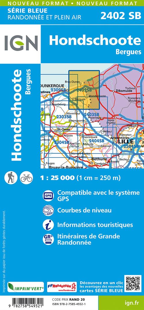
Wandelkaart 2402 SB - Serie Bleue Hondschoote / Bergues | IGN - Institut Géographique National (9782758558675)
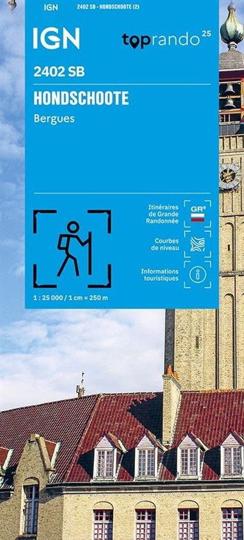
- ISBN / CODE: 9782758558675
- Editie: 14-09-2026
- Druk: 2
- Aantal blz.: 1
- Schaal: 1:25000
- Uitgever: IGN - Institut Géographique National
- Soort: Wandelkaart
- Serie: SB - Serie Bleue
- Taal: Frans
- Hoogte: 22.0 cm
- Breedte: 11.0 cm
- Gewicht: 94.0 g
- Uitvoering: Papier
- Bindwijze: -
- Schrijf als eerste een review
-
€ 17,95
Dit artikel is (tijdelijk) niet leverbaar
-
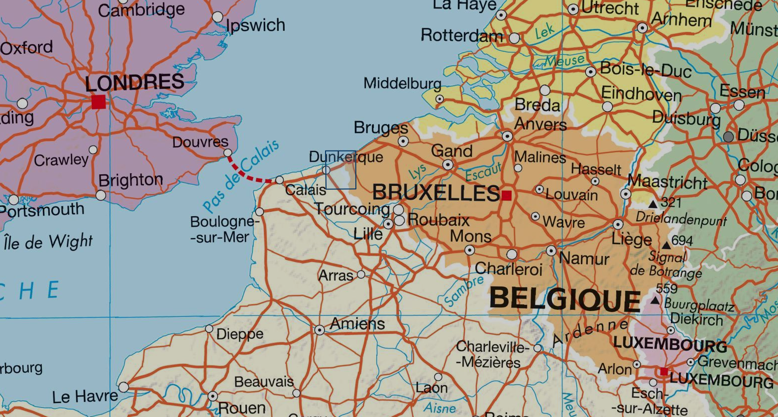
Overzicht IGN 25.000 Pays de Calais - Picardië: Noord

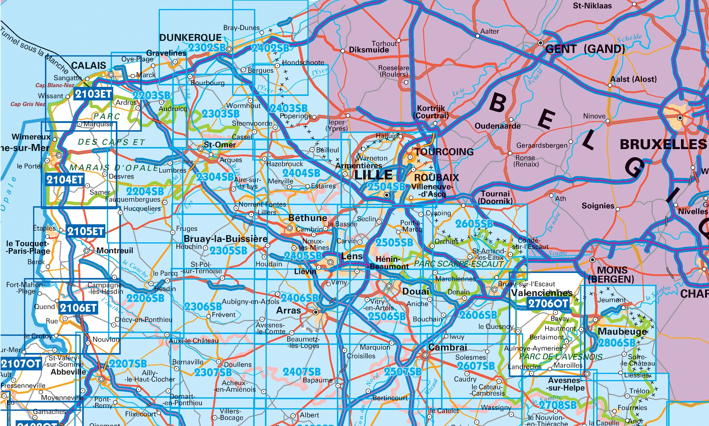
Producten op deze overzichtskaart:
Klik op een product om naar de pagina van dat product te gaan.
- Wandelkaart 2103ET Calais Site des Caps / Forêt de Guînes PNR | IGN - Institut Géographique National
- Wandelkaart 2104ET Boulogne-sur-Mer / Forêts du Boulonnais PNR | IGN - Institut Géographique National
- Wandelkaart 2105ET Le Touquet-Paris-Plage / Berck / Vallée de la Canche | IGN - Institut Géographique National
- Wandelkaart - Topografische kaart 2106ET Baie de Somme, Le Crotoy, Fort-Mahon-Plage | IGN - Institut Géographique National
- Wandelkaart - Topografische kaart 2107OT Le Tréport | IGN - Institut Géographique National
- Wandelkaart 2203 SB - Serie Bleue Gravelines / Audruicq | IGN - Institut Géographique National
- Wandelkaart - Wegenkaart - landkaart 2204 SB - Serie Bleue Lumbres / Fruges | IGN - Institut Géographique National
- Wandelkaart - Topografische kaart 2206 SB - Serie Bleue Hesdin, Auxi-le-Château | IGN - Institut Géographique National
- Wandelkaart - Topografische kaart 2207 SB - Serie Bleue Abbeville, Domart-en-Ponthieu | IGN - Institut Géographique National
- Wandelkaart 2302 SB - Serie Bleue Dunkerque / Gravelines | IGN - Institut Géographique National
- Wandelkaart 2303 SB - Serie Bleue Wormhout / Cassel / Watten | IGN - Institut Géographique National
- Wandelkaart 2304 SB - Serie Bleue St-Omer / Aire-sur-la-Lys | IGN - Institut Géographique National
- Wandelkaart - Topografische kaart 2305 SB - Serie Bleue Lillers - Heuchin | IGN - Institut Géographique National
- Wandelkaart - Topografische kaart 2306 SB - Serie Bleue Saint-Michel-Sur-Ternoise, Frévent | IGN - Institut Géographique National
- Wandelkaart - Topografische kaart 2307 SB - Serie Bleue Doullens - Beauval | IGN - Institut Géographique National
- Wandelkaart 2402 SB - Serie Bleue Hondschoote / Bergues | IGN - Institut Géographique National
- Wandelkaart 2403 SB - Serie Bleue Bailleul / Steenvoorde | IGN - Institut Géographique National
- Wandelkaart - Topografische kaart 2404 SB - Serie Bleue Armentieres - Hazebrouck | IGN - Institut Géographique National
- Wandelkaart - Topografische kaart 2405 SB - Serie Bleue Lens - Béthune | IGN - Institut Géographique National
- Wandelkaart - Topografische kaart 2406 SB - Serie Bleue Arras, Avesnes-le-Comte | IGN - Institut Géographique National
- Wandelkaart - Topografische kaart 2407 SB - Serie Bleue Bapaume, Acheux-en-Amiénois | IGN - Institut Géographique National
- Wandelkaart - Topografische kaart 2504 SB - Serie Bleue Lille - Roubaix - Tourcoing | IGN - Institut Géographique National
- Wandelkaart - Topografische kaart 2505 SB - Serie Bleue Leforest - Cysoing - Hénin-Beaumont - Carvin | IGN - Institut Géographique National
- Wandelkaart - Topografische kaart 2506 SB - Serie Bleue Douai - Rouvroy - Vitry-en-Artois | IGN - Institut Géographique National
- Wandelkaart - Topografische kaart 2507 SB - Serie Bleue Cambrai - Bertincourt | IGN - Institut Géographique National
- Wandelkaart - Topografische kaart 2605 SB - Serie Bleue Condé-sur-l'Escaut, St-Amand-les-Eaux | IGN - Institut Géographique National
- Wandelkaart - Topografische kaart 2606 SB - Serie Bleue Valenciennes - Denain | IGN - Institut Géographique National
- Wandelkaart - Topografische kaart 2607 SB - Serie Bleue Le Cateau-Cambrésis, Caudry | IGN - Institut Géographique National
- Wandelkaart - Topografische kaart 2706OT Foret De Mormal | IGN - Institut Géographique National
- Wandelkaart - Topografische kaart 2806 SB - Serie Bleue Jeumont - Maubeuge | IGN - Institut Géographique National
-
Overzichtskaart Explorer 25.000 topografische kaarten Noord Schotland


Producten op deze overzichtskaart:
Klik op een product om naar de pagina van dat product te gaan.
- Wandelkaart 2402 SB - Serie Bleue Hondschoote / Bergues | IGN - Institut Géographique National
- Wandelkaart - Topografische kaart 416 OS Explorer Map Inverness, Loch Ness, Culloden | Ordnance Survey
- Wandelkaart - Topografische kaart 428 OS Explorer Map Kyle of Lochalsh, Plockton, Applecross | Ordnance Survey
- Wandelkaart - Topografische kaart 429 OS Explorer Map Glen Carron, West Monar | Ordnance Survey
- Wandelkaart - Topografische kaart 430 OS Explorer Map Loch Monar, Glen Cannich, Glen Strathfarrar | Ordnance Survey
- Wandelkaart - Topografische kaart 431 OS Explorer Map Glen Urquhart, Strathglass | Ordnance Survey
- Wandelkaart - Topografische kaart 432 OS Explorer Map Black Isle | Ordnance Survey
- Wandelkaart - Topografische kaart 433 OS Explorer Map Explorer Torridon - Beinn Eighe & Liathach | Ordnance Survey
- Wandelkaart - Topografische kaart 434 OS Explorer Map Gairloch / Loch Ewe | Ordnance Survey
- Wandelkaart - Topografische kaart 435 OS Explorer Map An Teallach / Slioch | Ordnance Survey
- Wandelkaart - Topografische kaart 436 OS Explorer Map Beinn Dearg, Loch Fannich | Ordnance Survey
- Wandelkaart - Topografische kaart 437 OS Explorer Map Ben Wyvis, Strathpeffer | Ordnance Survey
- Wandelkaart - Topografische kaart 438 OS Explorer Map Dornoch, Tain | Ordnance Survey
- Wandelkaart - Topografische kaart 439 OS Explorer Map Coigach, Summer Isles | Ordnance Survey
- Wandelkaart - Topografische kaart 440 OS Explorer Map Glen Cassley, Glen Oykel | Ordnance Survey
- Wandelkaart - Topografische kaart 441 OS Explorer Map Lairg, Bonar Bridge, Golspie | Ordnance Survey
- Wandelkaart - Topografische kaart 442 OS Explorer Map Assynt, Lochinver | Ordnance Survey
- Wandelkaart - Topografische kaart 443 OS Explorer Map Ben Kilbreck, Ben Armine | Ordnance Survey
- Wandelkaart - Topografische kaart 445 OS Explorer Map Foinaven, Arkle, Kylesku, Scourie | Ordnance Survey
- Wandelkaart - Topografische kaart 446 OS Explorer Map Durness, Cape Wrath | Ordnance Survey
- Wandelkaart - Topografische kaart 447 OS Explorer Map Ben Hope, Ben Loyal, Kyle of Tongue | Ordnance Survey
- Wandelkaart - Topografische kaart 448 OS Explorer Map Strath Naver & Loch Loyal | Ordnance Survey
- Wandelkaart - Topografische kaart 449 OS Explorer Map Strath Halladale & Strathy Point | Ordnance Survey
- Wandelkaart - Topografische kaart 450 OS Explorer Map Wick, The Flow Country | Ordnance Survey
- Wandelkaart - Topografische kaart 451 OS Explorer Map Thurso, John o' Groats | Ordnance Survey
Overzichtskaarten
Beschrijving
In de loop van de tijd is IGN de 25.000 serie aan het vervangen: de oude versies Est en Ouest (E en O aanduiding achter het nummer van de kaart) gaan verdwijnen en worden vervangen door een kaart met nummer en gevolgd door de letters SB. In de meeste gevalen is het een samenvoeging van de E en O kaart, de SB kaart beslaat dan ook een groter gebied.
De wandelkaart die de perfectie benadert! Werkelijk alle topografische details zijn er op te vinden; van hoogtelijnen tot aan bruggetjes en allerlei wandelpaden. Daarnaast hebben de makers een flinke dosis toeristische informatie op de kaart verwerkt: campings, gites d étape en ingetekende doorgaande wandelpaden, de grandes randonnées. Het kleurgebruik is geweldig met schaduwzijdes, bos, weiland, etc goed te onderscheiden. De kaart is uitgevoerd met raster van graden, dus deze is GPS - toepasbaar!
De TOP 25 kaarten (kaart nummers die eindigen op "T") hebben betrekking op gebieden van bijzonder toeristisch belang zoals de Alpen, de Pyreneeën,De Cevennes, de Vogezen, de Provence, en de Atlantische en Middellandse zeekusten. De kaarten hebben een opdruk en benadrukken zo de lokale wandelpaden, lange afstand GR routes en, in voorkomend geval, ski routes. Andere toeristische informatie omvat campings, paardensport of kanocentra, hutten, berghutten, etc. Elke "TOP 25" kaart bedekt een gebied van ongeveer 28 x 21 km.
van de uitgever
L'indispensable carte de randonnée IGN 2402SB. D'une très grande précision elle contient tous les détails existants sur le terrain : voies de communication jusqu'au moindre sentier, constructions jusqu'au hangar, bois, arbre isolé, rivière, source... Sans oublier la représentation du relief par des courbes de niveau. Les sentiers balisés et les informations touristiques sont également représentées.
Communes couvertes : Bissezeele, Coudekerque-Branche, Crochte, Hondschoote, Bambecque, Rexpoëde, Hoymille, Leffrinckoucke, Quaëdypre, West-Cappel, Killem, Oost-Cappel, Warhem, Wylder, Socx, Bierne, Bray-Dunes, Zuydcoote, Ghyvelde, Téteghem-Coudekerque-Village, Uxem, Hondschoote, Bergues.
Lieux à découvrir : Moulin de la Victoire, Beauvoorde, Grande-Place, Moulin du Nord, Beffroi, Réserve Naturelle de la Dune Marchand, Réserve de West-Hock.
Dimensions : 96 cm x 121 cm
Reviews
Geen reviews gevonden voor dit product.
Schrijf een review
Graag horen wij wat u van dit artikel vindt. Vindt u het goed, leuk, mooi, slecht, lelijk, onbruikbaar of erg handig: schrijf gerust alles op! Het is niet alleen leuk om te doen maar u informeert andere klanten er ook nog mee!
Alle gerelateerde rubrieken >
Ook interessant voor Picardie - Noordwest Frankrijk
-

Fietskaart F-PIC ADFC Radtourenkarte
€ 11,95Fietskaarten Parijs (departement) -

Wandelgids 8000 Au fil de la Somme G
€ 19,95Wandelgidsen Somme -

Wandelkaart - Topografische kaart 23
€ 17,95Topografische kaarten Picardie - Noordwest Frankrijk -

Camperkaart 774 Frankrijk Noord-West
€ 11,95Camperkaarten Picardie - Noordwest Frankrijk -

Fietsgids Paris - Londre a velo, Par
€ 18,50Fietsgidsen Parijs (departement)