Winkelwagen
Geen items in winkelwagen
Ga naar winkelwagen
Wandelkaarten - Languedoc - Rousillon
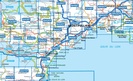
Overzichtskaarten
-
Wandelkaarten IGN 25.000 Languedoc -Rousillon
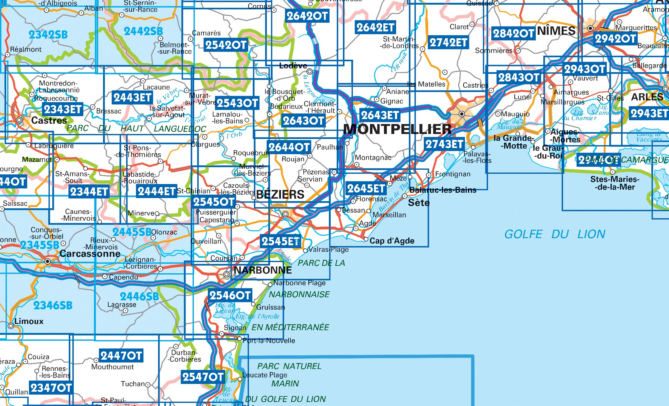
Producten op deze overzichtskaart:
Klik op een product om naar de pagina van dat product te gaan.
- Wandelkaart - Topografische kaart 2243 SB - Serie Bleue Puylaurens, Lautrec | IGN - Institut Géographique National
- Wandelkaart - Topografische kaart 2342 SB - Serie Bleue Réalmont - Alban | IGN - Institut Géographique National
- Wandelkaart - Topografische kaart 2343ET Castres, Sidobre, Brassac, Vebre, PNR du Haut Languedoc | IGN - Institut Géographique National
- Wandelkaart - Topografische kaart 2344ET Montagne Noire est | IGN - Institut Géographique National
- Wandelkaart - Topografische kaart 2344OT Montagne Noire (ouest) - Revel - Labrugiere - PNR du Haut Languedoc | IGN - Institut Géographique National
- Wandelkaart - Topografische kaart 2345 SB - Serie Bleue Carcassonne - Alzonne | IGN - Institut Géographique National
- Wandelkaart - Topografische kaart 2346 SB - Serie Bleue Cazilhac - Limoux | IGN - Institut Géographique National
- Wandelkaart - Topografische kaart 2442 SB - Serie Bleue Belmont-sur-Rance, St-Sernin-sur-Rance | IGN - Institut Géographique National
- Wandelkaart - Topografische kaart 2443ET Monts de Lacaune, La Salvetat - sur - Agout, PNR du Haut Languedoc | IGN - Institut Géographique National
- Wandelkaart - Topografische kaart 2444ET Somail - Minervois | IGN - Institut Géographique National
- Wandelkaart - Topografische kaart 2445 SB - Serie Bleue Lézignan - Corbieres, Rieux-Minervois | IGN - Institut Géographique National
- Wandelkaart - Topografische kaart 2446 SB - Serie Bleue Ferrals-les-Corbières, Capendu | IGN - Institut Géographique National
- Wandelkaart - Topografische kaart 2542OT Camarès - Avène | IGN - Institut Géographique National
- Wandelkaart - Topografische kaart 2543OT Lamalou-les-Bains, Olargues, Roquebrun, Le Caroux, PNR du Haut Languedoc | IGN - Institut Géographique National
- Wandelkaart - Topografische kaart 2545OT St-Chinian - L'etang de Montady | IGN - Institut Géographique National
- Wandelkaart - Topografische kaart 2546OT Narbonne | IGN - Institut Géographique National
- Wandelkaart 2547OT Durban-Corbières / Leucate Plages du Roussillon | IGN - Institut Géographique National
- Wandelkaart - Topografische kaart 2642ET St.-Guilhem-le-Desert | IGN - Institut Géographique National
- Wandelkaart - Topografische kaart 2642OT Le Caylar - La Couvertoirade | IGN - Institut Géographique National
- Wandelkaart 2643ET Clermont-l'Hérault | IGN - Institut Géographique National
- Wandelkaart - Topografische kaart 2643OT Lodeve | IGN - Institut Géographique National
- Wandelkaart - Topografische kaart 2644OT Pézenas - Murviel-lès-Béziers | IGN - Institut Géographique National
- Wandelkaart - Topografische kaart 2742ET St.-Martin-de-Londres, Ganges | IGN - Institut Géographique National
- Wandelkaart 2743ET Montpellier / Palavas-les-Flots | IGN - Institut Géographique National
- Wandelkaart 2943OT Saint-Gilles / Vauvert / le Petite Camargue | IGN - Institut Géographique National
- Wandelkaart - Topografische kaart 2944OT Saintes-Maries-de-la-Mer | IGN - Institut Géographique National
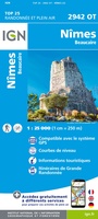 Wandelkaart - Topografische kaart 2942OT Nîmes | IGN - Institut Géographique National
 Wandelkaart - Topografische kaart 2943ET Arles | IGN - Institut Géographique National
 Wandelkaart - Topografische kaart 2944OT Saintes-Maries-de-la-Mer | IGN - Institut Géographique National
 Wandelkaart - Topografische kaart 3044OT Port-Saint-Louis-du-Rhône | IGN - Institut Géographique National
 Wandelkaart - Topografische kaart 2542OT Camarès - Avène | IGN - Institut Géographique National
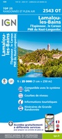 Wandelkaart - Topografische kaart 2543OT Lamalou-les-Bains, Olargues, Roquebrun, Le Caroux, PNR du Haut Languedoc | IGN - Institut Géographique National★★★★★
 Wandelkaart - Topografische kaart 2545OT St-Chinian - L'etang de Montady | IGN - Institut Géographique National
 Wandelkaart - Topografische kaart 2546OT Narbonne | IGN - Institut Géographique National
 Wandelkaart - Topografische kaart 2642ET St.-Guilhem-le-Desert | IGN - Institut Géographique National
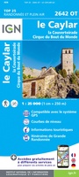 Wandelkaart - Topografische kaart 2642OT Le Caylar - La Couvertoirade | IGN - Institut Géographique National★★★★★
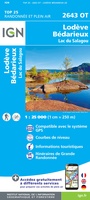 Wandelkaart - Topografische kaart 2643OT Lodeve | IGN - Institut Géographique National
 Wandelkaart - Topografische kaart 2644OT Pézenas - Murviel-lès-Béziers | IGN - Institut Géographique National
 Wandelkaart - Topografische kaart 2742ET St.-Martin-de-Londres, Ganges | IGN - Institut Géographique National
 Wandelkaart - Topografische kaart 2243 SB - Serie Bleue Puylaurens, Lautrec | IGN - Institut Géographique National
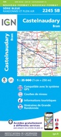 Wandelkaart - Topografische kaart 2245 SB - Serie Bleue Bram - Castelnaudary | IGN - Institut Géographique National
 Wandelkaart - Topografische kaart 2342 SB - Serie Bleue Réalmont - Alban | IGN - Institut Géographique National
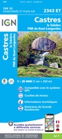 Wandelkaart - Topografische kaart 2343ET Castres, Sidobre, Brassac, Vebre, PNR du Haut Languedoc | IGN - Institut Géographique National★★★★★
 Wandelkaart - Topografische kaart 2344ET Montagne Noire est | IGN - Institut Géographique National
 Wandelkaart - Topografische kaart 2344OT Montagne Noire (ouest) - Revel - Labrugiere - PNR du Haut Languedoc | IGN - Institut Géographique National
 Wandelkaart - Topografische kaart 2345 SB - Serie Bleue Carcassonne - Alzonne | IGN - Institut Géographique National
Laatste reviews

Top gids met alle benodigde informatie.
Prachtige wandelgids voorzien van alle voor de wandelaars benodigde informatie (accommodaties, restaurants en cafés, vervoersmogelijkheden enz.). Ook is de gids beschreven in twee richtingen en …
★★★★★ door Mathie Hoenjet 27 juni 2026 | Heeft dit artikel gekocht
snel bezorgd
Zoals altijd duidelijke en overzichtelijke kaart van Michelin
★★★★★ door Charles Trippelvitz 26 juni 2026 | Heeft dit artikel gekocht
Het was heel leuk om de Vennbahn te fietsen aan de hand van deze handige gids!
Door deze gids konden we ons heel goed voorbereiden op onze fietstocht. En het gebruik onderweg was ook prima. Jammer dat de campings onderweg wat …
★★★★★ door Helma Feenstra 26 juni 2026 | Heeft dit artikel gekocht
Simpele keuze ondersteuning op website en hele snelle levering
Kort voor vakantie naar de Galapagos eilanden toch nog behoefte aan extra reisgids. Simpel kunnen bestellen en snelle levering. Zou niet weten wat er beter …
★★★★★ door Piet Grootenboer 25 juni 2026 | Heeft dit artikel gekocht