Winkelwagen
Geen items in winkelwagen
Ga naar winkelwagen
Wandelkaarten - Aquitaine
 Wandelkaart 1 Pays Basque Ouest | Rando Editions
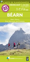 Wandelkaart 3 Béarn - Bearn | Rando Editions★★★★★
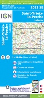 Wandelkaart - Topografische kaart 2033 SB - Serie Bleue Saint-Yrieix-La Perche-Lubersac | IGN - Institut Géographique National
 Wandelkaart - Topografische kaart 2034 SB - Serie Bleue Objat - Hautefort | IGN - Institut Géographique National★★★★★
 Wandelkaart - Topografische kaart 2035 SB - Serie Bleue Terrasson-Lavilledieu, Montignac, Grotte de Lascaux | IGN - Institut Géographique National★★★★★
 Wandelkaart - Topografische kaart 2036ET Sarlat-la-Caneda, Souillac | IGN - Institut Géographique National★★★★★
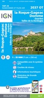 Wandelkaart - Topografische kaart 2037OT Roque-Gageac, Domme | IGN - Institut Géographique National★★★★★
 Wandelkaart - Topografische kaart 2038 SB - Serie Bleue Puy l'Evêque, Luzech | IGN - Institut Géographique National
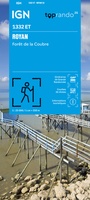 Wandelkaart 1332ET Royan / Forêt de la Coubre | IGN - Institut Géographique National
 Wandelkaart - Topografische kaart 1336ET Lac de Lacanau & Le Porge | IGN - Institut Géographique National
 Wandelkaart - Topografische kaart 1337ET Bassin D'Arcachon | IGN - Institut Géographique National★★★★★
 Wandelkaart - Topografische kaart 1339ET Biscarrosse | IGN - Institut Géographique National
 Wandelkaart 1340ET Mimizan / Lac d'Aureilhan | IGN - Institut Géographique National
 Wandelkaart 1341ET Castets / Lit-et-Mixe / Léon | IGN - Institut Géographique National
 Wandelkaart - Topografische kaart 1342 SB - Serie Bleue Dax | IGN - Institut Géographique National
 Wandelkaart 1343OT Capbreton / Vieux-Boucau-les-Bains / Soustons | IGN - Institut Géographique National
 Wandelkaart - Topografische kaart 1344OT Bayonne | IGN - Institut Géographique National
 Wandelkaart - Topografische kaart 1345OT Cambo-les-Bains – Hasparren | IGN - Institut Géographique National
 Topografische kaart - Wandelkaart 1346ET Forêt d'Iraty - Pic d'Orly | IGN - Institut Géographique National
 Topografische kaart - Wandelkaart 1346OT St.-Jean-Pied-de-Port | IGN - Institut Géographique National
- 1
- 2
- 3
- Volgende >>
- 5
Laatste reviews

Simpele keuze ondersteuning op website en hele snelle levering
Kort voor vakantie naar de Galapagos eilanden toch nog behoefte aan extra reisgids. Simpel kunnen bestellen en snelle levering. Zou niet weten wat er beter …
★★★★★ door Piet Grootenboer 25 juni 2026 | Heeft dit artikel gekocht
Te gek
Enorm mooie wereldkaart met details en snelle fijne levering.
★★★★★ door Steven Goyvaerts 25 juni 2026 | Heeft dit artikel gekocht
Goede gids voor pelgrims
Deze Cicerone gids over de via Francigena is uitermate geschikt om je route en etappes te plannen als je de Via Francigena vanuit Zwitserland gaat …
★★★★★ door Vic 24 juni 2026 | Heeft dit artikel gekocht
Aantrekkelijk en boordevol nuttige info
Heerlijk om al te kunnen voorbereiden op een fantastische vakantie met dit uiterst fijne boek.
★★★★★ door Harry 24 juni 2026 | Heeft dit artikel gekocht