Winkelwagen
Geen items in winkelwagen
Ga naar winkelwagen
Wandelkaarten - Alpen - Vaucluse - Drome - Vercors
Overzichtskaarten
-
Wandelkaarten IGN 25.000 Franse Alpen: Vercors - Drome - Vaucluse
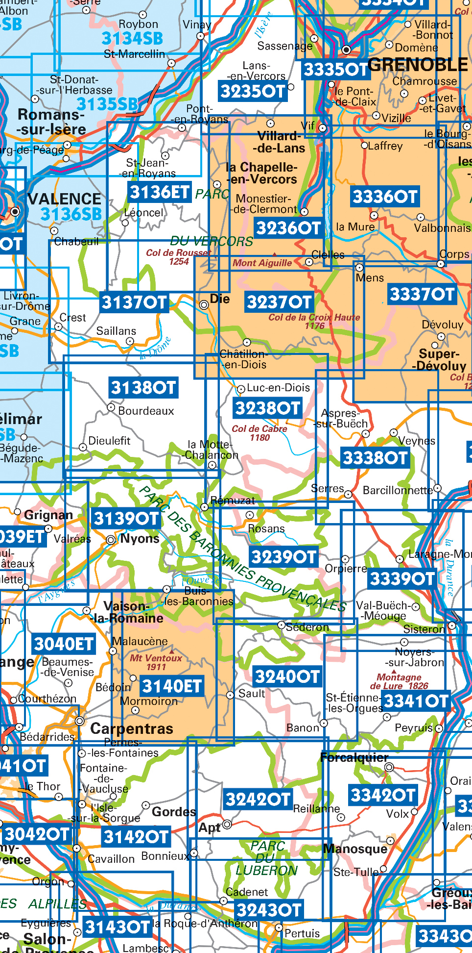
Producten op deze overzichtskaart:
Klik op een product om naar de pagina van dat product te gaan.
- Wandelkaart - Topografische kaart 3037 SB - Serie Bleue Crest – La Voulte-sur-Rhône | IGN - Institut Géographique National
- Wandelkaart - Topografische kaart 3038 SB - Serie Bleue Montélimar | IGN - Institut Géographique National
- Wandelkaart - Topografische kaart 3039ET Valréas | IGN - Institut Géographique National
- Wandelkaart - Topografische kaart 3040ET Carpentras | IGN - Institut Géographique National
- Wandelkaart - Topografische kaart 3040OT Orange | IGN - Institut Géographique National
- Wandelkaart - Topografische kaart 3041OT Avignon | IGN - Institut Géographique National
- Wandelkaart - Topografische kaart 3136ET Combe Laval | IGN - Institut Géographique National
- Wandelkaart - Topografische kaart 3137OT Die – Crest – Saillans | IGN - Institut Géographique National
- Wandelkaart - Topografische kaart 3138OT Dieulefit | IGN - Institut Géographique National
- Wandelkaart - Topografische kaart 3139OT Nyons - Rémuzat | IGN - Institut Géographique National
- Wandelkaart - Topografische kaart 3140ET Mont Ventoux | IGN - Institut Géographique National
- Wandelkaart - Topografische kaart 3140ETR Mont Ventoux | IGN - Institut Géographique National
- Wandelkaart - Topografische kaart 3142OT Cavaillon | IGN - Institut Géographique National
- Wandelkaart - Topografische kaart 3235OT Autrans | IGN - Institut Géographique National
- Wandelkaart 3236OT Villard-de-Lans | IGN - Institut Géographique National
- Wandelkaart - Topografische kaart 3236OTR Villard-de-Lans / Mont Aiguille / PNR du Vercors | IGN - Institut Géographique National1
- Wandelkaart - Topografische kaart 3237OT Glandasse | IGN - Institut Géographique National
- Wandelkaart - Topografische kaart 3237OTR Glandasse / Col de la Croix-Haute / PNR du Vercors | IGN - Institut Géographique National
- Wandelkaart 3239OT Rosans / Orpierre / Baronnies Orientales | IGN - Institut Géographique National
- Wandelkaart - Topografische kaart 3240OT Banon - Sault | IGN - Institut Géographique National
- Wandelkaart - Topografische kaart 3242OT Apt | IGN - Institut Géographique National
- Wandelkaart - Topografische kaart 3243OT Pertuis - Lourmarin | IGN - Institut Géographique National
- Wandelkaart - Topografische kaart 3338OT Serres - Veynes | IGN - Institut Géographique National
- Wandelkaart 3339OT Sisteron / Laragne-Montéglin / Montagne de Chabre | IGN - Institut Géographique National
- Wandelkaart - Topografische kaart 3342OT Manosque - Forcalquier | IGN - Institut Géographique National
 Wandelkaart - Topografische kaart 3235OT Autrans | IGN - Institut Géographique National★★★★★
 Wandelkaart 3236OT Villard-de-Lans | IGN - Institut Géographique National★★★★★
 Wandelkaart - Topografische kaart 3237OT Glandasse | IGN - Institut Géographique National
 Wandelkaart - Topografische kaart 3240OT Banon - Sault | IGN - Institut Géographique National★★★★★
 Wandelkaart - Topografische kaart 3242OT Apt | IGN - Institut Géographique National
 Wandelkaart - Topografische kaart 3243OT Pertuis - Lourmarin | IGN - Institut Géographique National★★★★★
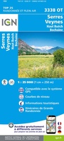 Wandelkaart - Topografische kaart 3338OT Serres - Veynes | IGN - Institut Géographique National
 Wandelkaart - Topografische kaart 3342OT Manosque - Forcalquier | IGN - Institut Géographique National
 Wandelkaart - Topografische kaart 3037 SB - Serie Bleue Crest – La Voulte-sur-Rhône | IGN - Institut Géographique National
 Wandelkaart - Topografische kaart 3038 SB - Serie Bleue Montélimar | IGN - Institut Géographique National
 Wandelkaart - Topografische kaart 3039ET Valréas | IGN - Institut Géographique National
 Wandelkaart - Topografische kaart 3040ET Carpentras | IGN - Institut Géographique National
 Wandelkaart - Topografische kaart 3040OT Orange | IGN - Institut Géographique National
 Wandelkaart - Topografische kaart 3041OT Avignon | IGN - Institut Géographique National
 Wandelkaart - Topografische kaart 3042OT Saint-Rémy-de-Provence | IGN - Institut Géographique National★★★★★
 Wandelkaart - Topografische kaart 3136ET Combe Laval | IGN - Institut Géographique National★★★★★
 Wandelkaart - Topografische kaart 3137OT Die – Crest – Saillans | IGN - Institut Géographique National★★★★★
 Wandelkaart - Topografische kaart 3138OT Dieulefit | IGN - Institut Géographique National★★★★★
 Wandelkaart - Topografische kaart 3139OT Nyons - Rémuzat | IGN - Institut Géographique National★★★★★
 Wandelkaart - Topografische kaart 3140ET Mont Ventoux | IGN - Institut Géographique National★★★★★★★★★★
Laatste reviews

Simpele keuze ondersteuning op website en hele snelle levering
Kort voor vakantie naar de Galapagos eilanden toch nog behoefte aan extra reisgids. Simpel kunnen bestellen en snelle levering. Zou niet weten wat er beter …
★★★★★ door Piet Grootenboer 25 juni 2026 | Heeft dit artikel gekocht
Te gek
Enorm mooie wereldkaart met details en snelle fijne levering.
★★★★★ door Steven Goyvaerts 25 juni 2026 | Heeft dit artikel gekocht
Goede gids voor pelgrims
Deze Cicerone gids over de via Francigena is uitermate geschikt om je route en etappes te plannen als je de Via Francigena vanuit Zwitserland gaat …
★★★★★ door Vic 24 juni 2026 | Heeft dit artikel gekocht
Aantrekkelijk en boordevol nuttige info
Heerlijk om al te kunnen voorbereiden op een fantastische vakantie met dit uiterst fijne boek.
★★★★★ door Harry 24 juni 2026 | Heeft dit artikel gekocht