Winkelwagen
Geen items in winkelwagen
Ga naar winkelwagen
Wandelkaarten - Pyreneeën
Overzichtskaarten
-
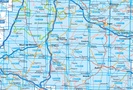
Wandelkaarten IGN 25.000 Midi - Pyreneeën : West

Producten op deze overzichtskaart:
Klik op een product om naar de pagina van dat product te gaan.
- Wandelkaart - Topografische kaart 1544 SB - Serie Bleue Arthez-de-Béarn | IGN - Institut Géographique National
- Wandelkaart - Topografische kaart 1644 SB - Serie Bleue Lembeye | IGN - Institut Géographique National
- Topografische kaart - Wandelkaart 1739 SB - Serie Bleue Tonneins - Casteljaloux | IGN - Institut Géographique National
- Wandelkaart - Topografische kaart 1740 SB - Serie Bleue Nérac | IGN - Institut Géographique National
- Wandelkaart - Topografische kaart 1741 SB - Serie Bleue Mézin | IGN - Institut Géographique National
- Topografische kaart - Wandelkaart 1742 SB - Serie Bleue Eauze | IGN - Institut Géographique National
- Wandelkaart - Topografische kaart 1743 SB - Serie Bleue Plaisance - Montesquiou | IGN - Institut Géographique National
- Wandelkaart - Topografische kaart 1744 SB - Serie Bleue Miélan - Vic en Bigorre | IGN - Institut Géographique National
- Wandelkaart 1840 SB - Serie Bleue Agen | IGN - Institut Géographique National
- Wandelkaart - Topografische kaart 1844 SB - Serie Bleue Mirande - Masseube | IGN - Institut Géographique National
- Wandelkaart - Topografische kaart 1939 SB - Serie Bleue Penne-d'Agenais | IGN - Institut Géographique National
- Wandelkaart - Topografische kaart 1941 SB - Serie Bleue Saint-Nicolas-de-la-Grave | IGN - Institut Géographique National
-
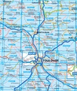
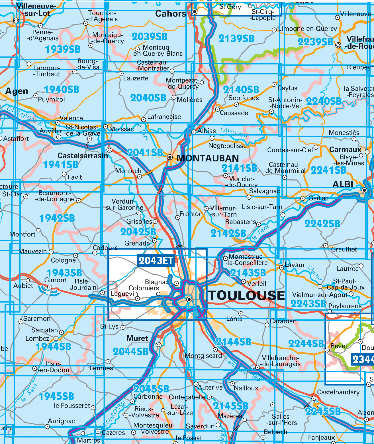
Wandelkaarten IGN 25.000 Midi - Pyreneeën : Oost
Producten op deze overzichtskaart:
Klik op een product om naar de pagina van dat product te gaan.
- Wandelkaart - Topografische kaart 1940 SB - Serie Bleue Valence | IGN - Institut Géographique National
- Wandelkaart - Topografische kaart 1942 SB - Serie Bleue Beaumont-de-Lomagne | IGN - Institut Géographique National
- Wandelkaart - Topografische kaart 1943 SB - Serie Bleue L'Isle-Jourdain | IGN - Institut Géographique National
- Wandelkaart - Topografische kaart 1944 SB - Serie Bleue Samatan | IGN - Institut Géographique National
- Wandelkaart - Topografische kaart 1945 SB - Serie Bleue Le Fousseret - Aurignac | IGN - Institut Géographique National
- Wandelkaart - Topografische kaart 2039 SB - Serie Bleue Montcuq-en-Quercy-Blanc, Labastide-Marnhac | IGN - Institut Géographique National
- Wandelkaart - Topografische kaart 2040 SB - Serie Bleue Moissac | IGN - Institut Géographique National
- Wandelkaart - Topografische kaart 2041 SB - Serie Bleue Montauban (Tarn-et-Garonne) - Castelsarrasin | IGN - Institut Géographique National
- Wandelkaart - Topografische kaart 2042SB SB - Serie Bleue Grenade | IGN - Institut Géographique National
- Wandelkaart - Topografische kaart 2043ET Toulouse | IGN - Institut Géographique National
- Wandelkaart - Topografische kaart 2044 SB - Serie Bleue Muret, Saint Lys | IGN - Institut Géographique National
- Wandelkaart - Topografische kaart 2045 SB - Serie Bleue Lézat-sur-Lèze, Cazeres | IGN - Institut Géographique National
- Wandelkaart - Topografische kaart 2139 SB - Serie Bleue Cahors | IGN - Institut Géographique National
- Wandelkaart - Topografische kaart 2140 SB - Serie Bleue Caussade | IGN - Institut Géographique National
- Wandelkaart - Topografische kaart 2141 SB - Serie Bleue Nègrepelisse | IGN - Institut Géographique National
- Wandelkaart - Topografische kaart 2142 SB - Serie Bleue Villemur-sur-Tarn | IGN - Institut Géographique National
- Wandelkaart - Topografische kaart 2143 SB - Serie Bleue Montastruc-la-Conseillère, Lavaur | IGN - Institut Géographique National
- Wandelkaart - Topografische kaart 2144 SB - Serie Bleue Ramonville-Saint-Agne | IGN - Institut Géographique National
- Wandelkaart - Topografische kaart 2145 SB - Serie Bleue Auterive - Mazères - Saverdun | IGN - Institut Géographique National
- Wandelkaart - Topografische kaart 2239 SB - Serie Bleue Villefranche-de-Rouergue, Martiel | IGN - Institut Géographique National
- Wandelkaart - Topografische kaart 2241 SB - Serie Bleue Albi, Cordes-sur-Ciel | IGN - Institut Géographique National
- Wandelkaart - Topografische kaart 2244 SB - Serie Bleue Revel, St-Félix-Lauragais, Sorèze | IGN - Institut Géographique National
- Wandelkaart - Topografische kaart 2245 SB - Serie Bleue Bram - Castelnaudary | IGN - Institut Géographique National
-
Wandelkaarten IGN 25.000 Pyreneeën : West


Producten op deze overzichtskaart:
Klik op een product om naar de pagina van dat product te gaan.
- Wandelkaart - Topografische kaart 1245OT Hendaye - St.Jean de Luz - Cote d'Argent | IGN - Institut Géographique National
- Wandelkaart - Topografische kaart 1343E SB - Serie Bleue Saint-Geours-de-Maremne | IGN - Institut Géographique National
- Wandelkaart - Topografische kaart 1344 SB - Serie Bleue Peyrehorade | IGN - Institut Géographique National
- Wandelkaart - Topografische kaart 1344OT Bayonne | IGN - Institut Géographique National
- Wandelkaart - Topografische kaart 1345OT Cambo-les-Bains – Hasparren | IGN - Institut Géographique National
- Topografische kaart - Wandelkaart 1346ET Forêt d'Iraty - Pic d'Orly | IGN - Institut Géographique National
- Topografische kaart - Wandelkaart 1346OT St.-Jean-Pied-de-Port | IGN - Institut Géographique National
- Wandelkaart - Topografische kaart 1444 SB - Serie Bleue Orthez | IGN - Institut Géographique National
- Wandelkaart - Topografische kaart 1445 SB - Serie Bleue Mauléon-Licharre – St-Palais | IGN - Institut Géographique National
- Wandelkaart - Topografische kaart 1446ET Tardets-Sorholus, Arette | IGN - Institut Géographique National
- Wandelkaart - Topografische kaart 1545 SB - Serie Bleue Oloron – Sainte-Marie | IGN - Institut Géographique National
- Wandelkaart - Topografische kaart 1545ET Pau | IGN - Institut Géographique National
- Wandelkaart - Topografische kaart 1546ET Laruns, Gourette | IGN - Institut Géographique National
- Wandelkaart - Topografische kaart 1546OT Oloron-Sainte.Marie, Vallee d'Aspe | IGN - Institut Géographique National
- Wandelkaart - Topografische kaart 1547OT Ossau - Vallée D'Aspe | IGN - Institut Géographique National
- Topografische kaart - Wandelkaart 1645 Pontacq - Ossun - Ger | IGN - Institut Géographique National
- Wandelkaart - Topografische kaart 1647ET Lourdes, Argeles-Gazost, Le Lavedan, Pierrefitte-Nestalas, Aucun | IGN - Institut Géographique National
- Wandelkaart - Topografische kaart 1647OT Vignemale, Ossau, Cauterets, Gourette | IGN - Institut Géographique National
- Wandelkaart - Topografische kaart 1745 SB - Serie Bleue Tarbes | IGN - Institut Géographique National
- Wandelkaart - Topografische kaart 1746 SB - Serie Bleue Bagnères-de-Bigorre | IGN - Institut Géographique National
- Wandelkaart - Topografische kaart 1747ET Bagnères-de-Bigorre | IGN - Institut Géographique National
- Wandelkaart - Topografische kaart 1748ET Neouvielle | IGN - Institut Géographique National
- Wandelkaart - Topografische kaart 1748OT Gavarnie | IGN - Institut Géographique National
- Wandelkaart - Topografische kaart 1845 SB - Serie Bleue Boulogne-sur-Gesse | IGN - Institut Géographique National
- Wandelkaart - Topografische kaart 1846 SB - Serie Bleue Lannemezan | IGN - Institut Géographique National
- Wandelkaart - Topografische kaart 1847OT Saint Bertrand de Comminges, Arreau | IGN - Institut Géographique National
- Wandelkaart - Topografische kaart 1848OT Bagnères de Luchon, | IGN - Institut Géographique National
- Wandelkaart - Topografische kaart 1848OTR Bagnères-de-Luchon | IGN - Institut Géographique National
-
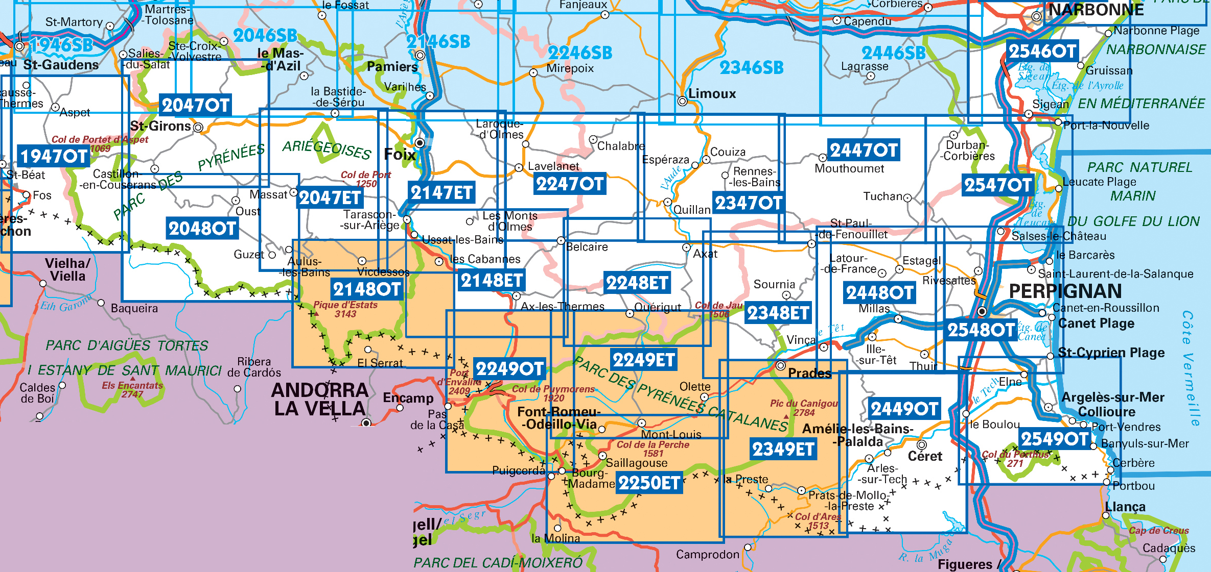
Wandelkaarten IGN 25.000 Pyreneeën : Oost

Producten op deze overzichtskaart:
Klik op een product om naar de pagina van dat product te gaan.
- Wandelkaart - Topografische kaart 1946 SB - Serie Bleue St-Gaudens, Salies-du-Salat | IGN - Institut Géographique National
- Wandelkaart - Topografische kaart 1947OT Aspet, Pic de Mauberme | IGN - Institut Géographique National
- Wandelkaart 2046 SB - Serie Bleue Le Mas-d'Azil | IGN - Institut Géographique National
- Wandelkaart - Topografische kaart 2047ET Massat - Pic des Trois Seigneurs - PNR Pyr. Ariégeoises | IGN - Institut Géographique National
- Wandelkaart 2047OT St-Girons / Couserans | IGN - Institut Géographique National
- Wandelkaart - Topografische kaart 2048OT Aulus-les-Bains, Mont Valier | IGN - Institut Géographique National
- Wandelkaart 2146 SB - Serie Bleue Pamiers / Varilhes | IGN - Institut Géographique National
- Wandelkaart 2147ET Foix | IGN - Institut Géographique National
- Wandelkaart 2148ET Ax-les-Thermes, Ussat, Les Cabannes, Ax-Bonascre | IGN - Institut Géographique National
- Wandelkaart 2148OT Vicdessos / Pique d'Estats / Pic du Montcalm | IGN - Institut Géographique National
- Wandelkaart - Topografische kaart 2246 SB - Serie Bleue Mirepoix | IGN - Institut Géographique National
- Wandelkaart - Topografische kaart 2247OT Lavelanet, Chalabre, Montségur, Laroque-d'Olmes | IGN - Institut Géographique National
- Wandelkaart - Topografische kaart 2248ET Axat, Querigut | IGN - Institut Géographique National
- Wandelkaart - Topografische kaart 2249ET Font Romeu, Capcir, Olette | IGN - Institut Géographique National
- Wandelkaart - Topografische kaart 2249OT Bourg-Madame, Pic Carlit, Col de Puymorens, Port d'Envalira | IGN - Institut Géographique National
- Wandelkaart - Topografische kaart 2250ET Bourg-Madame - Mont-Louis | IGN - Institut Géographique National
- Wandelkaart - Topografische kaart 2347OT Quillan, Alet-les-Bains, Couiza, Rennes-les-Bains, Esperaza | IGN - Institut Géographique National
- Wandelkaart - Topografische kaart 2348ET Prades, Sournia, Vinca, St.Paul-de-Fenouillet | IGN - Institut Géographique National
- Wandelkaart - Topografische kaart 2349ET Massif du Canigou, La Preste, Prats-de-Mollo, Vernet-les-Bains | IGN - Institut Géographique National
- Wandelkaart - Topografische kaart 2447OT Tuchan | IGN - Institut Géographique National
- Wandelkaart - Topografische kaart 2448OT Thuir, Ille-sur-Tet, Latour-de-France, Estagel, Millas | IGN - Institut Géographique National
- Wandelkaart - Topografische kaart 2449OT Céret, Amélie-les-Bains-Palalda, Vallée du Tech | IGN - Institut Géographique National
- Wandelkaart 2548OT Perpignan / Plages du Roussillon | IGN - Institut Géographique National
- Wandelkaart - Topografische kaart 2549OT Banyuls-sur-Mer | IGN - Institut Géographique National
 Wandelkaart 1 Pays Basque Ouest | Rando Editions
 Wandelkaart 3 Béarn - Bearn | Rando Editions★★★★★
 Wandelkaart - Topografische kaart 2549OT Banyuls-sur-Mer | IGN - Institut Géographique National
 Wandelkaart - Topografische kaart 2239 SB - Serie Bleue Villefranche-de-Rouergue, Martiel | IGN - Institut Géographique National
 Wandelkaart - Topografische kaart 2241 SB - Serie Bleue Albi, Cordes-sur-Ciel | IGN - Institut Géographique National★★★★★
 Wandelkaart - Topografische kaart 2244 SB - Serie Bleue Revel, St-Félix-Lauragais, Sorèze | IGN - Institut Géographique National
 Wandelkaart - Topografische kaart 2245 SB - Serie Bleue Bram - Castelnaudary | IGN - Institut Géographique National
 Wandelkaart - Topografische kaart 2246 SB - Serie Bleue Mirepoix | IGN - Institut Géographique National
 Wandelkaart - Topografische kaart 2247OT Lavelanet, Chalabre, Montségur, Laroque-d'Olmes | IGN - Institut Géographique National
 Wandelkaart - Topografische kaart 2248ET Axat, Querigut | IGN - Institut Géographique National★★★★★
 Wandelkaart - Topografische kaart 2249ET Font Romeu, Capcir, Olette | IGN - Institut Géographique National★★★★★
 Wandelkaart - Topografische kaart 2249OT Bourg-Madame, Pic Carlit, Col de Puymorens, Port d'Envalira | IGN - Institut Géographique National★★★★★
 Wandelkaart - Topografische kaart 2250ET Bourg-Madame - Mont-Louis | IGN - Institut Géographique National★★★★★
 Wandelkaart - Topografische kaart 2347OT Quillan, Alet-les-Bains, Couiza, Rennes-les-Bains, Esperaza | IGN - Institut Géographique National
 Wandelkaart - Topografische kaart 2348ET Prades, Sournia, Vinca, St.Paul-de-Fenouillet | IGN - Institut Géographique National
 Wandelkaart - Topografische kaart 2349ET Massif du Canigou, La Preste, Prats-de-Mollo, Vernet-les-Bains | IGN - Institut Géographique National★★★★★
 Wandelkaart - Topografische kaart 2447OT Tuchan | IGN - Institut Géographique National
 Wandelkaart - Topografische kaart 2448OT Thuir, Ille-sur-Tet, Latour-de-France, Estagel, Millas | IGN - Institut Géographique National
 Wandelkaart - Topografische kaart 2449OT Céret, Amélie-les-Bains-Palalda, Vallée du Tech | IGN - Institut Géographique National
 Wandelkaart 2 Pays Basque Est | Rando Editions★★★★★
- 1
- 2
- 3
- Volgende >>
- 5
Laatste reviews

Compact gidsje
Ben nog niet het veld in geweest met de gids maar de eerste indruk is veel informatie om een meerdaagse tocht uit te stippelen.
★★★★★ door Henk 04 juli 2026 | Heeft dit artikel gekocht
Beschikbaarheid en snelheid
Prima in orde!
★★★★★ door Marko 04 juli 2026 | Heeft dit artikel gekocht
Lekker analoog
Fijn boekje met veel informatie, behalve knooppunten Utrecht af en toe incorrect. Wat heerlijk om offline te navigeren, lekker analoog. Zodra je het systeem begrijpt …
★★★★★ door Daan 03 juli 2026 | Heeft dit artikel gekocht
Aanrader
Als je van geschiedenis, Groningen en kaarteen houdt, is dit echt een aanrader!
★★★★★ door Reinout 03 juli 2026 | Heeft dit artikel gekocht