Winkelwagen
Geen items in winkelwagen
Ga naar winkelwagen
Wandelkaarten - Bourgondië
Overzichtskaarten
-
Wandelkaarten IGN 25.000 Bourgondië: West

Producten op deze overzichtskaart:
Klik op een product om naar de pagina van dat product te gaan.
- Wandelkaart - Topografische kaart 2325 SB - Serie Bleue Châteuneuf-sur-Cher, Levet | IGN - Institut Géographique National
- Topografische kaart - Wandelkaart 2326 SB - Serie Bleue Saint-Amand-Montrond | IGN - Institut Géographique National
- Wandelkaart - Topografische kaart 2419 SB - Serie Bleue Montargis - Lorris | IGN - Institut Géographique National
- Wandelkaart - Topografische kaart 2420 SB - Serie Bleue Châtillon-Coligny, Nogent-sur-Vernisson | IGN - Institut Géographique National
- Wandelkaart - Topografische kaart 2421 SB - Serie Bleue Briare | IGN - Institut Géographique National
- Wandelkaart - Topografische kaart 2422 SB - Serie Bleue St-Satur, Léré, Vailly-sur-Sauldre | IGN - Institut Géographique National
- Wandelkaart 2423 SB - Serie Bleue Les Aix-d'Angillon / Sancerre | IGN - Institut Géographique National
- Wandelkaart - Topografische kaart 2425 SB - Serie Bleue Dun-sur-Aubron - Blet | IGN - Institut Géographique National
- Topografische kaart - Wandelkaart 2426 SB - Serie Bleue Charenton-du-Cher | IGN - Institut Géographique National
- Wandelkaart - Topografische kaart 2519 SB - Serie Bleue Courtenay, Château-Renard | IGN - Institut Géographique National
- Wandelkaart - Topografische kaart 2520 SB - Serie Bleue Champignelles, Bléneau, Charny Orée de Puisaye | IGN - Institut Géographique National
- Wandelkaart - Topografische kaart 2521 SB - Serie Bleue St-Fargeau, Neuvy-sur-Loire | IGN - Institut Géographique National
- Wandelkaart 2522 SB - Serie Bleue Cosne / Cours-sur-Loire / Donzy | NGI - Nationaal Geografisch Instituut
- Topografische kaart - Wandelkaart 2523 SB - Serie Bleue La Charité-sur-Loire | IGN - Institut Géographique National
- Wandelkaart - Topografische kaart 2524 SB - Serie Bleue Nevers, Jouet-sur-l'Aubois | IGN - Institut Géographique National
- Wandelkaart - Topografische kaart 2525 SB - Serie Bleue La Guerche-sur-l'Aubois, Sancoins, Magny-Cours | IGN - Institut Géographique National
- Topografische kaart - Wandelkaart 2526 SB - Serie Bleue Lurcy-Lévis | IGN - Institut Géographique National
- Wandelkaart - Topografische kaart 2618 SB - Serie Bleue Sens | IGN - Institut Géographique National
- Wandelkaart - Topografische kaart 2619 SB - Serie Bleue Joigny | IGN - Institut Géographique National
- Wandelkaart - Topografische kaart 2620 SB - Serie Bleue Auxerre - Toucy | IGN - Institut Géographique National
- Topografische kaart - Wandelkaart 2621 SB - Serie Bleue Courson-les-Carrières, Thury | IGN - Institut Géographique National
- Wandelkaart - Topografische kaart 2622 SB - Serie Bleue Clamecy - Varzy | IGN - Institut Géographique National
- Topografische kaart - Wandelkaart 2623 SB - Serie Bleue Prémery | IGN - Institut Géographique National
- Wandelkaart - Topografische kaart 2624 SB - Serie Bleue St-Benin-D'Azy – St-Saulge | IGN - Institut Géographique National
- Wandelkaart - Topografische kaart 2625 SB - Serie Bleue Decize - Imphy | IGN - Institut Géographique National
- Wandelkaart - Topografische kaart 2626 SB - Serie Bleue Dornes | IGN - Institut Géographique National
-
Wandelkaarten IGN 25.000 Bourgondië: OOSTELIJK GEDEELTE + MORVAN

Producten op deze overzichtskaart:
Klik op een product om naar de pagina van dat product te gaan.
- Wandelkaart - Topografische kaart 2719 SB - Serie Bleue Saint-Florentin – Flogny-la-Chapelle | IGN - Institut Géographique National
- Wandelkaart 2720 SB - Serie Bleue Chablis / Champs-sur-Yonne | IGN - Institut Géographique National
- Topografische kaart - Wandelkaart 2721 SB - Serie Bleue Vermenton | IGN - Institut Géographique National
- Topografische kaart - Wandelkaart 2722ET Avallon - Vézelay | IGN - Institut Géographique National
- Wandelkaart - Topografische kaart 2723 SB - Serie Bleue Corbigny | IGN - Institut Géographique National
- Topografische kaart - Wandelkaart 2723ET Château-Chinon | IGN - Institut Géographique National
- Topografische kaart - Wandelkaart 2725 SB - Serie Bleue Moulins-Engilbert | IGN - Institut Géographique National
- Topografische kaart - Wandelkaart 2819 SB - Serie Bleue Chaource | IGN - Institut Géographique National
- Topografische kaart - Wandelkaart 2820 SB - Serie Bleue Tonnerre | IGN - Institut Géographique National
- Topografische kaart - Wandelkaart 2821 SB - Serie Bleue L'Isle-sur-Serein | IGN - Institut Géographique National
- Wandelkaart - Topografische kaart 2822OT Quarre-les-Tombes | IGN - Institut Géographique National
- Topografische kaart - Wandelkaart 2823ET Saulieu - Lac de Settons | IGN - Institut Géographique National
- Wandelkaart - Topografische kaart 2824OT Autun - Mont Beuvray | IGN - Institut Géographique National
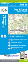
- Topografische kaart - Wandelkaart 2919 SB - Serie Bleue les Riceys | IGN - Institut Géographique National
- Topografische kaart - Wandelkaart 2920 SB - Serie Bleue Châtillon-sur-Seine | IGN - Institut Géographique National
- Topografische kaart - Wandelkaart 2921 Baigneux-les-Juifs, Alésia, Montbard | IGN - Institut Géographique National
- Wandelkaart - Topografische kaart 2922 SB - Serie Bleue Semur-en-Auxois – Vitteaux | IGN - Institut Géographique National
- Wandelkaart - Topografische kaart 2923 SB - Serie Bleue Pouilly-en-Auxois – Thoisy-la-Berchère | IGN - Institut Géographique National
- Wandelkaart - Topografische kaart 2924 SB - Serie Bleue Arnay-le-Duc – Epignac | IGN - Institut Géographique National
- Wandelkaart - Topografische kaart 2925 SB - Serie Bleue Autun - Le Creusot | IGN - Institut Géographique National
- Topografische kaart - Wandelkaart 3019 SB - Serie Bleue Châteauvillain | IGN - Institut Géographique National
- Topografische kaart - Wandelkaart 3020 SB - Serie Bleue Recey-sur-Ource | IGN - Institut Géographique National
- Wandelkaart - Topografische kaart 3021 Grancey-le-Château-Neuvelle – Aignay-le-Duc | IGN - Institut Géographique National
- Wandelkaart - Topografische kaart 3022ET Val-Suzon - St-Seine-l'Abbaye - Dijon Ouest | IGN - Institut Géographique National
- Wandelkaart - Topografische kaart 3023OT Nuits-St-Georges | IGN - Institut Géographique National
- Wandelkaart - Topografische kaart 3024OT Beaune Chagny | IGN - Institut Géographique National
- Topografische kaart - Wandelkaart 3121 SB - Serie Bleue Is-sur-Tille | IGN - Institut Géographique National
- Wandelkaart - Topografische kaart 3122 SB - Serie Bleue Mirebeau-sur-Bèze | IGN - Institut Géographique National
- Wandelkaart - Topografische kaart 3123 SB - Serie Bleue Dijon | IGN - Institut Géographique National
- Wandelkaart - Topografische kaart 3124 SB - Serie Bleue Seurre | IGN - Institut Géographique National
-
Wandelkaarten IGN 25.000 Bourgondië: ZUIDELIJK GEDEELTE

Producten op deze overzichtskaart:
Klik op een product om naar de pagina van dat product te gaan.
- Wandelkaart - Topografische kaart 2627 SB - Serie Bleue Moulins | IGN - Institut Géographique National
- Wandelkaart - Topografische kaart 2628 SB - Serie Bleue St-Pourçain-sur-Sioule | IGN - Institut Géographique National
- Wandelkaart - Topografische kaart 2629 SB - Serie Bleue Vichy | IGN - Institut Géographique National
- Wandelkaart - Topografische kaart 2630 SB - Serie Bleue Maringues | IGN - Institut Géographique National
- Topografische kaart - Wandelkaart 2726 SB - Serie Bleue Bourbon-Lancy | IGN - Institut Géographique National
- Wandelkaart - Topografische kaart 2727 SB - Serie Bleue Dompierre-sur-Besbre | IGN - Institut Géographique National
- Wandelkaart - Topografische kaart 2728 SB - Serie Bleue Le Donjon | IGN - Institut Géographique National
- Wandelkaart - Topografische kaart 2729 SB - Serie Bleue Lapalisse | IGN - Institut Géographique National
- Wandelkaart - Topografische kaart 2826 SB - Serie Bleue Luzy, Toulon-sur-Arroux | IGN - Institut Géographique National
- Wandelkaart - Topografische kaart 2827 SB - Serie Bleue Paray-le-Monial | IGN - Institut Géographique National
- Wandelkaart - Topografische kaart 2828 SB - Serie Bleue Charolles | IGN - Institut Géographique National
- Wandelkaart - Topografische kaart 2829 SB - Serie Bleue Charlieu – Chauffailles | IGN - Institut Géographique National
- Wandelkaart - Topografische kaart 2830 SB - Serie Bleue Roanne – Thizy-les-Bourgs | IGN - Institut Géographique National
- Wandelkaart - Topografische kaart 2926 SB - Serie Bleue Montceau-les-Mines, Ecuisses | IGN - Institut Géographique National
- Wandelkaart - Topografische kaart 2927 SB - Serie Bleue St-Bonnet-de-Joux – Saint-Gengoux-le-National | IGN - Institut Géographique National
- Wandelkaart - Topografische kaart 2928 SB - Serie Bleue Cluny Matour | IGN - Institut Géographique National
- Wandelkaart - Topografische kaart 2929ET Beaujeu - Belleville - Haut Beaujolais – Rhônevallei – Bourgondië | IGN - Institut Géographique National
- Wandelkaart - Topografische kaart 3026 SB - Serie Bleue Chalon-sur-Saône, St-Gernain-du-Plain | IGN - Institut Géographique National
- Wandelkaart - Topografische kaart 3027 SB - Serie Bleue Tournus - Lugny | IGN - Institut Géographique National
- Wandelkaart - Topografische kaart 3028OT Mâcon - Cluny | IGN - Institut Géographique National
- Wandelkaart - Topografische kaart 3029 SB - Serie Bleue Châtillon-sur-Chalaronne – Belleville | IGN - Institut Géographique National
- Wandelkaart - Topografische kaart 3127 SB - Serie Bleue Cuiseaux | IGN - Institut Géographique National
 Topografische kaart - Wandelkaart 2919 SB - Serie Bleue les Riceys | IGN - Institut Géographique National
 Topografische kaart - Wandelkaart 2920 SB - Serie Bleue Châtillon-sur-Seine | IGN - Institut Géographique National
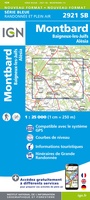 Topografische kaart - Wandelkaart 2921 Baigneux-les-Juifs, Alésia, Montbard | IGN - Institut Géographique National
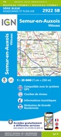 Wandelkaart - Topografische kaart 2922 SB - Serie Bleue Semur-en-Auxois – Vitteaux | IGN - Institut Géographique National★★★★★
 Wandelkaart - Topografische kaart 2923 SB - Serie Bleue Pouilly-en-Auxois – Thoisy-la-Berchère | IGN - Institut Géographique National
 Wandelkaart - Topografische kaart 2924 SB - Serie Bleue Arnay-le-Duc – Epignac | IGN - Institut Géographique National★★★★★
 Wandelkaart - Topografische kaart 2925 SB - Serie Bleue Autun - Le Creusot | IGN - Institut Géographique National
 Wandelkaart - Topografische kaart 2926 SB - Serie Bleue Montceau-les-Mines, Ecuisses | IGN - Institut Géographique National
 Wandelkaart - Topografische kaart 2927 SB - Serie Bleue St-Bonnet-de-Joux – Saint-Gengoux-le-National | IGN - Institut Géographique National
 Wandelkaart - Topografische kaart 2928 SB - Serie Bleue Cluny Matour | IGN - Institut Géographique National
 Wandelkaart - Topografische kaart 2929ET Beaujeu - Belleville - Haut Beaujolais – Rhônevallei – Bourgondië | IGN - Institut Géographique National
 Topografische kaart - Wandelkaart 3019 SB - Serie Bleue Châteauvillain | IGN - Institut Géographique National
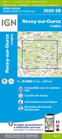 Topografische kaart - Wandelkaart 3020 SB - Serie Bleue Recey-sur-Ource | IGN - Institut Géographique National
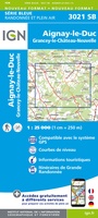 Wandelkaart - Topografische kaart 3021 Grancey-le-Château-Neuvelle – Aignay-le-Duc | IGN - Institut Géographique National
 Wandelkaart - Topografische kaart 3022ET Val-Suzon - St-Seine-l'Abbaye - Dijon Ouest | IGN - Institut Géographique National★★★★★
 Wandelkaart - Topografische kaart 3023OT Nuits-St-Georges | IGN - Institut Géographique National
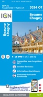 Wandelkaart - Topografische kaart 3024OT Beaune Chagny | IGN - Institut Géographique National
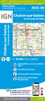 Wandelkaart - Topografische kaart 3026 SB - Serie Bleue Chalon-sur-Saône, St-Gernain-du-Plain | IGN - Institut Géographique National
 Wandelkaart - Topografische kaart 3027 SB - Serie Bleue Tournus - Lugny | IGN - Institut Géographique National
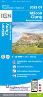 Wandelkaart - Topografische kaart 3028OT Mâcon - Cluny | IGN - Institut Géographique National
- 1
- 2
- 3
- Volgende >>
- 4
Laatste reviews

Simpele keuze ondersteuning op website en hele snelle levering
Kort voor vakantie naar de Galapagos eilanden toch nog behoefte aan extra reisgids. Simpel kunnen bestellen en snelle levering. Zou niet weten wat er beter …
★★★★★ door Piet Grootenboer 25 juni 2026 | Heeft dit artikel gekocht
Te gek
Enorm mooie wereldkaart met details en snelle fijne levering.
★★★★★ door Steven Goyvaerts 25 juni 2026 | Heeft dit artikel gekocht
Goede gids voor pelgrims
Deze Cicerone gids over de via Francigena is uitermate geschikt om je route en etappes te plannen als je de Via Francigena vanuit Zwitserland gaat …
★★★★★ door Vic 24 juni 2026 | Heeft dit artikel gekocht
Aantrekkelijk en boordevol nuttige info
Heerlijk om al te kunnen voorbereiden op een fantastische vakantie met dit uiterst fijne boek.
★★★★★ door Harry 24 juni 2026 | Heeft dit artikel gekocht