Winkelwagen
Geen items in winkelwagen
Ga naar winkelwagen
Wandelkaarten - Nationaal park Écrins
Overzichtskaarten
-
Wandelkaarten IGN 25.000 Hautes Alpes: Ecrins
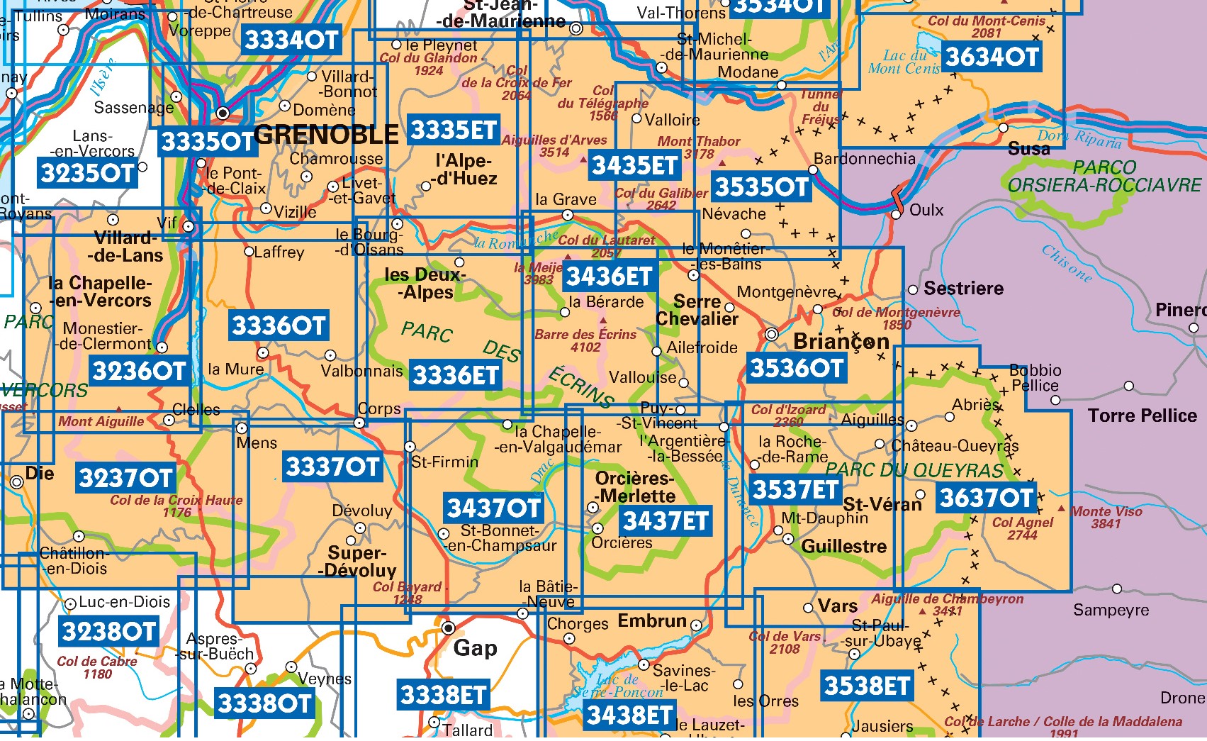
Producten op deze overzichtskaart:
Klik op een product om naar de pagina van dat product te gaan.
- Wandelkaart - Topografische kaart 3335OT Grenoble | IGN - Institut Géographique National
- Wandelkaart - Topografische kaart 3335OTR Grenoble | IGN - Institut Géographique National
- Wandelkaart - Topografische kaart 3336ET Les Deux Alpes | IGN - Institut Géographique National
- Wandelkaart - Topografische kaart 3336ETR Les Deux Alpes / Olan / Muzelle /PNR des Ecrins | IGN - Institut Géographique National
- Wandelkaart - Topografische kaart 3336OT La Mure | IGN - Institut Géographique National
- Wandelkaart - Topografische kaart 3337OT Dévoluy | IGN - Institut Géographique National
- Wandelkaart - Topografische kaart 3337OTR Dévoluy | IGN - Institut Géographique National
- Wandelkaart - Topografische kaart 3338ET Gap | IGN - Institut Géographique National
- Wandelkaart - Topografische kaart 3436ET Meije - Pelvoux | IGN - Institut Géographique National
- Wandelkaart - Topografische kaart 3437ET Orcières-Merlette | IGN - Institut Géographique National
- Wandelkaart - Topografische kaart 3437OT Champsaur | IGN - Institut Géographique National
- Wandelkaart - Topografische kaart 3438ET Embrun | IGN - Institut Géographique National
- Wandelkaart - Topografische kaart 3536OT Briançon | IGN - Institut Géographique National
- Wandelkaart - Topografische kaart 3537ET Guillestre | IGN - Institut Géographique National
- Wandelkaart - Topografische kaart 3538ET Aiguille de Chamberyron | IGN - Institut Géographique National
- Wandelkaart - Topografische kaart 3637OT Mont Viso | IGN - Institut Géographique National
 Wandelkaart - Topografische kaart 3637OT Mont Viso | IGN - Institut Géographique National★★★★★
 Wandelkaart - Topografische kaart 3639OT Haute Tinée 1 | IGN - Institut Géographique National
 Wandelkaart 6 Queyras - Ubaye | Didier Richard★★★★★
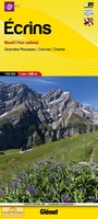 Wandelkaart 5 Ecrins Massif | Didier Richard
 Wandelkaart Tour de l'Oisans et des Écrins GR54 | Didier Richard
 Wandelkaart - Wegenkaart - landkaart 89024 Grande traversée des Alpes GR5 | IGN - Institut Géographique National★★★★★★★★★★
 Wandelkaart 89034 Tour de Oisans et des Ecrins GR54 | IGN - Institut Géographique National
 Fietskaart - Wandelkaart 75005 Briançonnais – Queyras | IGN - Institut Géographique National★★★★★
 Fietskaart - Wandelkaart 75006 Oisans Champsaur - Massif des Ecrins | IGN - Institut Géographique National
 Fietskaart - Wandelkaart 75008 Ubaye, Val d'Allos, Lac de Serre-Poncon | IGN - Institut Géographique National
 Wandelkaart Queyras Parc naturel regional | Didier Richard
Laatste reviews

Mooie gedetailleerde kaart van uitstekende kwaliteit
De kaart van Sumatra geeft een goed overzicht van de infrastructuur van Sumatra.
★★★★★ door Cor Verheul 02 januari 2026 | Heeft dit artikel gekocht
Jacobspad Uithuizen - Hasselt; De ontvanger was er heel blij mee
Mooi om te geven
★★★★★ door Martsjen Wiersma 01 januari 2026 | Heeft dit artikel gekocht
Moeilijk te zien
Voor mij een lastig te gebruiken plattegrond. Moeilijk om hiermee te oriënteren in de omgeving.
★★★★★ door Marco 01 januari 2026 | Heeft dit artikel gekocht
vermoedelijk een nuttig boekje naast Google translate
dit boekje aangeschaft ter ondersteuning bij mogelijke taalproblemen; de waarde ervan zal blijken tijden de reis in juni 2026
★★★★★ door Bert Bosch 31 december 2025 | Heeft dit artikel gekocht