
Winkelwagen
Geen items in winkelwagen
Ga naar winkelwagen
Wandelkaarten - Vendee
 Wandelkaart - Topografische kaart 1324 SB - Serie Bleue Clisson | IGN - Institut Géographique National
 Wandelkaart - Topografische kaart 1325 SB - Serie Bleue Montaigu | IGN - Institut Géographique National
 Wandelkaart - Topografische kaart 1326 SB - Serie Bleue La Roche-sur-Yon | IGN - Institut Géographique National
 Wandelkaart 1327 SB - Serie Bleue Luçon / St-Michel-en-l'Herm | IGN - Institut Géographique National
 Wandelkaart 1328OT La Tranche-s-Mer / l'Aiguillon-s-Mer PNR Marais Poitevin | IGN - Institut Géographique National
 Wandelkaart - Topografische kaart 1329ET La Rochelle - Anse de l'Aiguillon | IGN - Institut Géographique National
 Wandelkaart - Topografische kaart 1424 SB - Serie Bleue Cholet | IGN - Institut Géographique National
 Wandelkaart - Topografische kaart 1425 SB - Serie Bleue Les Herbiers | IGN - Institut Géographique National
 Wandelkaart - Topografische kaart 1426 SB - Serie Bleue Chantonnay | IGN - Institut Géographique National
 Wandelkaart 1427 SB - Serie Bleue Fontenay-le-Comte | IGN - Institut Géographique National
 Wandelkaart 1428 SB - Serie Bleue Marans | IGN - Institut Géographique National
 Wandelkaart - Topografische kaart 1225 SB - Serie Bleue Legé | IGN - Institut Géographique National
 Wandelkaart - Topografische kaart 1226 SB - Serie Bleue Le Poiré-sur-Vie, Aizenay, La Mothe-Achard | IGN - Institut Géographique National
 Wandelkaart - Topografische kaart 1227 SB - Serie Bleue Aubigny-les-Clouzeaux | IGN - Institut Géographique National
 Wandelkaart 1227OT Les Sables-d'Olonne | IGN - Institut Géographique National
 Wandelkaart - Topografische kaart 1528 SB - Serie Bleue Niort | IGN - Institut Géographique National
 Wandelkaart - Topografische kaart 1125 SB - Serie Bleue Challans, Machecoul-Saint-Même | IGN - Institut Géographique National
 Wandelkaart - Topografische kaart 1125OT Ile de Noirmoutier, Beauvoir-sur-Mer & Bourgneuf-en-Ret | IGN - Institut Géographique National
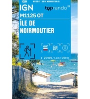 Wandelkaart 1125OT Ile de Noirmoutier mini | IGN - Institut Géographique National
 Wandelkaart - Topografische kaart 1126OT Ile d'Yeu, Saint-Gilles-Croix-de-Vie & Saint-Jean-de-Mont | IGN - Institut Géographique National
Laatste reviews

Fijne kaart
Zeer fijne duidelijke kaart, je kunt Australië in z’n geheel overzien als je de kaart uitvouwt. Goede kaart om reis met de auto te plannen
★★★★★ door Marlies 28 oktober 2026 | Heeft dit artikel gekocht
Zeer gebruiksvriendelijk
Net terug van onze vakantie in Griekenland. We hebben 3 dagen op het eiland Andros verbleven en dit boekje was een waardige wandelgids.
★★★★★ door Frank Uytterschaut 27 oktober 2026 | Heeft dit artikel gekocht
retro wereldkaart-tas
een hele grote tas, fijn voor niet te zware spullen. En makkelijk om overal mee naar toe te nemen. En ook belangrijk, hij ziet er …
★★★★★ door Lisette Emmen 27 oktober 2026 | Heeft dit artikel gekocht
en nu fietsen maar
ik had nog een hele oude liggen, nu een handzamer formaat dus ook makkelijker om mee te nemen bij meerdaagse fietstochten
★★★★★ door Lisette 27 oktober 2026 | Heeft dit artikel gekocht