Winkelwagen
Geen items in winkelwagen
Ga naar winkelwagen
Wandelkaarten - Alpen - Vaucluse - Drome - Vercors
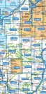
Overzichtskaarten
-
Wandelkaarten IGN 25.000 Franse Alpen: Vercors - Drome - Vaucluse
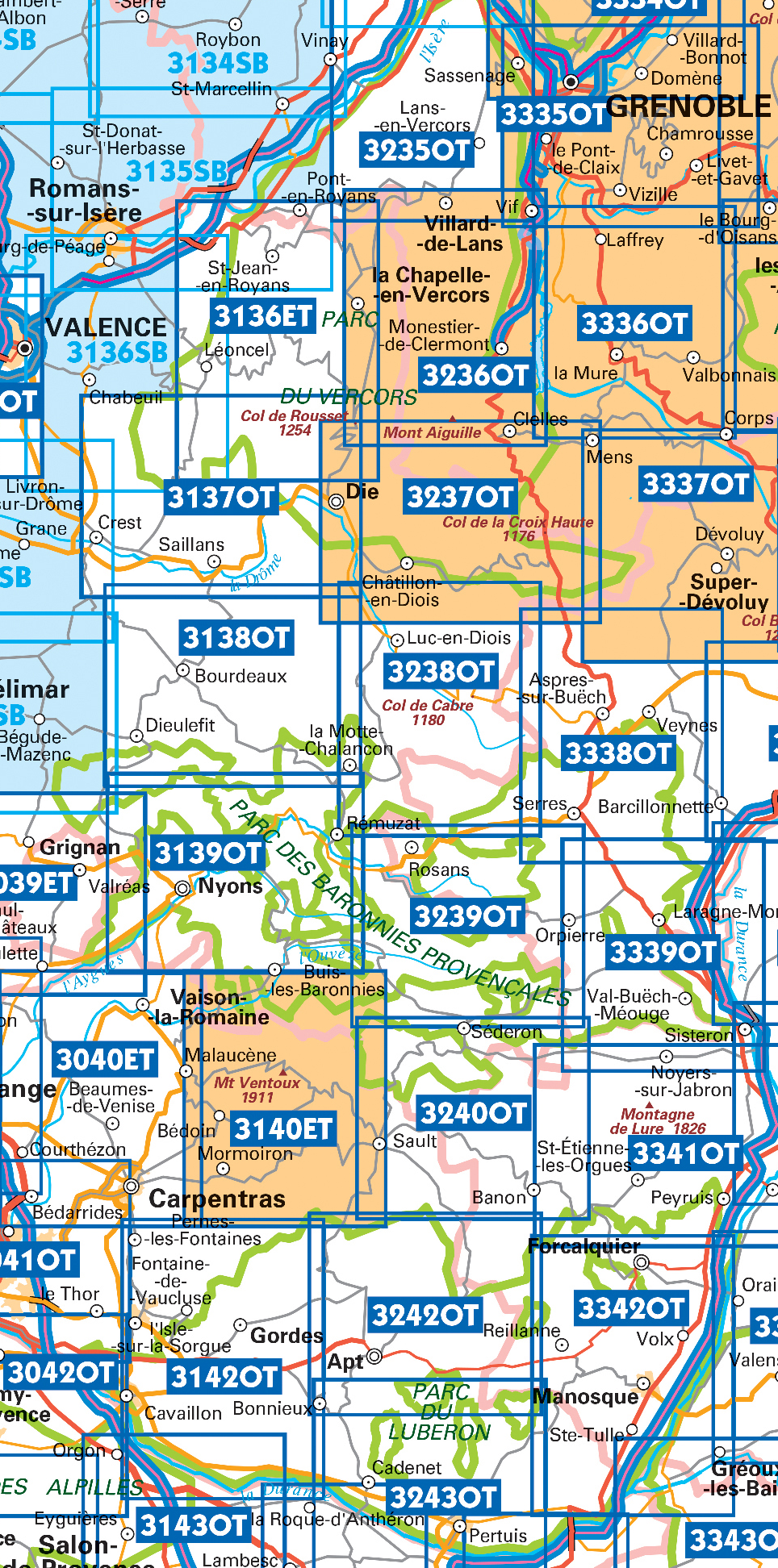
Producten op deze overzichtskaart:
Klik op een product om naar de pagina van dat product te gaan.
- Wandelkaart - Topografische kaart 3037 SB - Serie Bleue Crest – La Voulte-sur-Rhône | IGN - Institut Géographique National
- Wandelkaart - Topografische kaart 3038 SB - Serie Bleue Montélimar | IGN - Institut Géographique National
- Wandelkaart - Topografische kaart 3039ET Valréas | IGN - Institut Géographique National
- Wandelkaart - Topografische kaart 3040ET Carpentras | IGN - Institut Géographique National
- Wandelkaart - Topografische kaart 3040OT Orange | IGN - Institut Géographique National
- Wandelkaart - Topografische kaart 3041OT Avignon | IGN - Institut Géographique National
- Wandelkaart - Topografische kaart 3136ET Combe Laval | IGN - Institut Géographique National
- Wandelkaart - Topografische kaart 3137OT Die – Crest – Saillans | IGN - Institut Géographique National
- Wandelkaart - Topografische kaart 3138OT Dieulefit | IGN - Institut Géographique National
- Wandelkaart - Topografische kaart 3139OT Nyons - Rémuzat | IGN - Institut Géographique National
- Wandelkaart - Topografische kaart 3140ET Mont Ventoux | IGN - Institut Géographique National
- Wandelkaart - Topografische kaart 3140ETR Mont Ventoux | IGN - Institut Géographique National
- Wandelkaart - Topografische kaart 3142OT Cavaillon | IGN - Institut Géographique National
- Wandelkaart - Topografische kaart 3235OT Autrans | IGN - Institut Géographique National
- Wandelkaart 3236OT Villard-de-Lans | IGN - Institut Géographique National
- Wandelkaart - Topografische kaart 3236OTR Villard-de-Lans / Mont Aiguille / PNR du Vercors | IGN - Institut Géographique National1
- Wandelkaart - Topografische kaart 3237OT Glandasse | IGN - Institut Géographique National
- Wandelkaart - Topografische kaart 3237OTR Glandasse / Col de la Croix-Haute / PNR du Vercors | IGN - Institut Géographique National
- Wandelkaart 3239OT Rosans / Orpierre / Baronnies Orientales | IGN - Institut Géographique National
- Wandelkaart - Topografische kaart 3240OT Banon - Sault | IGN - Institut Géographique National
- Wandelkaart - Topografische kaart 3242OT Apt | IGN - Institut Géographique National
- Wandelkaart - Topografische kaart 3243OT Pertuis - Lourmarin | IGN - Institut Géographique National
- Wandelkaart - Topografische kaart 3338OT Serres - Veynes | IGN - Institut Géographique National
- Wandelkaart 3339OT Sisteron / Laragne-Montéglin / Montagne de Chabre | IGN - Institut Géographique National
- Wandelkaart - Topografische kaart 3342OT Manosque - Forcalquier | IGN - Institut Géographique National
 Wandelkaart - Topografische kaart 3338OT Serres - Veynes | IGN - Institut Géographique National
 Wandelkaart - Topografische kaart 3342OT Manosque - Forcalquier | IGN - Institut Géographique National
 Wandelkaart - Topografische kaart 3037 SB - Serie Bleue Crest – La Voulte-sur-Rhône | IGN - Institut Géographique National
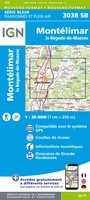 Wandelkaart - Topografische kaart 3038 SB - Serie Bleue Montélimar | IGN - Institut Géographique National
 Wandelkaart - Topografische kaart 3039ET Valréas | IGN - Institut Géographique National
 Wandelkaart - Topografische kaart 3040ET Carpentras | IGN - Institut Géographique National
 Wandelkaart - Topografische kaart 3040OT Orange | IGN - Institut Géographique National
 Wandelkaart - Topografische kaart 3041OT Avignon | IGN - Institut Géographique National
 Wandelkaart - Topografische kaart 3042OT Saint-Rémy-de-Provence | IGN - Institut Géographique National★★★★★
 Wandelkaart - Topografische kaart 3137OT Die – Crest – Saillans | IGN - Institut Géographique National★★★★★
 Wandelkaart - Topografische kaart 3138OT Dieulefit | IGN - Institut Géographique National★★★★★
 Wandelkaart - Topografische kaart 3139OT Nyons - Rémuzat | IGN - Institut Géographique National★★★★★
 Wandelkaart - Topografische kaart 3140ET Mont Ventoux | IGN - Institut Géographique National★★★★★★★★★★
 Wandelkaart - Topografische kaart 3142OT Cavaillon | IGN - Institut Géographique National
 Wandelkaart - Topografische kaart 3235OT Autrans | IGN - Institut Géographique National★★★★★
 Wandelkaart 3236OT Villard-de-Lans | IGN - Institut Géographique National★★★★★
 Wandelkaart - Topografische kaart 3237OT Glandasse | IGN - Institut Géographique National
 Wandelkaart - Topografische kaart 3240OT Banon - Sault | IGN - Institut Géographique National★★★★★
 Wandelkaart - Topografische kaart 3242OT Apt | IGN - Institut Géographique National
 Wandelkaart - Topografische kaart 3243OT Pertuis - Lourmarin | IGN - Institut Géographique National★★★★★
Laatste reviews

Leuk informatief boek, precieze route goed weergegeven.
Keurig verpakt, snel verzonden. Boek voldoet aan mijn verwachtingen!
★★★★★ door Beatrice 12 mei 2026 | Heeft dit artikel gekocht
Top service en snelle verzending
Zoals altijd een goede ervaring en een perfecte snelle levering
★★★★★ door Perry Miog 12 mei 2026 | Heeft dit artikel gekocht
Mooie fietskaarten snelle verzending
Altijd weer fijn om te vinden wat ik zoek. Ruim aanbod van fietskaarten.
★★★★★ door Trudy 11 mei 2026 | Heeft dit artikel gekocht
Prachtige wandelingen, duidelijk beschreven
Handig formaat wandelgidsje met schitterende wandelingen in noord Portugal. De duidelijke beschrijvingen zijn handig zowel voor het plannen van de wandeling, bij het vinden van …
★★★★★ door Annemieke 11 mei 2026 | Heeft dit artikel gekocht