Winkelwagen
Geen items in winkelwagen
Ga naar winkelwagen
Wandelkaarten - Pays de la Loire
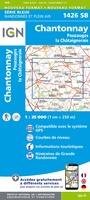 Wandelkaart - Topografische kaart 1426 SB - Serie Bleue Chantonnay | IGN - Institut Géographique National
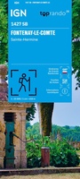 Wandelkaart 1427 SB - Serie Bleue Fontenay-le-Comte | IGN - Institut Géographique National
 Wandelkaart 1428 SB - Serie Bleue Marans | IGN - Institut Géographique National
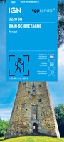 Wandelkaart 1220 SB - Serie Bleue Bain-de-Bretagne / Rougé | IGN - Institut Géographique National
 Wandelkaart - Topografische kaart 1221 SB - Serie Bleue Guémené – Penfao – Nozay | IGN - Institut Géographique National
 Wandelkaart - Topografische kaart 1222 SB - Serie Bleue Blain - Nort-sur-Erdre | IGN - Institut Géographique National
 Topografische kaart - Wandelkaart 1224 SB - Serie Bleue St-Philbert-de-Grand-Lieu, Les Sorinières | IGN - Institut Géographique National
 Wandelkaart - Topografische kaart 1225 SB - Serie Bleue Legé | IGN - Institut Géographique National
 Wandelkaart - Topografische kaart 1226 SB - Serie Bleue Le Poiré-sur-Vie, Aizenay, La Mothe-Achard | IGN - Institut Géographique National
 Wandelkaart - Topografische kaart 1227 SB - Serie Bleue Aubigny-les-Clouzeaux | IGN - Institut Géographique National
 Wandelkaart 1227OT Les Sables-d'Olonne | IGN - Institut Géographique National
 Wandelkaart - Topografische kaart 1517 SB - Serie Bleue Mayenne - Le Horps | IGN - Institut Géographique National★★★★★
 Wandelkaart - Topografische kaart 1518 SB - Serie Bleue Evron - Montsûrs | IGN - Institut Géographique National★★★★★
 Wandelkaart - Topografische kaart 1519 SB - Serie Bleue Meslay-du-Maine, Vaiges | IGN - Institut Géographique National
 Wandelkaart - Topografische kaart 1520 SB - Serie Bleue Château-Gontier | IGN - Institut Géographique National
 Wandelkaart - Topografische kaart 1521 SB - Serie Bleue le Lion-d'Angers | IGN - Institut Géographique National
 Wandelkaart - Topografische kaart 1522ET Angers | IGN - Institut Géographique National
 Topografische kaart - Wandelkaart 1524 SB - Serie Bleue Vihiers | IGN - Institut Géographique National
 Wandelkaart - Topografische kaart 1528 SB - Serie Bleue Niort | IGN - Institut Géographique National
 Wandelkaart - Topografische kaart 1617 SB - Serie Bleue Villaines-la-Juhel, St-Pierre-des-Nids, Alpes Mancelles | IGN - Institut Géographique National
Laatste reviews

Top gids met alle benodigde informatie.
Prachtige wandelgids voorzien van alle voor de wandelaars benodigde informatie (accommodaties, restaurants en cafés, vervoersmogelijkheden enz.). Ook is de gids beschreven in twee richtingen en …
★★★★★ door Mathie Hoenjet 27 juni 2026 | Heeft dit artikel gekocht
snel bezorgd
Zoals altijd duidelijke en overzichtelijke kaart van Michelin
★★★★★ door Charles Trippelvitz 26 juni 2026 | Heeft dit artikel gekocht
Het was heel leuk om de Vennbahn te fietsen aan de hand van deze handige gids!
Door deze gids konden we ons heel goed voorbereiden op onze fietstocht. En het gebruik onderweg was ook prima. Jammer dat de campings onderweg wat …
★★★★★ door Helma Feenstra 26 juni 2026 | Heeft dit artikel gekocht
Simpele keuze ondersteuning op website en hele snelle levering
Kort voor vakantie naar de Galapagos eilanden toch nog behoefte aan extra reisgids. Simpel kunnen bestellen en snelle levering. Zou niet weten wat er beter …
★★★★★ door Piet Grootenboer 25 juni 2026 | Heeft dit artikel gekocht