Winkelwagen
Geen items in winkelwagen
Ga naar winkelwagen
Wandelkaarten - Bretagne
Overzichtskaarten
-
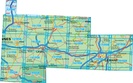
Wandelkaart IGN 25.000 Bretagne WESTELIJK GEDEELTE
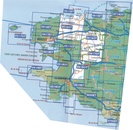
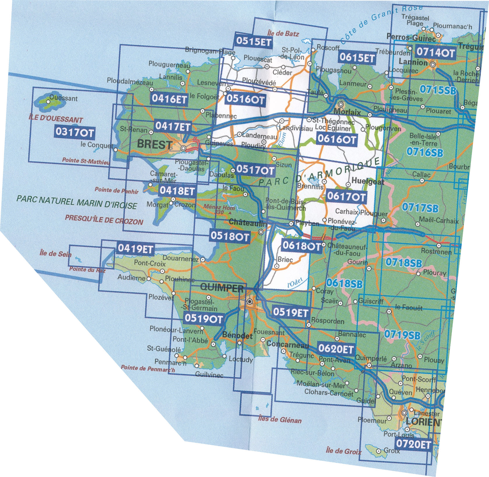
Producten op deze overzichtskaart:
Klik op een product om naar de pagina van dat product te gaan.
- Wandelkaart - Topografische kaart 0317OT Île d'Ouessant, Le Conquet | IGN - Institut Géographique National
- Wandelkaart - Topografische kaart 0416ET Plouguerneau, Les Abers, Plabennec, Ploudalmezeau | IGN - Institut Géographique National
- Wandelkaart - Topografische kaart 0417ET Brest, Pointe de St.Mathieu, St.-Renan, Le Conquet, Guipavas | IGN - Institut Géographique National
- Wandelkaart - Topografische kaart 0418ET Camaret, Presqu'Île de Crozon, Morgat | IGN - Institut Géographique National
- Wandelkaart - Topografische kaart 0419ET Audierne, Pointe du Raz, Pont-Croix,Plouhinec, Plozévet | IGN - Institut Géographique National
- Wandelkaart - Topografische kaart 0515ET St.Pol-de-Léon, Roscoff, Brignogan-Plage, Plouescat, Cléder Bretagne | IGN - Institut Géographique National
- Wandelkaart - Topografische kaart 0516OT Landerneau, Landivisiau | IGN - Institut Géographique National
- Wandelkaart - Topografische kaart 0517OT Plougastel, Daoulas, Le Faou, PNR D'Armorique | IGN - Institut Géographique National
- Wandelkaart - Topografische kaart 0518OT Chateaulin, Douarnenez, Locronan, Ménez Hom, Le Faou | IGN - Institut Géographique National
- Wandelkaart - Topografische kaart 0519ET Quimper, Concarneau, Fouesnant, Beg-Meil, iles de Glénan | IGN - Institut Géographique National
- Wandelkaart - Topografische kaart 0519OT Pont l Abbé, Pointe de Penmarc h, Plogastel-St.-Germain, Plonéour-Lanvern | IGN - Institut Géographique National
- Wandelkaart - Topografische kaart 0615ET Morlaix, Lanmeur, Plougasnou, Taule, Plestin-les-Greves | IGN - Institut Géographique National
- Wandelkaart - Topografische kaart 0616OT Morlaix - Vallée Queffleuth - PNR Armorique | IGN - Institut Géographique National
- Wandelkaart - Topografische kaart 0617OT Huelgoat, Monts d´Arrée, PNR d´Armorique, Plonevez - du - Faou | IGN - Institut Géographique National
- Wandelkaart - Topografische kaart 0618OT Châteauneuf-du-Fao, Vallée l'Aulne - PNR Armorique | IGN - Institut Géographique National
- Wandelkaart - Topografische kaart 0618SB Scaër | IGN - Institut Géographique National
- Wandelkaart - Topografische kaart 0620ET Quimperlé, Pont-Aven, Tregunc, Bannalec, Clohars-Carnoët | IGN - Institut Géographique National
- Wandelkaart - Topografische kaart 0714OT Perros-Guirec, Lannion, Trégastel-Plage, Trébeurden, Côte de Granit Rose | IGN - Institut Géographique National
- Wandelkaart - Topografische kaart 0715SB Bégard - Lannion | IGN - Institut Géographique National
- Wandelkaart - Topografische kaart 0716SB Belle-Isle-en-Terre, Guerlesquin | IGN - Institut Géographique National
- Wandelkaart - Topografische kaart 0717SB Carhaix-Plouguer, Maël-Carhaix | IGN - Institut Géographique National
- Wandelkaart - Topografische kaart 0718SB Rostrenen | IGN - Institut Géographique National
- Wandelkaart - Topografische kaart 0719SB Plouay - Le Faouet | IGN - Institut Géographique National
- Wandelkaart - Topografische kaart 0720ET Lorient - Ile de Groix | IGN - Institut Géographique National
-
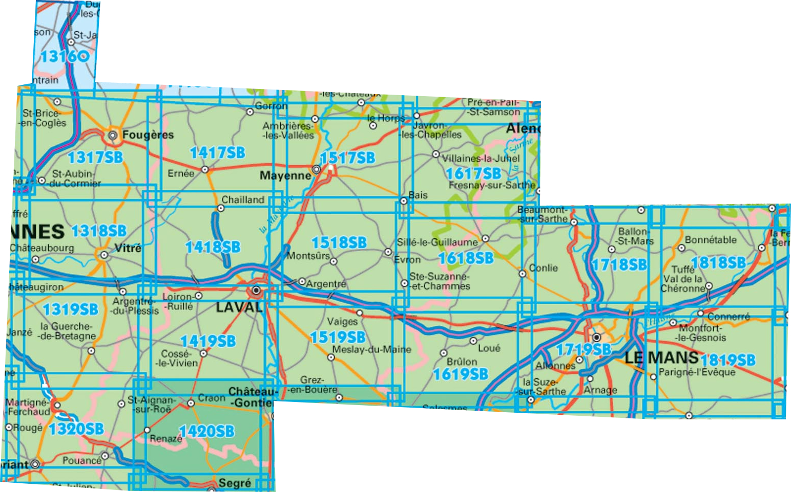
Wandelkaart IGN 25.000 Bretagne MIDDEN GEDEELTE
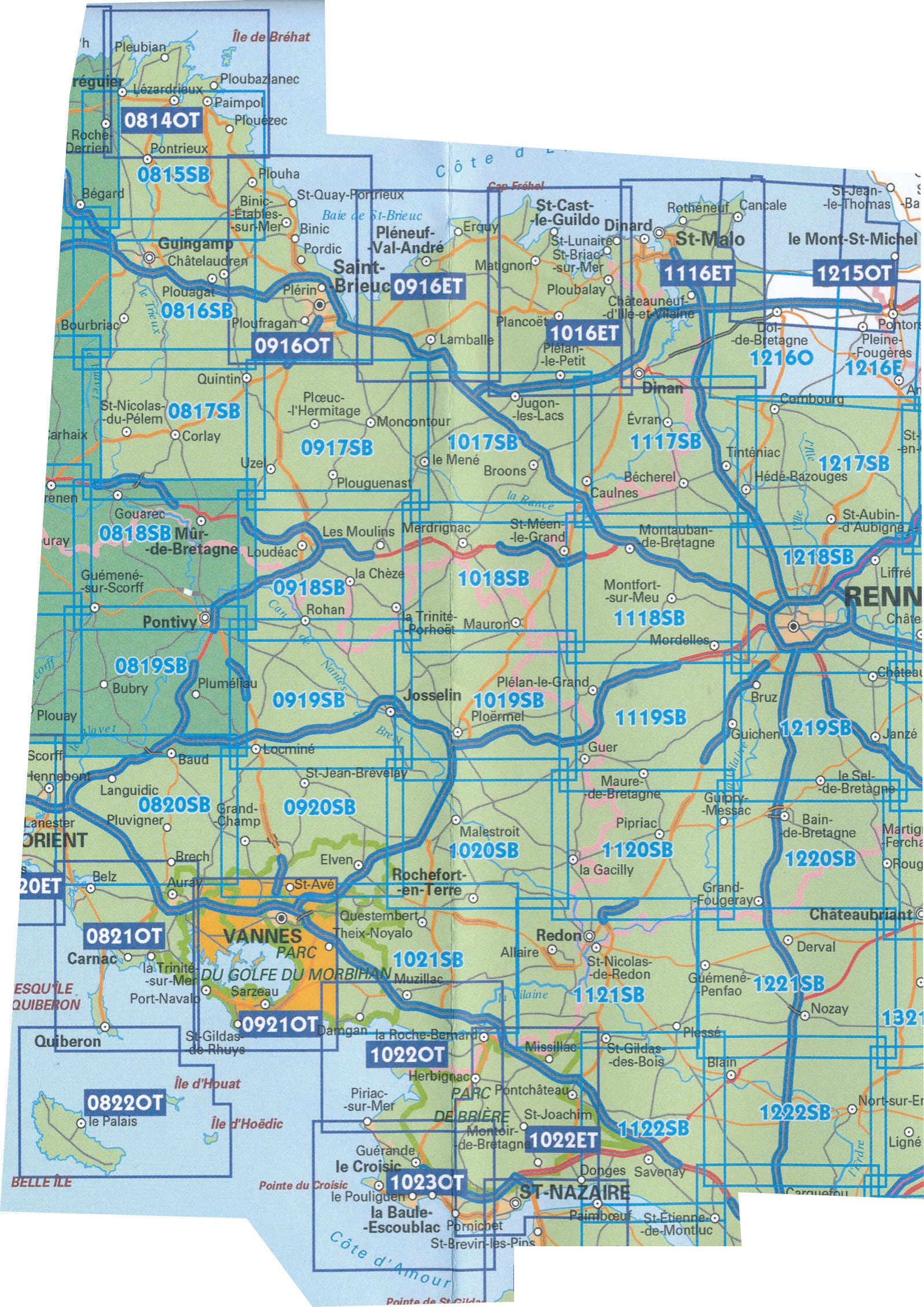
Producten op deze overzichtskaart:
Klik op een product om naar de pagina van dat product te gaan.
- Topografische kaart - Wandelkaart 0814OT Paimpol | IGN - Institut Géographique National
- Wandelkaart - Topografische kaart 0815SB Paimpol - Pontrieux | IGN - Institut Géographique National
- Wandelkaart - Topografische kaart 0816SB Guingamp | IGN - Institut Géographique National
- Wandelkaart - Topografische kaart 0817SB Quintin - St-Nicolas-du-Pelem | IGN - Institut Géographique National
- Wandelkaart - Topografische kaart 0818SB Pontivy | IGN - Institut Géographique National
- Wandelkaart - Topografische kaart 0819SB Pluméliau | IGN - Institut Géographique National
- Wandelkaart - Topografische kaart 0820SB Baud - Languidic | IGN - Institut Géographique National
- Wandelkaart - Topografische kaart 0821OT Presqu'Ile de Quiberon - Auray - Carnac Bretagne | IGN - Institut Géographique National
- Wandelkaart - Topografische kaart 0822OT Belle-Ile - Ile d'Houat et d'Hoëdic Bretagne | IGN - Institut Géographique National
- Wandelkaart - Topografische kaart 0916ET Erquy - le Val-André | IGN - Institut Géographique National
- Wandelkaart - Topografische kaart 0916OT Saint-Brieuc | IGN - Institut Géographique National
- Wandelkaart - Topografische kaart 0917SB Ploeuc-sur-Lié – Moncontour | IGN - Institut Géographique National
- Topografische kaart - Wandelkaart 0918SB La Trinité-Porhoët, Loudeac | IGN - Institut Géographique National
- Wandelkaart - Topografische kaart 0919SB Locmine - Josselin | IGN - Institut Géographique National
- Wandelkaart - Topografische kaart 0920SB Elven - Grand-Champ | IGN - Institut Géographique National
- Wandelkaart - Topografische kaart 0921OT Vannes | IGN - Institut Géographique National
- Wandelkaart - Topografische kaart 1016ET St.-Cast-le-Guildo - Cap Fréhel | IGN - Institut Géographique National
- Wandelkaart - Topografische kaart 1017SB Broons - Plenee Jugon | IGN - Institut Géographique National
- Wandelkaart - Topografische kaart 1018SB Saint-Méen-le-Grand – Merdrignac | IGN - Institut Géographique National
- Wandelkaart - Topografische kaart 1019SB Paimpont - Ploërmel | IGN - Institut Géographique National
- Wandelkaart - Topografische kaart 1020SB Malestroit - Peillac | IGN - Institut Géographique National
- Wandelkaart - Topografische kaart 1021SB Questembert - La Roche-Bernard | IGN - Institut Géographique National
- Wandelkaart - Topografische kaart 1022ET Saint-Nazaire & Parc Naturel Regional de Briere | IGN - Institut Géographique National
- Wandelkaart - Topografische kaart 1022OT La Roche-Bernard & Parc Naturel Regional de Briere | IGN - Institut Géographique National
- Topografische kaart - Wandelkaart 1023OT La Baule & Parc Naturel Regional de Briere | IGN - Institut Géographique National
- Wandelkaart - Topografische kaart 1116ET Saint-Malo – Dinard – Dinan – Rothéneuf – Cancale – Châteauneuf-d'ille-Vilaine | IGN - Institut Géographique National
- Wandelkaart - Topografische kaart 1117SB Dinan – Caulne -, Tinténiac | IGN - Institut Géographique National
- Wandelkaart - Topografische kaart 1118SB Montfort-sur-Meu – Montauban-de-Bretagne | IGN - Institut Géographique National
- Topografische kaart - Wandelkaart 1119SB Bréal-sous-Montfort, Guer | IGN - Institut Géographique National
- Wandelkaart - Topografische kaart 1120SB Pipriac – La Gacilly | IGN - Institut Géographique National
- Wandelkaart - Topografische kaart 1121SB Redon – St-Gildas-des-Bois | IGN - Institut Géographique National
- Topografische kaart - Wandelkaart 1122SB Savenay | IGN - Institut Géographique National
- Wandelkaart - Topografische kaart 1215OT Le Mont St.-Michel, Dol-de-Bretagne | IGN - Institut Géographique National
- Wandelkaart - Topografische kaart 1216SB Dol-de-Bretagne | IGN - Institut Géographique National
- Wandelkaart - Topografische kaart 1217SB Combourg – St-Aubin-d'Aubigné | IGN - Institut Géographique National
- Wandelkaart - Topografische kaart 1218SB Rennes – Cesson-Sévigné – Liffré | IGN - Institut Géographique National
- Wandelkaart - Topografische kaart 1219SB Bruz - Janzé | IGN - Institut Géographique National
- Wandelkaart - Topografische kaart 1220SB Bain-de-Bretagne – Rougé | IGN - Institut Géographique National
-
Wandelkaart IGN 25.000 Bretagne OOSTELIJK GEDEELTE
Producten op deze overzichtskaart:
Klik op een product om naar de pagina van dat product te gaan.
- Wandelkaart - Topografische kaart 1316SB St-Hilaire-du-Harcouët | IGN - Institut Géographique National
- Wandelkaart 1317SB Fougères – St-Brice-en-Coglès | IGN - Institut Géographique National
- Wandelkaart - Topografische kaart 1318SB Vitré - Châteaubourg | IGN - Institut Géographique National
- Wandelkaart - Topografische kaart 1319SB La Guerche-de-Bretagne – Retiers | IGN - Institut Géographique National
- Wandelkaart - Topografische kaart 1320SB Châteaubriant - Pouancé | IGN - Institut Géographique National
- Wandelkaart - Topografische kaart 1417SB Ernée - Gorron | IGN - Institut Géographique National
- Wandelkaart - Topografische kaart 1418SB Laval - Port-Brillet | IGN - Institut Géographique National
- Wandelkaart - Topografische kaart 1419SB Cossé-le-Vivien - L'Huisserie | IGN - Institut Géographique National
- Wandelkaart - Topografische kaart 1420SB Craon | IGN - Institut Géographique National
- Wandelkaart - Topografische kaart 1517SB Mayenne - Le Horps | IGN - Institut Géographique National
- Wandelkaart - Topografische kaart 1518SB Evron - Montsûrs | IGN - Institut Géographique National
- Wandelkaart - Topografische kaart 1519SB Meslay-du-Maine, Vaiges | IGN - Institut Géographique National
- Wandelkaart - Topografische kaart 1617SB Villaines-la-Juhel, St-Pierre-des-Nids, Alpes Mancelles | IGN - Institut Géographique National
- Wandelkaart - Topografische kaart 1618SB Sillé-le-Guillaum, Conlie Ste-Suzanne | IGN - Institut Géographique National
- Wandelkaart - Topografische kaart 1619SB Loué - Brûlon, Noyen-sur-Sarthe | IGN - Institut Géographique National
- Wandelkaart - Topografische kaart 1718SB Beaumont-sur-Sarthe - Ballon | IGN - Institut Géographique National
- Wandelkaart - Topografische kaart 1719SB Le Mans - La Suze-sur-Sarthe | IGN - Institut Géographique National
- Wandelkaart - Topografische kaart 1818SB La Ferté-Bernard | IGN - Institut Géographique National
 Wandelkaart - Topografische kaart 1118SB Montfort-sur-Meu – Montauban-de-Bretagne | IGN - Institut Géographique National
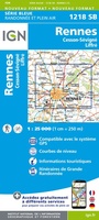 Wandelkaart - Topografische kaart 1218SB Rennes – Cesson-Sévigné – Liffré | IGN - Institut Géographique National
 Wandelkaart - Topografische kaart 0819SB Pluméliau | IGN - Institut Géographique National
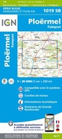 Wandelkaart - Topografische kaart 1019SB Paimpont - Ploërmel | IGN - Institut Géographique National
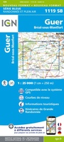 Topografische kaart - Wandelkaart 1119SB Bréal-sous-Montfort, Guer | IGN - Institut Géographique National
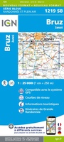 Wandelkaart - Topografische kaart 1219SB Bruz - Janzé | IGN - Institut Géographique National
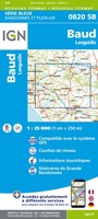 Wandelkaart - Topografische kaart 0820SB Baud - Languidic | IGN - Institut Géographique National
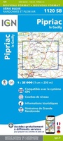 Wandelkaart - Topografische kaart 1120SB Pipriac – La Gacilly | IGN - Institut Géographique National
 Wandelkaart - Topografische kaart 1220SB Bain-de-Bretagne – Rougé | IGN - Institut Géographique National
 Wandelkaart - Topografische kaart 1121SB Redon – St-Gildas-des-Bois | IGN - Institut Géographique National
 Topografische kaart - Wandelkaart 1122SB Savenay | IGN - Institut Géographique National
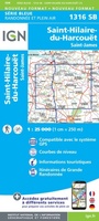 Wandelkaart - Topografische kaart 1316SB St-Hilaire-du-Harcouët | IGN - Institut Géographique National
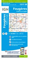 Wandelkaart 1317SB Fougères – St-Brice-en-Coglès | IGN - Institut Géographique National
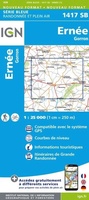 Wandelkaart - Topografische kaart 1417SB Ernée - Gorron | IGN - Institut Géographique National
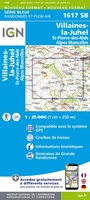 Wandelkaart - Topografische kaart 1617SB Villaines-la-Juhel, St-Pierre-des-Nids, Alpes Mancelles | IGN - Institut Géographique National
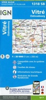 Wandelkaart - Topografische kaart 1318SB Vitré - Châteaubourg | IGN - Institut Géographique National
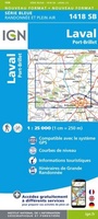 Wandelkaart - Topografische kaart 1418SB Laval - Port-Brillet | IGN - Institut Géographique National★★★★★
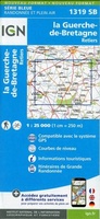 Wandelkaart - Topografische kaart 1319SB La Guerche-de-Bretagne – Retiers | IGN - Institut Géographique National
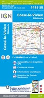 Wandelkaart - Topografische kaart 1419SB Cossé-le-Vivien - L'Huisserie | IGN - Institut Géographique National
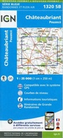 Wandelkaart - Topografische kaart 1320SB Châteaubriant - Pouancé | IGN - Institut Géographique National
Laatste reviews

Ziet er goed uit
Duidelijke kaart, ook met kleinere wegen. Snelle levering
★★★★★ door Ger Sulkers 02 mei 2024 | Heeft dit artikel gekocht
Tevreden
Ja wij zijn tevreden, alleen is mijn vriendin het boekje al kwijtgeraakt bij onze eerste wandeling.🙁
★★★★★ door Mark 02 mei 2024 | Heeft dit artikel gekocht
Dik tevreden
Ja ik ben dik tevreden over de wegenkaart van Kazachstan. Stond alles op wat ik wou dus heel erg tevreden daarover.
★★★★★ door Sjoerd Westra 02 mei 2024 | Heeft dit artikel gekocht
Mooie kaarten
Zoals altijd mooie verzorgde kaarten die tijdens de reis van pas komen en achteraf mooie herinneringen oproepen.
★★★★★ door Klaas Wijnberg 02 mei 2024 | Heeft dit artikel gekocht