Winkelwagen
Geen items in winkelwagen
Ga naar winkelwagen
Wandelkaarten - Rhône-Alpes
 Wandelkaart - Topografische kaart 3033 SB - Serie Bleue Roussillon, Vienne | IGN - Institut Géographique National
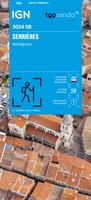 Wandelkaart 3034 SB - Serie Bleue Serrières / Anneyron | IGN - Institut Géographique National★★★★★
 Wandelkaart - Topografische kaart 3035 SB - Serie Bleue Tounon-sur-Rhône – Satillieu | IGN - Institut Géographique National
 Topografische kaart - Wandelkaart 3036OT Valence | IGN - Institut Géographique National
 Wandelkaart - Topografische kaart 3037 SB - Serie Bleue Crest – La Voulte-sur-Rhône | IGN - Institut Géographique National
 Wandelkaart - Topografische kaart 3038 SB - Serie Bleue Montélimar | IGN - Institut Géographique National
 Wandelkaart - Topografische kaart 3039ET Valréas | IGN - Institut Géographique National
 Wandelkaart - Topografische kaart 3040ET Carpentras | IGN - Institut Géographique National
 Wandelkaart - Topografische kaart 3040OT Orange | IGN - Institut Géographique National
 Wandelkaart - Topografische kaart 3041OT Avignon | IGN - Institut Géographique National
 Wandelkaart - Topografische kaart 3128 SB - Serie Bleue Montrevel-en-Bresse, Marboz | IGN - Institut Géographique National
 Wandelkaart - Topografische kaart 3130 SB - Serie Bleue Ambérieu-en-Bugey | IGN - Institut Géographique National
 Wandelkaart - Topografische kaart 3131 SB - Serie Bleue Meyzieu | IGN - Institut Géographique National
 Wandelkaart - Topografische kaart 3132 SB - Serie Bleue Bourgoin-Jallieu - La Velpillere | IGN - Institut Géographique National
 Wandelkaart - Topografische kaart 3133 SB - Serie Bleue La Côte-St-André – St-Jean-de-Bournay | IGN - Institut Géographique National
 Topografische kaart - Wandelkaart 3134 SB - Serie Bleue St-Etienne-de-St-Geoirs / Le Grand-Serre | IGN - Institut Géographique National
 Topografische kaart - Wandelkaart 3135 Romans-sur-Isère, St-Marcellin | IGN - Institut Géographique National
 Wandelkaart - Topografische kaart 3136ET Combe Laval | IGN - Institut Géographique National★★★★★
 Wandelkaart - Topografische kaart 3137OT Die – Crest – Saillans | IGN - Institut Géographique National★★★★★
 Wandelkaart - Topografische kaart 3138OT Dieulefit | IGN - Institut Géographique National★★★★★
Laatste reviews

Simpele keuze ondersteuning op website en hele snelle levering
Kort voor vakantie naar de Galapagos eilanden toch nog behoefte aan extra reisgids. Simpel kunnen bestellen en snelle levering. Zou niet weten wat er beter …
★★★★★ door Piet Grootenboer 25 juni 2026 | Heeft dit artikel gekocht
Te gek
Enorm mooie wereldkaart met details en snelle fijne levering.
★★★★★ door Steven Goyvaerts 25 juni 2026 | Heeft dit artikel gekocht
Goede gids voor pelgrims
Deze Cicerone gids over de via Francigena is uitermate geschikt om je route en etappes te plannen als je de Via Francigena vanuit Zwitserland gaat …
★★★★★ door Vic 24 juni 2026 | Heeft dit artikel gekocht
Aantrekkelijk en boordevol nuttige info
Heerlijk om al te kunnen voorbereiden op een fantastische vakantie met dit uiterst fijne boek.
★★★★★ door Harry 24 juni 2026 | Heeft dit artikel gekocht