Winkelwagen
Geen items in winkelwagen
Ga naar winkelwagen
Wandelkaarten - Poitou-Charentes
 Wandelkaart - Topografische kaart 1626 SB - Serie Bleue Parthenay - Thenezay | IGN - Institut Géographique National
 Wandelkaart - Topografische kaart 1627 SB - Serie Bleue Mazieres-en-Gatine, Vasles | IGN - Institut Géographique National
 Wandelkaart - Topografische kaart 1628 SB - Serie Bleue St-Maixent-l'Ecole, Lezay | IGN - Institut Géographique National
 Wandelkaart - Topografische kaart 1629 Melle | IGN - Institut Géographique National
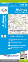 Wandelkaart - Topografische kaart 1630 SB - Serie Bleue Aulnay | IGN - Institut Géographique National
 Wandelkaart - Topografische kaart 1631 SB - Serie Bleue Matha | IGN - Institut Géographique National
 Wandelkaart - Topografische kaart 1632 SB - Serie Bleue Cognac | IGN - Institut Géographique National
 Wandelkaart - Topografische kaart 1633 SB - Serie Bleue Barbezieux-Saint-Hilaire | IGN - Institut Géographique National
 Wandelkaart - Topografische kaart 1634 SB - Serie Bleue Brossac - Montguyon | IGN - Institut Géographique National
 Wandelkaart - Topografische kaart 1724 SB - Serie Bleue Loudun – Richelieu | IGN - Institut Géographique National★★★★★
 Wandelkaart - Topografische kaart 1725 SB - Serie Bleue Lencloitre, St-Jean-de-Sauves | IGN - Institut Géographique National
 Wandelkaart 1726 SB - Serie Bleue Neuville-de-Poitou - Vouillé - Mirebeau | IGN - Institut Géographique National
 Wandelkaart 1727 SB - Serie Bleue Poitiers - Coulombiers | IGN - Institut Géographique National
 Wandelkaart - Topografische kaart 1728 SB - Serie Bleue Vivonne - Lusignan | IGN - Institut Géographique National
 Wandelkaart - Topografische kaart 1729 SB - Serie Bleue Civray - Sauze - Vaussais | IGN - Institut Géographique National
 Wandelkaart - Topografische kaart 1730 SB - Serie Bleue Ruffec - Villefagnan | IGN - Institut Géographique National
 Wandelkaart - Topografische kaart 1731 SB - Serie Bleue Mansle | IGN - Institut Géographique National
 Wandelkaart - Topografische kaart 1732 SB - Serie Bleue Angoulême, Ruelle-sur-Touvre | IGN - Institut Géographique National
 Wandelkaart - Topografische kaart 1733 SB - Serie Bleue Montmoreau-Saint-Cybard | IGN - Institut Géographique National
 Wandelkaart - Topografische kaart 1734 SB - Serie Bleue Ribérac - Chalais | IGN - Institut Géographique National
Laatste reviews

Een zeer onhandige wegenkaart
Wij dachten er goed aanrecht doen een zeer uitgebreide wegenatlas aan te schaffen, maar toen wij deze goed bestudeerden kwamen wij erachter dat dit een …
★★★★★ door Herman van Mal 18 juni 2026 | Heeft dit artikel gekocht
Nuttige en handige reisgids!
De gids geeft brede informatie over Transsylvanië, inclusief zijn gecompliceerde geschiedenis, musea, kerken en andere bezienswaardigheden, en wat praktische zaken. Dit laatste onderwerp is wel …
★★★★★ door Frank Bakx 16 juni 2026 | Heeft dit artikel gekocht
Super service
Makkelijk bestelproces. Snel geleverd en goede service!
★★★★★ door tanja kleerekoper 16 juni 2026 | Heeft dit artikel gekocht
Wandelkaart Noord Drente / Drentse Aa
Prachtige wandelkaart.Handzaam mooie routes. Prima verpakt en snel verzonden!
★★★★★ door Gerard 16 juni 2026 | Heeft dit artikel gekocht