Wandelkaarten - Normandië
Overzichtskaarten
-
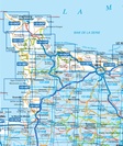
Wandelkaarten IGN 25.000 Normandië: West
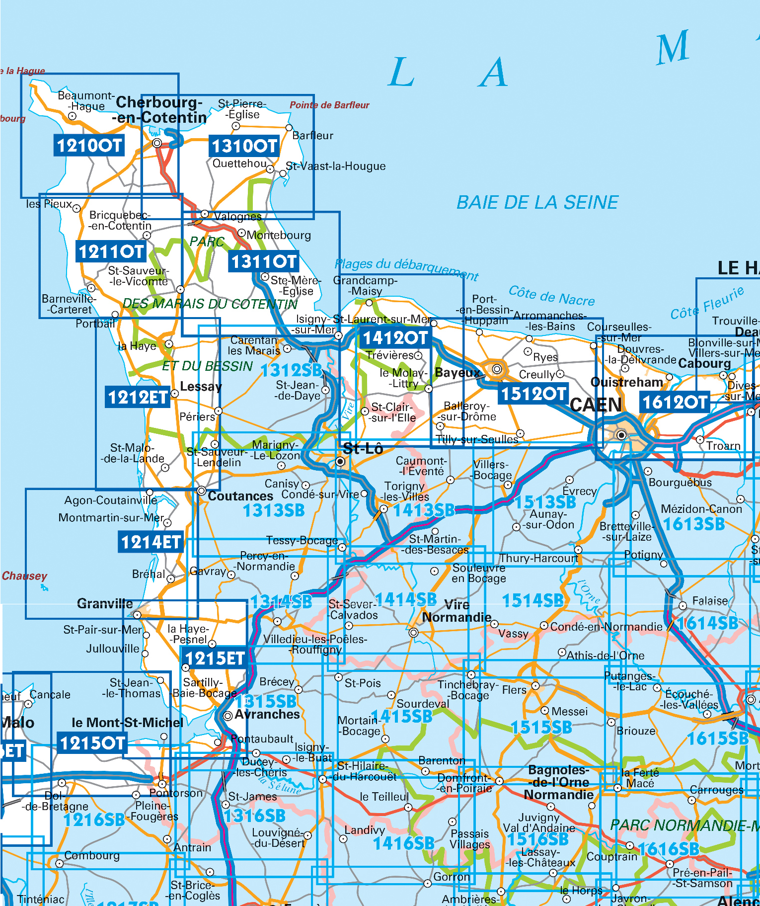
Producten op deze overzichtskaart:
Klik op een product om naar de pagina van dat product te gaan.
- Wandelkaart - Topografische kaart 1210OT Cherbourg-en-Cotentin, Cap de la Hague | IGN - Institut Géographique National
- Wandelkaart - Topografische kaart 1211OT Les Pieux, Barneville, Carteret | IGN - Institut Géographique National
- Wandelkaart - Topografische kaart 1212ET La Haye-du-Puits Lessay | IGN - Institut Géographique National
- Wandelkaart - Topografische kaart 1214ET Granville, Coutances, Iles Chausey | IGN - Institut Géographique National
- Wandelkaart - Topografische kaart 1215ET Avranches, Granville, Le Mont Saint Michel | IGN - Institut Géographique National
- Wandelkaart - Topografische kaart 1310OT Cherbourg, Pointe de Barfleur | IGN - Institut Géographique National
- Wandelkaart - Topografische kaart 1311OT Valoges - Ste-Mère-Eglise Utah Beach | IGN - Institut Géographique National
- Wandelkaart - Topografische kaart 1312SB Carentan - Periers | IGN - Institut Géographique National
- Wandelkaart - Topografische kaart 1313SB St-Lô - Coutances | IGN - Institut Géographique National
- Wandelkaart - Topografische kaart 1314SB Villedieu-les-Poêlles, Gavray | IGN - Institut Géographique National
- Wandelkaart - Topografische kaart 1315SB Brécey - Ducey - Avranches | IGN - Institut Géographique National
- Wandelkaart - Topografische kaart 1412OT Pointe Du Hoc - Omaha Beach | IGN - Institut Géographique National
- Wandelkaart - Topografische kaart 1413SB Condé-sur-Vire, Caumont- sur-Aure | IGN - Institut Géographique National
- Wandelkaart - Topografische kaart 1414SB Vire Normandie, Souleuvre en Bocage | IGN - Institut Géographique National
- Wandelkaart - Topografische kaart 1415SB Tinchebray - Bocage | IGN - Institut Géographique National
- Wandelkaart - Topografische kaart 1416SB Le Teilleul | IGN - Institut Géographique National
- Wandelkaart - Topografische kaart 1512OT Bayeux Arromanches Les Bains Plages - Normandië | IGN - Institut Géographique National
- Wandelkaart - Topografische kaart 1513SB Aunay-sur-Odon | IGN - Institut Géographique National
- Topografische kaart - Wandelkaart 1514SB Condé-sur-Noireau | IGN - Institut Géographique National
- Wandelkaart - Topografische kaart 1515SB Flers | IGN - Institut Géographique National
- Wandelkaart - Topografische kaart 1516SB Domfront | IGN - Institut Géographique National
- Wandelkaart - Topografische kaart 1612OT Caen - Ouistreham , Normandië | IGN - Institut Géographique National
- Wandelkaart - Topografische kaart 1616SB La Ferté-Macé, Pré-en-Pail, Carrouges | IGN - Institut Géographique National
-
Wandelkaarten IGN 25.000 Normandië: Oost
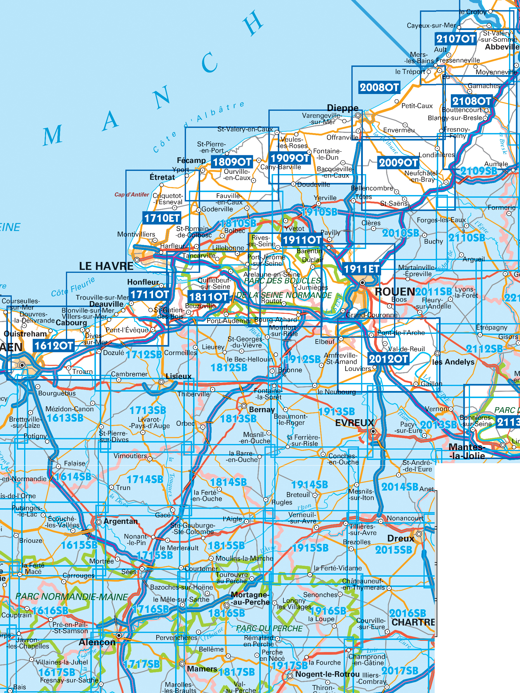
Producten op deze overzichtskaart:
Klik op een product om naar de pagina van dat product te gaan.
- Topografische kaart - Wandelkaart 1613SB Saint-Pierre-sur-Dives | IGN - Institut Géographique National
- Wandelkaart - Topografische kaart 1614SB Falaise | IGN - Institut Géographique National
- Wandelkaart - Topografische kaart 1615SB Argentan - Putanges-Pont-Ecrepin | IGN - Institut Géographique National
- Wandelkaart - Topografische kaart 1710ET Le Havre, Etretat, PNR des Boucles Seine Normandie | IGN - Institut Géographique National
- Wandelkaart - Topografische kaart 1711OT Honfleur Deauville | IGN - Institut Géographique National
- Wandelkaart - Topografische kaart 1712SB Lisieux - Cambremer | IGN - Institut Géographique National
- Wandelkaart - Topografische kaart 1713SB Livarot - Beuvillers | IGN - Institut Géographique National
- Wandelkaart - Topografische kaart 1714SB Vimoutiers - Trun | IGN - Institut Géographique National
- Wandelkaart - Topografische kaart 1715SB Sées - Gace | IGN - Institut Géographique National
- Wandelkaart - Topografische kaart 1716SB Alençon - Sées | IGN - Institut Géographique National
- Wandelkaart - Topografische kaart 1717SB Alençon - Marolles-les-Braults | IGN - Institut Géographique National
- Wandelkaart - Topografische kaart 1809OT Fecamp, St-Valery-en-Caux, Cote d'Albatre | IGN - Institut Géographique National
- Wandelkaart - Topografische kaart 1810SB Bolbec | IGN - Institut Géographique National
- Wandelkaart - Topografische kaart 1811OT Pont Audemer Tancarville | IGN - Institut Géographique National
- Wandelkaart - Topografische kaart 1812SB Brionne – Cormeilles | IGN - Institut Géographique National
- Wandelkaart - Topografische kaart 1813SB Bernay - Orbec | IGN - Institut Géographique National
- Wandelkaart - Topografische kaart 1814SB Rugles – La Ferté-Frênel | IGN - Institut Géographique National
- Wandelkaart - Topografische kaart 1815SB L'Aigle - Ste-Gauburge - Ste Colombe | IGN - Institut Géographique National
- Wandelkaart - Topografische kaart 1816SB Mortagne-au-Perche - Mêle-sur-Sarthe | IGN - Institut Géographique National
- Wandelkaart - Topografische kaart 1817SB Mamers - Bellême - Le Theil | IGN - Institut Géographique National
- Topografische kaart - Wandelkaart 1909OT St-Valery-en-Caux | IGN - Institut Géographique National
- Wandelkaart - Topografische kaart 1910SB Yvetot | IGN - Institut Géographique National
- Wandelkaart - Topografische kaart 1911ET Rouen, Forets Rouennaises, PNR | IGN - Institut Géographique National
- Wandelkaart - Topografische kaart 1911OT Forets De Brotonne | IGN - Institut Géographique National
- Topografische kaart - Wandelkaart 1912SB Elbeuf | IGN - Institut Géographique National
- Wandelkaart - Topografische kaart 1913SB Evreux - Conches-en-Ouche | IGN - Institut Géographique National
- Wandelkaart - Topografische kaart 1914SB Breteuil – La Neuve-Lyre | IGN - Institut Géographique National
- Wandelkaart - Topografische kaart 2008OT Dieppe - Envermeu - Fresnoy - Folny | IGN - Institut Géographique National
- Topografische kaart - Wandelkaart 2009OT Forêt d'Eawy, Neufchâtel-en-Bray | IGN - Institut Géographique National
- Wandelkaart - Topografische kaart 2010SB Saint-Saëns | IGN - Institut Géographique National
- Wandelkaart - Topografische kaart 2011SB Fleury-sur-Andelle | IGN - Institut Géographique National
- Wandelkaart - Topografische kaart 2012OT Foret De Bord-Louviers | IGN - Institut Géographique National
- Wandelkaart - Topografische kaart 2013SB Evreux - Vernon - Pacy-sur-Eure | IGN - Institut Géographique National
- Wandelkaart - Topografische kaart 2014SB Saint-André-de-l'Eure, Nonancourt | IGN - Institut Géographique National
- Wandelkaart - Topografische kaart 2107OT Le Tréport | IGN - Institut Géographique National
- Wandelkaart - Topografische kaart 2108OT Foret d'Eu, Blangy-sur-Bresle, Gamaches | IGN - Institut Géographique National
- Wandelkaart - Topografische kaart 2109SB Aumale, Neufchâtel-en-Bray | IGN - Institut Géographique National
- Wandelkaart - Topografische kaart 2110SB Formerie, Forges-les-Eaux | IGN - Institut Géographique National
- Wandelkaart - Topografische kaart 2112SB Gisors - Etrépagny | IGN - Institut Géographique National
- Wandelkaart - Topografische kaart 2114SB Houdan - Aubergenville | IGN - Institut Géographique National
 Wandelkaart - Topografische kaart 1516SB Domfront | IGN - Institut Géographique National
De wandelkaart die de perfectie benadert! Werkelijk alle topografische details zijn er op te vinden; van hoogtelijnen tot aan bruggetjes en allerlei wandelpaden. Daarnaast hebben de makers een flinke dosis …
 Wandelkaart - Topografische kaart 1716SB Alençon - Sées | IGN - Institut Géographique National
Een nieuwe serie van IGN: de oude versies Est en Ouest (E en O aanduiding achter het nummer van de kaart) gaan verdwijnen en worden vervangen door een kaart met …
 Wandelkaart - Topografische kaart 1816SB Mortagne-au-Perche - Mêle-sur-Sarthe | IGN - Institut Géographique National
Een nieuwe serie van IGN: de oude versies Est en Ouest (E en O aanduiding achter het nummer van de kaart) gaan verdwijnen en worden vervangen door een kaart met …
 Wandelkaart - Topografische kaart 1817SB Mamers - Bellême - Le Theil | IGN - Institut Géographique National
Een nieuwe serie van IGN: de oude versies Est en Ouest (E en O aanduiding achter het nummer van de kaart) gaan verdwijnen en worden vervangen door een kaart met …
Laatste reviews

Het is een fijn boekje dat makkelijk te hanteren is ( spiraalrug). Zeer complete info over sluizen, waterdiepte, campings, etc. Het enige wat wennen is, …
★★★★★ door Gert Jan Pullen 15 juni 2024 | Heeft dit artikel gekocht
Prima kaart, veel gebruikt tijdens de vakantie.
★★★★★ door Lolke 14 juni 2024 | Heeft dit artikel gekocht
Boekje is handzaam om mee te nemen en geeft voldoende detail informatie om jouw eigen reisplan te maken, met voorgestelde etappes indien je 8, 10, …
★★★★★ door Michiel 14 juni 2024 | Heeft dit artikel gekocht
Mooie plattegrond van Brugge, nog beter was een aparte vergroting van de binnenstad geweest. Die is vaak het belangrijkst en in veel plattegronden van grotere …
★★★★★ door Wim van Gammeren 14 juni 2024 | Heeft dit artikel gekocht