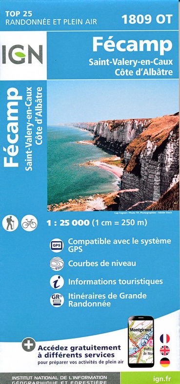
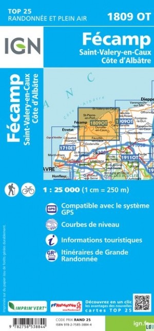
Wandelkaart - Topografische kaart 1809OT Fecamp, St-Valery-en-Caux, Cote d'Albatre | IGN - Institut Géographique National (9782758553649)
- ISBN / CODE: 9782758553649
- Editie: meest recente versie
- Schaal: 1:25000
- Uitgever: IGN - Institut Géographique National
- Soort: Topografische kaart, Wandelkaart
- Serie: Top 25
- Taal: Frans
- Uitvoering: Papier
- Bindwijze: -
- Schrijf als eerste een review
-
€ 16,95
Op voorraad. Voor 17.00 uur op werkdagen besteld, morgen in huis in Nederland Levertijd Belgie
Gratis verzending in Nederland vanaf €35,-

(6).jpg)
-
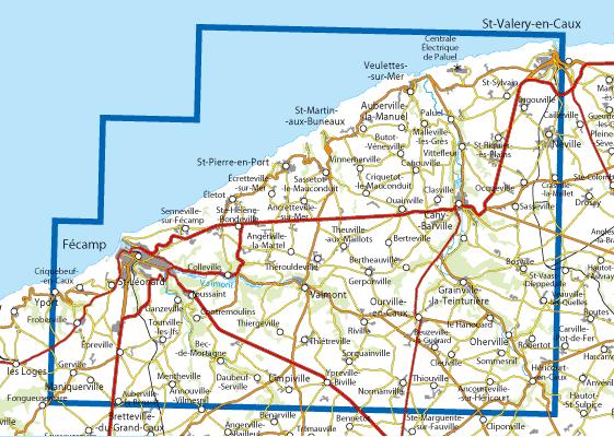
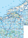
Topografische kaarten IGN 25.000 Normandië: Oost

Producten op deze overzichtskaart:
Klik op een product om naar de pagina van dat product te gaan.
- Topografische kaart - Wandelkaart 1613SB Saint-Pierre-sur-Dives | IGN - Institut Géographique National
- Wandelkaart - Topografische kaart 1614SB Falaise | IGN - Institut Géographique National
- Wandelkaart - Topografische kaart 1615SB Argentan - Putanges-Pont-Ecrepin | IGN - Institut Géographique National
- Wandelkaart - Topografische kaart 1710ET Le Havre, Etretat, PNR des Boucles Seine Normandie | IGN - Institut Géographique National
- Wandelkaart - Topografische kaart 1711OT Honfleur Deauville | IGN - Institut Géographique National
- Wandelkaart - Topografische kaart 1712SB Lisieux - Cambremer | IGN - Institut Géographique National
- Wandelkaart - Topografische kaart 1713SB Livarot - Beuvillers | IGN - Institut Géographique National
- Wandelkaart - Topografische kaart 1714SB Vimoutiers - Trun | IGN - Institut Géographique National
- Wandelkaart - Topografische kaart 1715SB Sées - Gace | IGN - Institut Géographique National
- Wandelkaart - Topografische kaart 1716SB Alençon - Sées | IGN - Institut Géographique National
- Wandelkaart - Topografische kaart 1717SB Alençon - Marolles-les-Braults | IGN - Institut Géographique National
- Wandelkaart - Topografische kaart 1809OT Fecamp, St-Valery-en-Caux, Cote d'Albatre | IGN - Institut Géographique National
- Wandelkaart - Topografische kaart 1810SB Bolbec | IGN - Institut Géographique National
- Wandelkaart - Topografische kaart 1811OT Pont Audemer Tancarville | IGN - Institut Géographique National
- Wandelkaart - Topografische kaart 1812SB Brionne – Cormeilles | IGN - Institut Géographique National
- Wandelkaart - Topografische kaart 1813SB Bernay - Orbec | IGN - Institut Géographique National
- Wandelkaart - Topografische kaart 1814SB Rugles – La Ferté-Frênel | IGN - Institut Géographique National
- Wandelkaart - Topografische kaart 1815SB L'Aigle - Ste-Gauburge - Ste Colombe | IGN - Institut Géographique National
- Wandelkaart - Topografische kaart 1816SB Mortagne-au-Perche - Mêle-sur-Sarthe | IGN - Institut Géographique National
- Wandelkaart - Topografische kaart 1817SB Mamers - Bellême - Le Theil | IGN - Institut Géographique National
- Topografische kaart - Wandelkaart 1909OT St-Valery-en-Caux | IGN - Institut Géographique National
- Wandelkaart - Topografische kaart 1910SB Yvetot | IGN - Institut Géographique National
- Wandelkaart - Topografische kaart 1911ET Rouen, Forets Rouennaises, PNR | IGN - Institut Géographique National
- Wandelkaart - Topografische kaart 1911OT Forets De Brotonne | IGN - Institut Géographique National
- Topografische kaart - Wandelkaart 1912SB Elbeuf | IGN - Institut Géographique National
- Wandelkaart - Topografische kaart 1913SB Evreux - Conches-en-Ouche | IGN - Institut Géographique National
- Wandelkaart - Topografische kaart 1914SB Breteuil – La Neuve-Lyre | IGN - Institut Géographique National
- Wandelkaart - Topografische kaart 2008OT Dieppe - Envermeu - Fresnoy - Folny | IGN - Institut Géographique National
- Topografische kaart - Wandelkaart 2009OT Forêt d'Eawy, Neufchâtel-en-Bray | IGN - Institut Géographique National
- Wandelkaart - Topografische kaart 2010SB Saint-Saëns | IGN - Institut Géographique National
- Wandelkaart - Topografische kaart 2011SB Fleury-sur-Andelle | IGN - Institut Géographique National
- Wandelkaart - Topografische kaart 2012OT Foret De Bord-Louviers | IGN - Institut Géographique National
- Wandelkaart - Topografische kaart 2013SB Evreux - Vernon - Pacy-sur-Eure | IGN - Institut Géographique National
- Wandelkaart - Topografische kaart 2014SB Saint-André-de-l'Eure, Nonancourt | IGN - Institut Géographique National
- Wandelkaart - Topografische kaart 2107OT Le Tréport | IGN - Institut Géographique National
- Wandelkaart - Topografische kaart 2108OT Foret d'Eu, Blangy-sur-Bresle, Gamaches | IGN - Institut Géographique National
- Wandelkaart - Topografische kaart 2109SB Aumale, Neufchâtel-en-Bray | IGN - Institut Géographique National
- Wandelkaart - Topografische kaart 2110SB Formerie, Forges-les-Eaux | IGN - Institut Géographique National
- Wandelkaart - Topografische kaart 2112SB Gisors - Etrépagny | IGN - Institut Géographique National
- Wandelkaart - Topografische kaart 2114SB Houdan - Aubergenville | IGN - Institut Géographique National
-
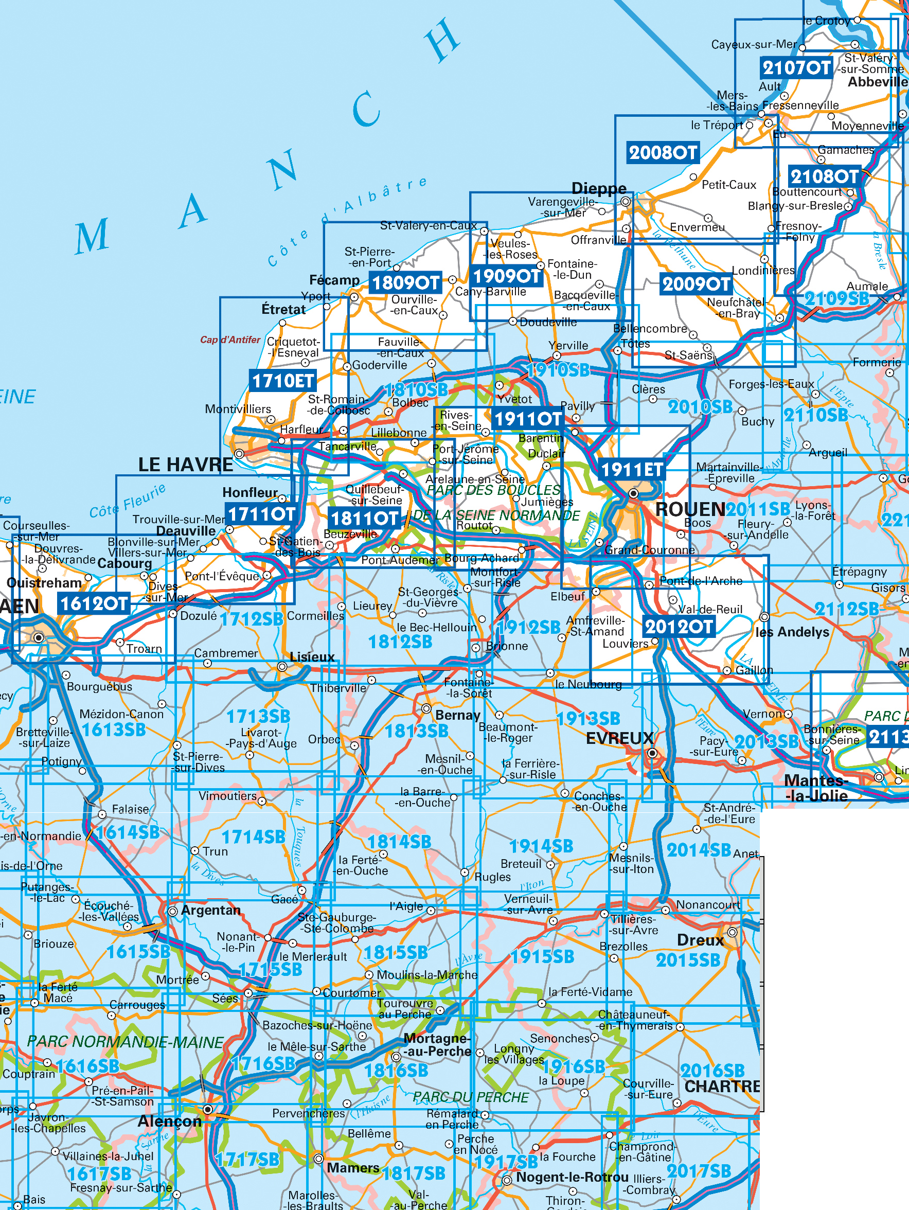
Wandelkaarten IGN 25.000 Normandië: Oost

Producten op deze overzichtskaart:
Klik op een product om naar de pagina van dat product te gaan.
- Topografische kaart - Wandelkaart 1613SB Saint-Pierre-sur-Dives | IGN - Institut Géographique National
- Wandelkaart - Topografische kaart 1614SB Falaise | IGN - Institut Géographique National
- Wandelkaart - Topografische kaart 1615SB Argentan - Putanges-Pont-Ecrepin | IGN - Institut Géographique National
- Wandelkaart - Topografische kaart 1710ET Le Havre, Etretat, PNR des Boucles Seine Normandie | IGN - Institut Géographique National
- Wandelkaart - Topografische kaart 1711OT Honfleur Deauville | IGN - Institut Géographique National
- Wandelkaart - Topografische kaart 1712SB Lisieux - Cambremer | IGN - Institut Géographique National
- Wandelkaart - Topografische kaart 1713SB Livarot - Beuvillers | IGN - Institut Géographique National
- Wandelkaart - Topografische kaart 1714SB Vimoutiers - Trun | IGN - Institut Géographique National
- Wandelkaart - Topografische kaart 1715SB Sées - Gace | IGN - Institut Géographique National
- Wandelkaart - Topografische kaart 1716SB Alençon - Sées | IGN - Institut Géographique National
- Wandelkaart - Topografische kaart 1717SB Alençon - Marolles-les-Braults | IGN - Institut Géographique National
- Wandelkaart - Topografische kaart 1809OT Fecamp, St-Valery-en-Caux, Cote d'Albatre | IGN - Institut Géographique National
- Wandelkaart - Topografische kaart 1810SB Bolbec | IGN - Institut Géographique National
- Wandelkaart - Topografische kaart 1811OT Pont Audemer Tancarville | IGN - Institut Géographique National
- Wandelkaart - Topografische kaart 1812SB Brionne – Cormeilles | IGN - Institut Géographique National
- Wandelkaart - Topografische kaart 1813SB Bernay - Orbec | IGN - Institut Géographique National
- Wandelkaart - Topografische kaart 1814SB Rugles – La Ferté-Frênel | IGN - Institut Géographique National
- Wandelkaart - Topografische kaart 1815SB L'Aigle - Ste-Gauburge - Ste Colombe | IGN - Institut Géographique National
- Wandelkaart - Topografische kaart 1816SB Mortagne-au-Perche - Mêle-sur-Sarthe | IGN - Institut Géographique National
- Wandelkaart - Topografische kaart 1817SB Mamers - Bellême - Le Theil | IGN - Institut Géographique National
- Topografische kaart - Wandelkaart 1909OT St-Valery-en-Caux | IGN - Institut Géographique National
- Wandelkaart - Topografische kaart 1910SB Yvetot | IGN - Institut Géographique National
- Wandelkaart - Topografische kaart 1911ET Rouen, Forets Rouennaises, PNR | IGN - Institut Géographique National
- Wandelkaart - Topografische kaart 1911OT Forets De Brotonne | IGN - Institut Géographique National
- Topografische kaart - Wandelkaart 1912SB Elbeuf | IGN - Institut Géographique National
- Wandelkaart - Topografische kaart 1913SB Evreux - Conches-en-Ouche | IGN - Institut Géographique National
- Wandelkaart - Topografische kaart 1914SB Breteuil – La Neuve-Lyre | IGN - Institut Géographique National
- Wandelkaart - Topografische kaart 2008OT Dieppe - Envermeu - Fresnoy - Folny | IGN - Institut Géographique National
- Topografische kaart - Wandelkaart 2009OT Forêt d'Eawy, Neufchâtel-en-Bray | IGN - Institut Géographique National
- Wandelkaart - Topografische kaart 2010SB Saint-Saëns | IGN - Institut Géographique National
- Wandelkaart - Topografische kaart 2011SB Fleury-sur-Andelle | IGN - Institut Géographique National
- Wandelkaart - Topografische kaart 2012OT Foret De Bord-Louviers | IGN - Institut Géographique National
- Wandelkaart - Topografische kaart 2013SB Evreux - Vernon - Pacy-sur-Eure | IGN - Institut Géographique National
- Wandelkaart - Topografische kaart 2014SB Saint-André-de-l'Eure, Nonancourt | IGN - Institut Géographique National
- Wandelkaart - Topografische kaart 2107OT Le Tréport | IGN - Institut Géographique National
- Wandelkaart - Topografische kaart 2108OT Foret d'Eu, Blangy-sur-Bresle, Gamaches | IGN - Institut Géographique National
- Wandelkaart - Topografische kaart 2109SB Aumale, Neufchâtel-en-Bray | IGN - Institut Géographique National
- Wandelkaart - Topografische kaart 2110SB Formerie, Forges-les-Eaux | IGN - Institut Géographique National
- Wandelkaart - Topografische kaart 2112SB Gisors - Etrépagny | IGN - Institut Géographique National
- Wandelkaart - Topografische kaart 2114SB Houdan - Aubergenville | IGN - Institut Géographique National
Overzichtskaarten
Beschrijving
De wandelkaart die de perfectie benadert! Werkelijk alle topografische details zijn er op te vinden; van hoogtelijnen tot aan bruggetjes en allerlei wandelpaden. Daarnaast hebben de makers een flinke dosis toeristische informatie op de kaart verwerkt: campings, gites d étape, restaurants en ingetekende doorgaande wandelpaden, de grandes randonnées. Het kleurgebruik is geweldig met schaduwzijdes, bos, weiland, etc goed te onderscheiden. De kaart is uitgevoerd met raster van graden, dus deze is GPS - toepasbaar!
Reviews
Geen reviews gevonden voor dit product.
Schrijf een review
Graag horen wij wat u van dit artikel vindt. Vindt u het goed, leuk, mooi, slecht, lelijk, onbruikbaar of erg handig: schrijf gerust alles op! Het is niet alleen leuk om te doen maar u informeert andere klanten er ook nog mee!
Ook interessant voor europa/frankrijk/normandie
-

Fietskaart - Wegenkaart - landkaart
€ 10,95Fietskaarten Normandië -

Wandelgids 200 Tour du Cotentin GR22
€ 19,95Wandelgidsen Normandië -

Wandelkaart - Topografische kaart 18
€ 17,95Topografische kaarten Normandië -

Historische Kaart Major & Mrs Holt's
€ 9,95Historische Kaarten Normandië -

Reisgids ANWB Ontdek Normandië | ANW
€ 23,50Reisgidsen Normandië