Winkelwagen
Geen items in winkelwagen
Ga naar winkelwagen
Topografische kaarten - Champagne - Ardennen
Overzichtskaarten
-
Topografische kaarten IGN 25.000 Champagne - Ardennen: Zuid

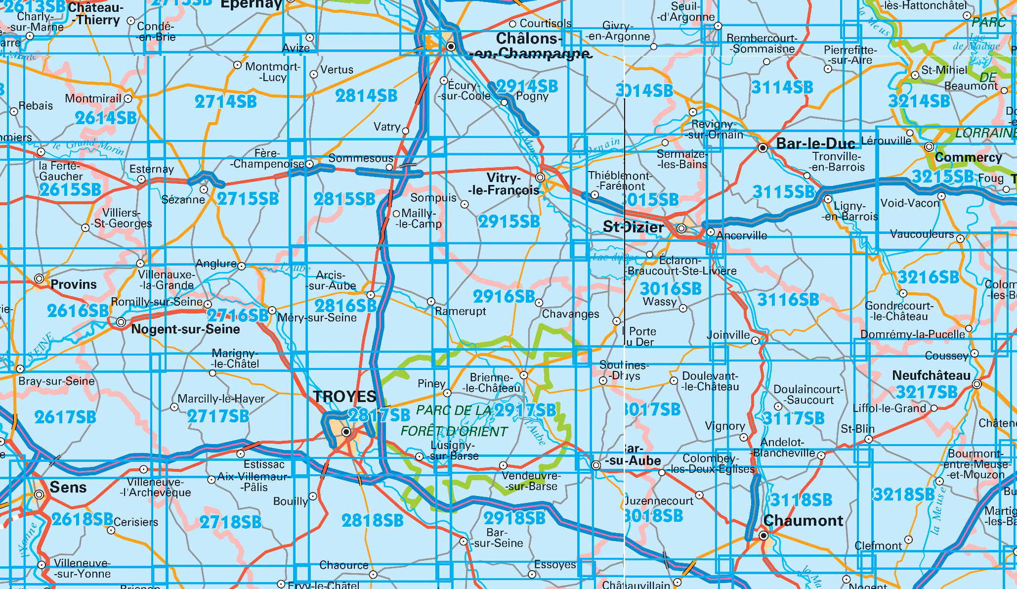
Producten op deze overzichtskaart:
Klik op een product om naar de pagina van dat product te gaan.
- Wandelkaart - Topografische kaart 2615 SB - Serie Bleue Esternay, Villiers-St-Georges | IGN - Institut Géographique National
- Wandelkaart - Topografische kaart 2616 SB - Serie Bleue Provins | IGN - Institut Géographique National
- Wandelkaart - Topografische kaart 2714 SB - Serie Bleue Montmort-Lucy | IGN - Institut Géographique National
- Wandelkaart - Topografische kaart 2715 SB - Serie Bleue Connantre - Sézanne | IGN - Institut Géographique National
- Wandelkaart - Topografische kaart 2716 SB - Serie Bleue Romilly-sur-Seine | IGN - Institut Géographique National
- Wandelkaart - Topografische kaart 2717 SB - Serie Bleue Estissac | IGN - Institut Géographique National
- Wandelkaart - Topografische kaart 2718 SB - Serie Bleue Auxon | IGN - Institut Géographique National
- Wandelkaart - Topografische kaart 2814 SB - Serie Bleue Thibie - Vertus | IGN - Institut Géographique National
- Wandelkaart - Topografische kaart 2815 SB - Serie Bleue Mailly-le-Camp, Fère-Champenoise | IGN - Institut Géographique National
- Wandelkaart - Topografische kaart 2816 SB - Serie Bleue Arcis-sur-Aube, Plancy-l'Abbaye | IGN - Institut Géographique National
- Wandelkaart - Topografische kaart 2817 SB - Serie Bleue Troyes, Lusigny-sur-Barse | IGN - Institut Géographique National
- Topografische kaart - Wandelkaart 2818 SB - Serie Bleue Bouilly | IGN - Institut Géographique National
- Wandelkaart - Topografische kaart 2914 SB - Serie Bleue Marson, Châlons-en-Champagne | IGN - Institut Géographique National
- Wandelkaart - Topografische kaart 2915 SB - Serie Bleue Vitry-le-François, Sompuis | IGN - Institut Géographique National
- Wandelkaart - Topografische kaart 2916 SB - Serie Bleue Chavanges, Dampierre | IGN - Institut Géographique National
- Wandelkaart - Topografische kaart 2917 SB - Serie Bleue Brienne-le-Chateau, Piney, Lacs de la Foret d'Orient | IGN - Institut Géographique National
- Wandelkaart - Topografische kaart 3014 SB - Serie Bleue Revigny-sur-Ornain | IGN - Institut Géographique National
- Wandelkaart - Topografische kaart 3015 SB - Serie Bleue Saint-Dizier, Pargny-sur-Saulx | IGN - Institut Géographique National
- Wandelkaart - Topografische kaart 3016 SB - Serie Bleue Wassy, Montier-en-Der, Lac du Der-Chantecoq | IGN - Institut Géographique National
- Wandelkaart - Topografische kaart 3017 SB - Serie Bleue Doulevant-le-Chateau, Soulaines, Dhuys | IGN - Institut Géographique National
- Topografische kaart - Wandelkaart 3018 SB - Serie Bleue Bar-sur-Aube | IGN - Institut Géographique National
- Wandelkaart - Topografische kaart 3114 SB - Serie Bleue Pierrefitte-sur-Aire | IGN - Institut Géographique National
- Wandelkaart - Topografische kaart 3115 SB - Serie Bleue Bar-le-Duc | IGN - Institut Géographique National
- Wandelkaart - Topografische kaart 3116 SB - Serie Bleue Joinville | IGN - Institut Géographique National
- Wandelkaart - Topografische kaart 3117 SB - Serie Bleue Doulaincourt, Saucourt, Andelot-Blancheville | IGN - Institut Géographique National
- Wandelkaart - Topografische kaart 3118 SB - Serie Bleue Chaumont, Biesles | IGN - Institut Géographique National
- Topografische kaart - Wandelkaart 3119 SB - Serie Bleue Nogent | IGN - Institut Géographique National
- Topografische kaart - Wandelkaart 3120 SB - Serie Bleue Langres - Auberive | IGN - Institut Géographique National
- Wandelkaart - Topografische kaart 3215 SB - Serie Bleue Commercy | IGN - Institut Géographique National
- Wandelkaart - Topografische kaart 3216 SB - Serie Bleue Gondrecourt-le-Château | IGN - Institut Géographique National
- Wandelkaart - Topografische kaart 3217 SB - Serie Bleue Neufchateau, St-Blin | IGN - Institut Géographique National
- Wandelkaart - Topografische kaart 3218 SB - Serie Bleue Bourmont - Clefmont | IGN - Institut Géographique National
- Wandelkaart - Topografische kaart 3219 SB - Serie Bleue Bourbonne-les-Bains - Val-de-Meuse (Montigny-le-Roi) | IGN - Institut Géographique National
-
Topografische kaarten IGN 25.000 Champagne - Ardennen: Noord
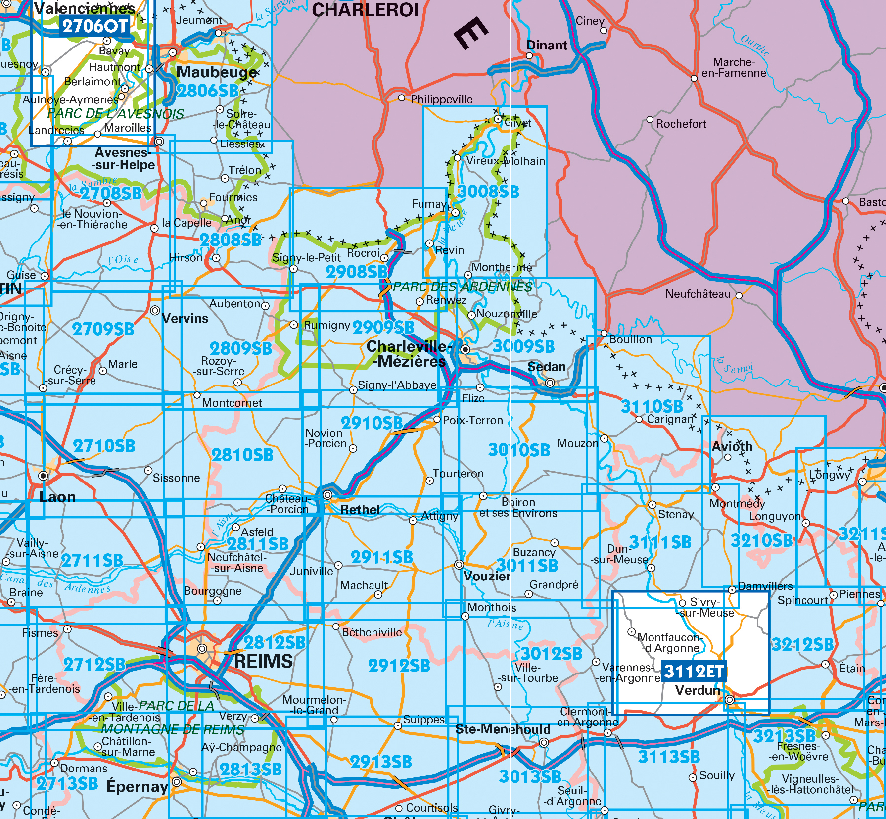
Producten op deze overzichtskaart:
Klik op een product om naar de pagina van dat product te gaan.
- Wandelkaart - Topografische kaart 2712 SB - Serie Bleue Gueux - Fismes | IGN - Institut Géographique National
- Wandelkaart - Topografische kaart 2713 SB - Serie Bleue Epernay - Dormans | IGN - Institut Géographique National
- Wandelkaart - Topografische kaart 2809 SB - Serie Bleue Rozoy-sur-Serre - Aubenton | IGN - Institut Géographique National
- Wandelkaart - Topografische kaart 2810 SB - Serie Bleue Château-Porcien, Dizy-le-Gros | IGN - Institut Géographique National
- Wandelkaart - Topografische kaart 2811 SB - Serie Bleue Bazancourt - Guignicourt - Asfeld | IGN - Institut Géographique National
- Wandelkaart - Topografische kaart 2812 SB - Serie Bleue Verzy - Reims | IGN - Institut Géographique National
- Wandelkaart - Topografische kaart 2813 SB - Serie Bleue Epernay-Verzy | IGN - Institut Géographique National
- Wandelkaart - Topografische kaart 2908 SB - Serie Bleue Revin, Rocroi, Maubert-Fontaine | IGN - Institut Géographique National
- Wandelkaart - Topografische kaart 2909 SB - Serie Bleue Renwez-Signy, L'Abbaye | IGN - Institut Géographique National
- Wandelkaart - Topografische kaart 2910 SB - Serie Bleue Rethel - Tourteron | IGN - Institut Géographique National
- Wandelkaart - Topografische kaart 2911 SB - Serie Bleue Attigny | IGN - Institut Géographique National
- Wandelkaart - Topografische kaart 2912 SB - Serie Bleue Mourmelon-le-Grand | IGN - Institut Géographique National
- Wandelkaart - Topografische kaart 2913 SB - Serie Bleue Châlons-en-Champagne | IGN - Institut Géographique National
- Topografische kaart - Wandelkaart 3008 SB - Serie Bleue Fumay | IGN - Institut Géographique National
- Wandelkaart - Topografische kaart 3010 SB - Serie Bleue le Chesne | IGN - Institut Géographique National
- Wandelkaart - Topografische kaart 3011 SB - Serie Bleue Vouziers | IGN - Institut Géographique National
- Topografische kaart - Wandelkaart 3012 SB - Serie Bleue Varennes-en-Argonne | IGN - Institut Géographique National
- Wandelkaart - Topografische kaart 3013 SB - Serie Bleue Ste-Menehould | IGN - Institut Géographique National
- Wandelkaart - Topografische kaart 3110 SB - Serie Bleue Carignan | IGN - Institut Géographique National
- Wandelkaart - Topografische kaart 3111 SB - Serie Bleue Stenay | IGN - Institut Géographique National
- Wandelkaart - Topografische kaart 3112ET Forêts de Verdun et du Mort-Homme | IGN - Institut Géographique National
- Wandelkaart - Topografische kaart 3113 SB - Serie Bleue Clermont-en-Argonne | IGN - Institut Géographique National
- Wandelkaart - Topografische kaart 3213 SB - Serie Bleue Vigneulles-lès-Hattonchâtel | IGN - Institut Géographique National
 Wandelkaart - Topografische kaart 2740ET Corniche des Cevennes | IGN - Institut Géographique National
 Wandelkaart - Topografische kaart 2806 SB - Serie Bleue Jeumont - Maubeuge | IGN - Institut Géographique National
 Wandelkaart - Topografische kaart 2809 SB - Serie Bleue Rozoy-sur-Serre - Aubenton | IGN - Institut Géographique National★★★★★
 Wandelkaart - Topografische kaart 2810 SB - Serie Bleue Château-Porcien, Dizy-le-Gros | IGN - Institut Géographique National
 Wandelkaart - Topografische kaart 2811 SB - Serie Bleue Bazancourt - Guignicourt - Asfeld | IGN - Institut Géographique National
 Wandelkaart - Topografische kaart 2812 SB - Serie Bleue Verzy - Reims | IGN - Institut Géographique National
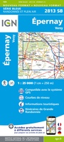 Wandelkaart - Topografische kaart 2813 SB - Serie Bleue Epernay-Verzy | IGN - Institut Géographique National
 Wandelkaart - Topografische kaart 2814 SB - Serie Bleue Thibie - Vertus | IGN - Institut Géographique National
 Wandelkaart - Topografische kaart 2815 SB - Serie Bleue Mailly-le-Camp, Fère-Champenoise | IGN - Institut Géographique National
 Wandelkaart - Topografische kaart 2816 SB - Serie Bleue Arcis-sur-Aube, Plancy-l'Abbaye | IGN - Institut Géographique National
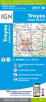 Wandelkaart - Topografische kaart 2817 SB - Serie Bleue Troyes, Lusigny-sur-Barse | IGN - Institut Géographique National
 Topografische kaart - Wandelkaart 2818 SB - Serie Bleue Bouilly | IGN - Institut Géographique National
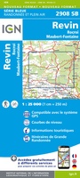 Wandelkaart - Topografische kaart 2908 SB - Serie Bleue Revin, Rocroi, Maubert-Fontaine | IGN - Institut Géographique National
 Wandelkaart - Topografische kaart 2909 SB - Serie Bleue Renwez-Signy, L'Abbaye | IGN - Institut Géographique National★★★★★
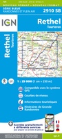 Wandelkaart - Topografische kaart 2910 SB - Serie Bleue Rethel - Tourteron | IGN - Institut Géographique National
 Wandelkaart - Topografische kaart 2911 SB - Serie Bleue Attigny | IGN - Institut Géographique National
 Wandelkaart - Topografische kaart 2912 SB - Serie Bleue Mourmelon-le-Grand | IGN - Institut Géographique National
 Wandelkaart - Topografische kaart 2913 SB - Serie Bleue Châlons-en-Champagne | IGN - Institut Géographique National
 Wandelkaart - Topografische kaart 2914 SB - Serie Bleue Marson, Châlons-en-Champagne | IGN - Institut Géographique National
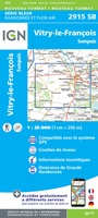 Wandelkaart - Topografische kaart 2915 SB - Serie Bleue Vitry-le-François, Sompuis | IGN - Institut Géographique National
Laatste reviews

Uitstekend
Zeer vlotte levering. Prima ingepakt. Kaart voldoet aan de verwachtingen.
★★★★★ door John Gielen 20 maart 2026 | Heeft dit artikel gekocht
Prima artikel en snel afgeleverd
Prima artikel en snel afgeleverd!
★★★★★ door Cees veltman 20 maart 2026 | Heeft dit artikel gekocht
Perfect e kaart
Een mooie bruikbare kaart, goede kwaliteit papier.
★★★★★ door Ferry 20 maart 2026 | Heeft dit artikel gekocht
Prima wandelkaart
Zoals verwacht weer een prima wandelkaart en snelle levering
★★★★★ door Frank 19 maart 2026 | Heeft dit artikel gekocht