Winkelwagen
Geen items in winkelwagen
Ga naar winkelwagen
Topografische kaarten - Midi-Pyrénées
 Wandelkaart - Topografische kaart 2539 SB - Serie Bleue Sévérac-le-Château, Lapanouse | IGN - Institut Géographique National
 Wandelkaart - Topografische kaart 2542OT Camarès - Avène | IGN - Institut Géographique National
 Topografische kaart - Wandelkaart 2640OT Gorges du Tarn et de la Jonte / Causse Méjan PNR | IGN - Institut Géographique National★★★★★
 Wandelkaart - Topografische kaart 2642OT Le Caylar - La Couvertoirade | IGN - Institut Géographique National★★★★★
 Wandelkaart - Topografische kaart 2227 SB - Serie Bleue La Châtre, Neuvy-St-Sépulchre | IGN - Institut Géographique National★★★★★
 Wandelkaart - Topografische kaart 2236 SB - Serie Bleue Saint-Céré, Sousceyrac-en-Quercy | IGN - Institut Géographique National★★★★★
 Wandelkaart - Topografische kaart 2237 SB - Serie Bleue Latronquière, Lacapelle-Marival | IGN - Institut Géographique National
 Wandelkaart - Topografische kaart 2238 SB - Serie Bleue Figeac | IGN - Institut Géographique National★★★★★
 Wandelkaart - Topografische kaart 2240 SB - Serie Bleue Varen, Laguépie, Najac | IGN - Institut Géographique National
 Wandelkaart - Topografische kaart 2241 SB - Serie Bleue Albi, Cordes-sur-Ciel | IGN - Institut Géographique National★★★★★
 Wandelkaart - Topografische kaart 2242 SB - Serie Bleue Gaillac, Graulhet | IGN - Institut Géographique National
 Wandelkaart - Topografische kaart 2243 SB - Serie Bleue Puylaurens, Lautrec | IGN - Institut Géographique National
 Wandelkaart - Topografische kaart 2244 SB - Serie Bleue Revel, St-Félix-Lauragais, Sorèze | IGN - Institut Géographique National
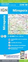 Wandelkaart - Topografische kaart 2246 SB - Serie Bleue Mirepoix | IGN - Institut Géographique National
 Wandelkaart - Topografische kaart 2247OT Lavelanet, Chalabre, Montségur, Laroque-d'Olmes | IGN - Institut Géographique National
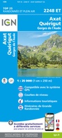 Wandelkaart - Topografische kaart 2248ET Axat, Querigut | IGN - Institut Géographique National★★★★★
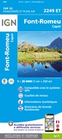 Wandelkaart - Topografische kaart 2249ET Font Romeu, Capcir, Olette | IGN - Institut Géographique National★★★★★
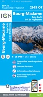 Wandelkaart - Topografische kaart 2249OT Bourg-Madame, Pic Carlit, Col de Puymorens, Port d'Envalira | IGN - Institut Géographique National★★★★★
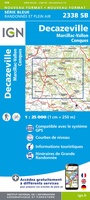 Wandelkaart - Topografische kaart 2338 SB - Serie Bleue Decazeville | IGN - Institut Géographique National
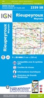 Wandelkaart - Topografische kaart 2339 SB - Serie Bleue Rieupeyroux - Moyrazes | IGN - Institut Géographique National
- 1
- 2
- 3
- Volgende >>
- 5
Laatste reviews

Onmisbaar
Deze kaart is onmisbaar bij het wandelen in de Eifel, we lopen jaarlijks de Hermannsweg met een vergelijkbare kaart en we kunnen echt niet zonder, …
★★★★★ door R. van den Driesche 01 juli 2026 | Heeft dit artikel gekocht
Prima kaart doe vlot is geleverd.
Ideale kaart om als toerist door Jutland te trekken. Prettige schaal.
★★★★★ door Irma van Hof 01 juli 2026 | Heeft dit artikel gekocht
Prima wandelgidsen
Kompassboekjes zijn prima gidsen. Dat wordt een leuke vakantie.
★★★★★ door Anna 01 juli 2026 | Heeft dit artikel gekocht
Handig formaat en gedetailleerd
Perfecte wegenatlas en door het A4 formaat handiger dan een uitvouwbare kaart. Fijne combinatie van de wegenatlas en het navigatiesysteem van google maps
★★★★★ door Hay van Emden 30 juni 2026 | Heeft dit artikel gekocht