Winkelwagen
Geen items in winkelwagen
Ga naar winkelwagen
Wandelkaarten - Cevennen
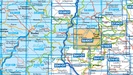
Overzichtskaarten
-
Wandelkaarten IGN 25.000 Cevennen
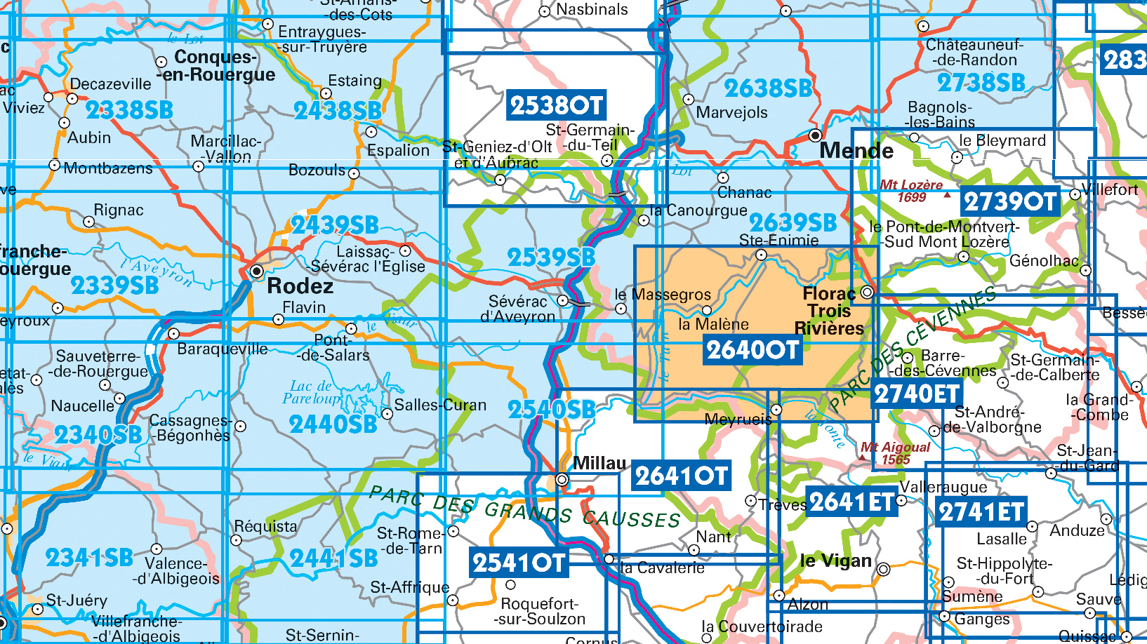
Producten op deze overzichtskaart:
Klik op een product om naar de pagina van dat product te gaan.
- Wandelkaart - Topografische kaart 2241 SB - Serie Bleue Albi, Cordes-sur-Ciel | IGN - Institut Géographique National
- Wandelkaart - Topografische kaart 2338 SB - Serie Bleue Decazeville | IGN - Institut Géographique National
- Wandelkaart - Topografische kaart 2339 SB - Serie Bleue Rieupeyroux - Moyrazes | IGN - Institut Géographique National
- Wandelkaart - Topografische kaart 2340 SB - Serie Bleue Naucelle, La Salvetat, Peyrales | IGN - Institut Géographique National
- Wandelkaart - Topografische kaart 2341 SB - Serie Bleue Carmaux, Valence-d'Albigeoi | IGN - Institut Géographique National
- Wandelkaart - Topografische kaart 2438 SB - Serie Bleue Espalion - Estaing | IGN - Institut Géographique National
- Wandelkaart - Topografische kaart 2439 SB - Serie Bleue Rodez - Laissac | IGN - Institut Géographique National
- Wandelkaart - Topografische kaart 2440 SB - Serie Bleue Salles-Curan, Lac de Pareloup, Cassagnes, Begonhes | IGN - Institut Géographique National
- Wandelkaart - Topografische kaart 2441 SB - Serie Bleue Réquista, Villefranche-de-Panat | IGN - Institut Géographique National
- Wandelkaart 2538OT Ste-Eulalie-d'Olt | IGN - Institut Géographique National
- Wandelkaart - Topografische kaart 2539 SB - Serie Bleue Sévérac-le-Château, Lapanouse | IGN - Institut Géographique National
- Wandelkaart 2540 SB - Serie Bleue St-Beauzély / Aguessac / Gorges du Tarn | IGN - Institut Géographique National
- Wandelkaart 2541OT Millau / St-Affrique / PNR Grands Causses | IGN - Institut Géographique National
- Wandelkaart - Topografische kaart 2638 SB - Serie Bleue Mende | IGN - Institut Géographique National
- Wandelkaart - Topografische kaart 2639 SB - Serie Bleue Florac | IGN - Institut Géographique National
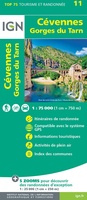
- Topografische kaart - Wandelkaart 2640OT Gorges du Tarn et de la Jonte / Causse Méjan PNR | IGN - Institut Géographique National
- Wandelkaart - Topografische kaart 2641ET Mont Aigoual | IGN - Institut Géographique National
- Wandelkaart 2641OT Millau / Gorges de la Dourbie / Causse Noir | IGN - Institut Géographique National
- Wandelkaart - Topografische kaart 2738 SB - Serie Bleue Le Bleymard | IGN - Institut Géographique National
- Wandelkaart - Topografische kaart 2739OT Mont Lozère - Florac | IGN - Institut Géographique National
- Wandelkaart - Topografische kaart 2740ET Corniche des Cevennes | IGN - Institut Géographique National
- Wandelkaart - Topografische kaart 2741ET Saint-Hippolyte-du-Fort | IGN - Institut Géographique National
 Wandelkaart - Fietskaart 75011 Cevennes PRN - Gorges du Tarn | IGN - Institut Géographique National★★★★★
 Wandelkaart - Fietskaart 75016 Cézallier – Monts du Cantal | IGN - Institut Géographique National
 Wandelkaart - Topografische kaart 2741ET Saint-Hippolyte-du-Fort | IGN - Institut Géographique National
Laatste reviews

LEUK ORIGINEEL KADO
enthousiast ontvangen door klanten. Is met de kinderen van 7 en 5 jaar oud gelijk aan de slag gegaan
★★★★★ door aam van ruler 30 december 2025 | Heeft dit artikel gekocht
Goede, uitgebreide gids
Nederlandstalige (vertaalde) reisgids met veel informatie, ook over praktische zaken. Duidelijke streek- en stadkaartjes met wandelroutes, ook handig.
★★★★★ door Kees H. 30 december 2025 | Heeft dit artikel gekocht
I.c.m. website een actuele basis
Dit boekje met beknopte omschrijving en de erin afgedrukte wandel(deel)kaarten vormen een prima basis voor het rondje Limburg. Je bent vrij om te bepalen waar …
★★★★★ door Greenline 29 december 2025 | Heeft dit artikel gekocht
Prima kaart
Snel geleverd en goede wandelkaart
★★★★★ door Rinske 29 december 2025 | Heeft dit artikel gekocht