Winkelwagen
Geen items in winkelwagen
Ga naar winkelwagen
Wandelkaarten - Cevennen
Overzichtskaarten
-
Wandelkaarten IGN 25.000 Cevennen
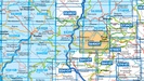
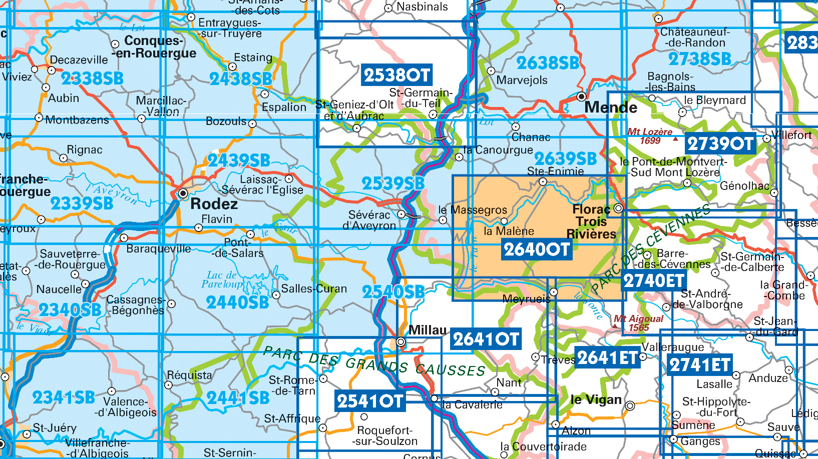
Producten op deze overzichtskaart:
Klik op een product om naar de pagina van dat product te gaan.
- Wandelkaart - Topografische kaart 2241SB Albi, Cordes-sur-Ciel | IGN - Institut Géographique National
- Wandelkaart - Topografische kaart 2338SB Decazeville | IGN - Institut Géographique National
- Wandelkaart - Topografische kaart 2339SB Rieupeyroux - Moyrazes | IGN - Institut Géographique National
- Wandelkaart - Topografische kaart 2340SB Naucelle, La Salvetat, Peyrales | IGN - Institut Géographique National
- Wandelkaart - Topografische kaart 2341SB Carmaux, Valence-d'Albigeoi | IGN - Institut Géographique National
- Wandelkaart - Topografische kaart 2438SB Espalion - Estaing | IGN - Institut Géographique National
- Wandelkaart - Topografische kaart 2439SB Rodez - Laissac | IGN - Institut Géographique National
- Wandelkaart - Topografische kaart 2440SB Salles-Curan, Lac de Pareloup, Cassagnes, Begonhes | IGN - Institut Géographique National
- Wandelkaart - Topografische kaart 2441SB Réquista, Villefranche-de-Panat | IGN - Institut Géographique National
- Wandelkaart - Topografische kaart 2538OT Ste-Eulalie-d'Olt - Hte Vallée du Lot - Mt d'Aubrac | IGN - Institut Géographique National
- Wandelkaart - Topografische kaart 2539SB Sévérac-le-Château, Lapanouse | IGN - Institut Géographique National
- Wandelkaart - Topografische kaart 2540SB St-Beauzély, Aguessac, Gorges-du-Tarn | IGN - Institut Géographique National
- Wandelkaart - Topografische kaart 2541OT Millau, St-Affrique - PNR Grands Causses | IGN - Institut Géographique National
- Wandelkaart - Topografische kaart 2638SB Mende | IGN - Institut Géographique National
- Wandelkaart - Topografische kaart 2639SB Florac | IGN - Institut Géographique National
- Wandelkaart - Topografische kaart 2640OT Gorges du Tarn et de la Jonte | IGN - Institut Géographique National
- Wandelkaart - Topografische kaart 2641ET Mont Aigoual | IGN - Institut Géographique National
- Wandelkaart - Topografische kaart 2641OT Millau | IGN - Institut Géographique National
- Wandelkaart - Topografische kaart 2738SB Le Bleymard | IGN - Institut Géographique National
- Wandelkaart - Topografische kaart 2739OT Mont Lozère - Florac | IGN - Institut Géographique National
- Wandelkaart - Topografische kaart 2740ET Corniche des Cevennes | IGN - Institut Géographique National
- Wandelkaart - Topografische kaart 2741ET Saint-Hippolyte-du-Fort | IGN - Institut Géographique National
 Wandelkaart - Topografische kaart 2338SB Decazeville | IGN - Institut Géographique National
 Wandelkaart - Topografische kaart 2438SB Espalion - Estaing | IGN - Institut Géographique National
 Wandelkaart - Topografische kaart 2638SB Mende | IGN - Institut Géographique National
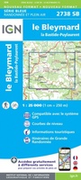 Wandelkaart - Topografische kaart 2738SB Le Bleymard | IGN - Institut Géographique National
 Wandelkaart - Topografische kaart 2339SB Rieupeyroux - Moyrazes | IGN - Institut Géographique National
 Wandelkaart - Topografische kaart 2439SB Rodez - Laissac | IGN - Institut Géographique National
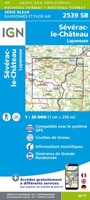 Wandelkaart - Topografische kaart 2539SB Sévérac-le-Château, Lapanouse | IGN - Institut Géographique National
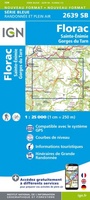 Wandelkaart - Topografische kaart 2639SB Florac | IGN - Institut Géographique National
 Wandelkaart - Topografische kaart 2440SB Salles-Curan, Lac de Pareloup, Cassagnes, Begonhes | IGN - Institut Géographique National
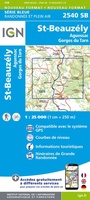 Wandelkaart - Topografische kaart 2540SB St-Beauzély, Aguessac, Gorges-du-Tarn | IGN - Institut Géographique National
 Wandelkaart - Topografische kaart 2441SB Réquista, Villefranche-de-Panat | IGN - Institut Géographique National★★★★★
 Wandelkaart - Topografische kaart 2541OT Millau, St-Affrique - PNR Grands Causses | IGN - Institut Géographique National
 Wandelkaart - Topografische kaart 2641OT Millau | IGN - Institut Géographique National★★★★★
 Wandelkaart - Topografische kaart 2640OT Gorges du Tarn et de la Jonte | IGN - Institut Géographique National★★★★★
 Wandelkaart - Topografische kaart 2641ET Mont Aigoual | IGN - Institut Géographique National
 Wandelkaart - Topografische kaart 2642ET St.-Guilhem-le-Desert | IGN - Institut Géographique National
 Wandelkaart - Topografische kaart 2739OT Mont Lozère - Florac | IGN - Institut Géographique National★★★★★
 Wandelkaart - Topografische kaart 2740ET Corniche des Cevennes | IGN - Institut Géographique National
 Wandelkaart - Topografische kaart 2741ET Saint-Hippolyte-du-Fort | IGN - Institut Géographique National
 Wandelkaart - Topografische kaart 2839OT Besseges - Les-Vans | IGN - Institut Géographique National
Laatste reviews

Handige plattegrond.
Heel handige plattegrond voor bezoek aan Havana. Makkelijk op te vouwen tot een klein handzaam pakketje.
★★★★★ door Marte 20 april 2024 | Heeft dit artikel gekocht
Goede, duidelijke kaart.
Goede, behoorlijk gedetailleerde kaart waarop je ook landschap en dorpen kunt zien.
★★★★★ door Marte 20 april 2024 | Heeft dit artikel gekocht
Fijn en overzichtelijk, wel een behoorlijk gewicht in je rugtas
Een makkelijk en bruikbaar boek om planten op naam te kunnen brengen middels heldere sleutels. Het boek wordt beschouwd als een boek om altijd bij …
★★★★★ door Peter Teune 19 april 2024 | Heeft dit artikel gekocht
Mooie duidelijke gids, hopelijk ook makkelijk in gebruik.
Mooie duidelijke gids, hopelijk ook makkelijk in gebruik. Nog niet gebruikt maar het is een duidelijke gids die ook in de voorbereidingen goed van pas …
★★★★★ door Jo 19 april 2024 | Heeft dit artikel gekocht