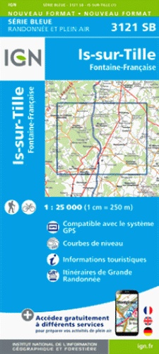
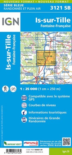
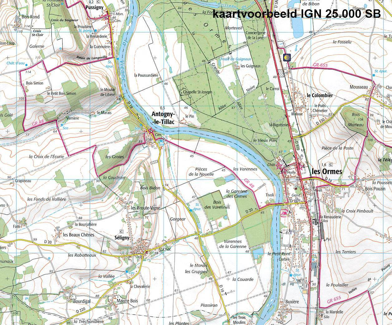
Topografische kaart - Wandelkaart 3121SB Is-sur-Tille | IGN - Institut Géographique National (9782758537434)
Fontaine-Française
- ISBN / CODE: 9782758537434
- Editie: meest recente versie
- Schaal: 1:25000
- Uitgever: IGN - Institut Géographique National
- Soort: Topografische kaart, Wandelkaart
- Serie: Serie bleue
- Taal: Frans
- Schrijf als eerste een review
-
€ 16,95
Leverbaar in 3 - 5 werkdagen in huis in Nederland Levertijd Belgie
Gratis verzending in Nederland vanaf €35,-
-
Topografische kaarten IGN 25.000 Bourgondië: OOSTELIJK GEDEELTE + MORVAN

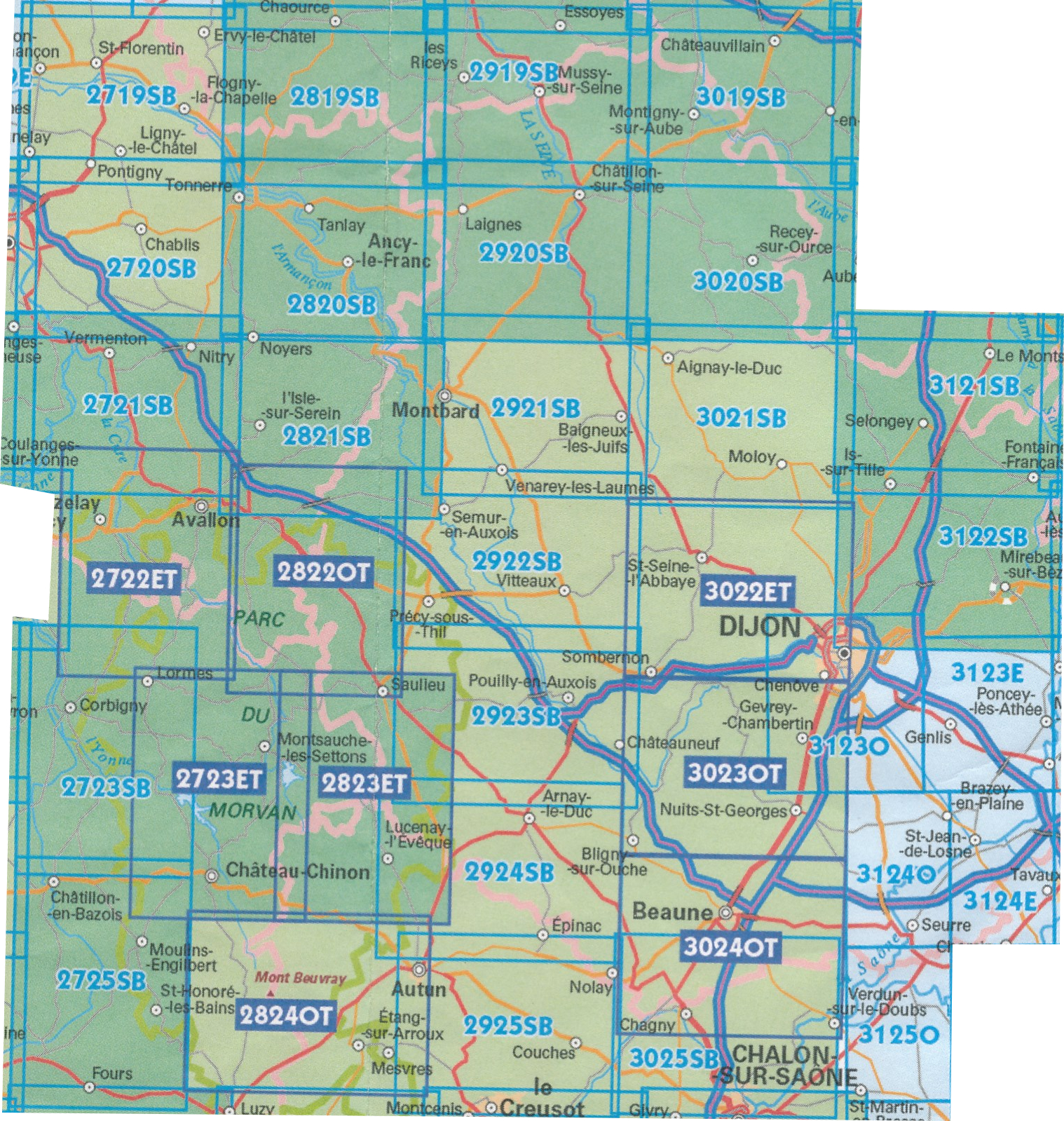
Producten op deze overzichtskaart:
Klik op een product om naar de pagina van dat product te gaan.
- Wandelkaart - Topografische kaart 2719SB Saint-Florentin – Flogny-la-Chapelle | IGN - Institut Géographique National
- Wandelkaart - Topografische kaart 2720SB Chablis, Champs-sur-Yonne | IGN - Institut Géographique National
- Topografische kaart - Wandelkaart 2721SB Vermenton | IGN - Institut Géographique National
- Topografische kaart - Wandelkaart 2722ET Avallon - Vézelay | IGN - Institut Géographique National
- Topografische kaart - Wandelkaart 2723ET Château-Chinon | IGN - Institut Géographique National
- Wandelkaart - Topografische kaart 2723SB Corbigny | IGN - Institut Géographique National
- Topografische kaart - Wandelkaart 2725SB Moulins-Engilbert | IGN - Institut Géographique National
- Topografische kaart - Wandelkaart 2819SB Chaource | IGN - Institut Géographique National
- Topografische kaart - Wandelkaart 2820SB Tonnerre | IGN - Institut Géographique National
- Topografische kaart - Wandelkaart 2821SB L'Isle-sur-Serein | IGN - Institut Géographique National
- Wandelkaart - Topografische kaart 2822OT Quarre-les-Tombes | IGN - Institut Géographique National
- Topografische kaart - Wandelkaart 2823ET Saulieu - Lac de Settons | IGN - Institut Géographique National
- Wandelkaart - Topografische kaart 2824OT Autun - Mont Beuvray | IGN - Institut Géographique National
- Topografische kaart - Wandelkaart 2919SB les Riceys | IGN - Institut Géographique National
- Topografische kaart - Wandelkaart 2920SB Châtillon-sur-Seine | IGN - Institut Géographique National
- Topografische kaart - Wandelkaart 2921SB Baigneux-les-Juifs, Alésia, Montbard | IGN - Institut Géographique National
- Wandelkaart - Topografische kaart 2922SB Semur-en-Auxois – Vitteaux | IGN - Institut Géographique National
- Wandelkaart - Topografische kaart 2923SB Pouilly-en-Auxois – Thoisy-la-Berchère | IGN - Institut Géographique National
- Wandelkaart - Topografische kaart 2924SB Arnay-le-Duc – Epignac | IGN - Institut Géographique National
- Wandelkaart - Topografische kaart 2925SB Autun - Le Creusot | IGN - Institut Géographique National
- Topografische kaart - Wandelkaart 3019SB Châteauvillain | IGN - Institut Géographique National
- Topografische kaart - Wandelkaart 3020SB Recey-sur-Ource | IGN - Institut Géographique National
- Wandelkaart - Topografische kaart 3021SB Grancey-le-Château-Neuvelle – Aignay-le-Duc | IGN - Institut Géographique National
- Wandelkaart - Topografische kaart 3022ET Val-Suzon - St-Seine-l'Abbaye - Dijon Ouest | IGN - Institut Géographique National
- Wandelkaart - Topografische kaart 3023OT Nuits-St-Georges | IGN - Institut Géographique National
- Wandelkaart - Topografische kaart 3024OT Beaune Chagny | IGN - Institut Géographique National
- Wandelkaart - Topografische kaart 3025SB Chalon-sur-Saone (Nord), Chagny | IGN - Institut Géographique National
- Topografische kaart - Wandelkaart 3121SB Is-sur-Tille | IGN - Institut Géographique National
- Wandelkaart - Topografische kaart 3122SB Mirebeau-sur-Bèze | IGN - Institut Géographique National
- Wandelkaart - Topografische kaart 3123SB Dijon | IGN - Institut Géographique National
- Wandelkaart - Topografische kaart 3124SB Seurre | IGN - Institut Géographique National
-
Wandelkaarten IGN 25.000 Bourgondië: OOSTELIJK GEDEELTE + MORVAN

Producten op deze overzichtskaart:
Klik op een product om naar de pagina van dat product te gaan.
- Wandelkaart - Topografische kaart 2719SB Saint-Florentin – Flogny-la-Chapelle | IGN - Institut Géographique National
- Wandelkaart - Topografische kaart 2720SB Chablis, Champs-sur-Yonne | IGN - Institut Géographique National
- Topografische kaart - Wandelkaart 2721SB Vermenton | IGN - Institut Géographique National
- Topografische kaart - Wandelkaart 2722ET Avallon - Vézelay | IGN - Institut Géographique National
- Topografische kaart - Wandelkaart 2723ET Château-Chinon | IGN - Institut Géographique National
- Wandelkaart - Topografische kaart 2723SB Corbigny | IGN - Institut Géographique National
- Topografische kaart - Wandelkaart 2725SB Moulins-Engilbert | IGN - Institut Géographique National
- Topografische kaart - Wandelkaart 2819SB Chaource | IGN - Institut Géographique National
- Topografische kaart - Wandelkaart 2820SB Tonnerre | IGN - Institut Géographique National
- Topografische kaart - Wandelkaart 2821SB L'Isle-sur-Serein | IGN - Institut Géographique National
- Wandelkaart - Topografische kaart 2822OT Quarre-les-Tombes | IGN - Institut Géographique National
- Topografische kaart - Wandelkaart 2823ET Saulieu - Lac de Settons | IGN - Institut Géographique National
- Wandelkaart - Topografische kaart 2824OT Autun - Mont Beuvray | IGN - Institut Géographique National
- Topografische kaart - Wandelkaart 2919SB les Riceys | IGN - Institut Géographique National
- Topografische kaart - Wandelkaart 2920SB Châtillon-sur-Seine | IGN - Institut Géographique National
- Topografische kaart - Wandelkaart 2921SB Baigneux-les-Juifs, Alésia, Montbard | IGN - Institut Géographique National
- Wandelkaart - Topografische kaart 2922SB Semur-en-Auxois – Vitteaux | IGN - Institut Géographique National
- Wandelkaart - Topografische kaart 2923SB Pouilly-en-Auxois – Thoisy-la-Berchère | IGN - Institut Géographique National
- Wandelkaart - Topografische kaart 2924SB Arnay-le-Duc – Epignac | IGN - Institut Géographique National
- Wandelkaart - Topografische kaart 2925SB Autun - Le Creusot | IGN - Institut Géographique National
- Topografische kaart - Wandelkaart 3019SB Châteauvillain | IGN - Institut Géographique National
- Topografische kaart - Wandelkaart 3020SB Recey-sur-Ource | IGN - Institut Géographique National
- Wandelkaart - Topografische kaart 3021SB Grancey-le-Château-Neuvelle – Aignay-le-Duc | IGN - Institut Géographique National
- Wandelkaart - Topografische kaart 3022ET Val-Suzon - St-Seine-l'Abbaye - Dijon Ouest | IGN - Institut Géographique National
- Wandelkaart - Topografische kaart 3023OT Nuits-St-Georges | IGN - Institut Géographique National
- Wandelkaart - Topografische kaart 3024OT Beaune Chagny | IGN - Institut Géographique National
- Wandelkaart - Topografische kaart 3025SB Chalon-sur-Saone (Nord), Chagny | IGN - Institut Géographique National
- Topografische kaart - Wandelkaart 3121SB Is-sur-Tille | IGN - Institut Géographique National
- Wandelkaart - Topografische kaart 3122SB Mirebeau-sur-Bèze | IGN - Institut Géographique National
- Wandelkaart - Topografische kaart 3123SB Dijon | IGN - Institut Géographique National
- Wandelkaart - Topografische kaart 3124SB Seurre | IGN - Institut Géographique National
Overzichtskaarten
Beschrijving
Reviews
Geen reviews gevonden voor dit product.
Schrijf een review
Graag horen wij wat u van dit artikel vindt. Vindt u het goed, leuk, mooi, slecht, lelijk, onbruikbaar of erg handig: schrijf gerust alles op! Het is niet alleen leuk om te doen maar u informeert andere klanten er ook nog mee!
Ook interessant voor europa/frankrijk/bourgondie
-

Wandelgids Burgund - Bourgondië | Ro
€ 18,50Wandelgidsen Bourgondië -

Topografische kaart - Wandelkaart 26
€ 16,95Topografische kaarten Bourgondië -

Topografische kaart - Wandelkaart 25
€ 16,95Topografische kaarten Bourgondië -

Wegenkaart - landkaart 327 Loire - R
€ 9,95Wegenkaarten Bourgondië -

Wandelkaart - Topografische kaart 24
€ 16,95Topografische kaarten Bourgondië