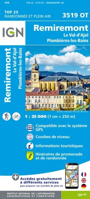
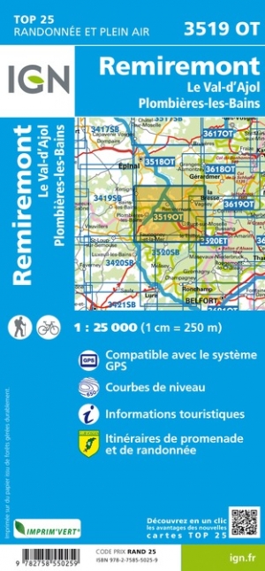
Wandelkaart - Topografische kaart 3519OT Remiremont | IGN - Institut Géographique National (9782758550259)
Le Val-d'Ajol Plombieres-les-Bains
- ISBN / CODE: 9782758550259
- Editie: nieuwste editie
- Schaal: 1:25000
- Uitgever: IGN - Institut Géographique National
- Soort: Topografische kaart, Wandelkaart
- Serie: Top 25
- Taal: Frans
- Beoordeling: 4,8 ★★★★★ (4 reviews) Schrijf een review
-
€ 16,95
Levertijd 2 - 4 werkdagen in huis in Nederland Levertijd Belgie
Gratis verzending in Nederland vanaf €35,-
.jpg)
-
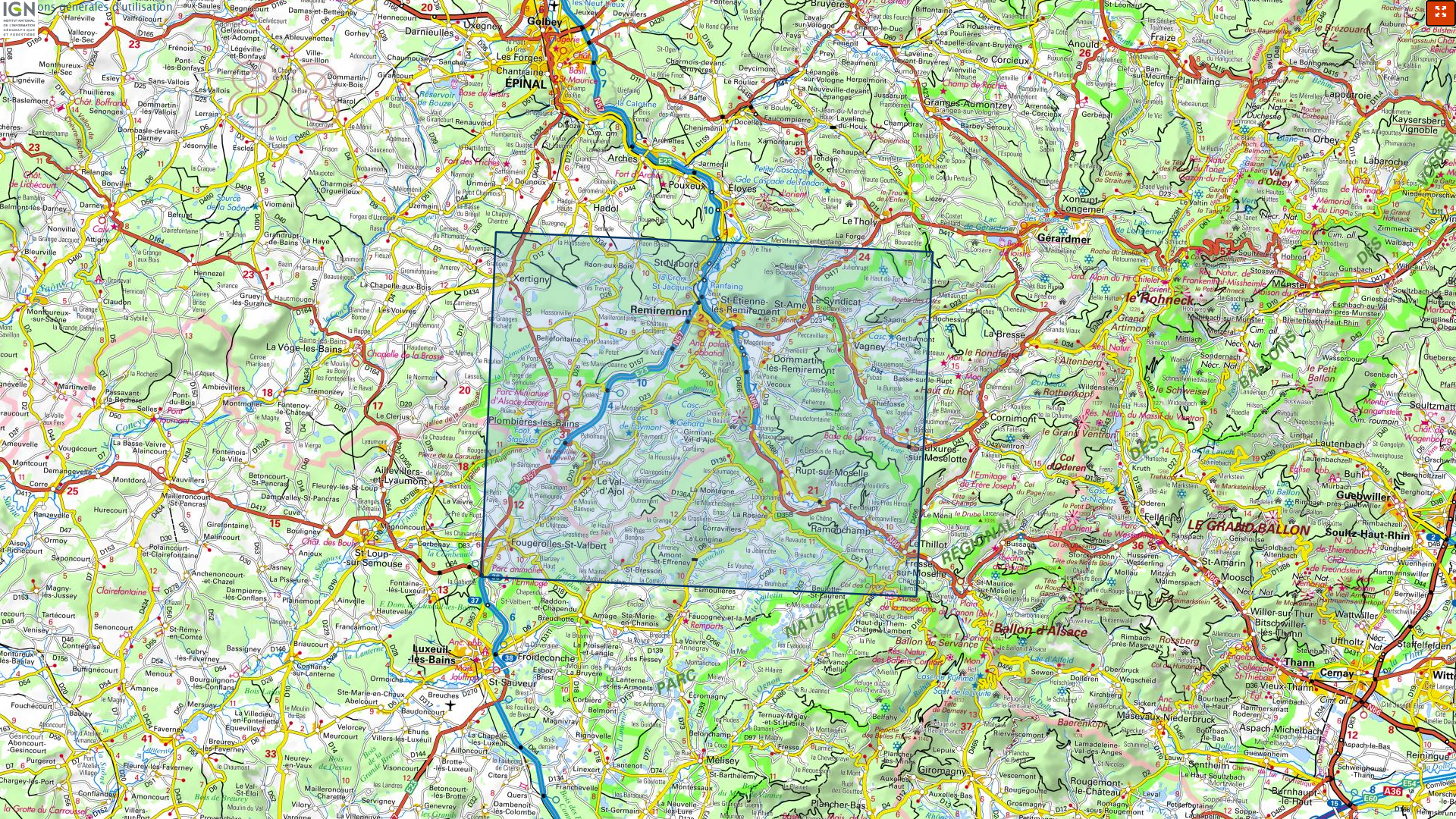
Overzicht IGN 25.000 Elzas - Lotharingen: West
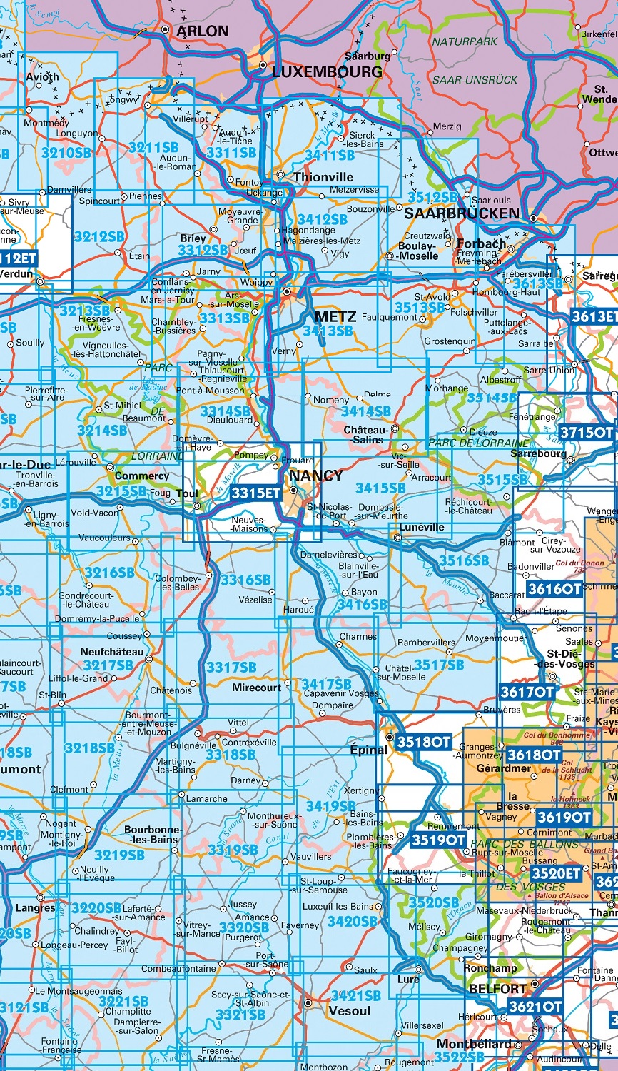
Producten op deze overzichtskaart:
Klik op een product om naar de pagina van dat product te gaan.
- Wandelkaart - Topografische kaart 3210SB Longuyon | IGN - Institut Géographique National
- Wandelkaart - Topografische kaart 3211SB Longuyon - Longwy | IGN - Institut Géographique National
- Wandelkaart - Topografische kaart 3212SB Étain | IGN - Institut Géographique National
- Wandelkaart - Topografische kaart 3214SB St-Mihiel | IGN - Institut Géographique National
- Wandelkaart - Topografische kaart 3311SB Hayange, Villerupt, Audun-le-Roman | IGN - Institut Géographique National
- Wandelkaart - Topografische kaart 3312SB Briey | IGN - Institut Géographique National
- Wandelkaart - Topografische kaart 3313SB Ars-sur-Moselle | IGN - Institut Géographique National
- Wandelkaart - Topografische kaart 3314SB Pont-à-Mousson | IGN - Institut Géographique National
- Wandelkaart - Topografische kaart 3315ET Nancy - Toul | IGN - Institut Géographique National
- Wandelkaart - Topografische kaart 3316SB Vézelise | IGN - Institut Géographique National
- Wandelkaart - Topografische kaart 3317SB Chatenois | IGN - Institut Géographique National
- Topografische kaart - Wandelkaart 3318SB Vittel | IGN - Institut Géographique National
- Wandelkaart - Topografische kaart 3411SB Thionville | IGN - Institut Géographique National
- Wandelkaart - Topografische kaart 3412SB Woippy | IGN - Institut Géographique National
- Wandelkaart - Topografische kaart 3413SB Metz | IGN - Institut Géographique National
- Wandelkaart - Topografische kaart 3414SB Château-Salins | IGN - Institut Géographique National
- Wandelkaart - Topografische kaart 3415SB Saint-Nicolas-de-Port | IGN - Institut Géographique National
- Wandelkaart - Topografische kaart 3417SB Mirecourt - Charmes | IGN - Institut Géographique National
- Wandelkaart - Topografische kaart 3419SB Bains-les-Bains | IGN - Institut Géographique National
- Wandelkaart - Topografische kaart 3512SB Bouzonville | IGN - Institut Géographique National
- Wandelkaart - Topografische kaart 3513SB Saint-Avold / Faulquemont | IGN - Institut Géographique National
- Wandelkaart - Topografische kaart 3514SB Dieuze / Albestroff | IGN - Institut Géographique National
- Wandelkaart - Topografische kaart 3515SB Lorquin - Avricourt | IGN - Institut Géographique National
- Wandelkaart - Topografische kaart 3516SB Lunéville / Baccarat | IGN - Institut Géographique National
- Wandelkaart - Topografische kaart 3517SB Rambervillers | IGN - Institut Géographique National
- Wandelkaart - Topografische kaart 3518OT Epinal | IGN - Institut Géographique National
- Wandelkaart - Topografische kaart 3519OT Remiremont | IGN - Institut Géographique National
- Wandelkaart - Topografische kaart 3520SB Mélisey - Lure | IGN - Institut Géographique National
- Wandelkaart - Topografische kaart 3613SB Forbach - Sarreguemines | IGN - Institut Géographique National
-
Overzicht IGN 25.000 Elzas - Lotharingen: West


Producten op deze overzichtskaart:
Klik op een product om naar de pagina van dat product te gaan.
- Wandelkaart - Topografische kaart 3210SB Longuyon | IGN - Institut Géographique National
- Wandelkaart - Topografische kaart 3211SB Longuyon - Longwy | IGN - Institut Géographique National
- Wandelkaart - Topografische kaart 3212SB Étain | IGN - Institut Géographique National
- Wandelkaart - Topografische kaart 3214SB St-Mihiel | IGN - Institut Géographique National
- Wandelkaart - Topografische kaart 3311SB Hayange, Villerupt, Audun-le-Roman | IGN - Institut Géographique National
- Wandelkaart - Topografische kaart 3312SB Briey | IGN - Institut Géographique National
- Wandelkaart - Topografische kaart 3313SB Ars-sur-Moselle | IGN - Institut Géographique National
- Wandelkaart - Topografische kaart 3314SB Pont-à-Mousson | IGN - Institut Géographique National
- Wandelkaart - Topografische kaart 3315ET Nancy - Toul | IGN - Institut Géographique National
- Wandelkaart - Topografische kaart 3316SB Vézelise | IGN - Institut Géographique National
- Wandelkaart - Topografische kaart 3317SB Chatenois | IGN - Institut Géographique National
- Topografische kaart - Wandelkaart 3318SB Vittel | IGN - Institut Géographique National
- Wandelkaart - Topografische kaart 3411SB Thionville | IGN - Institut Géographique National
- Wandelkaart - Topografische kaart 3412SB Woippy | IGN - Institut Géographique National
- Wandelkaart - Topografische kaart 3413SB Metz | IGN - Institut Géographique National
- Wandelkaart - Topografische kaart 3414SB Château-Salins | IGN - Institut Géographique National
- Wandelkaart - Topografische kaart 3415SB Saint-Nicolas-de-Port | IGN - Institut Géographique National
- Wandelkaart - Topografische kaart 3417SB Mirecourt - Charmes | IGN - Institut Géographique National
- Wandelkaart - Topografische kaart 3419SB Bains-les-Bains | IGN - Institut Géographique National
- Wandelkaart - Topografische kaart 3512SB Bouzonville | IGN - Institut Géographique National
- Wandelkaart - Topografische kaart 3513SB Saint-Avold / Faulquemont | IGN - Institut Géographique National
- Wandelkaart - Topografische kaart 3514SB Dieuze / Albestroff | IGN - Institut Géographique National
- Wandelkaart - Topografische kaart 3515SB Lorquin - Avricourt | IGN - Institut Géographique National
- Wandelkaart - Topografische kaart 3516SB Lunéville / Baccarat | IGN - Institut Géographique National
- Wandelkaart - Topografische kaart 3517SB Rambervillers | IGN - Institut Géographique National
- Wandelkaart - Topografische kaart 3518OT Epinal | IGN - Institut Géographique National
- Wandelkaart - Topografische kaart 3519OT Remiremont | IGN - Institut Géographique National
- Wandelkaart - Topografische kaart 3520SB Mélisey - Lure | IGN - Institut Géographique National
- Wandelkaart - Topografische kaart 3613SB Forbach - Sarreguemines | IGN - Institut Géographique National
-
Overzicht IGN 25.000 Vogezen en Elzas - Lotharingen: Oost

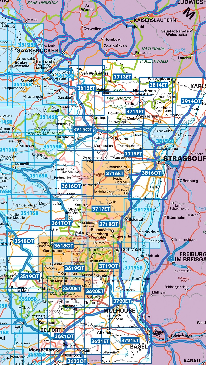
Producten op deze overzichtskaart:
Klik op een product om naar de pagina van dat product te gaan.
- Wandelkaart - Topografische kaart 3518OT Epinal | IGN - Institut Géographique National
- Wandelkaart - Topografische kaart 3519OT Remiremont | IGN - Institut Géographique National
- Wandelkaart - Topografische kaart 3520ET Ballon d'Alsace | IGN - Institut Géographique National
- Wandelkaart - Topografische kaart 3613ET Sarreguemines | IGN - Institut Géographique National
- Wandelkaart - Topografische kaart 3614ET Sarre-Union - Phalsbourg | IGN - Institut Géographique National
- Wandelkaart - Topografische kaart 3616OT Lac de Pierre-Percée - Le Donon | IGN - Institut Géographique National
- Wandelkaart - Topografische kaart 3617OT St-Dié-des-Vosges | IGN - Institut Géographique National
- Wandelkaart - Topografische kaart 3618OT Le Hohneck - Gérardmer | IGN - Institut Géographique National
- Wandelkaart - Topografische kaart 3619OT Bussang - La Bresse | IGN - Institut Géographique National
- Wandelkaart - Topografische kaart 3620ET Grand Ballon | IGN - Institut Géographique National
- Wandelkaart - Topografische kaart 3621ET Dannemarie - Delle - Sundgau | IGN - Institut Géographique National
- Wandelkaart - Topografische kaart 3713ET Pays de Bitche - Dambach - PNR des Vosges du Nord | IGN - Institut Géographique National
- Wandelkaart - Topografische kaart 3714ET la Petite Pierre - Petite Pierre, Niederbronn-les-Bains, PNR Vosges du Nord | IGN - Institut Géographique National
- Wandelkaart - Topografische kaart 3715ET Wasselone - Rocher de Dabo - Saverne | IGN - Institut Géographique National
- Wandelkaart - Topografische kaart 3715OT Sarrebourg - Phalsbourg - Pays des Etangs | IGN - Institut Géographique National
- Wandelkaart - Topografische kaart 3716ET le Donon, Obernai, Mont Ste-Odile | IGN - Institut Géographique National
- Wandelkaart - Topografische kaart 3717ET Barr - Le Howald - Villé - Vallée de la Bruche | IGN - Institut Géographique National
- Wandelkaart - Topografische kaart 3718OT Selestat - Col Du Bonhomme | IGN - Institut Géographique National
- Wandelkaart - Topografische kaart 3719OT Colmar & Le Hohneck | IGN - Institut Géographique National
- Wandelkaart - Topografische kaart 3719SB Colmar | IGN - Institut Géographique National
- Wandelkaart - Topografische kaart 3720ET Mulhouse | IGN - Institut Géographique National
- Wandelkaart - Topografische kaart 3721ET Altkirch - Bâle - Sundgau | IGN - Institut Géographique National
- Wandelkaart - Topografische kaart 3814ET Hagenau - Lembach - PNR des Vosges du Nord | IGN - Institut Géographique National
- Wandelkaart - Topografische kaart 3815SB Bischwiller - Brumath | IGN - Institut Géographique National
- Wandelkaart - Topografische kaart 3816OT Strasbourg | IGN - Institut Géographique National
- Wandelkaart - Topografische kaart 3817SB Sélestat - Marckolsheim | IGN - Institut Géographique National
- Wandelkaart - Topografische kaart 3914OT Wissembourg | IGN - Institut Géographique National
-
Overzicht IGN 25.000 Vogezen en Elzas - Lotharingen: Oost

Producten op deze overzichtskaart:
Klik op een product om naar de pagina van dat product te gaan.
- Wandelkaart - Topografische kaart 3518OT Epinal | IGN - Institut Géographique National
- Wandelkaart - Topografische kaart 3519OT Remiremont | IGN - Institut Géographique National
- Wandelkaart - Topografische kaart 3520ET Ballon d'Alsace | IGN - Institut Géographique National
- Wandelkaart - Topografische kaart 3613ET Sarreguemines | IGN - Institut Géographique National
- Wandelkaart - Topografische kaart 3614ET Sarre-Union - Phalsbourg | IGN - Institut Géographique National
- Wandelkaart - Topografische kaart 3616OT Lac de Pierre-Percée - Le Donon | IGN - Institut Géographique National
- Wandelkaart - Topografische kaart 3617OT St-Dié-des-Vosges | IGN - Institut Géographique National
- Wandelkaart - Topografische kaart 3618OT Le Hohneck - Gérardmer | IGN - Institut Géographique National
- Wandelkaart - Topografische kaart 3619OT Bussang - La Bresse | IGN - Institut Géographique National
- Wandelkaart - Topografische kaart 3620ET Grand Ballon | IGN - Institut Géographique National
- Wandelkaart - Topografische kaart 3621ET Dannemarie - Delle - Sundgau | IGN - Institut Géographique National
- Wandelkaart - Topografische kaart 3713ET Pays de Bitche - Dambach - PNR des Vosges du Nord | IGN - Institut Géographique National
- Wandelkaart - Topografische kaart 3714ET la Petite Pierre - Petite Pierre, Niederbronn-les-Bains, PNR Vosges du Nord | IGN - Institut Géographique National
- Wandelkaart - Topografische kaart 3715ET Wasselone - Rocher de Dabo - Saverne | IGN - Institut Géographique National
- Wandelkaart - Topografische kaart 3715OT Sarrebourg - Phalsbourg - Pays des Etangs | IGN - Institut Géographique National
- Wandelkaart - Topografische kaart 3716ET le Donon, Obernai, Mont Ste-Odile | IGN - Institut Géographique National
- Wandelkaart - Topografische kaart 3717ET Barr - Le Howald - Villé - Vallée de la Bruche | IGN - Institut Géographique National
- Wandelkaart - Topografische kaart 3718OT Selestat - Col Du Bonhomme | IGN - Institut Géographique National
- Wandelkaart - Topografische kaart 3719OT Colmar & Le Hohneck | IGN - Institut Géographique National
- Wandelkaart - Topografische kaart 3719SB Colmar | IGN - Institut Géographique National
- Wandelkaart - Topografische kaart 3720ET Mulhouse | IGN - Institut Géographique National
- Wandelkaart - Topografische kaart 3721ET Altkirch - Bâle - Sundgau | IGN - Institut Géographique National
- Wandelkaart - Topografische kaart 3814ET Hagenau - Lembach - PNR des Vosges du Nord | IGN - Institut Géographique National
- Wandelkaart - Topografische kaart 3815SB Bischwiller - Brumath | IGN - Institut Géographique National
- Wandelkaart - Topografische kaart 3816OT Strasbourg | IGN - Institut Géographique National
- Wandelkaart - Topografische kaart 3817SB Sélestat - Marckolsheim | IGN - Institut Géographique National
- Wandelkaart - Topografische kaart 3914OT Wissembourg | IGN - Institut Géographique National
Overzichtskaarten
Beschrijving
Reviews
prima wandelkaart!
★★★★★ door L Bolt 12 augustus 2020 | Heeft dit artikel gekochtVond u dit een nuttige review? (login om te beoordelen)
Heerlijk gewandeld tijdens de vakantie met deze kaart in de hand. De kleinste wandelpaden staan erop. Ook een groot aantal uitgezette routes is terug te vinden op de kaart. Aanrader!
★★★★★ door Christine Hiemstra 8 oktober 2014Vond u dit een nuttige review? (login om te beoordelen)
Prima, actuele kaart. Staan ook veel bewijzerde wandelroutes op aangegeven! Prima alternatief voor diegene die (nog) niet met GPS op pad gaan.
★★★★★ door H. Mestrom 5 augustus 2013Vond u dit een nuttige review? (login om te beoordelen)
Schrijf een review
Graag horen wij wat u van dit artikel vindt. Vindt u het goed, leuk, mooi, slecht, lelijk, onbruikbaar of erg handig: schrijf gerust alles op! Het is niet alleen leuk om te doen maar u informeert andere klanten er ook nog mee!
Ook interessant voor europa/frankrijk/vogezen-elzas
-

Campergids 06 Mit dem Wohnmobil ins
€ 22,95Campergidsen Vogezen - Elzas - Lotharingen -

Fietskaart 27 Fietsroute-Netwerk Fr
€ 9,95Fietskaarten Vogezen - Elzas - Lotharingen -

Reisgids Michelin groene gids Elzas
€ 25,99Reisgidsen Vogezen - Elzas - Lotharingen -

Wegenkaart - landkaart 314 Haute Sao
€ 9,95Wegenkaarten Vogezen - Elzas - Lotharingen -

Wandelkaart - Topografische kaart 33
€ 16,95Topografische kaarten Vogezen - Elzas - Lotharingen