Wandelkaart - Topografische kaart 3518OT Epinal | IGN - Institut Géographique National (9782758550242)
Bruyeres Vallee de Moselle
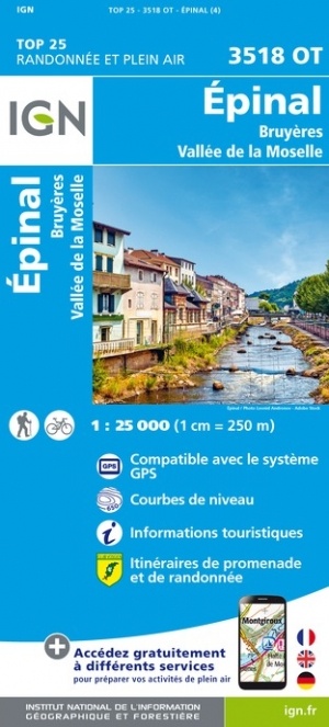
- ISBN / CODE: 9782758550242
- Editie: nieuwste editie
- Schaal: 1:25000
- Uitgever: IGN - Institut Géographique National
- Soort: Topografische kaart, Wandelkaart
- Serie: Top 25
- Taal: Frans
- Schrijf als eerste een review
-
€ 16,95
Op voorraad. Voor 17.00 uur op werkdagen besteld, morgen in huis in Nederland Levertijd Belgie
Gratis verzending in Nederland vanaf €35,-
.jpg)
-
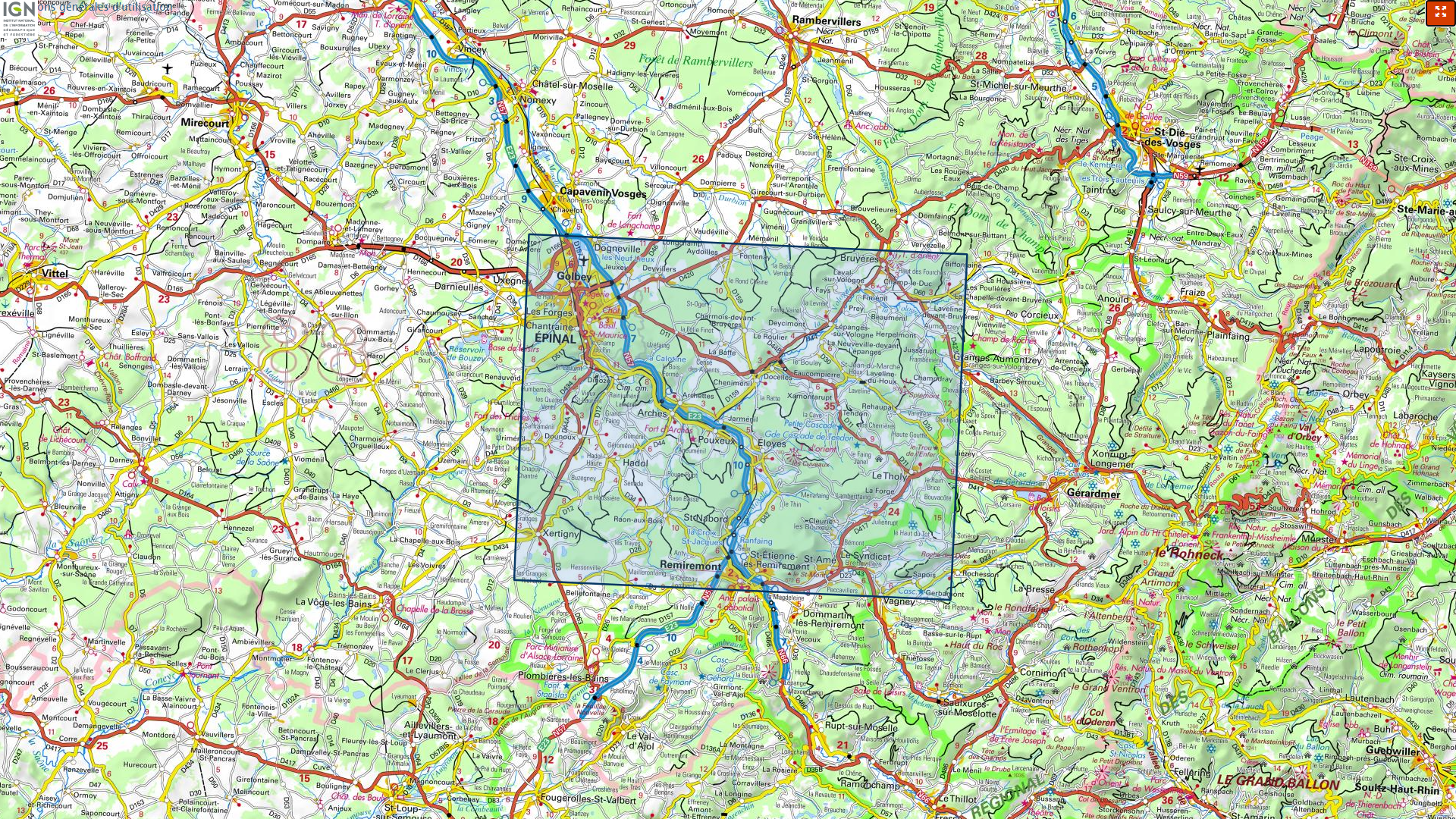
Overzicht IGN 25.000 Elzas - Lotharingen: West
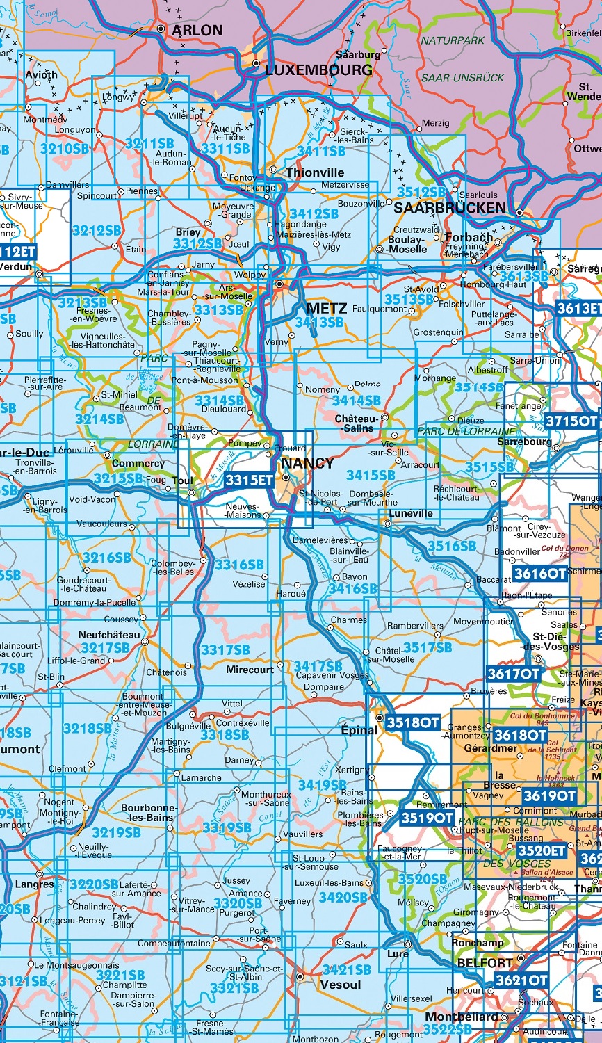
Producten op deze overzichtskaart:
Klik op een product om naar de pagina van dat product te gaan.
- Wandelkaart - Topografische kaart 3210SB Longuyon | IGN - Institut Géographique National
- Wandelkaart - Topografische kaart 3211SB Longuyon - Longwy | IGN - Institut Géographique National
- Wandelkaart - Topografische kaart 3212SB Étain | IGN - Institut Géographique National
- Wandelkaart - Topografische kaart 3214SB St-Mihiel | IGN - Institut Géographique National
- Wandelkaart - Topografische kaart 3311SB Hayange, Villerupt, Audun-le-Roman | IGN - Institut Géographique National
- Wandelkaart - Topografische kaart 3312SB Briey | IGN - Institut Géographique National
- Wandelkaart - Topografische kaart 3313SB Ars-sur-Moselle | IGN - Institut Géographique National
- Wandelkaart - Topografische kaart 3314SB Pont-à-Mousson | IGN - Institut Géographique National
- Wandelkaart - Topografische kaart 3315ET Nancy - Toul | IGN - Institut Géographique National
- Wandelkaart - Topografische kaart 3316SB Vézelise | IGN - Institut Géographique National
- Wandelkaart - Topografische kaart 3317SB Chatenois | IGN - Institut Géographique National
- Topografische kaart - Wandelkaart 3318SB Vittel | IGN - Institut Géographique National
- Wandelkaart - Topografische kaart 3411SB Thionville | IGN - Institut Géographique National
- Wandelkaart - Topografische kaart 3412SB Woippy | IGN - Institut Géographique National
- Wandelkaart - Topografische kaart 3413SB Metz | IGN - Institut Géographique National
- Wandelkaart - Topografische kaart 3414SB Château-Salins | IGN - Institut Géographique National
- Wandelkaart - Topografische kaart 3415SB Saint-Nicolas-de-Port | IGN - Institut Géographique National
- Wandelkaart - Topografische kaart 3417SB Mirecourt - Charmes | IGN - Institut Géographique National
- Wandelkaart - Topografische kaart 3419SB Bains-les-Bains | IGN - Institut Géographique National
- Wandelkaart - Topografische kaart 3512SB Bouzonville | IGN - Institut Géographique National
- Wandelkaart - Topografische kaart 3513SB Saint-Avold / Faulquemont | IGN - Institut Géographique National
- Wandelkaart - Topografische kaart 3514SB Dieuze / Albestroff | IGN - Institut Géographique National
- Wandelkaart - Topografische kaart 3515SB Lorquin - Avricourt | IGN - Institut Géographique National
- Wandelkaart - Topografische kaart 3516SB Lunéville / Baccarat | IGN - Institut Géographique National
- Wandelkaart - Topografische kaart 3517SB Rambervillers | IGN - Institut Géographique National
- Wandelkaart - Topografische kaart 3518OT Epinal | IGN - Institut Géographique National
- Wandelkaart - Topografische kaart 3519OT Remiremont | IGN - Institut Géographique National
- Wandelkaart - Topografische kaart 3520SB Mélisey - Lure | IGN - Institut Géographique National
- Wandelkaart - Topografische kaart 3613SB Forbach - Sarreguemines | IGN - Institut Géographique National
-
Overzicht IGN 25.000 Elzas - Lotharingen: West


Producten op deze overzichtskaart:
Klik op een product om naar de pagina van dat product te gaan.
- Wandelkaart - Topografische kaart 3210SB Longuyon | IGN - Institut Géographique National
- Wandelkaart - Topografische kaart 3211SB Longuyon - Longwy | IGN - Institut Géographique National
- Wandelkaart - Topografische kaart 3212SB Étain | IGN - Institut Géographique National
- Wandelkaart - Topografische kaart 3214SB St-Mihiel | IGN - Institut Géographique National
- Wandelkaart - Topografische kaart 3311SB Hayange, Villerupt, Audun-le-Roman | IGN - Institut Géographique National
- Wandelkaart - Topografische kaart 3312SB Briey | IGN - Institut Géographique National
- Wandelkaart - Topografische kaart 3313SB Ars-sur-Moselle | IGN - Institut Géographique National
- Wandelkaart - Topografische kaart 3314SB Pont-à-Mousson | IGN - Institut Géographique National
- Wandelkaart - Topografische kaart 3315ET Nancy - Toul | IGN - Institut Géographique National
- Wandelkaart - Topografische kaart 3316SB Vézelise | IGN - Institut Géographique National
- Wandelkaart - Topografische kaart 3317SB Chatenois | IGN - Institut Géographique National
- Topografische kaart - Wandelkaart 3318SB Vittel | IGN - Institut Géographique National
- Wandelkaart - Topografische kaart 3411SB Thionville | IGN - Institut Géographique National
- Wandelkaart - Topografische kaart 3412SB Woippy | IGN - Institut Géographique National
- Wandelkaart - Topografische kaart 3413SB Metz | IGN - Institut Géographique National
- Wandelkaart - Topografische kaart 3414SB Château-Salins | IGN - Institut Géographique National
- Wandelkaart - Topografische kaart 3415SB Saint-Nicolas-de-Port | IGN - Institut Géographique National
- Wandelkaart - Topografische kaart 3417SB Mirecourt - Charmes | IGN - Institut Géographique National
- Wandelkaart - Topografische kaart 3419SB Bains-les-Bains | IGN - Institut Géographique National
- Wandelkaart - Topografische kaart 3512SB Bouzonville | IGN - Institut Géographique National
- Wandelkaart - Topografische kaart 3513SB Saint-Avold / Faulquemont | IGN - Institut Géographique National
- Wandelkaart - Topografische kaart 3514SB Dieuze / Albestroff | IGN - Institut Géographique National
- Wandelkaart - Topografische kaart 3515SB Lorquin - Avricourt | IGN - Institut Géographique National
- Wandelkaart - Topografische kaart 3516SB Lunéville / Baccarat | IGN - Institut Géographique National
- Wandelkaart - Topografische kaart 3517SB Rambervillers | IGN - Institut Géographique National
- Wandelkaart - Topografische kaart 3518OT Epinal | IGN - Institut Géographique National
- Wandelkaart - Topografische kaart 3519OT Remiremont | IGN - Institut Géographique National
- Wandelkaart - Topografische kaart 3520SB Mélisey - Lure | IGN - Institut Géographique National
- Wandelkaart - Topografische kaart 3613SB Forbach - Sarreguemines | IGN - Institut Géographique National
-
Overzicht IGN 25.000 Vogezen en Elzas - Lotharingen: Oost

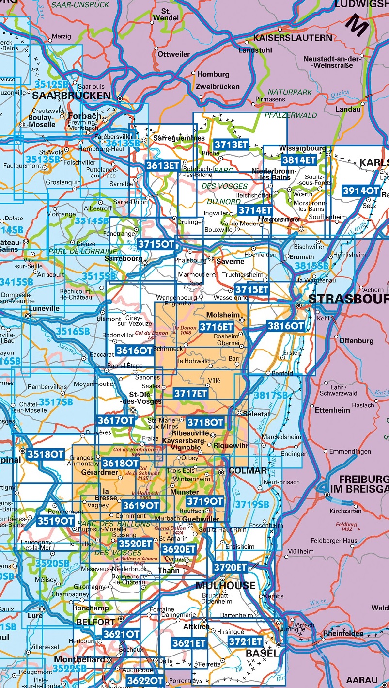
Producten op deze overzichtskaart:
Klik op een product om naar de pagina van dat product te gaan.
- Wandelkaart - Topografische kaart 3518OT Epinal | IGN - Institut Géographique National
- Wandelkaart - Topografische kaart 3519OT Remiremont | IGN - Institut Géographique National
- Wandelkaart - Topografische kaart 3520ET Ballon d'Alsace | IGN - Institut Géographique National
- Wandelkaart - Topografische kaart 3613ET Sarreguemines | IGN - Institut Géographique National
- Wandelkaart - Topografische kaart 3614ET Sarre-Union - Phalsbourg | IGN - Institut Géographique National
- Wandelkaart - Topografische kaart 3616OT Lac de Pierre-Percée - Le Donon | IGN - Institut Géographique National
- Wandelkaart - Topografische kaart 3617OT St-Dié-des-Vosges | IGN - Institut Géographique National
- Wandelkaart - Topografische kaart 3618OT Le Hohneck - Gérardmer | IGN - Institut Géographique National
- Wandelkaart - Topografische kaart 3619OT Bussang - La Bresse | IGN - Institut Géographique National
- Wandelkaart - Topografische kaart 3620ET Grand Ballon | IGN - Institut Géographique National
- Wandelkaart - Topografische kaart 3621ET Dannemarie - Delle - Sundgau | IGN - Institut Géographique National
- Wandelkaart - Topografische kaart 3713ET Pays de Bitche - Dambach - PNR des Vosges du Nord | IGN - Institut Géographique National
- Wandelkaart - Topografische kaart 3714ET la Petite Pierre - Petite Pierre, Niederbronn-les-Bains, PNR Vosges du Nord | IGN - Institut Géographique National
- Wandelkaart - Topografische kaart 3715ET Wasselone - Rocher de Dabo - Saverne | IGN - Institut Géographique National
- Wandelkaart - Topografische kaart 3715OT Sarrebourg - Phalsbourg - Pays des Etangs | IGN - Institut Géographique National
- Wandelkaart - Topografische kaart 3716ET le Donon, Obernai, Mont Ste-Odile | IGN - Institut Géographique National
- Wandelkaart - Topografische kaart 3717ET Barr - Le Howald - Villé - Vallée de la Bruche | IGN - Institut Géographique National
- Wandelkaart - Topografische kaart 3718OT Selestat - Col Du Bonhomme | IGN - Institut Géographique National
- Wandelkaart - Topografische kaart 3719OT Colmar & Le Hohneck | IGN - Institut Géographique National
- Wandelkaart - Topografische kaart 3719SB Colmar | IGN - Institut Géographique National
- Wandelkaart - Topografische kaart 3720ET Mulhouse | IGN - Institut Géographique National
- Wandelkaart - Topografische kaart 3721ET Altkirch - Bâle - Sundgau | IGN - Institut Géographique National
- Wandelkaart - Topografische kaart 3814ET Hagenau - Lembach - PNR des Vosges du Nord | IGN - Institut Géographique National
- Wandelkaart - Topografische kaart 3815SB Bischwiller - Brumath | IGN - Institut Géographique National
- Wandelkaart - Topografische kaart 3816OT Strasbourg | IGN - Institut Géographique National
- Wandelkaart - Topografische kaart 3817SB Sélestat - Marckolsheim | IGN - Institut Géographique National
- Wandelkaart - Topografische kaart 3914OT Wissembourg | IGN - Institut Géographique National
-
Overzicht IGN 25.000 Vogezen en Elzas - Lotharingen: Oost

Producten op deze overzichtskaart:
Klik op een product om naar de pagina van dat product te gaan.
- Wandelkaart - Topografische kaart 3518OT Epinal | IGN - Institut Géographique National
- Wandelkaart - Topografische kaart 3519OT Remiremont | IGN - Institut Géographique National
- Wandelkaart - Topografische kaart 3520ET Ballon d'Alsace | IGN - Institut Géographique National
- Wandelkaart - Topografische kaart 3613ET Sarreguemines | IGN - Institut Géographique National
- Wandelkaart - Topografische kaart 3614ET Sarre-Union - Phalsbourg | IGN - Institut Géographique National
- Wandelkaart - Topografische kaart 3616OT Lac de Pierre-Percée - Le Donon | IGN - Institut Géographique National
- Wandelkaart - Topografische kaart 3617OT St-Dié-des-Vosges | IGN - Institut Géographique National
- Wandelkaart - Topografische kaart 3618OT Le Hohneck - Gérardmer | IGN - Institut Géographique National
- Wandelkaart - Topografische kaart 3619OT Bussang - La Bresse | IGN - Institut Géographique National
- Wandelkaart - Topografische kaart 3620ET Grand Ballon | IGN - Institut Géographique National
- Wandelkaart - Topografische kaart 3621ET Dannemarie - Delle - Sundgau | IGN - Institut Géographique National
- Wandelkaart - Topografische kaart 3713ET Pays de Bitche - Dambach - PNR des Vosges du Nord | IGN - Institut Géographique National
- Wandelkaart - Topografische kaart 3714ET la Petite Pierre - Petite Pierre, Niederbronn-les-Bains, PNR Vosges du Nord | IGN - Institut Géographique National
- Wandelkaart - Topografische kaart 3715ET Wasselone - Rocher de Dabo - Saverne | IGN - Institut Géographique National
- Wandelkaart - Topografische kaart 3715OT Sarrebourg - Phalsbourg - Pays des Etangs | IGN - Institut Géographique National
- Wandelkaart - Topografische kaart 3716ET le Donon, Obernai, Mont Ste-Odile | IGN - Institut Géographique National
- Wandelkaart - Topografische kaart 3717ET Barr - Le Howald - Villé - Vallée de la Bruche | IGN - Institut Géographique National
- Wandelkaart - Topografische kaart 3718OT Selestat - Col Du Bonhomme | IGN - Institut Géographique National
- Wandelkaart - Topografische kaart 3719OT Colmar & Le Hohneck | IGN - Institut Géographique National
- Wandelkaart - Topografische kaart 3719SB Colmar | IGN - Institut Géographique National
- Wandelkaart - Topografische kaart 3720ET Mulhouse | IGN - Institut Géographique National
- Wandelkaart - Topografische kaart 3721ET Altkirch - Bâle - Sundgau | IGN - Institut Géographique National
- Wandelkaart - Topografische kaart 3814ET Hagenau - Lembach - PNR des Vosges du Nord | IGN - Institut Géographique National
- Wandelkaart - Topografische kaart 3815SB Bischwiller - Brumath | IGN - Institut Géographique National
- Wandelkaart - Topografische kaart 3816OT Strasbourg | IGN - Institut Géographique National
- Wandelkaart - Topografische kaart 3817SB Sélestat - Marckolsheim | IGN - Institut Géographique National
- Wandelkaart - Topografische kaart 3914OT Wissembourg | IGN - Institut Géographique National
Overzichtskaarten
Beschrijving
Reviews
Geen reviews gevonden voor dit product.
Schrijf een review
Graag horen wij wat u van dit artikel vindt. Vindt u het goed, leuk, mooi, slecht, lelijk, onbruikbaar of erg handig: schrijf gerust alles op! Het is niet alleen leuk om te doen maar u informeert andere klanten er ook nog mee!
Ook interessant voor europa/frankrijk/vogezen-elzas
-

Campergids 06 Mit dem Wohnmobil ins
€ 22,95Campergidsen Vogezen - Elzas - Lotharingen -

Fietskaart 27 Fietsroute-Netwerk Fr
€ 9,95Fietskaarten Vogezen - Elzas - Lotharingen -

Wandelkaart - Topografische kaart 32
€ 16,95Topografische kaarten Vogezen - Elzas - Lotharingen -

Wandelgids Vogesen - Vogezen | Rothe
€ 18,50Wandelgidsen Vogezen - Elzas - Lotharingen -

Reisgids Veelzijdig Vogezen | Edicol
€ 24,50Reisgidsen Vogezen - Elzas - Lotharingen