Winkelwagen
Geen items in winkelwagen
Ga naar winkelwagen
Topografische kaarten - Ardeche - Rhone Vallei
Overzichtskaarten
-
Topografische kaarten IGN 25.000 Ardeche - Rhone vallei Noord

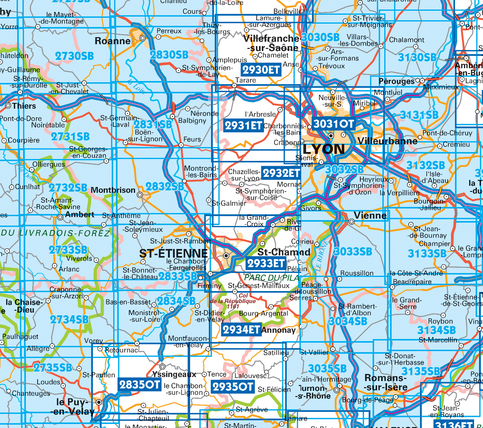
Producten op deze overzichtskaart:
Klik op een product om naar de pagina van dat product te gaan.
- Wandelkaart - Topografische kaart 2733SB St-Anthème, Arlanc | IGN - Institut Géographique National
- Wandelkaart - Topografische kaart 2831SB Feurs – Boën-sur-Lignon | IGN - Institut Géographique National
- Wandelkaart - Topografische kaart 2832SB Montbrison - Veauche | IGN - Institut Géographique National
- Wandelkaart - Topografische kaart 2833SB Firminy, St-Bonnet-le-Château | IGN - Institut Géographique National
- Wandelkaart - Topografische kaart 2834SB Monistrol-sur-Loire, Retournac | IGN - Institut Géographique National
- Wandelkaart - Topografische kaart 2835OT Le Puy-en-Velay | IGN - Institut Géographique National
- Wandelkaart - Topografische kaart 2930ET Villefranche-sur-Saône | IGN - Institut Géographique National
- Wandelkaart - Topografische kaart 2931ET L'Arbresle - Monts de Tarare – Col de la Luère – Rhônevallei - Bourgondië | IGN - Institut Géographique National
- Wandelkaart - Topografische kaart 2932ET Monts du Lyonnais | IGN - Institut Géographique National
- Wandelkaart - Topografische kaart 2933ET Massif du Pilat - St-Etienne - St-Chamond - PNR du Pilat Ardéche | IGN - Institut Géographique National
- Wandelkaart - Topografische kaart 2934ET Bourg-Argental - Col de la République - PNR du Pilat Ardéche | IGN - Institut Géographique National
- Wandelkaart - Topografische kaart 2935OT Le Chambon-sur-Lignon - St-Agrève Ardéche | IGN - Institut Géographique National
- Wandelkaart - Topografische kaart 3030SB Villars-les-Dombes – Villefranche-sur-Saône | IGN - Institut Géographique National
- Wandelkaart - Topografische kaart 3031OT Lyon - Villeurbanne - Mont d'Or | IGN - Institut Géographique National
- Wandelkaart - Topografische kaart 3032SB Vénissieux, Oullins, Givors | IGN - Institut Géographique National
- Wandelkaart - Topografische kaart 3033SB Roussillon, Vienne | IGN - Institut Géographique National
- Wandelkaart - Topografische kaart 3034SB Serrières | IGN - Institut Géographique National
- Wandelkaart - Topografische kaart 3035SB Tounon-sur-Rhône – Satillieu | IGN - Institut Géographique National
- Wandelkaart - Topografische kaart 3130SB Ambérieu-en-Bugey | IGN - Institut Géographique National
- Wandelkaart - Topografische kaart 3131SB Meyzieu | IGN - Institut Géographique National
- Wandelkaart - Topografische kaart 3132SB Bourgoin-Jallieu - La Velpillere | IGN - Institut Géographique National
- Wandelkaart - Topografische kaart 3133SB La Côte-St-André – St-Jean-de-Bournay | IGN - Institut Géographique National
- Wandelkaart - Topografische kaart 3134SB St-Etienne-de-St-Geoirs – Le Grand-Serre | IGN - Institut Géographique National
- Topografische kaart - Wandelkaart 3135SB Romans-sur-Isère, St-Marcellin | IGN - Institut Géographique National
-
Topografische kaarten IGN 25.000 Ardeche - Rhone vallei Zuid
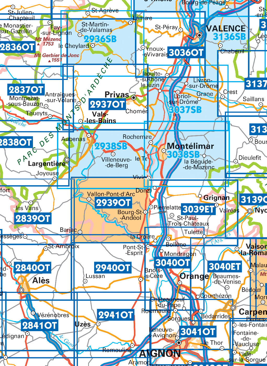
Producten op deze overzichtskaart:
Klik op een product om naar de pagina van dat product te gaan.
- Wandelkaart - Topografische kaart 2836OT Gerbier de Jonc | IGN - Institut Géographique National
- Wandelkaart - Topografische kaart 2837OT Lac d'Issarlès - Thueyts | IGN - Institut Géographique National
- Wandelkaart - Topografische kaart 2838OT Largentière | IGN - Institut Géographique National
- Wandelkaart - Topografische kaart 2839OT Besseges - Les-Vans | IGN - Institut Géographique National
- Wandelkaart - Topografische kaart 2840OT Ales | IGN - Institut Géographique National
- Wandelkaart - Topografische kaart 2841OT Vézénobres | IGN - Institut Géographique National
- Topografische kaart - Wandelkaart 2936SB le Cheylard | IGN - Institut Géographique National
- Wandelkaart - Topografische kaart 2937OT Privas – Vals-les-Bains | IGN - Institut Géographique National
- Wandelkaart - Topografische kaart 2938SB Largentière, Aubenas, Villeneuve-de-Berg | IGN - Institut Géographique National
- Wandelkaart - Topografische kaart 2939OT Gorges de l'Ardèche | IGN - Institut Géographique National
- Wandelkaart - Topografische kaart 2940OT Bagnols-sur-Cèze | IGN - Institut Géographique National
- Wandelkaart - Topografische kaart 2941OT Uzès - Remoulins | IGN - Institut Géographique National
- Wandelkaart - Topografische kaart 2942OT Nîmes | IGN - Institut Géographique National
- Topografische kaart - Wandelkaart 3036OT Valence | IGN - Institut Géographique National
- Wandelkaart - Topografische kaart 3037SB Crest – La Voulte-sur-Rhône | IGN - Institut Géographique National
- Wandelkaart - Topografische kaart 3038SB Montélimar | IGN - Institut Géographique National
- Wandelkaart - Topografische kaart 3039ET Valréas | IGN - Institut Géographique National
- Wandelkaart - Topografische kaart 3040OT Orange | IGN - Institut Géographique National
- Wandelkaart - Topografische kaart 3041OT Avignon | IGN - Institut Géographique National
- Wandelkaart - Topografische kaart 3136SB Bourg-de-Péage – Chabeuil | IGN - Institut Géographique National
 Wandelkaart - Topografische kaart 3041OT Avignon | IGN - Institut Géographique National
 Wandelkaart - Topografische kaart 3040OT Orange | IGN - Institut Géographique National
 Wandelkaart - Topografische kaart 3039ET Valréas | IGN - Institut Géographique National
 Wandelkaart - Topografische kaart 2839OT Besseges - Les-Vans | IGN - Institut Géographique National
 Wandelkaart - Topografische kaart 2840OT Ales | IGN - Institut Géographique National
 Wandelkaart - Topografische kaart 2836OT Gerbier de Jonc | IGN - Institut Géographique National
 Wandelkaart - Topografische kaart 2837OT Lac d'Issarlès - Thueyts | IGN - Institut Géographique National
 Wandelkaart - Topografische kaart 2838OT Largentière | IGN - Institut Géographique National★★★★★
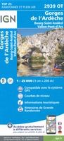 Wandelkaart - Topografische kaart 2939OT Gorges de l'Ardèche | IGN - Institut Géographique National★★★★★
 Wandelkaart - Topografische kaart 2940OT Bagnols-sur-Cèze | IGN - Institut Géographique National
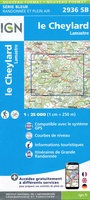 Topografische kaart - Wandelkaart 2936SB le Cheylard | IGN - Institut Géographique National★★★★★
 Wandelkaart - Topografische kaart 2938SB Largentière, Aubenas, Villeneuve-de-Berg | IGN - Institut Géographique National★★★★★
 Wandelkaart - Topografische kaart 2941OT Uzès - Remoulins | IGN - Institut Géographique National
 Wandelkaart - Topografische kaart 3031OT Lyon - Villeurbanne - Mont d'Or | IGN - Institut Géographique National
 Wandelkaart - Topografische kaart 2735SB Loudes, Le Puy-en-Velay | IGN - Institut Géographique National
 Wandelkaart - Topografische kaart 2942OT Nîmes | IGN - Institut Géographique National
 Wandelkaart - Topografische kaart 3030SB Villars-les-Dombes – Villefranche-sur-Saône | IGN - Institut Géographique National
 Wandelkaart - Topografische kaart 3130SB Ambérieu-en-Bugey | IGN - Institut Géographique National
 Wandelkaart - Topografische kaart 2831SB Feurs – Boën-sur-Lignon | IGN - Institut Géographique National
 Wandelkaart - Topografische kaart 3131SB Meyzieu | IGN - Institut Géographique National
Laatste reviews

Kaarten zullen zeker van pas komen
De kaarten zijn een cadeau voor onze dochter en onze schoonzoon die met hun kinderen een jaar met de camper gaan “zwerven”. Ze zijn van …
★★★★★ door Pierre van Tits 25 juli 2024 | Heeft dit artikel gekocht
Makkelijk te lezen kaart
Uw landkaarten hebben mij al veel plezier en voorpret bezorgd, ook heb ik inzicht gekregen in de onderlinge afstanden en in verband daarmee mijn reisplanning …
★★★★★ door Wout Breeschoten 25 juli 2024 | Heeft dit artikel gekocht
Veel plezier en voorpret door de kaart
Uw landkaarten hebben mij al veel plezier en voorpret bezorgd, ook heb ik inzicht gekregen in de onderlinge afstanden en in verband daarmee mijn reisplanning …
★★★★★ door Wout Breeschoten 25 juli 2024 | Heeft dit artikel gekocht
Prima kaart
Prima kaart, fijn ook dat hij niet kan scheuren.
★★★★★ door Madeleine Spliet 25 juli 2024 | Heeft dit artikel gekocht