Wandelkaart - Topografische kaart 1340ET Mimizan | IGN - Institut Géographique National (9782758542919)
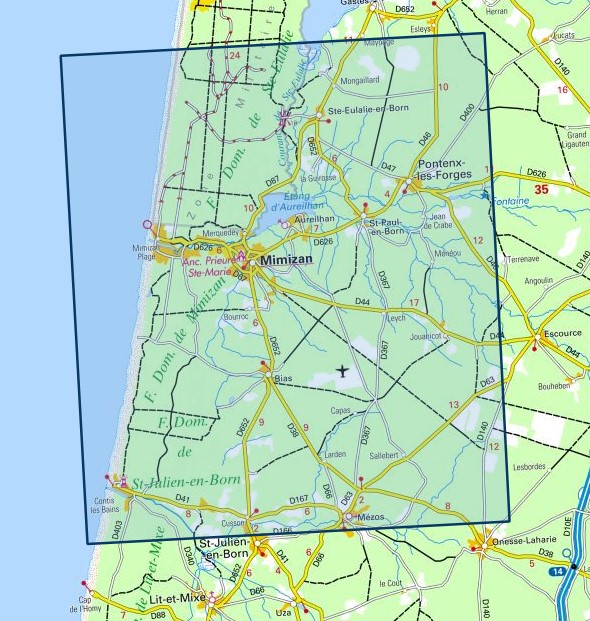
Lac d'Aureilhan
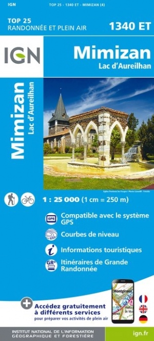
- ISBN / CODE: 9782758542919
- Editie: nieuwste editie
- Schaal: 1:25000
- Uitgever: IGN - Institut Géographique National
- Soort: Topografische kaart, Wandelkaart
- Serie: Top 25
- Taal: Frans
- Uitvoering: Papier
- Bindwijze: -
- Schrijf als eerste een review
-
€ 16,95
Op voorraad. Voor 17.00 uur op werkdagen besteld, morgen in huis in Nederland Levertijd Belgie
Gratis verzending in Nederland vanaf €35,-
-
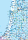
Topografische kaarten IGN 25.000 Atlantische Kust (Aquitaine): Zuid

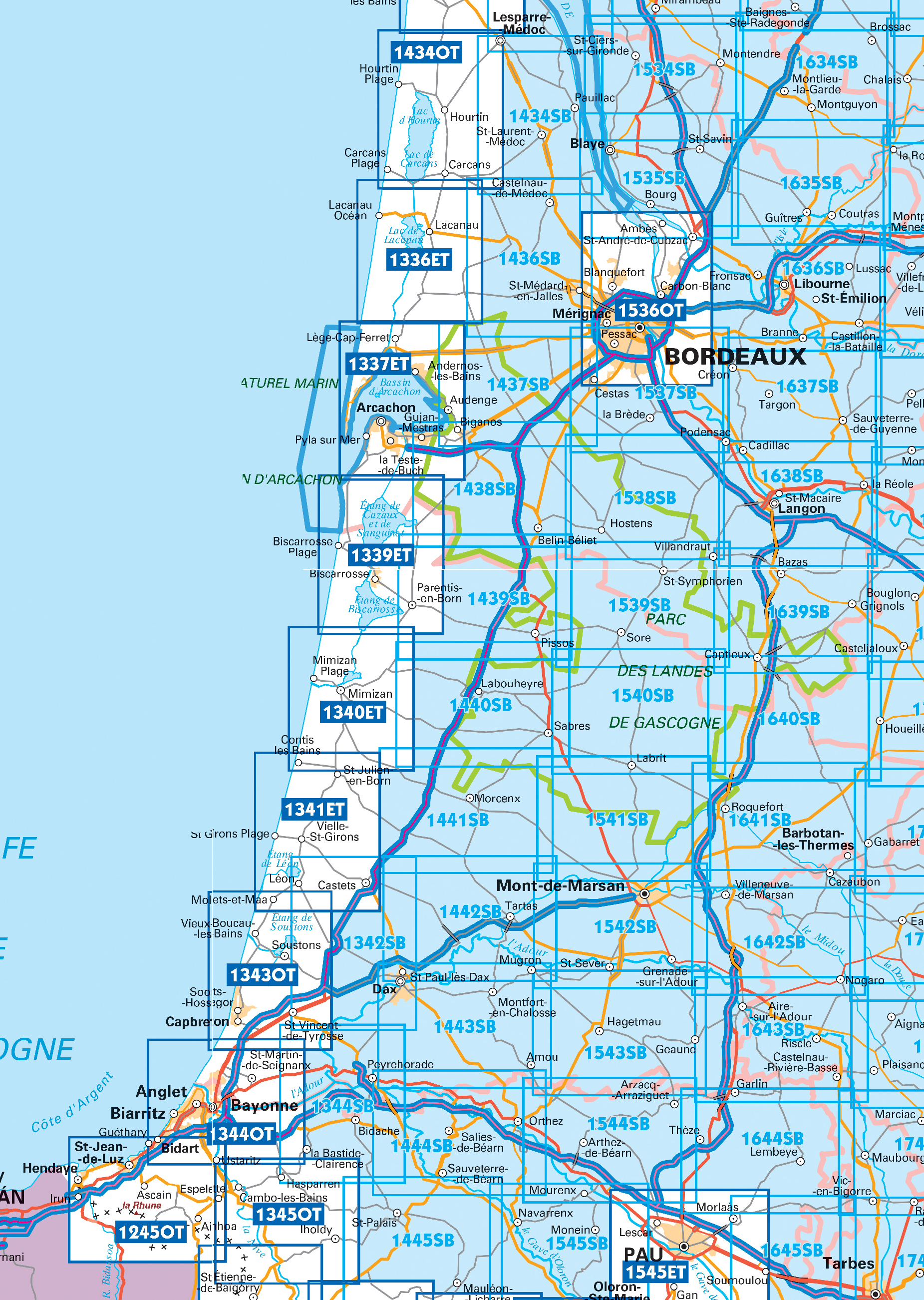
Producten op deze overzichtskaart:
Klik op een product om naar de pagina van dat product te gaan.
- Wandelkaart - Topografische kaart 1336ET Lac de Lacanau & Le Porge | IGN - Institut Géographique National
- Wandelkaart - Topografische kaart 1337ET Bassin D'Arcachon | IGN - Institut Géographique National
- Wandelkaart - Topografische kaart 1339ET Biscarrosse | IGN - Institut Géographique National
- Wandelkaart - Topografische kaart 1340ET Mimizan | IGN - Institut Géographique National
- Wandelkaart - Topografische kaart 1341ET Castets | IGN - Institut Géographique National
- Wandelkaart - Topografische kaart 1342SB Dax | IGN - Institut Géographique National
- Wandelkaart - Topografische kaart 1343OT Capbreton | IGN - Institut Géographique National
- Topografische kaart - Wandelkaart 1434OT Hourtin, Lacs d'Hourtin Et De Carcans | IGN - Institut Géographique National
- Wandelkaart - Topografische kaart 1434SB Lesparre-Médoc | IGN - Institut Géographique National
- Wandelkaart - Topografische kaart 1436SB St-Médard-en-Jalles | IGN - Institut Géographique National
- Wandelkaart - Topografische kaart 1437SB Saint-Jean-d'Illac | IGN - Institut Géographique National
- Wandelkaart - Topografische kaart 1438SB Belin-Béliet | IGN - Institut Géographique National
- Wandelkaart - Topografische kaart 1439SB Parentis-en-Born | IGN - Institut Géographique National
- Wandelkaart - Topografische kaart 1440SB Labouheyre | IGN - Institut Géographique National
- Wandelkaart - Topografische kaart 1441SB Morcenx | IGN - Institut Géographique National
- Wandelkaart - Topografische kaart 1442SB Tartas, Pontonx-sur-l'Adour | IGN - Institut Géographique National
- Topografische kaart - Wandelkaart 1534SB Montendre, St-Ciers-sur-Girond | IGN - Institut Géographique National
- Wandelkaart - Topografische kaart 1535SB Blaye | IGN - Institut Géographique National
- Wandelkaart - Topografische kaart 1536OT Bordeaux - Sud Médoc | IGN - Institut Géographique National
- Topografische kaart - Wandelkaart 1537SB Pessac | IGN - Institut Géographique National
- Wandelkaart - Topografische kaart 1538SB Landiras | IGN - Institut Géographique National
- Wandelkaart - Topografische kaart 1539SB St-Symphorien | IGN - Institut Géographique National
- Wandelkaart - Topografische kaart 1540SB Labrit | IGN - Institut Géographique National
- Wandelkaart - Topografische kaart 1634SB Brossac - Montguyon | IGN - Institut Géographique National
- Wandelkaart - Topografische kaart 1635SB Guîtres - Coutras | IGN - Institut Géographique National
- Wandelkaart - Topografische kaart 1636SB Libourne, Saint-Emilion | IGN - Institut Géographique National
- Wandelkaart - Topografische kaart 1637SB Podensac | IGN - Institut Géographique National
- Topografische kaart - Wandelkaart 1638SB La Réole - Langon | IGN - Institut Géographique National
- Wandelkaart - Topografische kaart 1639SB Grignols - Bazas | IGN - Institut Géographique National
- Wandelkaart - Topografische kaart 1640SB Losse | IGN - Institut Géographique National
-
Wandelkaarten IGN 25.000 Atlantische Kust (Aquitaine): Zuid

Producten op deze overzichtskaart:
Klik op een product om naar de pagina van dat product te gaan.
- Wandelkaart - Topografische kaart 1336ET Lac de Lacanau & Le Porge | IGN - Institut Géographique National
- Wandelkaart - Topografische kaart 1337ET Bassin D'Arcachon | IGN - Institut Géographique National
- Wandelkaart - Topografische kaart 1339ET Biscarrosse | IGN - Institut Géographique National
- Wandelkaart - Topografische kaart 1340ET Mimizan | IGN - Institut Géographique National
- Wandelkaart - Topografische kaart 1341ET Castets | IGN - Institut Géographique National
- Wandelkaart - Topografische kaart 1342SB Dax | IGN - Institut Géographique National
- Wandelkaart - Topografische kaart 1343OT Capbreton | IGN - Institut Géographique National
- Topografische kaart - Wandelkaart 1434OT Hourtin, Lacs d'Hourtin Et De Carcans | IGN - Institut Géographique National
- Wandelkaart - Topografische kaart 1434SB Lesparre-Médoc | IGN - Institut Géographique National
- Wandelkaart - Topografische kaart 1436SB St-Médard-en-Jalles | IGN - Institut Géographique National
- Wandelkaart - Topografische kaart 1437SB Saint-Jean-d'Illac | IGN - Institut Géographique National
- Wandelkaart - Topografische kaart 1438SB Belin-Béliet | IGN - Institut Géographique National
- Wandelkaart - Topografische kaart 1439SB Parentis-en-Born | IGN - Institut Géographique National
- Wandelkaart - Topografische kaart 1440SB Labouheyre | IGN - Institut Géographique National
- Wandelkaart - Topografische kaart 1441SB Morcenx | IGN - Institut Géographique National
- Wandelkaart - Topografische kaart 1442SB Tartas, Pontonx-sur-l'Adour | IGN - Institut Géographique National
- Topografische kaart - Wandelkaart 1534SB Montendre, St-Ciers-sur-Girond | IGN - Institut Géographique National
- Wandelkaart - Topografische kaart 1535SB Blaye | IGN - Institut Géographique National
- Wandelkaart - Topografische kaart 1536OT Bordeaux - Sud Médoc | IGN - Institut Géographique National
- Topografische kaart - Wandelkaart 1537SB Pessac | IGN - Institut Géographique National
- Wandelkaart - Topografische kaart 1538SB Landiras | IGN - Institut Géographique National
- Wandelkaart - Topografische kaart 1539SB St-Symphorien | IGN - Institut Géographique National
- Wandelkaart - Topografische kaart 1540SB Labrit | IGN - Institut Géographique National
- Wandelkaart - Topografische kaart 1634SB Brossac - Montguyon | IGN - Institut Géographique National
- Wandelkaart - Topografische kaart 1635SB Guîtres - Coutras | IGN - Institut Géographique National
- Wandelkaart - Topografische kaart 1636SB Libourne, Saint-Emilion | IGN - Institut Géographique National
- Wandelkaart - Topografische kaart 1637SB Podensac | IGN - Institut Géographique National
- Topografische kaart - Wandelkaart 1638SB La Réole - Langon | IGN - Institut Géographique National
- Wandelkaart - Topografische kaart 1639SB Grignols - Bazas | IGN - Institut Géographique National
- Wandelkaart - Topografische kaart 1640SB Losse | IGN - Institut Géographique National
Overzichtskaarten
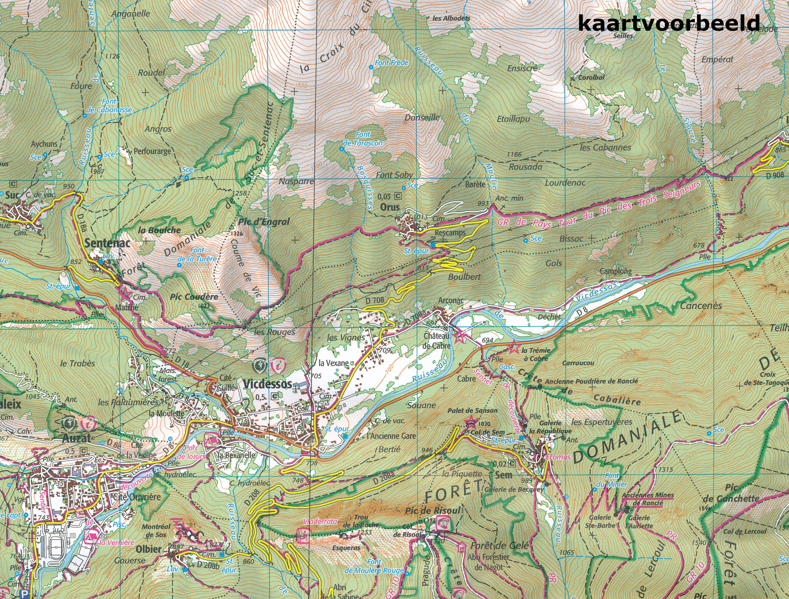
Beschrijving
Reviews
Geen reviews gevonden voor dit product.
Schrijf een review
Graag horen wij wat u van dit artikel vindt. Vindt u het goed, leuk, mooi, slecht, lelijk, onbruikbaar of erg handig: schrijf gerust alles op! Het is niet alleen leuk om te doen maar u informeert andere klanten er ook nog mee!
Ook interessant voor europa/frankrijk/atlantischekust
-

Reisgids ANWB extra Franse Atlantisc
€ 15,50Reisgidsen Franse Atlantische Kust - Nouvelle-Aquitaine -

Fietskaart - Wegenkaart - landkaart
€ 10,95Fietskaarten Franse Atlantische Kust - Nouvelle-Aquitaine -

Wandelkaart - Topografische kaart 14
€ 16,95Topografische kaarten Franse Atlantische Kust - Nouvelle-Aquitaine -

Wandelkaart - Topografische kaart 15
€ 16,95Topografische kaarten Franse Atlantische Kust - Nouvelle-Aquitaine -

Wandelkaart - Topografische kaart 14
€ 16,95Topografische kaarten Franse Atlantische Kust - Nouvelle-Aquitaine