Winkelwagen
Geen items in winkelwagen
Ga naar winkelwagen
Franse Atlantische Kust - Nouvelle-Aquitaine
 Wandelkaart - Topografische kaart 1329ET La Rochelle - Anse de l'Aiguillon | IGN - Institut Géographique National
 Wandelkaart - Topografische kaart 1329OT Ile De Re | IGN - Institut Géographique National
 Wandelkaart - Topografische kaart 1330OT Ile d'Oleron & Ile d'Aix | IGN - Institut Géographique National
 Wandelkaart - Topografische kaart 1336ET Lac de Lacanau & Le Porge | IGN - Institut Géographique National
 Wandelkaart - Topografische kaart 1337ET Bassin D'Arcachon | IGN - Institut Géographique National★★★★★
 Wandelkaart - Topografische kaart 1339ET Biscarrosse | IGN - Institut Géographique National
 Wandelkaart - Topografische kaart 1344OT Bayonne | IGN - Institut Géographique National
 Topografische kaart - Wandelkaart 1346ET Forêt d'Iraty - Pic d'Orly | IGN - Institut Géographique National
 Wandelkaart - Topografische kaart 1429 SB - Serie Bleue Surgères, Aigrefeuille-d'Aunis | IGN - Institut Géographique National
 Wandelkaart 1430OT Rochefort / Marennes | IGN - Institut Géographique National
 Wandelkaart - Topografische kaart 1433 SB - Serie Bleue Lesparre-Médoc | IGN - Institut Géographique National
 Wandelkaart - Topografische kaart 1433OT Soulac-Sur-Mer & Montalivet Pointe De Grave | IGN - Institut Géographique National
 Topografische kaart - Wandelkaart 1434OT Hourtin, Lacs d'Hourtin Et De Carcans | IGN - Institut Géographique National
 Wandelkaart - Topografische kaart 1436 SB - Serie Bleue St-Médard-en-Jalles | IGN - Institut Géographique National
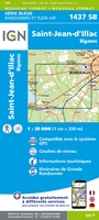 Wandelkaart - Topografische kaart 1437 SB - Serie Bleue Saint-Jean-d'Illac | IGN - Institut Géographique National
 Wandelkaart - Topografische kaart 1438 SB - Serie Bleue Belin-Béliet | IGN - Institut Géographique National
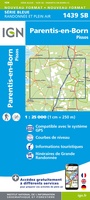 Wandelkaart - Topografische kaart 1439 SB - Serie Bleue Parentis-en-Born | IGN - Institut Géographique National
 Wandelkaart - Topografische kaart 1440 SB - Serie Bleue Labouheyre | IGN - Institut Géographique National
 Wandelkaart - Topografische kaart 1441 SB - Serie Bleue Morcenx | IGN - Institut Géographique National
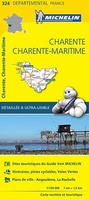 Wegenkaart - landkaart 324 Charente - Charente Maritime | Michelin★★★★★
- 1
- 2
- 3
- Volgende >>
- 6
Laatste reviews

alleen de grote routes
prima kaart voor overzicht van een gebied maar alleen de grote routes, bijvoorbeeld naar hutten, staan er op, om zelf wandelingen te plannen minder geschikt
★★★★★ door Jasper 31 juli 2026 | Heeft dit artikel gekocht
Perfect.
Snelle levering.
★★★★★ door Anton Deutekom 31 juli 2026 | Heeft dit artikel gekocht
prima kaart en snelle service van De Zwerver
handig
★★★★★ door Barbara 31 juli 2026 | Heeft dit artikel gekocht
heel tevreden
prima kaartenaanbod
★★★★★ door yvon werniers 30 juli 2026 | Heeft dit artikel gekocht