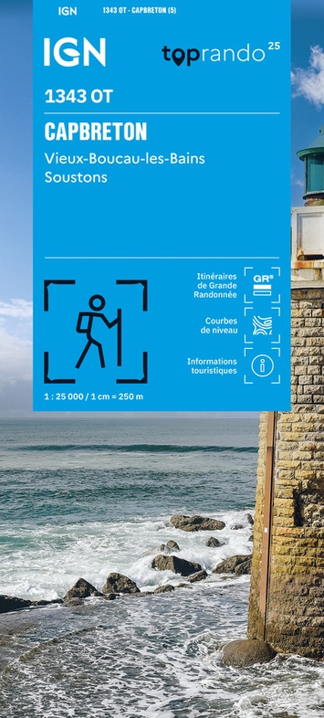
Wandelkaart 1343OT Capbreton / Vieux-Boucau-les-Bains / Soustons | IGN - Institut Géographique National (9782758557203)
- ISBN / CODE: 9782758557203
- Editie: 22-04-2025
- Druk: 5
- Aantal blz.: 1
- Schaal: 1:25000
- Uitgever: IGN - Institut Géographique National
- Soort: Wandelkaart
- Serie: Top 25
- Taal: Frans
- Hoogte: 24.0 cm
- Breedte: 11.0 cm
- Gewicht: 85.0 g
- Bindwijze: -
- Uitvoering: Papier
- Schrijf als eerste een review
-
€ 17,95
Leverbaar in 3 - 5 werkdagen in huis in Nederland Levertijd Belgie
Gratis verzending in Nederland vanaf €35,-

-
Wandelkaarten IGN 25.000 Atlantische Kust (Aquitaine): Zuid
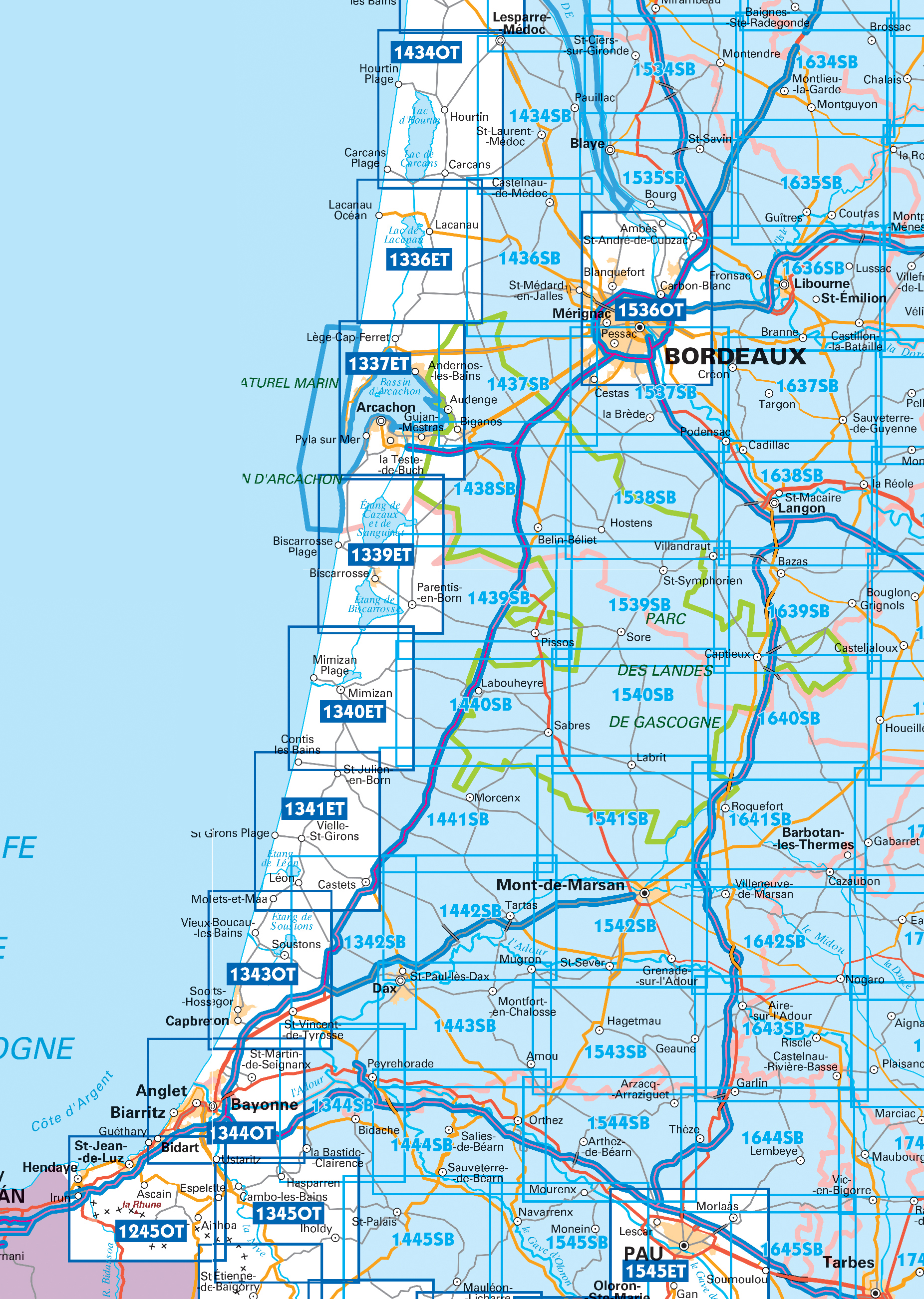
Producten op deze overzichtskaart:
Klik op een product om naar de pagina van dat product te gaan.
- Wandelkaart - Topografische kaart 1336ET Lac de Lacanau & Le Porge | IGN - Institut Géographique National
- Wandelkaart - Topografische kaart 1337ET Bassin D'Arcachon | IGN - Institut Géographique National
- Wandelkaart - Topografische kaart 1339ET Biscarrosse | IGN - Institut Géographique National
- Wandelkaart 1340ET Mimizan / Lac d'Aureilhan | IGN - Institut Géographique National
- Wandelkaart 1341ET Castets / Lit-et-Mixe / Léon | IGN - Institut Géographique National
- Wandelkaart - Topografische kaart 1342 SB - Serie Bleue Dax | IGN - Institut Géographique National
- Wandelkaart 1343OT Capbreton / Vieux-Boucau-les-Bains / Soustons | IGN - Institut Géographique National
- Wandelkaart 1434 SB - Serie Bleue Lesparre-Médoc | IGN - Institut Géographique National
- Topografische kaart - Wandelkaart 1434OT Hourtin, Lacs d'Hourtin Et De Carcans | IGN - Institut Géographique National
- Wandelkaart - Topografische kaart 1436 SB - Serie Bleue St-Médard-en-Jalles | IGN - Institut Géographique National
- Wandelkaart - Topografische kaart 1437 SB - Serie Bleue Saint-Jean-d'Illac | IGN - Institut Géographique National
- Wandelkaart - Topografische kaart 1438 SB - Serie Bleue Belin-Béliet | IGN - Institut Géographique National
- Wandelkaart - Topografische kaart 1439 SB - Serie Bleue Parentis-en-Born | IGN - Institut Géographique National
- Wandelkaart - Topografische kaart 1440 SB - Serie Bleue Labouheyre | IGN - Institut Géographique National
- Wandelkaart - Topografische kaart 1441 SB - Serie Bleue Morcenx | IGN - Institut Géographique National
- Wandelkaart - Topografische kaart 1442 SB - Serie Bleue Tartas, Pontonx-sur-l'Adour | IGN - Institut Géographique National
- Topografische kaart - Wandelkaart 1534 SB - Serie Bleue Montendre, St-Ciers-sur-Girond | IGN - Institut Géographique National
- Wandelkaart - Topografische kaart 1535 SB - Serie Bleue Blaye | IGN - Institut Géographique National
- Topografische kaart - Wandelkaart 1536OT Bordeaux / Sud Médoc | IGN - Institut Géographique National
- Topografische kaart - Wandelkaart 1537 SB - Serie Bleue Pessac | IGN - Institut Géographique National
- Wandelkaart - Topografische kaart 1538 SB - Serie Bleue Landiras | IGN - Institut Géographique National
- Wandelkaart - Topografische kaart 1539 SB - Serie Bleue St-Symphorien | IGN - Institut Géographique National
- Wandelkaart - Topografische kaart 1540 SB - Serie Bleue Labrit | IGN - Institut Géographique National
- Wandelkaart - Topografische kaart 1634 SB - Serie Bleue Brossac - Montguyon | IGN - Institut Géographique National
- Wandelkaart - Topografische kaart 1635 SB - Serie Bleue Guîtres - Coutras | IGN - Institut Géographique National
- Wandelkaart - Topografische kaart 1636 SB - Serie Bleue Libourne, Saint-Emilion | IGN - Institut Géographique National
- Wandelkaart - Topografische kaart 1637 SB - Serie Bleue Podensac | IGN - Institut Géographique National
- Topografische kaart - Wandelkaart 1638 La Réole - Langon | IGN - Institut Géographique National
- Wandelkaart - Topografische kaart 1639 SB - Serie Bleue Grignols - Bazas | IGN - Institut Géographique National
- Wandelkaart - Topografische kaart 1640 SB - Serie Bleue Losse | IGN - Institut Géographique National
Overzichtskaarten
Beschrijving
Van de uitgever
De TOP 25-serie is de cartografische referentie in Frankrijk. Het integreert:-een nauwkeurige beschrijving van het grondgebied op een schaal van 1: 25.000 (1 cm = 250 m)
-Gedetailleerde informatie voor de toeristische ontdekking en de praktijk van buitenactiviteiten, met name gemarkeerde wandelpaden
390 kaarten dekken de bergketens, de kustlijn en de beroemdste bosmassieven (grootstedelijk gebied)
17 kaarten bestrijken 4 overzeese departementen: Guadeloupe, Martinique, Mayotte en Reunion
Reviews
Geen reviews gevonden voor dit product.
Schrijf een review
Graag horen wij wat u van dit artikel vindt. Vindt u het goed, leuk, mooi, slecht, lelijk, onbruikbaar of erg handig: schrijf gerust alles op! Het is niet alleen leuk om te doen maar u informeert andere klanten er ook nog mee!
Ook interessant voor europa/frankrijk/aquitaine/landes
-

Wandelgids Atlantique littoral - 30
€ 14,95Wandelgidsen Finistère -

Fietsgids Côte Atlantique à vélo EV1
€ 19,95Fietsgidsen Loire-Atlantique -

Reisgids Bordelais Landes Lot-et-Gar
€ 16,95Reisgidsen Landes -

Wandelkaart - Topografische kaart 16
€ 17,95Topografische kaarten Landes -

Wegenkaart - landkaart 10 TOP 250 No
€ 9,95Wegenkaarten Gironde