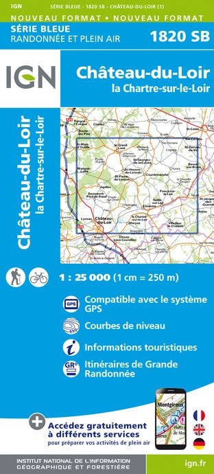
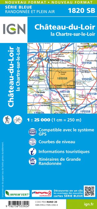
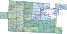
Wandelkaart - Topografische kaart 1820SB Château-du-Loir- La Chartre-sur-Loir | IGN - Institut Géographique National (9782758533924)
- ISBN / CODE: 9782758533924
- Editie: meest recente editie
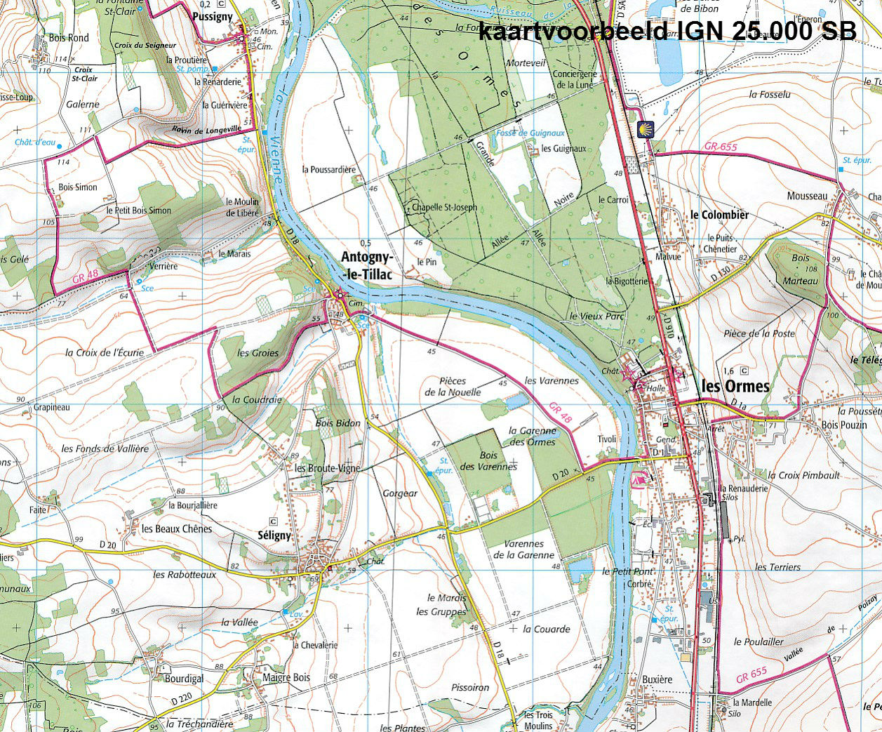
- Schaal: 1:25000
- Uitgever: IGN - Institut Géographique National
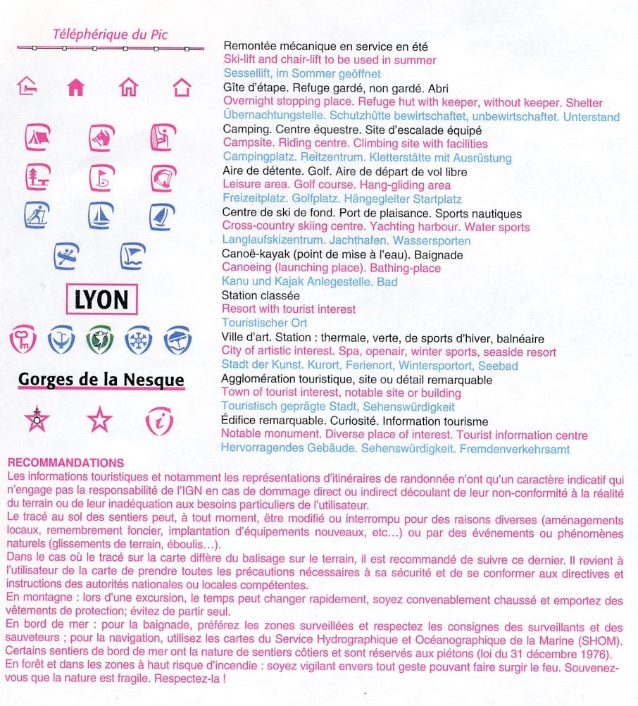
- Soort: Topografische kaart, Wandelkaart
- Serie: Serie bleue
- Taal: Frans
- Beoordeling: 5,0 ★★★★★ (1 review) Schrijf een review
-
€ 16,95
Op voorraad. Voor 17.00 uur op werkdagen besteld, morgen in huis in Nederland Levertijd Belgie
Gratis verzending in Nederland vanaf €35,-
-
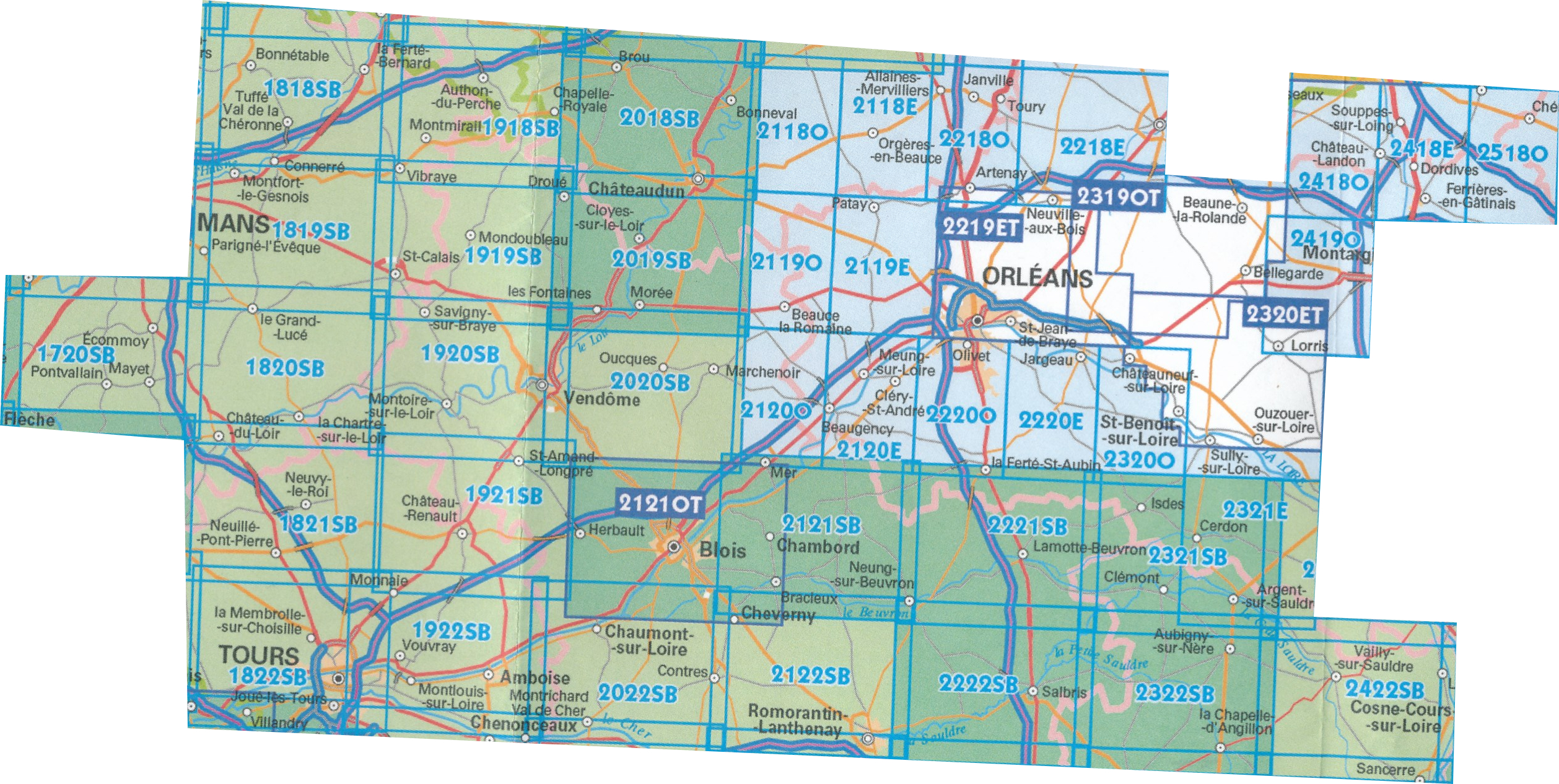
Topografische kaarten IGN 25.000 Loire - Centre: OOSTELIJKE GEDEELTE Orleans - Tours


Producten op deze overzichtskaart:
Klik op een product om naar de pagina van dat product te gaan.
- Wandelkaart - Topografische kaart 1720SB Ecommoy – Cérans-Foulletourte | IGN - Institut Géographique National
- Wandelkaart - Topografische kaart 1819SB Bouloire - Le Grand-Lucé | IGN - Institut Géographique National
- Wandelkaart - Topografische kaart 1820SB Château-du-Loir- La Chartre-sur-Loir | IGN - Institut Géographique National
- Wandelkaart - Topografische kaart 1821SB Château-du-Loir, Neuillé-Pont-Pierre | IGN - Institut Géographique National
- Wandelkaart - Topografische kaart 1822SB Tours - Langeais | IGN - Institut Géographique National
- Wandelkaart - Topografische kaart 1918SB Authon-du-Perche, La Bazoche-Gouet | IGN - Institut Géographique National
- Wandelkaart - Topografische kaart 1919SB St-Calais - Droué | IGN - Institut Géographique National
- Wandelkaart - Topografische kaart 1920SB Vendome, Montoire-sur-le-Loir | IGN - Institut Géographique National
- Wandelkaart - Topografische kaart 1921SB Château-Renault, St-Amand-Longpré | IGN - Institut Géographique National
- Wandelkaart - Topografische kaart 1922SB Amboise, Montlouis-sur-Loire | IGN - Institut Géographique National
- Topografische kaart - Wandelkaart 2018SB Châteaudun - Brou | IGN - Institut Géographique National
- Topografische kaart - Wandelkaart 2019SB Cloyes-sur-le-Loir | IGN - Institut Géographique National
- Topografische kaart - Wandelkaart 2020SB Oucques - Selommes - St-Ouen | IGN - Institut Géographique National
- Wandelkaart - Topografische kaart 2118SB Orgères-en-Beauce, Sancheville | IGN - Institut Géographique National
- Wandelkaart - Topografische kaart 2119SB Patay, Ouzouer-le-Marché | IGN - Institut Géographique National
- Wandelkaart - Topografische kaart 2120SB Beaugency, Mer, Meung-sur-Loire | IGN - Institut Géographique National
- Wandelkaart - Topografische kaart 2121SB Mer | IGN - Institut Géographique National
- Wandelkaart - Topografische kaart 2218SB Pithiviers, Neuville-aux-Bois, Artenay | IGN - Institut Géographique National
- Wandelkaart - Topografische kaart 2219SB Orléans - Fay aux Loges | IGN - Institut Géographique National
- Wandelkaart - Topografische kaart 2220SB Jargeau, Olivet, La Ferté-St-Aubin | IGN - Institut Géographique National
- Wandelkaart - Topografische kaart 2221SB Lamotte-Beuvron | IGN - Institut Géographique National
- Topografische kaart - Wandelkaart 2222SB Salbris | IGN - Institut Géographique National
- Topografische kaart - Wandelkaart 2222SB Salbris | IGN - Institut Géographique National
- Wandelkaart - Topografische kaart 2319SB Vitry-aux-Loges, Bellegarde | IGN - Institut Géographique National
- Wandelkaart - Topografische kaart 2320SB Châteauneuf-sur-Loire, Sully-sur-Loire | IGN - Institut Géographique National
- Topografische kaart - Wandelkaart 2321SB Argent-sur-Sauldre | IGN - Institut Géographique National
- Topografische kaart - Wandelkaart 2322SB Aubigny-sur-Nère | IGN - Institut Géographique National
- Wandelkaart - Topografische kaart 2418SB Château-Landon, Corbeilles | IGN - Institut Géographique National
- Wandelkaart - Topografische kaart 2518SB Lorrez-le-Bocage-Préaux, Chéroy, St-Valérien | IGN - Institut Géographique National
-
Wandelkaarten IGN 25.000 Loire - Centre: OOSTELIJKE GEDEELTE Orleans - Tours
Producten op deze overzichtskaart:
Klik op een product om naar de pagina van dat product te gaan.
- Wandelkaart - Topografische kaart 1720SB Ecommoy – Cérans-Foulletourte | IGN - Institut Géographique National
- Wandelkaart - Topografische kaart 1819SB Bouloire - Le Grand-Lucé | IGN - Institut Géographique National
- Wandelkaart - Topografische kaart 1820SB Château-du-Loir- La Chartre-sur-Loir | IGN - Institut Géographique National
- Wandelkaart - Topografische kaart 1821SB Château-du-Loir, Neuillé-Pont-Pierre | IGN - Institut Géographique National
- Wandelkaart - Topografische kaart 1822SB Tours - Langeais | IGN - Institut Géographique National
- Wandelkaart - Topografische kaart 1918SB Authon-du-Perche, La Bazoche-Gouet | IGN - Institut Géographique National
- Wandelkaart - Topografische kaart 1919SB St-Calais - Droué | IGN - Institut Géographique National
- Wandelkaart - Topografische kaart 1920SB Vendome, Montoire-sur-le-Loir | IGN - Institut Géographique National
- Wandelkaart - Topografische kaart 1921SB Château-Renault, St-Amand-Longpré | IGN - Institut Géographique National
- Wandelkaart - Topografische kaart 1922SB Amboise, Montlouis-sur-Loire | IGN - Institut Géographique National
- Topografische kaart - Wandelkaart 2018SB Châteaudun - Brou | IGN - Institut Géographique National
- Topografische kaart - Wandelkaart 2019SB Cloyes-sur-le-Loir | IGN - Institut Géographique National
- Topografische kaart - Wandelkaart 2020SB Oucques - Selommes - St-Ouen | IGN - Institut Géographique National
- Wandelkaart - Topografische kaart 2118SB Orgères-en-Beauce, Sancheville | IGN - Institut Géographique National
- Wandelkaart - Topografische kaart 2119SB Patay, Ouzouer-le-Marché | IGN - Institut Géographique National
- Wandelkaart - Topografische kaart 2120SB Beaugency, Mer, Meung-sur-Loire | IGN - Institut Géographique National
- Wandelkaart - Topografische kaart 2121SB Mer | IGN - Institut Géographique National
- Wandelkaart - Topografische kaart 2218SB Pithiviers, Neuville-aux-Bois, Artenay | IGN - Institut Géographique National
- Wandelkaart - Topografische kaart 2219SB Orléans - Fay aux Loges | IGN - Institut Géographique National
- Wandelkaart - Topografische kaart 2220SB Jargeau, Olivet, La Ferté-St-Aubin | IGN - Institut Géographique National
- Wandelkaart - Topografische kaart 2221SB Lamotte-Beuvron | IGN - Institut Géographique National
- Topografische kaart - Wandelkaart 2222SB Salbris | IGN - Institut Géographique National
- Wandelkaart - Topografische kaart 2319SB Vitry-aux-Loges, Bellegarde | IGN - Institut Géographique National
- Wandelkaart - Topografische kaart 2320SB Châteauneuf-sur-Loire, Sully-sur-Loire | IGN - Institut Géographique National
- Topografische kaart - Wandelkaart 2321SB Argent-sur-Sauldre | IGN - Institut Géographique National
- Topografische kaart - Wandelkaart 2322SB Aubigny-sur-Nère | IGN - Institut Géographique National
- Wandelkaart - Topografische kaart 2418SB Château-Landon, Corbeilles | IGN - Institut Géographique National
- Wandelkaart - Topografische kaart 2518SB Lorrez-le-Bocage-Préaux, Chéroy, St-Valérien | IGN - Institut Géographique National
Overzichtskaarten
Beschrijving
Reviews
Ik ben zeer tevreden over de afhandeling van mijn bestelling. Heel klantvriendelijk, supersnel, erg behulpzaam. Dit was de tweede keer dat ik kaarten bestelde en het klopte weer allemaal. Nogmaals bedankt en tot de volgende keer!
★★★★★ door Bep en Piet 24 juli 2013Vond u dit een nuttige review? (login om te beoordelen)
Schrijf een review
Graag horen wij wat u van dit artikel vindt. Vindt u het goed, leuk, mooi, slecht, lelijk, onbruikbaar of erg handig: schrijf gerust alles op! Het is niet alleen leuk om te doen maar u informeert andere klanten er ook nog mee!
Ook interessant voor europa/frankrijk/loire-centre
-

Wandelkaart - Topografische kaart 18
€ 16,95Topografische kaarten Centre - Val de Loire -

Wandelkaart - Topografische kaart 23
€ 16,95Topografische kaarten Centre - Val de Loire -

Wandelkaart - Topografische kaart 21
€ 16,95Topografische kaarten Centre - Val de Loire -

Wandelkaart - Topografische kaart 20
€ 16,95Topografische kaarten Centre - Val de Loire -

Wandelkaart - Topografische kaart 21
€ 16,95Topografische kaarten Centre - Val de Loire