Winkelwagen
Geen items in winkelwagen
Ga naar winkelwagen
Topografische kaarten - Languedoc - Rousillon
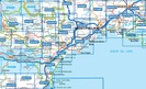
Overzichtskaarten
-
Topografische kaarten IGN 25.000 Languedoc -Rousillon
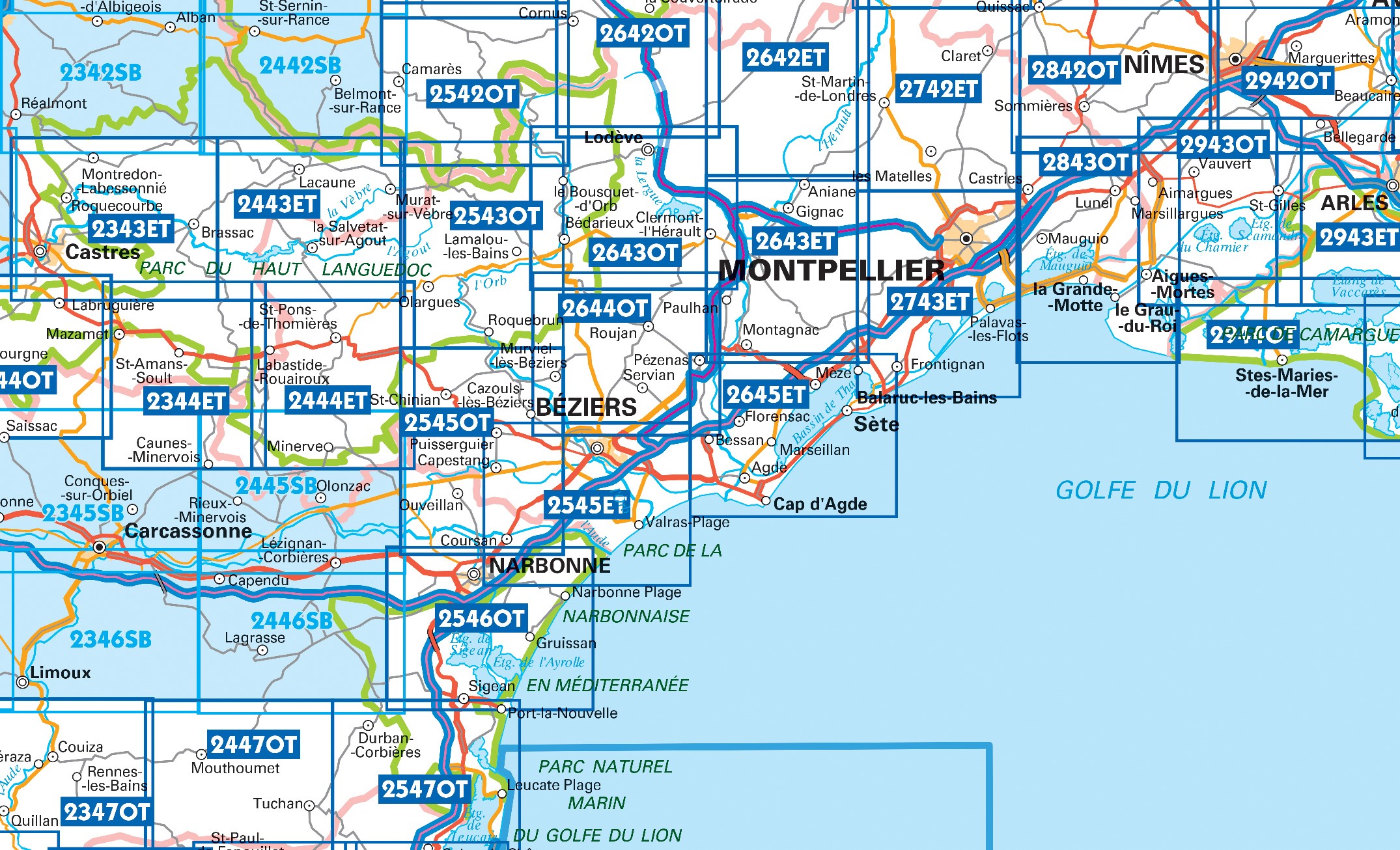
Producten op deze overzichtskaart:
Klik op een product om naar de pagina van dat product te gaan.
- Wandelkaart - Topografische kaart 2243 SB - Serie Bleue Puylaurens, Lautrec | IGN - Institut Géographique National
- Wandelkaart - Topografische kaart 2342 SB - Serie Bleue Réalmont - Alban | IGN - Institut Géographique National
- Wandelkaart - Topografische kaart 2343ET Castres, Sidobre, Brassac, Vebre, PNR du Haut Languedoc | IGN - Institut Géographique National
- Wandelkaart - Topografische kaart 2344ET Montagne Noire est | IGN - Institut Géographique National
- Wandelkaart - Topografische kaart 2344OT Montagne Noire (ouest) - Revel - Labrugiere - PNR du Haut Languedoc | IGN - Institut Géographique National
- Wandelkaart - Topografische kaart 2345 SB - Serie Bleue Carcassonne - Alzonne | IGN - Institut Géographique National
- Wandelkaart - Topografische kaart 2346 SB - Serie Bleue Cazilhac - Limoux | IGN - Institut Géographique National
- Wandelkaart - Topografische kaart 2442 SB - Serie Bleue Belmont-sur-Rance, St-Sernin-sur-Rance | IGN - Institut Géographique National
- Wandelkaart - Topografische kaart 2443ET Monts de Lacaune, La Salvetat - sur - Agout, PNR du Haut Languedoc | IGN - Institut Géographique National
- Wandelkaart - Topografische kaart 2444ET Somail - Minervois | IGN - Institut Géographique National
- Wandelkaart - Topografische kaart 2445 SB - Serie Bleue Lézignan - Corbieres, Rieux-Minervois | IGN - Institut Géographique National
- Wandelkaart - Topografische kaart 2446 SB - Serie Bleue Ferrals-les-Corbières, Capendu | IGN - Institut Géographique National
- Wandelkaart - Topografische kaart 2542OT Camarès - Avène | IGN - Institut Géographique National
- Wandelkaart - Topografische kaart 2543OT Lamalou-les-Bains, Olargues, Roquebrun, Le Caroux, PNR du Haut Languedoc | IGN - Institut Géographique National
- Wandelkaart - Topografische kaart 2545OT St-Chinian - L'etang de Montady | IGN - Institut Géographique National
- Wandelkaart - Topografische kaart 2546OT Narbonne | IGN - Institut Géographique National
- Wandelkaart - Topografische kaart 2642ET St.-Guilhem-le-Desert | IGN - Institut Géographique National
- Wandelkaart - Topografische kaart 2642OT Le Caylar - La Couvertoirade | IGN - Institut Géographique National
- Wandelkaart - Topografische kaart 2644OT Pézenas - Murviel-lès-Béziers | IGN - Institut Géographique National
- Wandelkaart - Topografische kaart 2742ET St.-Martin-de-Londres, Ganges | IGN - Institut Géographique National
- Wandelkaart - Topografische kaart 2944OT Saintes-Maries-de-la-Mer | IGN - Institut Géographique National
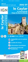 Wandelkaart - Topografische kaart 2642OT Le Caylar - La Couvertoirade | IGN - Institut Géographique National★★★★★
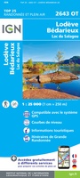 Wandelkaart - Topografische kaart 2643OT Lodeve | IGN - Institut Géographique National
 Wandelkaart - Topografische kaart 2644OT Pézenas - Murviel-lès-Béziers | IGN - Institut Géographique National
 Wandelkaart - Topografische kaart 2943ET Arles | IGN - Institut Géographique National
 Wandelkaart - Topografische kaart 2944OT Saintes-Maries-de-la-Mer | IGN - Institut Géographique National
 Wandelkaart - Topografische kaart 2742ET St.-Martin-de-Londres, Ganges | IGN - Institut Géographique National
Laatste reviews

Super handig en overzichtelijk
Ik ben dol op de veldkaarten over verschillende vogelsoorten, per land of werelddelen. Deze keer de kaart besteld over vogelsoorten in Afrika en tijdens mijn …
★★★★★ door Kelly Bosch 02 april 2026 | Heeft dit artikel gekocht
Precies wat ik zocht en snel leverbaar.
Precies wat ik zocht. De informatie op de website was duidelijk en klopte. Het was eerst niet leverbaar, maar ik had aangegeven dat ik bericht …
★★★★★ door Mieke van den Broek 01 april 2026 | Heeft dit artikel gekocht
Perfect
Snelle levering, prima verpakt, en de atlas van Duitsland is precies wat ik had verwacht, heel erg goed.
★★★★★ door Wil Van der Vlist 01 april 2026 | Heeft dit artikel gekocht
Vlotte service en een prima product!
Vlotte service en prima kaart van Slovenie
★★★★★ door Bert van Jaarsveld 31 maart 2026 | Heeft dit artikel gekocht