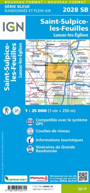
Wandelkaart - Topografische kaart 2028SB Saint-Sulpice-les-Feuilles | IGN - Institut Géographique National (9782758542711)
Lussac-les-Églises
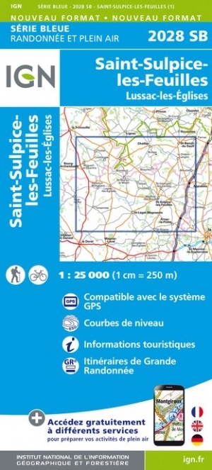
- ISBN / CODE: 9782758542711
- Editie: meest recente editie
- Schaal: 1:25000
- Uitgever: IGN - Institut Géographique National
- Soort: Topografische kaart, Wandelkaart
- Serie: Serie bleue
- Taal: Engels, Frans
- Schrijf als eerste een review
-
€ 16,95
Leverbaar in 3 - 5 werkdagen in huis in Nederland Levertijd Belgie
Gratis verzending in Nederland vanaf €35,-
-
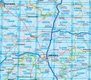
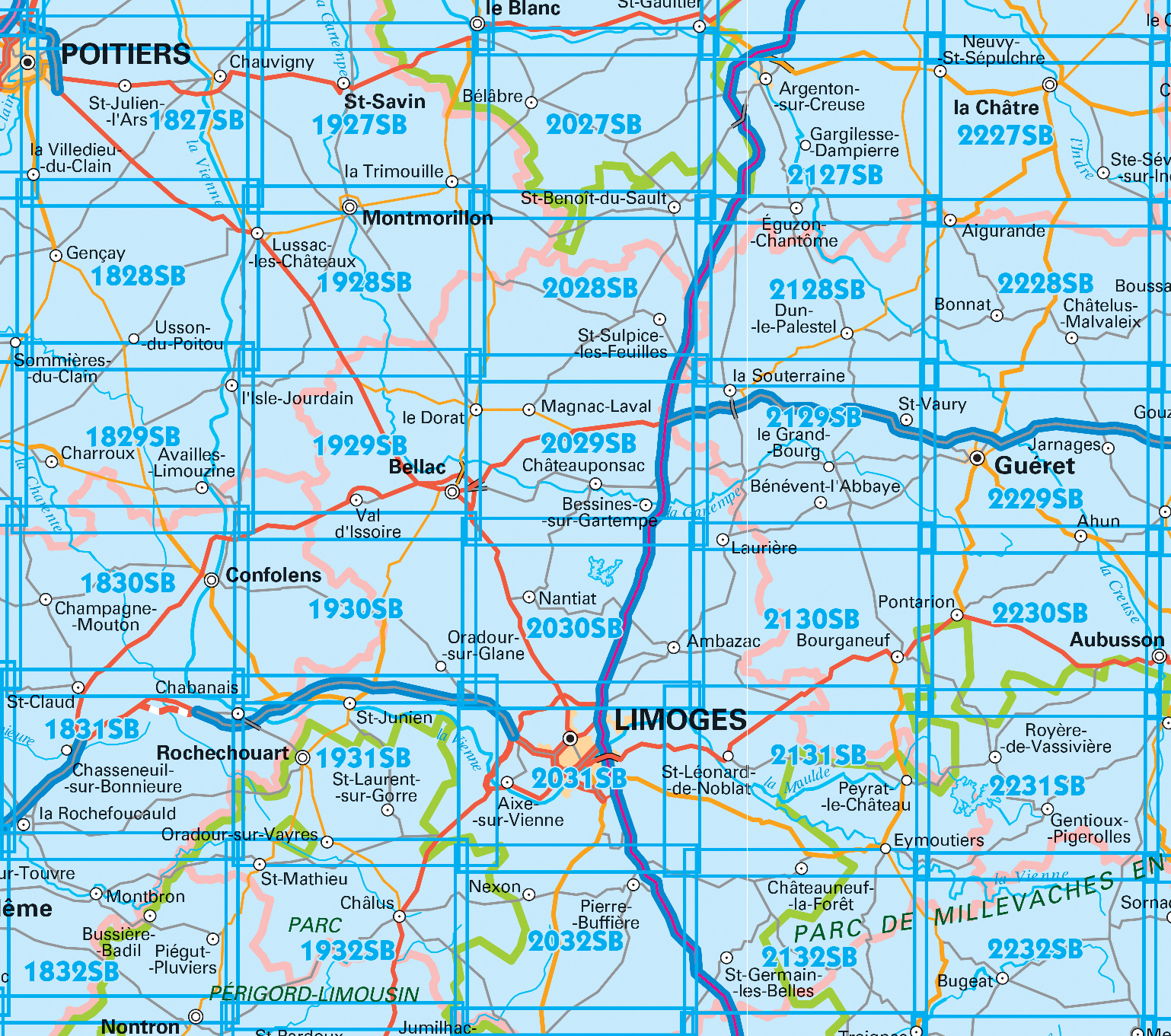
Topografische kaarten IGN 25.000 Limousin - Limoges


Producten op deze overzichtskaart:
Klik op een product om naar de pagina van dat product te gaan.
- Wandelkaart - Topografische kaart 1828SB Gençay - Persac | IGN - Institut Géographique National
- Wandelkaart - Topografische kaart 1829SB L'Isle-Jourdain - Charroux | IGN - Institut Géographique National
- Wandelkaart - Topografische kaart 1830SB Confolens | IGN - Institut Géographique National
- Wandelkaart - Topografische kaart 1831SB Rochefoucauld - Exideuil | IGN - Institut Géographique National
- Wandelkaart - Topografische kaart 1832SB Montbron, Piégut-Pluviers | IGN - Institut Géographique National
- Wandelkaart - Topografische kaart 1927SB La Trimouille | IGN - Institut Géographique National
- Wandelkaart - Topografische kaart 1928SB Montmorillon, Lathus-St-Rémy | IGN - Institut Géographique National
- Wandelkaart - Topografische kaart 1929SB Bellac - Adriers | IGN - Institut Géographique National
- Wandelkaart - Topografische kaart 1930SB Oradour-sur-Glane | IGN - Institut Géographique National
- Wandelkaart - Topografische kaart 1931SB Rochechouart | IGN - Institut Géographique National
- Wandelkaart - Topografische kaart 1932SB Châlus - St-Mathieu | IGN - Institut Géographique National
- Wandelkaart - Topografische kaart 2027SB Bélâbre, Saint-Benoît-du-Sault | IGN - Institut Géographique National
- Wandelkaart - Topografische kaart 2028SB Saint-Sulpice-les-Feuilles | IGN - Institut Géographique National
- Wandelkaart - Topografische kaart 2029SB Bessines-sur-Gartempe | IGN - Institut Géographique National
- Wandelkaart - Topografische kaart 2030SB Ambazac | IGN - Institut Géographique National
- Wandelkaart - Topografische kaart 2031SB Limoges | IGN - Institut Géographique National
- Wandelkaart - Topografische kaart 2032SB Nexon | IGN - Institut Géographique National
- Wandelkaart - Topografische kaart 2127SB Argenton-sur-Creuse, Cluis | IGN - Institut Géographique National
- Wandelkaart - Topografische kaart 2128SB Dun-le-Palestel | IGN - Institut Géographique National
- Wandelkaart - Topografische kaart 2129SB La Souterraine | IGN - Institut Géographique National
- Wandelkaart - Topografische kaart 2130SB St-Sulpice-Laurière, Bourganeuf | IGN - Institut Géographique National
- Wandelkaart - Topografische kaart 2131SB St-Léonard-de-Noblat, Eymoutiers | IGN - Institut Géographique National
- Wandelkaart - Topografische kaart 2132SB Châteauneuf-la-Forêt, Chamberet | IGN - Institut Géographique National
- Wandelkaart - Topografische kaart 2227SB La Châtre, Neuvy-St-Sépulchre | IGN - Institut Géographique National
- Wandelkaart - Topografische kaart 2228SB Châtelus-Malvaleix, Aigurande | IGN - Institut Géographique National
- Wandelkaart - Topografische kaart 2229SB Ahun - Gueret | IGN - Institut Géographique National
- Wandelkaart - Topografische kaart 2230SB Lavaveix-les-Mines, Pontarion | IGN - Institut Géographique National
- Wandelkaart - Topografische kaart 2231SB Gentioux-Pigerolles, Royère-de-Vassivière | IGN - Institut Géographique National
- Wandelkaart - Topografische kaart 2232SB Bugeat - Peyrelevade | IGN - Institut Géographique National
-
Wandelkaarten IGN 25.000 Limousin - Limoges
Producten op deze overzichtskaart:
Klik op een product om naar de pagina van dat product te gaan.
- Wandelkaart - Topografische kaart 1828SB Gençay - Persac | IGN - Institut Géographique National
- Wandelkaart - Topografische kaart 1829SB L'Isle-Jourdain - Charroux | IGN - Institut Géographique National
- Wandelkaart - Topografische kaart 1830SB Confolens | IGN - Institut Géographique National
- Wandelkaart - Topografische kaart 1831SB Rochefoucauld - Exideuil | IGN - Institut Géographique National
- Wandelkaart - Topografische kaart 1832SB Montbron, Piégut-Pluviers | IGN - Institut Géographique National
- Wandelkaart - Topografische kaart 1927SB La Trimouille | IGN - Institut Géographique National
- Wandelkaart - Topografische kaart 1928SB Montmorillon, Lathus-St-Rémy | IGN - Institut Géographique National
- Wandelkaart - Topografische kaart 1929SB Bellac - Adriers | IGN - Institut Géographique National
- Wandelkaart - Topografische kaart 1930SB Oradour-sur-Glane | IGN - Institut Géographique National
- Wandelkaart - Topografische kaart 1931SB Rochechouart | IGN - Institut Géographique National
- Wandelkaart - Topografische kaart 1932SB Châlus - St-Mathieu | IGN - Institut Géographique National
- Wandelkaart - Topografische kaart 2027SB Bélâbre, Saint-Benoît-du-Sault | IGN - Institut Géographique National
- Wandelkaart - Topografische kaart 2028SB Saint-Sulpice-les-Feuilles | IGN - Institut Géographique National
- Wandelkaart - Topografische kaart 2029SB Bessines-sur-Gartempe | IGN - Institut Géographique National
- Wandelkaart - Topografische kaart 2030SB Ambazac | IGN - Institut Géographique National
- Wandelkaart - Topografische kaart 2031SB Limoges | IGN - Institut Géographique National
- Wandelkaart - Topografische kaart 2032SB Nexon | IGN - Institut Géographique National
- Wandelkaart - Topografische kaart 2127SB Argenton-sur-Creuse, Cluis | IGN - Institut Géographique National
- Wandelkaart - Topografische kaart 2128SB Dun-le-Palestel | IGN - Institut Géographique National
- Wandelkaart - Topografische kaart 2129SB La Souterraine | IGN - Institut Géographique National
- Wandelkaart - Topografische kaart 2130SB St-Sulpice-Laurière, Bourganeuf | IGN - Institut Géographique National
- Wandelkaart - Topografische kaart 2131SB St-Léonard-de-Noblat, Eymoutiers | IGN - Institut Géographique National
- Wandelkaart - Topografische kaart 2132SB Châteauneuf-la-Forêt, Chamberet | IGN - Institut Géographique National
- Wandelkaart - Topografische kaart 2227SB La Châtre, Neuvy-St-Sépulchre | IGN - Institut Géographique National
- Wandelkaart - Topografische kaart 2228SB Châtelus-Malvaleix, Aigurande | IGN - Institut Géographique National
- Wandelkaart - Topografische kaart 2229SB Ahun - Gueret | IGN - Institut Géographique National
- Wandelkaart - Topografische kaart 2230SB Lavaveix-les-Mines, Pontarion | IGN - Institut Géographique National
- Wandelkaart - Topografische kaart 2231SB Gentioux-Pigerolles, Royère-de-Vassivière | IGN - Institut Géographique National
- Wandelkaart - Topografische kaart 2232SB Bugeat - Peyrelevade | IGN - Institut Géographique National
Overzichtskaarten
Beschrijving
Reviews
Geen reviews gevonden voor dit product.
Schrijf een review
Graag horen wij wat u van dit artikel vindt. Vindt u het goed, leuk, mooi, slecht, lelijk, onbruikbaar of erg handig: schrijf gerust alles op! Het is niet alleen leuk om te doen maar u informeert andere klanten er ook nog mee!
Ook interessant voor europa/frankrijk/dordogne
-

Wandelkaart - Topografische kaart 19
€ 16,95Topografische kaarten Dordogne - Limousin -

Wandelkaart - Topografische kaart 19
€ 16,95Topografische kaarten Dordogne - Limousin -

Wandelkaart - Topografische kaart 17
€ 16,95Topografische kaarten Dordogne - Limousin -

Wandelkaart - Topografische kaart 21
€ 16,95Topografische kaarten Dordogne - Limousin -

Wandelkaart - Topografische kaart 22
€ 16,95Topografische kaarten Dordogne - Limousin