Topografische kaarten - Frankrijk
De kaarten van IGN (kort voor Institute Geographique National), wandelkaarten voor Frankrijk, zijn van een ongekend hoog niveau. Met name de wandelkaarten 1:25.000 vinden wij geweldig: werkelijk alles staat erop, de kaarten bevatten zeer veel details en het kleurgebruik is fantastisch, waardoor alles ook nog eens heel goed leesbaar. Je hoort het: wij zijn fan van deze kaarten!
 Wandelkaart - Topografische kaart 1416 SB - Serie Bleue Le Teilleul | IGN - Institut Géographique National
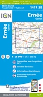 Wandelkaart - Topografische kaart 1417 SB - Serie Bleue Ernée - Gorron | IGN - Institut Géographique National
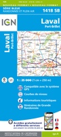 Wandelkaart - Topografische kaart 1418 SB - Serie Bleue Laval - Port-Brillet | IGN - Institut Géographique National★★★★★
 Wandelkaart - Topografische kaart 1419 SB - Serie Bleue Cossé-le-Vivien - L'Huisserie | IGN - Institut Géographique National
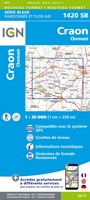 Wandelkaart - Topografische kaart 1420 SB - Serie Bleue Craon | IGN - Institut Géographique National
 Wandelkaart - Topografische kaart 1421 SB - Serie Bleue Segré | IGN - Institut Géographique National
 Wandelkaart - Topografische kaart 1422 SB - Serie Bleue Chalonnes-sur-Loire | IGN - Institut Géographique National
 Wandelkaart - Topografische kaart 1423 SB - Serie Bleue Chemillé-Melay | IGN - Institut Géographique National
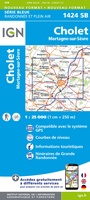 Wandelkaart - Topografische kaart 1424 SB - Serie Bleue Cholet | IGN - Institut Géographique National
 Wandelkaart - Topografische kaart 1425 SB - Serie Bleue Les Herbiers | IGN - Institut Géographique National
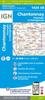 Wandelkaart - Topografische kaart 1426 SB - Serie Bleue Chantonnay | IGN - Institut Géographique National
 Wandelkaart - Topografische kaart 1427 SB - Serie Bleue Fontenay-le-Comte | IGN - Institut Géographique National
 Wandelkaart - Topografische kaart 1428 SB - Serie Bleue Marans | IGN - Institut Géographique National
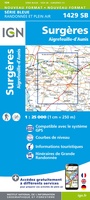 Wandelkaart - Topografische kaart 1429 SB - Serie Bleue Surgères, Aigrefeuille-d'Aunis | IGN - Institut Géographique National
 Wandelkaart - Topografische kaart 1430 SB - Serie Bleue Rochefort | IGN - Institut Géographique National
 Wandelkaart - Topografische kaart 1432 SB - Serie Bleue Saujon | IGN - Institut Géographique National
 Wandelkaart - Topografische kaart 1433 SB - Serie Bleue Lesparre-Médoc | IGN - Institut Géographique National
 Wandelkaart - Topografische kaart 1433OT Soulac-Sur-Mer & Montalivet Pointe De Grave | IGN - Institut Géographique National
 Topografische kaart - Wandelkaart 1434OT Hourtin, Lacs d'Hourtin Et De Carcans | IGN - Institut Géographique National
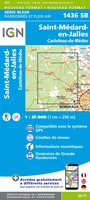 Wandelkaart - Topografische kaart 1436 SB - Serie Bleue St-Médard-en-Jalles | IGN - Institut Géographique National
Laatste reviews

Rother wandelgidsen stellen nooit teleur. Mooie routes, goede opgave kilometers, hoogtemeters en horeca. Een aanrader!
★★★★★ door Anita Geel 13 januari 2026 | Heeft dit artikel gekocht
Mooi boek met prachtige foto’s! Voldoet helemaal aan mijn verwachtingen.
★★★★★ door Hans Eldering 13 januari 2026 | Heeft dit artikel gekocht
het product voldeed aan mijn verwachtingen en was geplastificeerd wat natuurlijk perfect is voor kaart die veel wordt geraadpleegd!
★★★★★ door Peter Lantinga 13 januari 2026 | Heeft dit artikel gekocht
Ik heb de wegenkaart Maleisië aangeschaft om zelf een rondreis per huurauto te kunnen plannen. Deze kaart heeft daar heel goed bij geholpen doordat er …
★★★★★ door M. Rizvi 13 januari 2026 | Heeft dit artikel gekocht