Topografische kaarten - Frankrijk
De kaarten van IGN (kort voor Institute Geographique National), wandelkaarten voor Frankrijk, zijn van een ongekend hoog niveau. Met name de wandelkaarten 1:25.000 vinden wij geweldig: werkelijk alles staat erop, de kaarten bevatten zeer veel details en het kleurgebruik is fantastisch, waardoor alles ook nog eens heel goed leesbaar. Je hoort het: wij zijn fan van deze kaarten!
 Wandelkaart - Topografische kaart 2437 SB - Serie Bleue Laguiole, Entraygues-sur-Truyere | IGN - Institut Géographique National★★★★★
 Wandelkaart - Topografische kaart 2438 SB - Serie Bleue Espalion - Estaing | IGN - Institut Géographique National
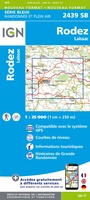 Wandelkaart - Topografische kaart 2439 SB - Serie Bleue Rodez - Laissac | IGN - Institut Géographique National
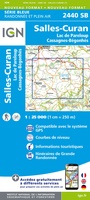 Wandelkaart - Topografische kaart 2440 SB - Serie Bleue Salles-Curan, Lac de Pareloup, Cassagnes, Begonhes | IGN - Institut Géographique National
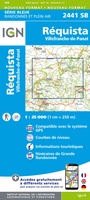 Wandelkaart - Topografische kaart 2441 SB - Serie Bleue Réquista, Villefranche-de-Panat | IGN - Institut Géographique National★★★★★
 Wandelkaart - Topografische kaart 2442 SB - Serie Bleue Belmont-sur-Rance, St-Sernin-sur-Rance | IGN - Institut Géographique National
 Wandelkaart - Topografische kaart 2443ET Monts de Lacaune, La Salvetat - sur - Agout, PNR du Haut Languedoc | IGN - Institut Géographique National★★★★★
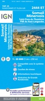 Wandelkaart - Topografische kaart 2444ET Somail - Minervois | IGN - Institut Géographique National
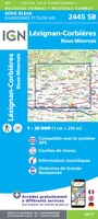 Wandelkaart - Topografische kaart 2445 SB - Serie Bleue Lézignan - Corbieres, Rieux-Minervois | IGN - Institut Géographique National
 Wandelkaart - Topografische kaart 2446 SB - Serie Bleue Ferrals-les-Corbières, Capendu | IGN - Institut Géographique National
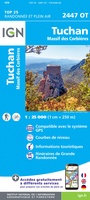 Wandelkaart - Topografische kaart 2447OT Tuchan | IGN - Institut Géographique National
 Wandelkaart - Topografische kaart 2448OT Thuir, Ille-sur-Tet, Latour-de-France, Estagel, Millas | IGN - Institut Géographique National
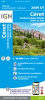 Wandelkaart - Topografische kaart 2449OT Céret, Amélie-les-Bains-Palalda, Vallée du Tech | IGN - Institut Géographique National
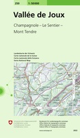 Wandelkaart - Topografische kaart 250 Vallée de Joux | Swisstopo
 Wandelkaart - Topografische kaart 2504 SB - Serie Bleue Lille - Roubaix - Tourcoing | IGN - Institut Géographique National
 Wandelkaart - Topografische kaart 2505 SB - Serie Bleue Leforest - Cysoing - Hénin-Beaumont - Carvin | IGN - Institut Géographique National
 Wandelkaart - Topografische kaart 2506 SB - Serie Bleue Douai - Rouvroy - Vitry-en-Artois | IGN - Institut Géographique National
 Wandelkaart - Topografische kaart 2507 SB - Serie Bleue Cambrai - Bertincourt | IGN - Institut Géographique National
 Wandelkaart - Topografische kaart 2508 SB - Serie Bleue Roisel - Péronne | IGN - Institut Géographique National
 Wandelkaart - Topografische kaart 2509 SB - Serie Bleue Ham - Nesle | IGN - Institut Géographique National
Laatste reviews

Op zich een goede kaart, maar het is eigenlijk gewoon een uitvergroting van de bekende 1:200.000-kaarten, dus weinig tot geen extra informatie. Wel wat duidelijker …
★★★★★ door FGM Ballhaus 13 mei 2026 | Heeft dit artikel gekocht
Duidelijke kaart, goed voor fietsen, iets minder voor wandelen door de schaal, maar er is heel weinig kaartmateriaal voor dit gebied dus daarom toch dik …
★★★★★ door FGM Ballhaus 13 mei 2026 | Heeft dit artikel gekocht
Fietskaart is een goede aanvulling op de Nederlandse fietskaarten, laat de Achterhoek zien maar ook een heel stuk Duitsland in (naar het oosten). Kwalitatief ook …
★★★★★ door FGM Ballhaus 13 mei 2026 | Heeft dit artikel gekocht
Keurig verpakt, snel verzonden. Boek voldoet aan mijn verwachtingen!
★★★★★ door Beatrice 12 mei 2026 | Heeft dit artikel gekocht