Topografische kaarten - Frankrijk
De kaarten van IGN (kort voor Institute Geographique National), wandelkaarten voor Frankrijk, zijn van een ongekend hoog niveau. Met name de wandelkaarten 1:25.000 vinden wij geweldig: werkelijk alles staat erop, de kaarten bevatten zeer veel details en het kleurgebruik is fantastisch, waardoor alles ook nog eens heel goed leesbaar. Je hoort het: wij zijn fan van deze kaarten!
 Wandelkaart - Topografische kaart 2709 SB - Serie Bleue Vervins - Marie | IGN - Institut Géographique National
 Wandelkaart - Topografische kaart 271 Chablais | Swisstopo
 Wandelkaart - Topografische kaart 2710 SB - Serie Bleue Sissonne - Laon | IGN - Institut Géographique National
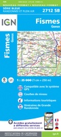 Wandelkaart - Topografische kaart 2712 SB - Serie Bleue Gueux - Fismes | IGN - Institut Géographique National
 Wandelkaart - Topografische kaart 2713 SB - Serie Bleue Epernay - Dormans | IGN - Institut Géographique National
 Wandelkaart - Topografische kaart 2714 SB - Serie Bleue Montmort-Lucy | IGN - Institut Géographique National
 Wandelkaart - Topografische kaart 2715 SB - Serie Bleue Connantre - Sézanne | IGN - Institut Géographique National
 Wandelkaart - Topografische kaart 2716 SB - Serie Bleue Romilly-sur-Seine | IGN - Institut Géographique National
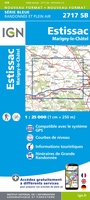 Wandelkaart - Topografische kaart 2717 SB - Serie Bleue Estissac | IGN - Institut Géographique National
 Wandelkaart - Topografische kaart 2718 SB - Serie Bleue Auxon | IGN - Institut Géographique National
 Wandelkaart - Topografische kaart 2719 SB - Serie Bleue Saint-Florentin – Flogny-la-Chapelle | IGN - Institut Géographique National
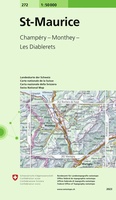 Wandelkaart - Topografische kaart 272 St-Maurice | Swisstopo
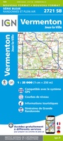 Topografische kaart - Wandelkaart 2721 SB - Serie Bleue Vermenton | IGN - Institut Géographique National
 Topografische kaart - Wandelkaart 2722ET Avallon - Vézelay | IGN - Institut Géographique National
 Wandelkaart - Topografische kaart 2723 SB - Serie Bleue Corbigny | IGN - Institut Géographique National
 Wandelkaart - Topografische kaart 2410 SB - Serie Bleue Ressons-sur-Matz, Montdidier | IGN - Institut Géographique National
 Wandelkaart - Topografische kaart 2411 SB - Serie Bleue Estrées-St-Denis, Clermont | IGN - Institut Géographique National
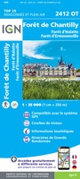 Wandelkaart - Topografische kaart 2412OT Forêt de Chantilly | IGN - Institut Géographique National★★★★★
 Wandelkaart - Topografische kaart 2413OT Dammartin-en-Goële, Centre | IGN - Institut Géographique National
 Wandelkaart - Topografische kaart 2414ET Marne-la-Vallée - Forêts: Crécy - Armainvilliers - Ferrières, Centre | IGN - Institut Géographique National
Laatste reviews

Op zich een goede kaart, maar het is eigenlijk gewoon een uitvergroting van de bekende 1:200.000-kaarten, dus weinig tot geen extra informatie. Wel wat duidelijker …
★★★★★ door FGM Ballhaus 13 mei 2026 | Heeft dit artikel gekocht
Duidelijke kaart, goed voor fietsen, iets minder voor wandelen door de schaal, maar er is heel weinig kaartmateriaal voor dit gebied dus daarom toch dik …
★★★★★ door FGM Ballhaus 13 mei 2026 | Heeft dit artikel gekocht
Fietskaart is een goede aanvulling op de Nederlandse fietskaarten, laat de Achterhoek zien maar ook een heel stuk Duitsland in (naar het oosten). Kwalitatief ook …
★★★★★ door FGM Ballhaus 13 mei 2026 | Heeft dit artikel gekocht
Keurig verpakt, snel verzonden. Boek voldoet aan mijn verwachtingen!
★★★★★ door Beatrice 12 mei 2026 | Heeft dit artikel gekocht