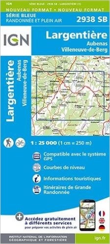
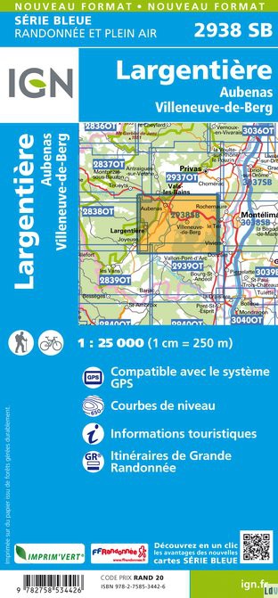
Wandelkaart - Topografische kaart 2938SB Largentière, Aubenas, Villeneuve-de-Berg | IGN - Institut Géographique National (9782758553564)
- ISBN / CODE: 9782758553564
- Editie: nieuwste editie
- Schaal: 1:25000
- Uitgever: IGN - Institut Géographique National
- Soort: Topografische kaart, Wandelkaart
- Serie: Serie bleue
- Taal: Frans
- Uitvoering: Papier
- Bindwijze: -
- Beoordeling: 5,0 ★★★★★ (1 review) Schrijf een review
-
€ 16,95
Levertijd 2 - 4 werkdagen in huis in Nederland Levertijd Belgie
Gratis verzending in Nederland vanaf €35,-
-
Topografische kaarten IGN 25.000 Ardeche - Rhone vallei Zuid

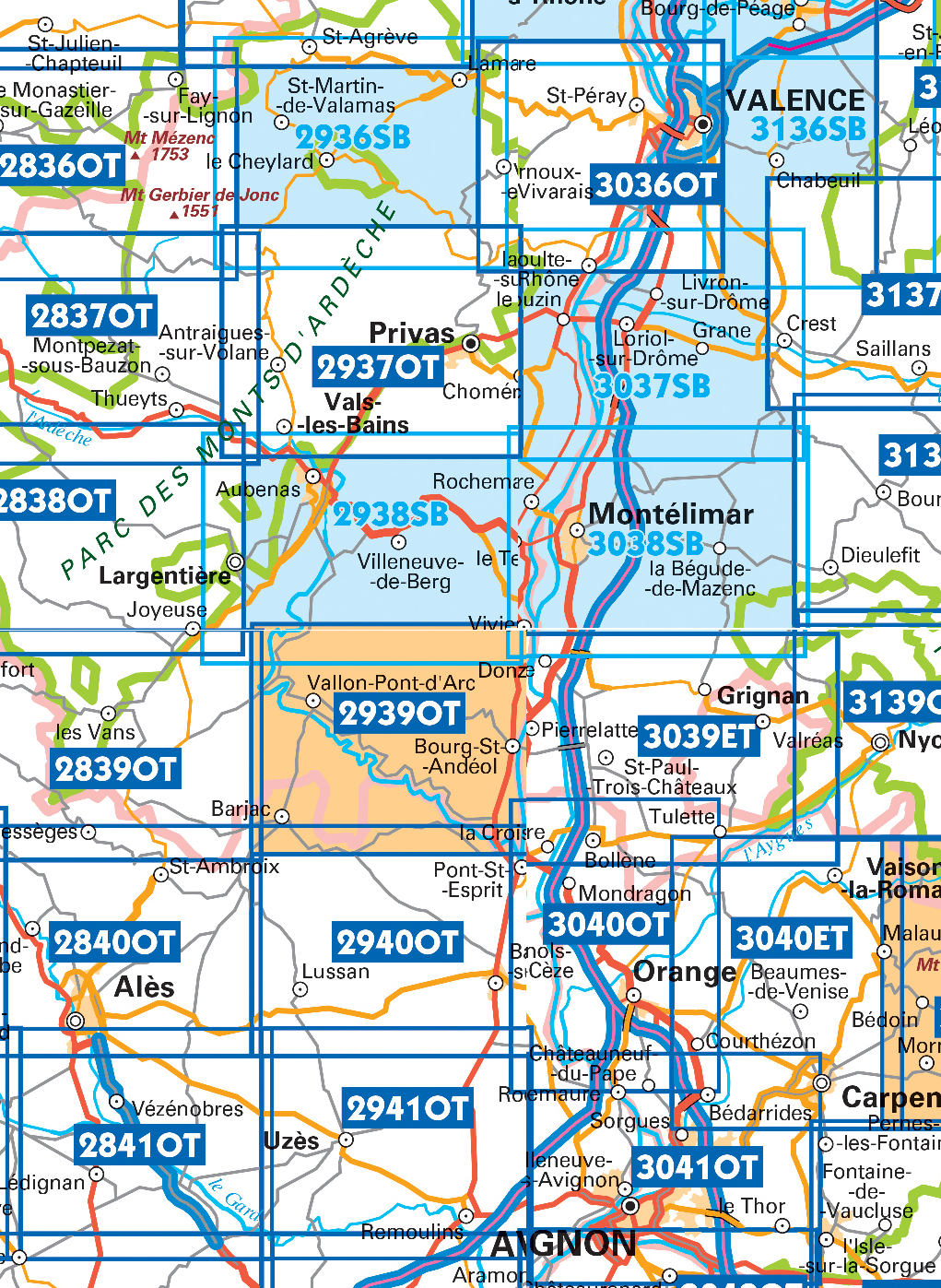
Producten op deze overzichtskaart:
Klik op een product om naar de pagina van dat product te gaan.
- Wandelkaart - Topografische kaart 2836OT Gerbier de Jonc | IGN - Institut Géographique National
- Wandelkaart - Topografische kaart 2837OT Lac d'Issarlès - Thueyts | IGN - Institut Géographique National
- Wandelkaart - Topografische kaart 2838OT Largentière | IGN - Institut Géographique National
- Wandelkaart - Topografische kaart 2839OT Besseges - Les-Vans | IGN - Institut Géographique National
- Wandelkaart - Topografische kaart 2840OT Ales | IGN - Institut Géographique National
- Wandelkaart - Topografische kaart 2841OT Vézénobres | IGN - Institut Géographique National
- Topografische kaart - Wandelkaart 2936SB le Cheylard | IGN - Institut Géographique National
- Wandelkaart - Topografische kaart 2937OT Privas – Vals-les-Bains | IGN - Institut Géographique National
- Wandelkaart - Topografische kaart 2938SB Largentière, Aubenas, Villeneuve-de-Berg | IGN - Institut Géographique National
- Wandelkaart - Topografische kaart 2939OT Gorges de l'Ardèche | IGN - Institut Géographique National
- Wandelkaart - Topografische kaart 2940OT Bagnols-sur-Cèze | IGN - Institut Géographique National
- Wandelkaart - Topografische kaart 2941OT Uzès - Remoulins | IGN - Institut Géographique National
- Wandelkaart - Topografische kaart 2942OT Nîmes | IGN - Institut Géographique National
- Topografische kaart - Wandelkaart 3036OT Valence | IGN - Institut Géographique National
- Wandelkaart - Topografische kaart 3037SB Crest – La Voulte-sur-Rhône | IGN - Institut Géographique National
- Wandelkaart - Topografische kaart 3038SB Montélimar | IGN - Institut Géographique National
- Wandelkaart - Topografische kaart 3039ET Valréas | IGN - Institut Géographique National
- Wandelkaart - Topografische kaart 3040OT Orange | IGN - Institut Géographique National
- Wandelkaart - Topografische kaart 3041OT Avignon | IGN - Institut Géographique National
- Wandelkaart - Topografische kaart 3136SB Bourg-de-Péage – Chabeuil | IGN - Institut Géographique National
-
Wandelkaarten IGN 25.000 Ardeche - Rhone vallei ZUIDELIJK GEDEELTE

Producten op deze overzichtskaart:
Klik op een product om naar de pagina van dat product te gaan.
- Wandelkaart - Topografische kaart 2836OT Gerbier de Jonc | IGN - Institut Géographique National
- Wandelkaart - Topografische kaart 2837OT Lac d'Issarlès - Thueyts | IGN - Institut Géographique National
- Wandelkaart - Topografische kaart 2838OT Largentière | IGN - Institut Géographique National
- Wandelkaart - Topografische kaart 2839OT Besseges - Les-Vans | IGN - Institut Géographique National
- Wandelkaart - Topografische kaart 2840OT Ales | IGN - Institut Géographique National
- Wandelkaart - Topografische kaart 2841OT Vézénobres | IGN - Institut Géographique National
- Topografische kaart - Wandelkaart 2936SB le Cheylard | IGN - Institut Géographique National
- Wandelkaart - Topografische kaart 2937OT Privas – Vals-les-Bains | IGN - Institut Géographique National
- Wandelkaart - Topografische kaart 2938SB Largentière, Aubenas, Villeneuve-de-Berg | IGN - Institut Géographique National
- Wandelkaart - Topografische kaart 2939OT Gorges de l'Ardèche | IGN - Institut Géographique National
- Wandelkaart - Topografische kaart 2940OT Bagnols-sur-Cèze | IGN - Institut Géographique National
- Wandelkaart - Topografische kaart 2941OT Uzès - Remoulins | IGN - Institut Géographique National
- Wandelkaart - Topografische kaart 2942OT Nîmes | IGN - Institut Géographique National
- Topografische kaart - Wandelkaart 3036OT Valence | IGN - Institut Géographique National
- Wandelkaart - Topografische kaart 3037SB Crest – La Voulte-sur-Rhône | IGN - Institut Géographique National
- Wandelkaart - Topografische kaart 3038SB Montélimar | IGN - Institut Géographique National
- Wandelkaart - Topografische kaart 3039ET Valréas | IGN - Institut Géographique National
- Wandelkaart - Topografische kaart 3040OT Orange | IGN - Institut Géographique National
- Wandelkaart - Topografische kaart 3041OT Avignon | IGN - Institut Géographique National
- Wandelkaart - Topografische kaart 3136SB Bourg-de-Péage – Chabeuil | IGN - Institut Géographique National
Overzichtskaarten
Beschrijving
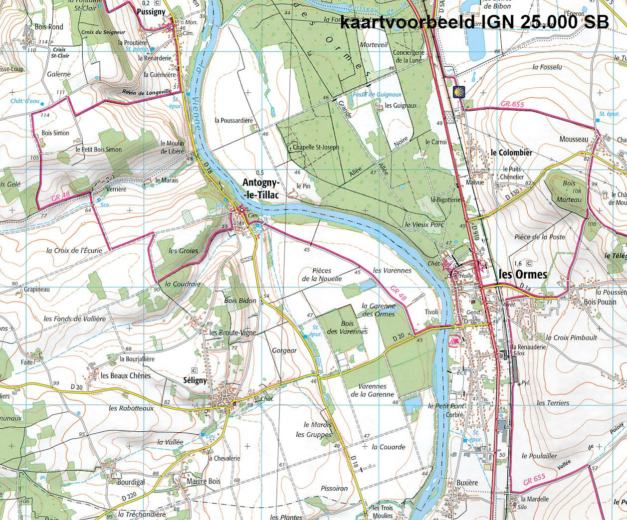
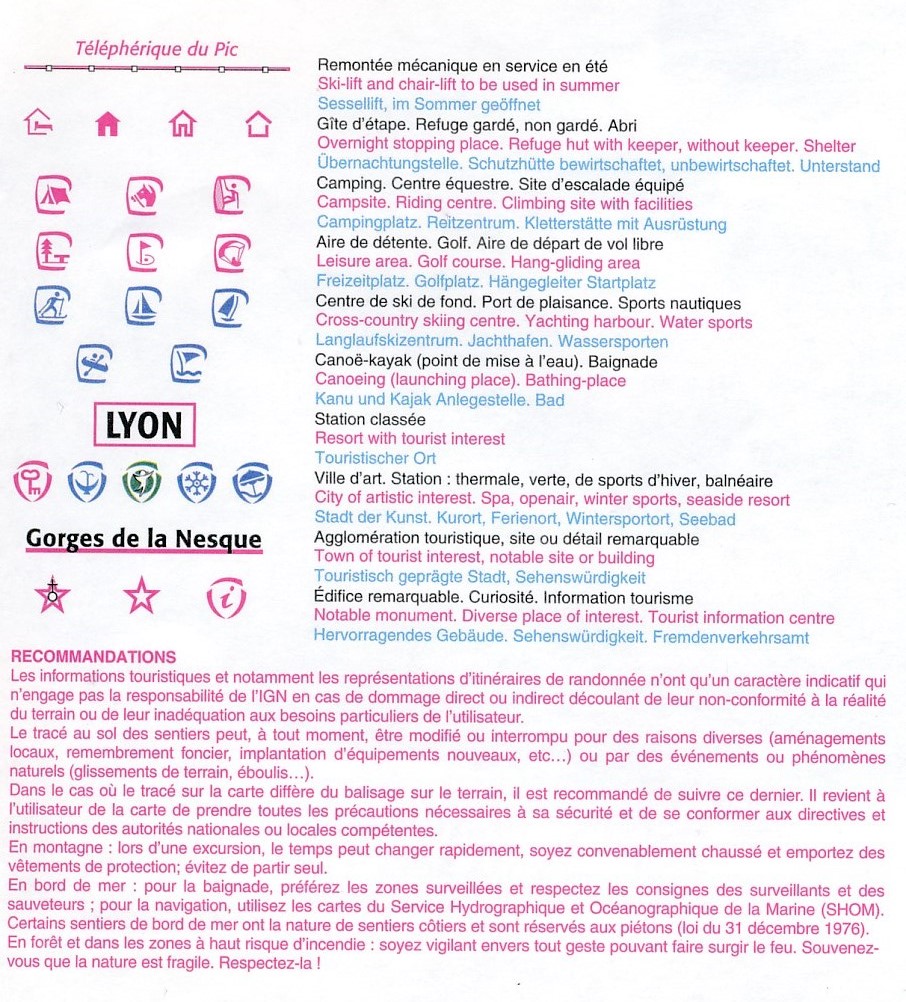
De rest van Frankrijk wordt in kaart gebracht met de "Série Bleu" (oude serie eindigend op O = ouest of E = est) welke geen speciale extra overdruk heeft om de wandelroutes aan te duiden. Op deze kaarten vind je dan ook geen toeristische informatie als campings en hutten; het zijn puur topografische kaarten, maar zoals gezegd bijzonder gedetailleerd. Elke "Série Bleu" kaart bedekt een gebied van ongeveer 20 x 14 km
Van de uitgever:
Reviews
Ik ben helemaal tevreden, prima kaarten en goede levering.
★★★★★ door Bert Offerman 28 februari 2019Vond u dit een nuttige review? (login om te beoordelen)
Schrijf een review
Graag horen wij wat u van dit artikel vindt. Vindt u het goed, leuk, mooi, slecht, lelijk, onbruikbaar of erg handig: schrijf gerust alles op! Het is niet alleen leuk om te doen maar u informeert andere klanten er ook nog mee!
Ook interessant voor europa/frankrijk/ardeche
-

Wandelkaart - Topografische kaart 28
€ 16,95Topografische kaarten Ardeche - Rhone Vallei -

Reisgids Michelin groene gids Ardèch
€ 22,99Reisgidsen Ardeche - Rhone Vallei -

Wandelkaart - Topografische kaart 29
€ 16,95Topografische kaarten Ardeche - Rhone Vallei -

Wandelgids D007 l' Ardèche a pied |
€ 17,95Wandelgidsen Ardeche - Rhone Vallei -

Wandelkaart - Topografische kaart 30
€ 16,95Topografische kaarten Ardeche - Rhone Vallei