
Winkelwagen
Geen items in winkelwagen
Ga naar winkelwagen
Topografische kaarten - Midi-Pyrénées
 Wandelkaart - Topografische kaart 2246 SB - Serie Bleue Mirepoix | IGN - Institut Géographique National
 Wandelkaart - Topografische kaart 2247OT Lavelanet, Chalabre, Montségur, Laroque-d'Olmes | IGN - Institut Géographique National
 Wandelkaart - Topografische kaart 2248ET Axat, Querigut | IGN - Institut Géographique National★★★★★
 Wandelkaart - Topografische kaart 2249ET Font Romeu, Capcir, Olette | IGN - Institut Géographique National★★★★★
 Wandelkaart - Topografische kaart 2249OT Bourg-Madame, Pic Carlit, Col de Puymorens, Port d'Envalira | IGN - Institut Géographique National★★★★★
 Wandelkaart - Topografische kaart 2338 SB - Serie Bleue Decazeville | IGN - Institut Géographique National
 Wandelkaart - Topografische kaart 2339 SB - Serie Bleue Rieupeyroux - Moyrazes | IGN - Institut Géographique National
 Topografische kaart - Wandelkaart 2340 SB - Serie Bleue Naucelle la Salvetat - Peyrales | IGN - Institut Géographique National
 Topografische kaart - Wandelkaart 2341 SB - Serie Bleue Carmaux - Valence-d'Albigeois | IGN - Institut Géographique National
 Topografische kaart - Wandelkaart 2342 SB - Serie Bleue Réalmont / Alban | IGN - Institut Géographique National
 Wandelkaart - Topografische kaart 2343ET Castres, Sidobre, Brassac, Vebre, PNR du Haut Languedoc | IGN - Institut Géographique National★★★★★
 Wandelkaart - Topografische kaart 2344OT Montagne Noire (ouest) - Revel - Labrugiere - PNR du Haut Languedoc | IGN - Institut Géographique National
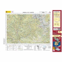 Topografische kaart 182 MT50 Rivera de Cardós | CNIG - Instituto Geográfico Nacional1
 Wandelkaart - Topografische kaart 1844 SB - Serie Bleue Mirande - Masseube | IGN - Institut Géographique National
 Wandelkaart - Topografische kaart 1845 SB - Serie Bleue Boulogne-sur-Gesse | IGN - Institut Géographique National
 Wandelkaart - Topografische kaart 1846 SB - Serie Bleue Lannemezan | IGN - Institut Géographique National
 Wandelkaart - Topografische kaart 1847OT Saint Bertrand de Comminges, Arreau | IGN - Institut Géographique National
 Wandelkaart - Topografische kaart 1848OT Bagnères de Luchon, | IGN - Institut Géographique National★★★★★
 Wandelkaart - Topografische kaart 1939 SB - Serie Bleue Penne-d'Agenais | IGN - Institut Géographique National
 Wandelkaart - Topografische kaart 1940 SB - Serie Bleue Valence | IGN - Institut Géographique National
Laatste reviews

Prima overzichtskaart
Prima overzichtskaart om een beeld te krijgen van het gebied, maar de schaal is te klein om betrouwbaar op te wandelen. Door de dichte begroeiing …
★★★★★ door Joris 16 november 2026 | Heeft dit artikel gekocht
Goeie kaarten en wandelgidsen
Schaf regelmatig kaarten, wandelgidsen en reisboeken aan bij de Zwerver. Fijn om zo'n goed adres te hebben!
★★★★★ door Klasien Horstman 16 november 2026 | Heeft dit artikel gekocht
Meer een wandelgids dan een pelgrimsgids
Talrijk zijn de alternatieve routes. Toeristische informatie is beknopt. Kaartjes soms op te grote schaal, zodat je alleen de tekst als leidraad hebt, omdat de …
★★★★★ door Jacq 16 november 2026 | Heeft dit artikel gekocht
Goed boek, snel geleverd
Heel fijn het goede boek kunnen selecteren op de website. Goed en snel verzonden.
★★★★★ door Lot 16 november 2026 | Heeft dit artikel gekocht