Topografische kaarten - Frankrijk
De kaarten van IGN (kort voor Institute Geographique National), wandelkaarten voor Frankrijk, zijn van een ongekend hoog niveau. Met name de wandelkaarten 1:25.000 vinden wij geweldig: werkelijk alles staat erop, de kaarten bevatten zeer veel details en het kleurgebruik is fantastisch, waardoor alles ook nog eens heel goed leesbaar. Je hoort het: wij zijn fan van deze kaarten!
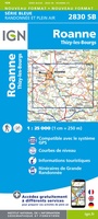 Wandelkaart - Topografische kaart 2830 SB - Serie Bleue Roanne – Thizy-les-Bourgs | IGN - Institut Géographique National
 Wandelkaart - Topografische kaart 2831 SB - Serie Bleue Feurs – Boën-sur-Lignon | IGN - Institut Géographique National
 Wandelkaart - Topografische kaart 2832 SB - Serie Bleue Montbrison - Veauche | IGN - Institut Géographique National
 Wandelkaart - Topografische kaart 2833 SB - Serie Bleue Firminy, St-Bonnet-le-Château | IGN - Institut Géographique National
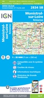 Wandelkaart - Topografische kaart 2834 SB - Serie Bleue Monistrol-sur-Loire, Retournac | IGN - Institut Géographique National
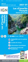 Wandelkaart - Topografische kaart 2837OT Lac d'Issarlès - Thueyts | IGN - Institut Géographique National
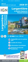 Wandelkaart - Topografische kaart 2838OT Largentière | IGN - Institut Géographique National★★★★★
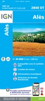 Wandelkaart - Topografische kaart 2840OT Ales | IGN - Institut Géographique National
 Wandelkaart - Topografische kaart 2841OT SB - Serie Bleue Vézénobres | IGN - Institut Géographique National
 Wandelkaart - Topografische kaart 2842OT Sommières, Vergèze | IGN - Institut Géographique National
 Wandelkaart - Topografische kaart 2843OT Aigues - Mortes - La Grande Motte | IGN - Institut Géographique National
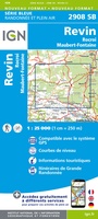 Wandelkaart - Topografische kaart 2908 SB - Serie Bleue Revin, Rocroi, Maubert-Fontaine | IGN - Institut Géographique National
 Wandelkaart - Topografische kaart 2909 SB - Serie Bleue Renwez-Signy, L'Abbaye | IGN - Institut Géographique National★★★★★
 Wandelkaart - Topografische kaart 2910 SB - Serie Bleue Rethel - Tourteron | IGN - Institut Géographique National
 Wandelkaart - Topografische kaart 2911 SB - Serie Bleue Attigny | IGN - Institut Géographique National
 Wandelkaart - Topografische kaart 2912 SB - Serie Bleue Mourmelon-le-Grand | IGN - Institut Géographique National
 Wandelkaart - Topografische kaart 2913 SB - Serie Bleue Châlons-en-Champagne | IGN - Institut Géographique National
 Wandelkaart - Topografische kaart 2914 SB - Serie Bleue Marson, Châlons-en-Champagne | IGN - Institut Géographique National
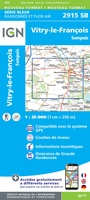 Wandelkaart - Topografische kaart 2915 SB - Serie Bleue Vitry-le-François, Sompuis | IGN - Institut Géographique National
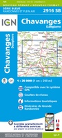 Wandelkaart - Topografische kaart 2916 SB - Serie Bleue Chavanges, Dampierre | IGN - Institut Géographique National
Laatste reviews

enthousiast ontvangen door klanten. Is met de kinderen van 7 en 5 jaar oud gelijk aan de slag gegaan
★★★★★ door aam van ruler 30 december 2025 | Heeft dit artikel gekocht
Nederlandstalige (vertaalde) reisgids met veel informatie, ook over praktische zaken. Duidelijke streek- en stadkaartjes met wandelroutes, ook handig.
★★★★★ door Kees H. 30 december 2025 | Heeft dit artikel gekocht
Dit boekje met beknopte omschrijving en de erin afgedrukte wandel(deel)kaarten vormen een prima basis voor het rondje Limburg. Je bent vrij om te bepalen waar …
★★★★★ door Greenline 29 december 2025 | Heeft dit artikel gekocht
Snel geleverd en goede wandelkaart
★★★★★ door Rinske 29 december 2025 | Heeft dit artikel gekocht