Topografische kaarten - Frankrijk
De kaarten van IGN (kort voor Institute Geographique National), wandelkaarten voor Frankrijk, zijn van een ongekend hoog niveau. Met name de wandelkaarten 1:25.000 vinden wij geweldig: werkelijk alles staat erop, de kaarten bevatten zeer veel details en het kleurgebruik is fantastisch, waardoor alles ook nog eens heel goed leesbaar. Je hoort het: wij zijn fan van deze kaarten!
 Wandelkaart - Topografische kaart 4255OT Bonifacio | IGN - Institut Géographique National
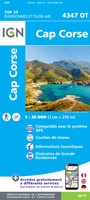 Wandelkaart - Topografische kaart 4347OT Cap Corse | IGN - Institut Géographique National
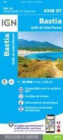 Wandelkaart - Topografische kaart 4348OT Bastia | IGN - Institut Géographique National
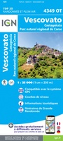 Wandelkaart - Topografische kaart 4349OT Vescovato | IGN - Institut Géographique National
 Wandelkaart - Topografische kaart 4351OT Cervione | IGN - Institut Géographique National
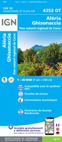 Wandelkaart - Topografische kaart 4352OT Aléria - Ghisonaccia | IGN - Institut Géographique National
 Fietskaart - Topografische kaart - Wegenkaart - landkaart 45 Haute-Savoie | Swisstopo
 Fietskaart - Topografische kaart - Wegenkaart - landkaart 46 Val de Bagnes | Swisstopo
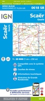 Wandelkaart - Topografische kaart 618 SB - Serie Bleue Scaër | IGN - Institut Géographique National
 Wandelkaart - Topografische kaart 618 SB - Serie Bleue Sillé-le-Guillaum, Conlie Ste-Suzanne | IGN - Institut Géographique National
 Topografische kaart 65 MT50 Bera/Vera de Bidasoa | CNIG - Instituto Geográfico Nacional1
 Topografische kaart 65-I Ergoien | CNIG - Instituto Geográfico Nacional1
 Topografische kaart 65-II Bera / Vera de Bidasoa | CNIG - Instituto Geográfico Nacional1
 Topografische kaart 66 MT50 Amaiur/Maya | CNIG - Instituto Geográfico Nacional1
 Topografische kaart 66-I Urdazubi / Urdax | CNIG - Instituto Geográfico Nacional1
 Topografische kaart 66-III Amaiur / Maya | CNIG - Instituto Geográfico Nacional1
 Wandelkaart - Topografische kaart 82018 Gorges du Verdon | IGN - Institut Géographique National
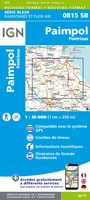 Wandelkaart - Topografische kaart 815 SB - Serie Bleue Paimpol - Pontrieux | IGN - Institut Géographique National
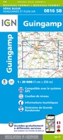 Wandelkaart - Topografische kaart 816 SB - Serie Bleue Guingamp | IGN - Institut Géographique National
 Wandelkaart - Topografische kaart 817 SB - Serie Bleue Quintin - St-Nicolas-du-Pelem | IGN - Institut Géographique National
Laatste reviews

Op ansichtkaartformaat een prachtige reliëfkaart van Vogezen en Elzas: alleen al voor het vooraf genieten een aanrader
★★★★★ door R.P. Koster 08 april 2026 | Heeft dit artikel gekocht
De beste kaartenmaker van Frankrijk: Michelin. Weer met mooie toeritische tips van de Elzas: een aanrader
★★★★★ door R.P. Koster 08 april 2026 | Heeft dit artikel gekocht
Mooie wandelgids (ook om cadeau te geven) als je van wandelen op de Veluwe houdt. Duidelijk, goed gedocumenteerd, zo te gebruiken
★★★★★ door R.P. Koster 08 april 2026 | Heeft dit artikel gekocht
Mooie overzichtelijke, zoveel mogelijk geüpdatete kaart van Curaçao. Wel groot. Goede kwaliteit.
★★★★★ door Maud van de Straat 08 april 2026 | Heeft dit artikel gekocht