Topografische kaarten - Frankrijk
De kaarten van IGN (kort voor Institute Geographique National), wandelkaarten voor Frankrijk, zijn van een ongekend hoog niveau. Met name de wandelkaarten 1:25.000 vinden wij geweldig: werkelijk alles staat erop, de kaarten bevatten zeer veel details en het kleurgebruik is fantastisch, waardoor alles ook nog eens heel goed leesbaar. Je hoort het: wij zijn fan van deze kaarten!
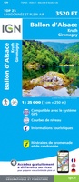 Wandelkaart - Topografische kaart 3520ET Ballon d'Alsace | IGN - Institut Géographique National★★★★★★★★★★
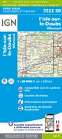 Wandelkaart - Topografische kaart 3522 SB - Serie Bleue L'Isle-sur-le-Doubs, Villersexel | IGN - Institut Géographique National
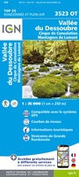 Wandelkaart - Topografische kaart 3523OT Vallee-du-Desoubre | IGN - Institut Géographique National
 Wandelkaart - Topografische kaart 3524OT Morteau | IGN - Institut Géographique National
 Wandelkaart - Topografische kaart 3528ET Morzine | IGN - Institut Géographique National★★★★★
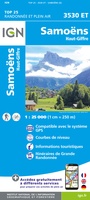 Wandelkaart - Topografische kaart 3530ET Samoëns | IGN - Institut Géographique National★★★★★
 Wandelkaart - Topografische kaart 3531ET Saint-Gervais-les-Bains | IGN - Institut Géographique National★★★★★
 Wandelkaart - Topografische kaart 3531OT Megève | IGN - Institut Géographique National★★★★★
 Wandelkaart - Topografische kaart 3532OT Massif du Beaufortain | IGN - Institut Géographique National
 Wandelkaart - Topografische kaart 3535OT Névache - Mont Thabor | IGN - Institut Géographique National★★★★★★★★★★
 Wandelkaart - Topografische kaart 3536OT Briançon | IGN - Institut Géographique National★★★★★★★★★★
 Wandelkaart - Topografische kaart 3537ET Guillestre | IGN - Institut Géographique National★★★★★
 Wandelkaart - Topografische kaart 3538ET Aiguille de Chamberyron | IGN - Institut Géographique National
 Wandelkaart - Topografische kaart 3542ET Haute Estéron | IGN - Institut Géographique National
 Wandelkaart - Topografische kaart 3543ET Haute Siagne | IGN - Institut Géographique National★★★★★
 Wandelkaart - Topografische kaart 3543OT Draguignan | IGN - Institut Géographique National
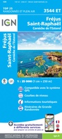 Topografische kaart - Wandelkaart 3544ET Fréjus - Saint-Raphaël | IGN - Institut Géographique National★★★★★
 Wandelkaart - Topografische kaart 3545OT Saint-Tropez - Sainte-Maxime | IGN - Institut Géographique National
 Wandelkaart - Topografische kaart 3613 SB - Serie Bleue Forbach - Sarreguemines | IGN - Institut Géographique National
 Wandelkaart - Topografische kaart 3613ET Sarreguemines | IGN - Institut Géographique National
Laatste reviews

Echt prachtig boek, uniek mag ik wel zeggen. Als cadeau gegeven aan onze vriend. Een super gaaf ‘tafelboek’ . We hebben er ook en standaard …
★★★★★ door Visser 08 januari 2026 | Heeft dit artikel gekocht
Wegens winter kunnen we het nog niet in de praktijk proberen, maar al enorm veel voorpret bij het lezen van deze prachtige wandelgids van de …
★★★★★ door Charlotte 08 januari 2026 | Heeft dit artikel gekocht
Keurige levering.
★★★★★ door JP 07 januari 2026 | Heeft dit artikel gekocht
Het zal voor mijn zus een beste uitdaging zijn om deze puzzel te maken. Hopelijk wordt ze bijgestaan door haar dochters. Het was een verjaardagscadeau. …
★★★★★ door Kees 07 januari 2026 | Heeft dit artikel gekocht