Topografische kaarten - Frankrijk
De kaarten van IGN (kort voor Institute Geographique National), wandelkaarten voor Frankrijk, zijn van een ongekend hoog niveau. Met name de wandelkaarten 1:25.000 vinden wij geweldig: werkelijk alles staat erop, de kaarten bevatten zeer veel details en het kleurgebruik is fantastisch, waardoor alles ook nog eens heel goed leesbaar. Je hoort het: wij zijn fan van deze kaarten!
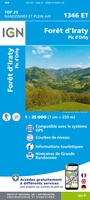 Topografische kaart - Wandelkaart 1346ET Forêt d'Iraty - Pic d'Orly | IGN - Institut Géographique National
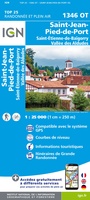 Topografische kaart - Wandelkaart 1346OT St.-Jean-Pied-de-Port | IGN - Institut Géographique National
 Wandelkaart - Topografische kaart 1412OT Pointe Du Hoc - Omaha Beach | IGN - Institut Géographique National★★★★★
 Wandelkaart - Topografische kaart 1413 SB - Serie Bleue Condé-sur-Vire, Caumont- sur-Aure | IGN - Institut Géographique National
 Wandelkaart - Topografische kaart 1414 SB - Serie Bleue Vire Normandie, Souleuvre en Bocage | IGN - Institut Géographique National
 Wandelkaart - Topografische kaart 1415 SB - Serie Bleue Tinchebray - Bocage | IGN - Institut Géographique National
 Wandelkaart - Topografische kaart 1416 SB - Serie Bleue Le Teilleul | IGN - Institut Géographique National
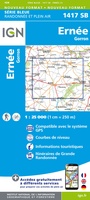 Wandelkaart - Topografische kaart 1417 SB - Serie Bleue Ernée - Gorron | IGN - Institut Géographique National
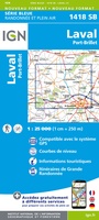 Wandelkaart - Topografische kaart 1418 SB - Serie Bleue Laval - Port-Brillet | IGN - Institut Géographique National★★★★★
 Wandelkaart - Topografische kaart 1419 SB - Serie Bleue Cossé-le-Vivien - L'Huisserie | IGN - Institut Géographique National
 Wandelkaart - Topografische kaart 1420 SB - Serie Bleue Craon | IGN - Institut Géographique National
 Wandelkaart - Topografische kaart 1421 SB - Serie Bleue Segré | IGN - Institut Géographique National
 Wandelkaart - Topografische kaart 1422 SB - Serie Bleue Chalonnes-sur-Loire | IGN - Institut Géographique National
 Wandelkaart - Topografische kaart 1423 SB - Serie Bleue Chemillé-Melay | IGN - Institut Géographique National
 Wandelkaart - Topografische kaart 1424 SB - Serie Bleue Cholet | IGN - Institut Géographique National
 Wandelkaart - Topografische kaart 1425 SB - Serie Bleue Les Herbiers | IGN - Institut Géographique National
 Wandelkaart - Topografische kaart 1426 SB - Serie Bleue Chantonnay | IGN - Institut Géographique National
 Wandelkaart - Topografische kaart 1429 SB - Serie Bleue Surgères, Aigrefeuille-d'Aunis | IGN - Institut Géographique National
 Wandelkaart - Topografische kaart 1433 SB - Serie Bleue Lesparre-Médoc | IGN - Institut Géographique National
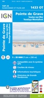 Wandelkaart - Topografische kaart 1433OT Soulac-Sur-Mer & Montalivet Pointe De Grave | IGN - Institut Géographique National
Laatste reviews

Heel blij mee! Super handzaam, lichtgewicht boekje om mee te nemen op de camino. Alles staat er overzichtelijk in wat nodig is. Deze gaat zeker …
★★★★★ door Greetje 20 april 2026 | Heeft dit artikel gekocht
Handig beknopt boekje met duidelijke kaartjes. Handige tips, ook over OV, musea e.d. Het formaat is passend binnen iedere rugak. Wel in het Engels, maar …
★★★★★ door Frits 20 april 2026 | Heeft dit artikel gekocht
Ik heb een wandelgids besteld bij De Zwerver. Deze lag al heel snel in de brievenbus. Het boekje werd puntgaaf geleverd.
★★★★★ door Arie Verhoef 20 april 2026 | Heeft dit artikel gekocht
Gedetailleerd, maar minder overzichtelijk in dichter bevolkt gebied
★★★★★ door Janine 19 april 2026 | Heeft dit artikel gekocht