Winkelwagen
Geen items in winkelwagen
Ga naar winkelwagen
Topografische kaarten - Frankrijk
De kaarten van IGN (kort voor Institute Geographique National), wandelkaarten voor Frankrijk, zijn van een ongekend hoog niveau. Met name de wandelkaarten 1:25.000 vinden wij geweldig: werkelijk alles staat erop, de kaarten bevatten zeer veel details en het kleurgebruik is fantastisch, waardoor alles ook nog eens heel goed leesbaar. Je hoort het: wij zijn fan van deze kaarten!
 Wandelkaart - Topografische kaart 3330OT Bellegarde-sur-Valserine | IGN - Institut Géographique National
 Wandelkaart - Topografische kaart 3332OT Chambéry - Aix-les-Bains | IGN - Institut Géographique National
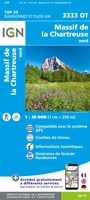 Wandelkaart - Topografische kaart 3333OT Massif de la Chartreuse Nord | IGN - Institut Géographique National★★★★★★★★★★
 Wandelkaart - Topografische kaart 3334OT Massif de la Chartreuse Sud | IGN - Institut Géographique National★★★★★
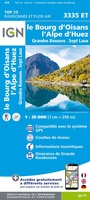 Wandelkaart - Topografische kaart 3335ET le Bourg d'Oisans - l'Alpe d'Huez | IGN - Institut Géographique National★★★★★
 Wandelkaart - Topografische kaart 3335OT Grenoble | IGN - Institut Géographique National★★★★★
 Wandelkaart - Topografische kaart 3336ET Les Deux Alpes | IGN - Institut Géographique National★★★★★
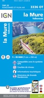 Wandelkaart - Topografische kaart 3336OT La Mure | IGN - Institut Géographique National★★★★★
 Wandelkaart - Topografische kaart 3337OT Dévoluy | IGN - Institut Géographique National★★★★★★★★★★
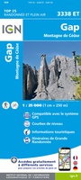 Wandelkaart - Topografische kaart 3338ET Gap | IGN - Institut Géographique National★★★★★
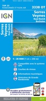 Wandelkaart - Topografische kaart 3338OT Serres - Veynes | IGN - Institut Géographique National
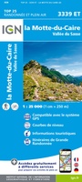 Wandelkaart - Topografische kaart 3339ET la Motte-du-Caire | IGN - Institut Géographique National
 Wandelkaart - Topografische kaart 3340ET Digne-les-Bains | IGN - Institut Géographique National
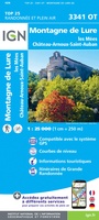 Wandelkaart - Topografische kaart 3341OT Montagne de Lure | IGN - Institut Géographique National
 Wandelkaart - Topografische kaart 3342ET Plateau de Valensole | IGN - Institut Géographique National
 Wandelkaart - Topografische kaart 3342OT Manosque - Forcalquier | IGN - Institut Géographique National
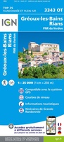 Wandelkaart - Topografische kaart 3343OT Gréoux-les-Bains - Rians | IGN - Institut Géographique National
 Wandelkaart - Topografische kaart 3344OT Saint-Maximin-la-Sainte-Baume | IGN - Institut Géographique National
 Wandelkaart - Topografische kaart 3345OT Signes – Tourves | IGN - Institut Géographique National
 Wandelkaart - Topografische kaart 3346OT Toulon | IGN - Institut Géographique National
Laatste reviews

Bruikbare kaart
Bruikbare kaart door interessante delen van Spanje. Er moet wel nog informatie bijgezocht worden
★★★★★ door Jef 27 december 2025 | Heeft dit artikel gekocht
Prima kaart
Prima kaart die veel informatie biedt. Goed om ritten te plannen over geasfalteerde wegen
★★★★★ door Jef 27 december 2025 | Heeft dit artikel gekocht
Prima kaart
Goede kaart om ritten over geasfalteerde wegen te plannen. Biedt veel informatie.
★★★★★ door Jef 27 december 2025 | Heeft dit artikel gekocht
adventure ver zoek
Overbodige kaart die niet biedt wat de titel beloofd. Bevat nauwelijks bruikbare informatie
★★★★★ door Jef 27 december 2025 | Heeft dit artikel gekocht