Topografische kaarten - Frankrijk
De kaarten van IGN (kort voor Institute Geographique National), wandelkaarten voor Frankrijk, zijn van een ongekend hoog niveau. Met name de wandelkaarten 1:25.000 vinden wij geweldig: werkelijk alles staat erop, de kaarten bevatten zeer veel details en het kleurgebruik is fantastisch, waardoor alles ook nog eens heel goed leesbaar. Je hoort het: wij zijn fan van deze kaarten!
 Wandelkaart - Topografische kaart 2742ET St.-Martin-de-Londres, Ganges | IGN - Institut Géographique National
 Wandelkaart - Topografische kaart 2806 SB - Serie Bleue Jeumont - Maubeuge | IGN - Institut Géographique National
 Wandelkaart - Topografische kaart 2808 SB - Serie Bleue Hirson - Fourmies | IGN - Institut Géographique National
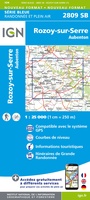 Wandelkaart - Topografische kaart 2809 SB - Serie Bleue Rozoy-sur-Serre - Aubenton | IGN - Institut Géographique National★★★★★
 Wandelkaart - Topografische kaart 2810 SB - Serie Bleue Château-Porcien, Dizy-le-Gros | IGN - Institut Géographique National
 Wandelkaart - Topografische kaart 2811 SB - Serie Bleue Bazancourt - Guignicourt - Asfeld | IGN - Institut Géographique National
 Wandelkaart - Topografische kaart 2812 SB - Serie Bleue Verzy - Reims | IGN - Institut Géographique National
 Wandelkaart - Topografische kaart 2813 SB - Serie Bleue Epernay-Verzy | IGN - Institut Géographique National
 Wandelkaart - Topografische kaart 2814 SB - Serie Bleue Thibie - Vertus | IGN - Institut Géographique National
 Wandelkaart - Topografische kaart 2815 SB - Serie Bleue Mailly-le-Camp, Fère-Champenoise | IGN - Institut Géographique National
 Wandelkaart - Topografische kaart 2816 SB - Serie Bleue Arcis-sur-Aube, Plancy-l'Abbaye | IGN - Institut Géographique National
 Wandelkaart - Topografische kaart 2817 SB - Serie Bleue Troyes, Lusigny-sur-Barse | IGN - Institut Géographique National
 Topografische kaart - Wandelkaart 2818 SB - Serie Bleue Bouilly | IGN - Institut Géographique National
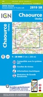 Topografische kaart - Wandelkaart 2819 SB - Serie Bleue Chaource | IGN - Institut Géographique National
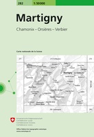 Wandelkaart - Topografische kaart 282 Martigny | Swisstopo
 Topografische kaart - Wandelkaart 2820 SB - Serie Bleue Tonnerre | IGN - Institut Géographique National
 Topografische kaart - Wandelkaart 2821 SB - Serie Bleue L'Isle-sur-Serein | IGN - Institut Géographique National★★★★★
 Wandelkaart - Topografische kaart 2822OT Quarre-les-Tombes | IGN - Institut Géographique National
 Topografische kaart - Wandelkaart 2823ET Saulieu - Lac de Settons | IGN - Institut Géographique National★★★★★
 Wandelkaart - Topografische kaart 2824OT Autun - Mont Beuvray | IGN - Institut Géographique National★★★★★
Laatste reviews

Rother wandelgidsen stellen nooit teleur. Mooie routes, goede opgave kilometers, hoogtemeters en horeca. Een aanrader!
★★★★★ door Anita Geel 13 januari 2026 | Heeft dit artikel gekocht
Mooi boek met prachtige foto’s! Voldoet helemaal aan mijn verwachtingen.
★★★★★ door Hans Eldering 13 januari 2026 | Heeft dit artikel gekocht
het product voldeed aan mijn verwachtingen en was geplastificeerd wat natuurlijk perfect is voor kaart die veel wordt geraadpleegd!
★★★★★ door Peter Lantinga 13 januari 2026 | Heeft dit artikel gekocht
Ik heb de wegenkaart Maleisië aangeschaft om zelf een rondreis per huurauto te kunnen plannen. Deze kaart heeft daar heel goed bij geholpen doordat er …
★★★★★ door M. Rizvi 13 januari 2026 | Heeft dit artikel gekocht