Topografische kaarten - Frankrijk
De kaarten van IGN (kort voor Institute Geographique National), wandelkaarten voor Frankrijk, zijn van een ongekend hoog niveau. Met name de wandelkaarten 1:25.000 vinden wij geweldig: werkelijk alles staat erop, de kaarten bevatten zeer veel details en het kleurgebruik is fantastisch, waardoor alles ook nog eens heel goed leesbaar. Je hoort het: wij zijn fan van deze kaarten!
 Wandelkaart - Topografische kaart 2928 SB - Serie Bleue Cluny Matour | IGN - Institut Géographique National
 Wandelkaart - Topografische kaart 2929ET Beaujeu - Belleville - Haut Beaujolais – Rhônevallei – Bourgondië | IGN - Institut Géographique National
 Wandelkaart - Topografische kaart 2931ET L'Arbresle - Monts de Tarare – Col de la Luère – Rhônevallei - Bourgondië | IGN - Institut Géographique National
 Wandelkaart - Topografische kaart 2932ET Monts du Lyonnais | IGN - Institut Géographique National
 Wandelkaart - Topografische kaart 2933ET Massif du Pilat - St-Etienne - St-Chamond - PNR du Pilat Ardéche | IGN - Institut Géographique National
 Wandelkaart - Topografische kaart 2934ET Bourg-Argental - Col de la République - PNR du Pilat Ardéche | IGN - Institut Géographique National
 Topografische kaart - Wandelkaart 2936 SB - Serie Bleue le Cheylard | IGN - Institut Géographique National★★★★★
 Wandelkaart - Topografische kaart 2937OT Privas – Vals-les-Bains | IGN - Institut Géographique National
 Wandelkaart - Topografische kaart 2938 SB - Serie Bleue Largentière, Aubenas, Villeneuve-de-Berg | IGN - Institut Géographique National★★★★★
 Wandelkaart - Topografische kaart 2939OT Gorges de l'Ardèche | IGN - Institut Géographique National★★★★★
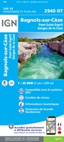 Wandelkaart - Topografische kaart 2940OT Bagnols-sur-Cèze | IGN - Institut Géographique National
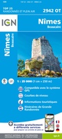 Wandelkaart - Topografische kaart 2942OT Nîmes | IGN - Institut Géographique National
 Wandelkaart - Topografische kaart 2943ET Arles | IGN - Institut Géographique National
 Wandelkaart - Topografische kaart 2944OT Saintes-Maries-de-la-Mer | IGN - Institut Géographique National
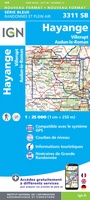 Wandelkaart - Topografische kaart 3311 SB - Serie Bleue Hayange, Villerupt, Audun-le-Roman | IGN - Institut Géographique National
 Wandelkaart - Topografische kaart 3312 SB - Serie Bleue Briey | IGN - Institut Géographique National
 Wandelkaart - Topografische kaart 3313 SB - Serie Bleue Ars-sur-Moselle | IGN - Institut Géographique National
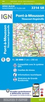 Wandelkaart - Topografische kaart 3314 SB - Serie Bleue Pont-à-Mousson | IGN - Institut Géographique National★★★★★
 Topografische kaart - Wandelkaart 3315ET Nancy / Toul / Forêt de Haye | IGN - Institut Géographique National
 Wandelkaart - Topografische kaart 3316 SB - Serie Bleue Vézelise | IGN - Institut Géographique National
Laatste reviews

Review van mijn vriendin. Heel mooi boek met gedetailleerde informatie over waar je op welk moment de foto's kan maken die je zou willen. Zelfs …
★★★★★ door Tony Everaert 17 januari 2026 | Heeft dit artikel gekocht
Precies wat ik zocht
★★★★★ door Hans Linneman 16 januari 2026 | Heeft dit artikel gekocht
Het is een zeer gedetailleerde landkaart, zoals ook door de Zwerver duidelijk omschreven. Zal voor mijn vakantie met een huurauto zeer nuttig zijn. De levering …
★★★★★ door Jeroen 16 januari 2026 | Heeft dit artikel gekocht
Mooi uitgevoerd en fijn. Bij elke wandeling niet alleen een kaartje en routebeschrijving, maar ook achtergrondinformatie en informatie over de natuur. Bevat dus echt korte …
★★★★★ door Arjan de Jong 15 januari 2026 | Heeft dit artikel gekocht