Winkelwagen
Geen items in winkelwagen
Ga naar winkelwagen
Topografische kaarten - Aquitaine
 Topografische kaart - Wandelkaart 1739 SB - Serie Bleue Tonneins - Casteljaloux | IGN - Institut Géographique National
 Wandelkaart - Topografische kaart 1740 SB - Serie Bleue Nérac | IGN - Institut Géographique National
 Wandelkaart - Topografische kaart 1741 SB - Serie Bleue Mézin | IGN - Institut Géographique National
 Topografische kaart - Wandelkaart 1742 SB - Serie Bleue Eauze | IGN - Institut Géographique National★★★★★
 Wandelkaart - Topografische kaart 1832 SB - Serie Bleue Montbron, Piégut-Pluviers | IGN - Institut Géographique National★★★★★
 Wandelkaart - Topografische kaart 1833 SB - Serie Bleue Nontron, Brantôme, Mareuil | IGN - Institut Géographique National
 Wandelkaart - Topografische kaart 1834 SB - Serie Bleue Périgueux , Tocane-Saint-Apre | IGN - Institut Géographique National
 Wandelkaart - Topografische kaart 1835 SB - Serie Bleue Villamblard, Saint-Astier, Mussidan | IGN - Institut Géographique National
 Wandelkaart - Topografische kaart 1836 SB - Serie Bleue Creysse - Bergerac | IGN - Institut Géographique National
 Wandelkaart - Topografische kaart 1837 SB - Serie Bleue Eymet - Castillonnès | IGN - Institut Géographique National
 Wandelkaart - Topografische kaart 1839 SB - Serie Bleue Villeneuve sur Lot - Castelmoron sur Lot | IGN - Institut Géographique National
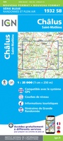 Wandelkaart - Topografische kaart 1932 SB - Serie Bleue Châlus - St-Mathieu | IGN - Institut Géographique National
 Wandelkaart - Topografische kaart 1933 SB - Serie Bleue Thiviers, St-Pardoux-la-Rivière | IGN - Institut Géographique National
 Wandelkaart - Topografische kaart 1934 SB - Serie Bleue Excideuil - Périgueux | IGN - Institut Géographique National
 Wandelkaart - Topografische kaart 1935 SB - Serie Bleue Vergt | IGN - Institut Géographique National
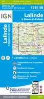 Wandelkaart - Topografische kaart 1936 SB - Serie Bleue Lalinde, le Buisson-de-Cadouin | IGN - Institut Géographique National
 Wandelkaart - Topografische kaart 1936ET Les Eyzies, St.-Cyprien, le Bugue, Beynac | IGN - Institut Géographique National★★★★★
 Wandelkaart - Topografische kaart 1937 SB - Serie Bleue Belves, Beaumont-du-Périgord | IGN - Institut Géographique National★★★★★
 Wandelkaart - Topografische kaart 1938 SB - Serie Bleue Fumel - Monflanquin | IGN - Institut Géographique National
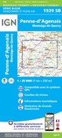 Wandelkaart - Topografische kaart 1939 SB - Serie Bleue Penne-d'Agenais | IGN - Institut Géographique National
Laatste reviews

Simpele keuze ondersteuning op website en hele snelle levering
Kort voor vakantie naar de Galapagos eilanden toch nog behoefte aan extra reisgids. Simpel kunnen bestellen en snelle levering. Zou niet weten wat er beter …
★★★★★ door Piet Grootenboer 25 juni 2026 | Heeft dit artikel gekocht
Te gek
Enorm mooie wereldkaart met details en snelle fijne levering.
★★★★★ door Steven Goyvaerts 25 juni 2026 | Heeft dit artikel gekocht
Goede gids voor pelgrims
Deze Cicerone gids over de via Francigena is uitermate geschikt om je route en etappes te plannen als je de Via Francigena vanuit Zwitserland gaat …
★★★★★ door Vic 24 juni 2026 | Heeft dit artikel gekocht
Aantrekkelijk en boordevol nuttige info
Heerlijk om al te kunnen voorbereiden op een fantastische vakantie met dit uiterst fijne boek.
★★★★★ door Harry 24 juni 2026 | Heeft dit artikel gekocht