Winkelwagen
Geen items in winkelwagen
Ga naar winkelwagen
Topografische kaarten - Aquitaine
 Wandelkaart - Topografische kaart 1445 SB - Serie Bleue Mauléon-Licharre – St-Palais | IGN - Institut Géographique National
 Wandelkaart - Topografische kaart 1446ET Tardets-Sorholus, Arette | IGN - Institut Géographique National★★★★★
 Wandelkaart - Topografische kaart 2033 SB - Serie Bleue Saint-Yrieix-La Perche-Lubersac | IGN - Institut Géographique National
 Wandelkaart - Topografische kaart 2034 SB - Serie Bleue Objat - Hautefort | IGN - Institut Géographique National★★★★★
 Wandelkaart - Topografische kaart 2035 SB - Serie Bleue Terrasson-Lavilledieu, Montignac, Grotte de Lascaux | IGN - Institut Géographique National★★★★★
 Wandelkaart - Topografische kaart 2036ET Sarlat-la-Caneda, Souillac | IGN - Institut Géographique National★★★★★
 Wandelkaart - Topografische kaart 2037OT Roque-Gageac, Domme | IGN - Institut Géographique National★★★★★
 Wandelkaart - Topografische kaart 2038 SB - Serie Bleue Puy l'Evêque, Luzech | IGN - Institut Géographique National
 Wandelkaart - Topografische kaart 1245OT Hendaye - St.Jean de Luz - Cote d'Argent | IGN - Institut Géographique National
 Wandelkaart - Topografische kaart 1523 SB - Serie Bleue Thouarcé | IGN - Institut Géographique National
 Topografische kaart - Wandelkaart 1534 SB - Serie Bleue Montendre, St-Ciers-sur-Girond | IGN - Institut Géographique National
 Wandelkaart - Topografische kaart 1535 SB - Serie Bleue Blaye | IGN - Institut Géographique National
 Topografische kaart - Wandelkaart 1536OT Bordeaux / Sud Médoc | IGN - Institut Géographique National
 Topografische kaart - Wandelkaart 1537 SB - Serie Bleue Pessac | IGN - Institut Géographique National
 Wandelkaart - Topografische kaart 1538 SB - Serie Bleue Landiras | IGN - Institut Géographique National
 Wandelkaart - Topografische kaart 1539 SB - Serie Bleue St-Symphorien | IGN - Institut Géographique National
 Wandelkaart - Topografische kaart 1540 SB - Serie Bleue Labrit | IGN - Institut Géographique National
 Wandelkaart - Topografische kaart 1541 SB - Serie Bleue Ygos-Saint-Saturnin | IGN - Institut Géographique National
 Wandelkaart - Topografische kaart 1543 SB - Serie Bleue Hagetmau | IGN - Institut Géographique National
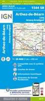 Wandelkaart - Topografische kaart 1544 SB - Serie Bleue Arthez-de-Béarn | IGN - Institut Géographique National
Laatste reviews

Simpele keuze ondersteuning op website en hele snelle levering
Kort voor vakantie naar de Galapagos eilanden toch nog behoefte aan extra reisgids. Simpel kunnen bestellen en snelle levering. Zou niet weten wat er beter …
★★★★★ door Piet Grootenboer 25 juni 2026 | Heeft dit artikel gekocht
Te gek
Enorm mooie wereldkaart met details en snelle fijne levering.
★★★★★ door Steven Goyvaerts 25 juni 2026 | Heeft dit artikel gekocht
Goede gids voor pelgrims
Deze Cicerone gids over de via Francigena is uitermate geschikt om je route en etappes te plannen als je de Via Francigena vanuit Zwitserland gaat …
★★★★★ door Vic 24 juni 2026 | Heeft dit artikel gekocht
Aantrekkelijk en boordevol nuttige info
Heerlijk om al te kunnen voorbereiden op een fantastische vakantie met dit uiterst fijne boek.
★★★★★ door Harry 24 juni 2026 | Heeft dit artikel gekocht