Winkelwagen
Geen items in winkelwagen
Ga naar winkelwagen
Topografische kaarten - Poitou-Charentes
 Wandelkaart - Topografische kaart 1329ET La Rochelle - Anse de l'Aiguillon | IGN - Institut Géographique National
 Wandelkaart - Topografische kaart 1329OT Ile De Re | IGN - Institut Géographique National
 Wandelkaart - Topografische kaart 1330OT Ile d'Oleron & Ile d'Aix | IGN - Institut Géographique National
 Wandelkaart - Topografische kaart 1425 SB - Serie Bleue Les Herbiers | IGN - Institut Géographique National
 Wandelkaart - Topografische kaart 1429 SB - Serie Bleue Surgères, Aigrefeuille-d'Aunis | IGN - Institut Géographique National
 Topografische kaart - Wandelkaart 1525 SB - Serie Bleue Bressuire | IGN - Institut Géographique National
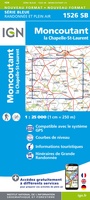 Wandelkaart - Topografische kaart 1526 SB - Serie Bleue Moncoutant - La Chapelle-Saint-Laurent | IGN - Institut Géographique National
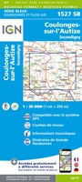 Wandelkaart - Topografische kaart 1527 SB - Serie Bleue Coulonges-sur-l'Autize, Secondigny | IGN - Institut Géographique National
 Wandelkaart - Topografische kaart 1529 SB - Serie Bleue Mauzé-sur-le-Mignon, Frontenay-Rohan, Foret de Chize | IGN - Institut Géographique National
 Wandelkaart - Topografische kaart 1530 SB - Serie Bleue Saint-Jean-d'Angély | IGN - Institut Géographique National
 Wandelkaart - Topografische kaart 1531 SB - Serie Bleue Saintes - Burie | IGN - Institut Géographique National★★★★★
 Wandelkaart - Topografische kaart 1532 SB - Serie Bleue Pons | IGN - Institut Géographique National
 Topografische kaart - Wandelkaart 1533 SB - Serie Bleue Jonzac | IGN - Institut Géographique National
 Topografische kaart - Wandelkaart 1534 SB - Serie Bleue Montendre, St-Ciers-sur-Girond | IGN - Institut Géographique National
 Topografische kaart - Wandelkaart 1625 SB - Serie Bleue Thouars | IGN - Institut Géographique National
 Wandelkaart - Topografische kaart 1626 SB - Serie Bleue Parthenay - Thenezay | IGN - Institut Géographique National
 Wandelkaart - Topografische kaart 1627 SB - Serie Bleue Mazieres-en-Gatine, Vasles | IGN - Institut Géographique National
 Wandelkaart - Topografische kaart 1628 SB - Serie Bleue St-Maixent-l'Ecole, Lezay | IGN - Institut Géographique National
 Wandelkaart - Topografische kaart 1629 Melle | IGN - Institut Géographique National
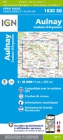 Wandelkaart - Topografische kaart 1630 SB - Serie Bleue Aulnay | IGN - Institut Géographique National
Laatste reviews

Vlotte service en een prima product!
Vlotte service en prima kaart van Slovenie
★★★★★ door Bert van Jaarsveld 31 maart 2026 | Heeft dit artikel gekocht
Lekker lichtgewicht, maar wel goed overzicht.
132 dagen GR20 in het voorjaar en alles zelf meenemen, betekent dat iedere gram telt. Deze kaart geeft een mooi overzicht van de hele route …
★★★★★ door Martin-Jan Strebe 31 maart 2026 | Heeft dit artikel gekocht
Fijn boekje! Helder en geruststellend
Vandaag bijkomen van de Fishermanstrail! Heb het boekje regelmatig erbij gepakt. De route staat duidelijk aangegeven en daarvoor het boek niet nodig. Wat prettig is …
★★★★★ door Inge Hendriks 31 maart 2026 | Heeft dit artikel gekocht
Wordt altijd goed geleverd.
Al meerdere reisboeken besteld en worden altijd snel en netjes geleverd.
★★★★★ door Jolande 31 maart 2026 | Heeft dit artikel gekocht