Topografische kaarten - Frankrijk
De kaarten van IGN (kort voor Institute Geographique National), wandelkaarten voor Frankrijk, zijn van een ongekend hoog niveau. Met name de wandelkaarten 1:25.000 vinden wij geweldig: werkelijk alles staat erop, de kaarten bevatten zeer veel details en het kleurgebruik is fantastisch, waardoor alles ook nog eens heel goed leesbaar. Je hoort het: wij zijn fan van deze kaarten!
 Wandelkaart - Topografische kaart 0714OT Perros-Guirec, Lannion, Trégastel-Plage, Trébeurden, Côte de Granit Rose | IGN - Institut Géographique National★★★★★
 Wandelkaart - Topografische kaart 0720ET Lorient - Ile de Groix | IGN - Institut Géographique National
 Topografische kaart - Wandelkaart 0814OT Paimpol | IGN - Institut Géographique National★★★★★★★★★★
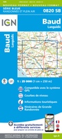 Wandelkaart - Topografische kaart 0820 SB - Serie Bleue Baud - Languidic | IGN - Institut Géographique National
 Wandelkaart - Topografische kaart 0821OT Presqu'Ile de Quiberon - Auray - Carnac Bretagne | IGN - Institut Géographique National
 Wandelkaart - Topografische kaart 0822OT Belle-Ile - Ile d'Houat et d'Hoëdic Bretagne | IGN - Institut Géographique National★★★★★
 Wandelkaart - Topografische kaart 0916ET Erquy - le Val-André | IGN - Institut Géographique National
 Wandelkaart - Topografische kaart 0916OT Saint-Brieuc | IGN - Institut Géographique National★★★★★
 Wandelkaart - Topografische kaart 0921OT Vannes | IGN - Institut Géographique National★★★★★
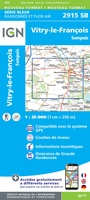 Wandelkaart - Topografische kaart 2915 SB - Serie Bleue Vitry-le-François, Sompuis | IGN - Institut Géographique National
 Wandelkaart - Topografische kaart 2916 SB - Serie Bleue Chavanges, Dampierre | IGN - Institut Géographique National
 Wandelkaart - Topografische kaart 2917 SB - Serie Bleue Brienne-le-Chateau, Piney, Lacs de la Foret d'Orient | IGN - Institut Géographique National
 Topografische kaart - Wandelkaart 2919 SB - Serie Bleue les Riceys | IGN - Institut Géographique National
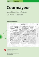 Wandelkaart - Topografische kaart 292 Courmayeur | Swisstopo
 Topografische kaart - Wandelkaart 2920 SB - Serie Bleue Châtillon-sur-Seine | IGN - Institut Géographique National
 Topografische kaart - Wandelkaart 2921 Baigneux-les-Juifs, Alésia, Montbard | IGN - Institut Géographique National
 Wandelkaart - Topografische kaart 2922 SB - Serie Bleue Semur-en-Auxois – Vitteaux | IGN - Institut Géographique National★★★★★
 Wandelkaart - Topografische kaart 2923 SB - Serie Bleue Pouilly-en-Auxois – Thoisy-la-Berchère | IGN - Institut Géographique National
 Wandelkaart - Topografische kaart 2924 SB - Serie Bleue Arnay-le-Duc – Epignac | IGN - Institut Géographique National★★★★★
 Wandelkaart - Topografische kaart 2925 SB - Serie Bleue Autun - Le Creusot | IGN - Institut Géographique National
- 1
- 2
- 3
- Volgende >>
- 50
Laatste reviews

Deze gids bevat een schat an informatie over talloze rondwandelingen langs de Jurassic Coast, met veel aandacht voor de geologische aspecten van deze kust. De …
★★★★★ door Raymond Franssen 13 juni 2026 | Heeft dit artikel gekocht
In deze nieuwe uitgave ontbreekt de routebeschrijving. Het bevat daar ipv veel info over de omgeving. Dat is leuk. De route is goed te wandelen …
★★★★★ door Irma Smit 13 juni 2026 | Heeft dit artikel gekocht
Duidelijke kaart voor gebied te verkennen met Moto
★★★★★ door Van Puymbroeck René 12 juni 2026 | Heeft dit artikel gekocht
Goede leesbare kaart inclusief route suggesties. Heb alleen op de kaart gelopen, zonder mobiele apparatuur. Heel goed te doen.
★★★★★ door Nick 10 juni 2026 | Heeft dit artikel gekocht