Topografische kaarten - Frankrijk
De kaarten van IGN (kort voor Institute Geographique National), wandelkaarten voor Frankrijk, zijn van een ongekend hoog niveau. Met name de wandelkaarten 1:25.000 vinden wij geweldig: werkelijk alles staat erop, de kaarten bevatten zeer veel details en het kleurgebruik is fantastisch, waardoor alles ook nog eens heel goed leesbaar. Je hoort het: wij zijn fan van deze kaarten!
 Wandelkaart - Topografische kaart 3216 SB - Serie Bleue Gondrecourt-le-Château | IGN - Institut Géographique National
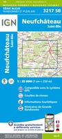 Wandelkaart - Topografische kaart 3217 SB - Serie Bleue Neufchateau, St-Blin | IGN - Institut Géographique National
 Wandelkaart - Topografische kaart 3218 SB - Serie Bleue Bourmont - Clefmont | IGN - Institut Géographique National
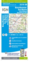 Wandelkaart - Topografische kaart 3219 SB - Serie Bleue Bourbonne-les-Bains - Val-de-Meuse (Montigny-le-Roi) | IGN - Institut Géographique National
 Topografische kaart - Wandelkaart 3220 SB - Serie Bleue Fayl-Billot | IGN - Institut Géographique National★★★★★
 Topografische kaart - Wandelkaart 3221 SB - Serie Bleue Champlitte | IGN - Institut Géographique National
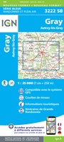 Wandelkaart - Topografische kaart 3222 SB - Serie Bleue Gray - Autrey-lès-Gray | IGN - Institut Géographique National
 Wandelkaart - Topografische kaart 3223 SB - Serie Bleue Pesmes - Gendrey | IGN - Institut Géographique National
 Wandelkaart - Topografische kaart 3224 Dole | IGN - Institut Géographique National
 Wandelkaart - Topografische kaart 3225 SB - Serie Bleue Poligny, Chaussin | IGN - Institut Géographique National
 Topografische kaart - Wandelkaart 3226ET Lons-le-Saunier / Poligny / Reculée de Baume | IGN - Institut Géographique National
 Wandelkaart - Topografische kaart 3227OT Saint Amour | IGN - Institut Géographique National
 Wandelkaart - Topografische kaart 2539 SB - Serie Bleue Sévérac-le-Château, Lapanouse | IGN - Institut Géographique National
 Wandelkaart - Topografische kaart 2542OT Camarès - Avène | IGN - Institut Géographique National
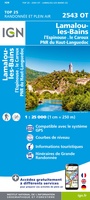 Wandelkaart - Topografische kaart 2543OT Lamalou-les-Bains, Olargues, Roquebrun, Le Caroux, PNR du Haut Languedoc | IGN - Institut Géographique National★★★★★
 Wandelkaart - Topografische kaart 2545OT St-Chinian - L'etang de Montady | IGN - Institut Géographique National
 Wandelkaart - Topografische kaart 2546OT Narbonne | IGN - Institut Géographique National
 Wandelkaart - Topografische kaart 2549OT Banyuls-sur-Mer | IGN - Institut Géographique National
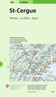 Wandelkaart - Topografische kaart 260 St-Cerque | Swisstopo
 Wandelkaart - Topografische kaart 2605 SB - Serie Bleue Condé-sur-l'Escaut, St-Amand-les-Eaux | IGN - Institut Géographique National
Laatste reviews

Prachtige wandelgids voorzien van alle voor de wandelaars benodigde informatie (accommodaties, restaurants en cafés, vervoersmogelijkheden enz.). Ook is de gids beschreven in twee richtingen en …
★★★★★ door Mathie Hoenjet 27 juni 2026 | Heeft dit artikel gekocht
Zoals altijd duidelijke en overzichtelijke kaart van Michelin
★★★★★ door Charles Trippelvitz 26 juni 2026 | Heeft dit artikel gekocht
Door deze gids konden we ons heel goed voorbereiden op onze fietstocht. En het gebruik onderweg was ook prima. Jammer dat de campings onderweg wat …
★★★★★ door Helma Feenstra 26 juni 2026 | Heeft dit artikel gekocht
Kort voor vakantie naar de Galapagos eilanden toch nog behoefte aan extra reisgids. Simpel kunnen bestellen en snelle levering. Zou niet weten wat er beter …
★★★★★ door Piet Grootenboer 25 juni 2026 | Heeft dit artikel gekocht