Topografische kaarten - Frankrijk
De kaarten van IGN (kort voor Institute Geographique National), wandelkaarten voor Frankrijk, zijn van een ongekend hoog niveau. Met name de wandelkaarten 1:25.000 vinden wij geweldig: werkelijk alles staat erop, de kaarten bevatten zeer veel details en het kleurgebruik is fantastisch, waardoor alles ook nog eens heel goed leesbaar. Je hoort het: wij zijn fan van deze kaarten!
 Fietskaart - Topografische kaart - Wegenkaart - landkaart 45 Haute-Savoie | Swisstopo
 Fietskaart - Topografische kaart - Wegenkaart - landkaart 46 Val de Bagnes | Swisstopo
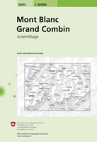 Wandelkaart - Topografische kaart 5003 Mont Blanc Grand Combin | Swisstopo
 Wandelkaart - Topografische kaart 618 SB - Serie Bleue Sillé-le-Guillaum, Conlie Ste-Suzanne | IGN - Institut Géographique National
 Wandelkaart - Topografische kaart 618 SB - Serie Bleue Scaër | IGN - Institut Géographique National
 Topografische kaart 65 MT50 Bera/Vera de Bidasoa | CNIG - Instituto Geográfico Nacional1
 Topografische kaart 65-I Ergoien | CNIG - Instituto Geográfico Nacional1
 Topografische kaart 65-II Bera / Vera de Bidasoa | CNIG - Instituto Geográfico Nacional1
 Topografische kaart 66 MT50 Amaiur/Maya | CNIG - Instituto Geográfico Nacional1
 Topografische kaart 66-I Urdazubi / Urdax | CNIG - Instituto Geográfico Nacional1
 Topografische kaart 66-III Amaiur / Maya | CNIG - Instituto Geográfico Nacional1
 Wandelkaart - Topografische kaart 715 SB - Serie Bleue Bégard - Lannion | IGN - Institut Géographique National
 Wandelkaart - Topografische kaart 716 SB - Serie Bleue Belle-Isle-en-Terre, Guerlesquin | IGN - Institut Géographique National
 Wandelkaart - Topografische kaart 717 SB - Serie Bleue Carhaix-Plouguer, Maël-Carhaix | IGN - Institut Géographique National
 Wandelkaart - Topografische kaart 718 SB - Serie Bleue Rostrenen | IGN - Institut Géographique National
 Topografische kaart 91 MT50 Elizondo | CNIG - Instituto Geográfico Nacional1
 Wandelkaart - Topografische kaart 917 SB - Serie Bleue Ploeuc-sur-Lié – Moncontour | IGN - Institut Géographique National
 Topografische kaart - Wandelkaart 918 La Trinité-Porhoët, Loudeac | IGN - Institut Géographique National
 Wandelkaart - Topografische kaart 920 SB - Serie Bleue Elven - Grand-Champ | IGN - Institut Géographique National
 Wandelkaart - Topografische kaart 815 SB - Serie Bleue Paimpol - Pontrieux | IGN - Institut Géographique National
Laatste reviews

Rother wandelgidsen stellen nooit teleur. Mooie routes, goede opgave kilometers, hoogtemeters en horeca. Een aanrader!
★★★★★ door Anita Geel 13 januari 2026 | Heeft dit artikel gekocht
Mooi boek met prachtige foto’s! Voldoet helemaal aan mijn verwachtingen.
★★★★★ door Hans Eldering 13 januari 2026 | Heeft dit artikel gekocht
het product voldeed aan mijn verwachtingen en was geplastificeerd wat natuurlijk perfect is voor kaart die veel wordt geraadpleegd!
★★★★★ door Peter Lantinga 13 januari 2026 | Heeft dit artikel gekocht
Ik heb de wegenkaart Maleisië aangeschaft om zelf een rondreis per huurauto te kunnen plannen. Deze kaart heeft daar heel goed bij geholpen doordat er …
★★★★★ door M. Rizvi 13 januari 2026 | Heeft dit artikel gekocht