Topografische kaarten - Frankrijk
De kaarten van IGN (kort voor Institute Geographique National), wandelkaarten voor Frankrijk, zijn van een ongekend hoog niveau. Met name de wandelkaarten 1:25.000 vinden wij geweldig: werkelijk alles staat erop, de kaarten bevatten zeer veel details en het kleurgebruik is fantastisch, waardoor alles ook nog eens heel goed leesbaar. Je hoort het: wij zijn fan van deze kaarten!
 Wandelkaart - Topografische kaart 3532ET les Arcs - la Plagne | IGN - Institut Géographique National★★★★★
 Wandelkaart - Topografische kaart 3532OT Massif du Beaufortain | IGN - Institut Géographique National
 Wandelkaart - Topografische kaart 3534OT Les Trois Vallées | IGN - Institut Géographique National★★★★★
 Wandelkaart - Topografische kaart 3535OT Névache - Mont Thabor | IGN - Institut Géographique National★★★★★★★★★★
 Wandelkaart - Topografische kaart 3536OT Briançon | IGN - Institut Géographique National★★★★★★★★★★
 Wandelkaart - Topografische kaart 3537ET Guillestre | IGN - Institut Géographique National★★★★★
 Wandelkaart - Topografische kaart 3538ET Aiguille de Chamberyron | IGN - Institut Géographique National
 Wandelkaart - Topografische kaart 3540ET Haute Vallée du Var | IGN - Institut Géographique National★★★★★
 Wandelkaart - Topografische kaart 3540OT Barcelonnette | IGN - Institut Géographique National
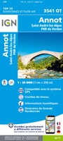 Wandelkaart - Topografische kaart 3541OT Annot | IGN - Institut Géographique National
 Wandelkaart - Topografische kaart 3542ET Haute Estéron | IGN - Institut Géographique National
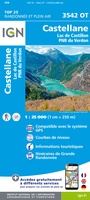 Wandelkaart - Topografische kaart 3542OT Castellane | IGN - Institut Géographique National
 Wandelkaart - Topografische kaart 3543ET Haute Siagne | IGN - Institut Géographique National★★★★★
 Wandelkaart - Topografische kaart 3543OT Draguignan | IGN - Institut Géographique National
 Topografische kaart - Wandelkaart 3544ET Fréjus - Saint-Raphaël | IGN - Institut Géographique National★★★★★
 Wandelkaart - Topografische kaart 3545OT Saint-Tropez - Sainte-Maxime | IGN - Institut Géographique National
 Wandelkaart - Topografische kaart 3613 SB - Serie Bleue Forbach - Sarreguemines | IGN - Institut Géographique National
 Wandelkaart - Topografische kaart 3613ET Sarreguemines | IGN - Institut Géographique National
 Wandelkaart - Topografische kaart 3614ET Sarre-Union - Phalsbourg | IGN - Institut Géographique National
 Wandelkaart - Topografische kaart 3616OT Lac de Pierre-Percée - Le Donon | IGN - Institut Géographique National★★★★★
Laatste reviews

Gemakkelijk opzoeken en mooie kaarten
★★★★★ door Til Palm 09 januari 2026 | Heeft dit artikel gekocht
Namaqualand en West Coast zijn de delen van Zuid-Afrika om in het voorjaar te bezoeken om te genieten van de uitbundige bloemenpracht die uitbarst na …
★★★★★ door Jan de Graaf 09 januari 2026 | Heeft dit artikel gekocht
Echt prachtig boek, uniek mag ik wel zeggen. Als cadeau gegeven aan onze vriend. Een super gaaf ‘tafelboek’ . We hebben er ook en standaard …
★★★★★ door Visser 08 januari 2026 | Heeft dit artikel gekocht
Wegens winter kunnen we het nog niet in de praktijk proberen, maar al enorm veel voorpret bij het lezen van deze prachtige wandelgids van de …
★★★★★ door Charlotte 08 januari 2026 | Heeft dit artikel gekocht