Topografische kaarten - Frankrijk
De kaarten van IGN (kort voor Institute Geographique National), wandelkaarten voor Frankrijk, zijn van een ongekend hoog niveau. Met name de wandelkaarten 1:25.000 vinden wij geweldig: werkelijk alles staat erop, de kaarten bevatten zeer veel details en het kleurgebruik is fantastisch, waardoor alles ook nog eens heel goed leesbaar. Je hoort het: wij zijn fan van deze kaarten!
 Wandelkaart - Topografische kaart 3540ET Haute Vallée du Var | IGN - Institut Géographique National★★★★★
 Wandelkaart - Topografische kaart 3540OT Barcelonnette | IGN - Institut Géographique National
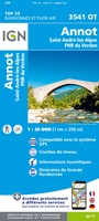 Wandelkaart - Topografische kaart 3541OT Annot | IGN - Institut Géographique National
 Wandelkaart - Topografische kaart 3542ET Haute Estéron | IGN - Institut Géographique National
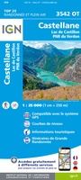 Wandelkaart - Topografische kaart 3542OT Castellane | IGN - Institut Géographique National
 Wandelkaart - Topografische kaart 3543ET Haute Siagne | IGN - Institut Géographique National★★★★★
 Wandelkaart - Topografische kaart 3543OT Draguignan | IGN - Institut Géographique National
 Topografische kaart - Wandelkaart 3544ET Fréjus - Saint-Raphaël | IGN - Institut Géographique National★★★★★
 Wandelkaart - Topografische kaart 3545OT Saint-Tropez - Sainte-Maxime | IGN - Institut Géographique National
 Wandelkaart - Topografische kaart 3613 SB - Serie Bleue Forbach - Sarreguemines | IGN - Institut Géographique National
 Wandelkaart - Topografische kaart 3613ET Sarreguemines | IGN - Institut Géographique National
 Wandelkaart - Topografische kaart 3614ET Sarre-Union - Phalsbourg | IGN - Institut Géographique National
 Wandelkaart - Topografische kaart 3616OT Lac de Pierre-Percée - Le Donon | IGN - Institut Géographique National★★★★★
 Wandelkaart - Topografische kaart 3617OT St-Dié-des-Vosges | IGN - Institut Géographique National
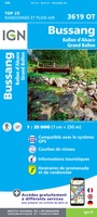 Wandelkaart - Topografische kaart 3619OT Bussang - La Bresse | IGN - Institut Géographique National★★★★★★★★★★
 Wandelkaart - Topografische kaart 3620ET Grand Ballon | IGN - Institut Géographique National★★★★★
 Wandelkaart - Topografische kaart 3621ET Dannemarie - Delle - Sundgau | IGN - Institut Géographique National
 Wandelkaart - Topografische kaart 3621OT Belfort - Montbeliard | IGN - Institut Géographique National
 Wandelkaart - Topografische kaart 3622OT Montbéliard | IGN - Institut Géographique National
 Wandelkaart - Topografische kaart 3623OT Maîche | IGN - Institut Géographique National
Laatste reviews

Bevat de gehele Picos de Europa. Goed in detail. Alle routes GR en PR-PNPE. Refugres en nog veel meer. Schaal 1 op 25.000 is fijn …
★★★★★ door M H 03 april 2026 | Heeft dit artikel gekocht
De bestelling snel en netjes afgehandeld
★★★★★ door Tiny Waltmans 03 april 2026 | Heeft dit artikel gekocht
Ik ben dol op de veldkaarten over verschillende vogelsoorten, per land of werelddelen. Deze keer de kaart besteld over vogelsoorten in Afrika en tijdens mijn …
★★★★★ door Kelly Bosch 02 april 2026 | Heeft dit artikel gekocht
Precies wat ik zocht. De informatie op de website was duidelijk en klopte. Het was eerst niet leverbaar, maar ik had aangegeven dat ik bericht …
★★★★★ door Mieke van den Broek 01 april 2026 | Heeft dit artikel gekocht