Topografische kaarten - Frankrijk
De kaarten van IGN (kort voor Institute Geographique National), wandelkaarten voor Frankrijk, zijn van een ongekend hoog niveau. Met name de wandelkaarten 1:25.000 vinden wij geweldig: werkelijk alles staat erop, de kaarten bevatten zeer veel details en het kleurgebruik is fantastisch, waardoor alles ook nog eens heel goed leesbaar. Je hoort het: wij zijn fan van deze kaarten!
 Wandelkaart - Topografische kaart 3520ET Ballon d'Alsace | IGN - Institut Géographique National★★★★★★★★★★
 Wandelkaart - Topografische kaart 3522 SB - Serie Bleue L'Isle-sur-le-Doubs, Villersexel | IGN - Institut Géographique National
 Wandelkaart - Topografische kaart 3523OT Vallee-du-Desoubre | IGN - Institut Géographique National
 Wandelkaart - Topografische kaart 3524OT Morteau | IGN - Institut Géographique National
 Wandelkaart - Topografische kaart 3530ET Samoëns | IGN - Institut Géographique National★★★★★
 Wandelkaart - Topografische kaart 3531ET Saint-Gervais-les-Bains | IGN - Institut Géographique National★★★★★
 Wandelkaart - Topografische kaart 3531OT Megève | IGN - Institut Géographique National★★★★★
 Wandelkaart - Topografische kaart 3532ET les Arcs - la Plagne | IGN - Institut Géographique National★★★★★
 Wandelkaart - Topografische kaart 3532OT Massif du Beaufortain | IGN - Institut Géographique National★★★★★
 Wandelkaart - Topografische kaart 3534OT Les Trois Vallées | IGN - Institut Géographique National★★★★★
 Wandelkaart - Topografische kaart 3535OT Névache - Mont Thabor | IGN - Institut Géographique National★★★★★★★★★★
 Wandelkaart - Topografische kaart 3536OT Briançon | IGN - Institut Géographique National★★★★★★★★★★
 Wandelkaart - Topografische kaart 3537ET Guillestre | IGN - Institut Géographique National★★★★★
 Wandelkaart - Topografische kaart 3538ET Aiguille de Chamberyron | IGN - Institut Géographique National
 Wandelkaart - Topografische kaart 3540ET Haute Vallée du Var | IGN - Institut Géographique National★★★★★
 Wandelkaart - Topografische kaart 3540OT Barcelonnette | IGN - Institut Géographique National
 Wandelkaart - Topografische kaart 3541OT Annot | IGN - Institut Géographique National
 Wandelkaart - Topografische kaart 3542ET Haute Estéron | IGN - Institut Géographique National
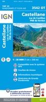 Wandelkaart - Topografische kaart 3542OT Castellane | IGN - Institut Géographique National
 Wandelkaart - Topografische kaart 3543ET Haute Siagne | IGN - Institut Géographique National★★★★★
Laatste reviews

Dit handzame en toch heel informatieve en duidelijke boekje over de Camino Primitivo heeft mij positief verrast. Zoveel handige informatie in zo’n klein en toch …
★★★★★ door Belin 10 april 2026 | Heeft dit artikel gekocht
Het boek voldoet geheel aan mijn behoefte, goede route omschrijving, duidelijke kaarten en extra informatie. Had al eerder boeken van deze schrijver aangeschaft over andere …
★★★★★ door Th. Veerkamp 10 april 2026 | Heeft dit artikel gekocht
Met de kaart leek het of we de route al aan het lopen waren!
★★★★★ door Muskens Joost 10 april 2026 | Heeft dit artikel gekocht
Blij met een fietskaart, maar: Het was mij niet duidelijk dat bij een aparte fietskaart van het Gota-kanaal met die naamgeving, het westelijk deel tussen …
★★★★★ door Remco Korteweg 09 april 2026 | Heeft dit artikel gekocht